 Sketch Map of the English Lake District

|

|
|
|
map type:- Black 1905 map |
|
|
|
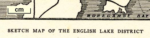
Sketch Map of the English Lake District, by John
Bartholomew, Edinburgh, published by Adam and Charles Black,
London, 1905
Included at the back of The English Lakes, painted by Alfred Heaton Cooper, described by William T Palmer, published by Adam and Charles Black, London, 1905, 2nd edn 1908. Included at the back of Wild Lakeland by MacKenzie MacBride, published by Adam and Charles Black, 4-6 Soho Square, London, 2nd edn 1928. |
||
|
(example JandMN (195_1))
|
||
| map feature:- | up is N & sea shaded & coast shaded & rivers & lakes & relief & hill hachuring (very little) & spot heights & county & settlements & railways | |
| inscription:- |
printed bottom right
Bartholomew, Edinr. |
|
| inscription:- |
printed bottom
SKETCH MAP OF THE ENGLISH LAKE DISTRICT |
|
| wxh, sheet:- | 13.5x20.5cm | |
| wxh, map:- | 102x158mm | |
| sources:- |
JandMN Collection |
|
| items seen (illustrated items in bold):- | ||

|
JandMN (195_1) -- map -- Sketch Map of the English Lake District | |
| see:- | JandMN (468_76) -- map -- Sketch Map of the English Lake District | |