 Descripsion of the Kingdoms of England, Scotland and
Ireland
Descripsion of the Kingdoms of England, Scotland and
Ireland

|

|
|
|
map type:- Woutneel 1603 |
|
|
|
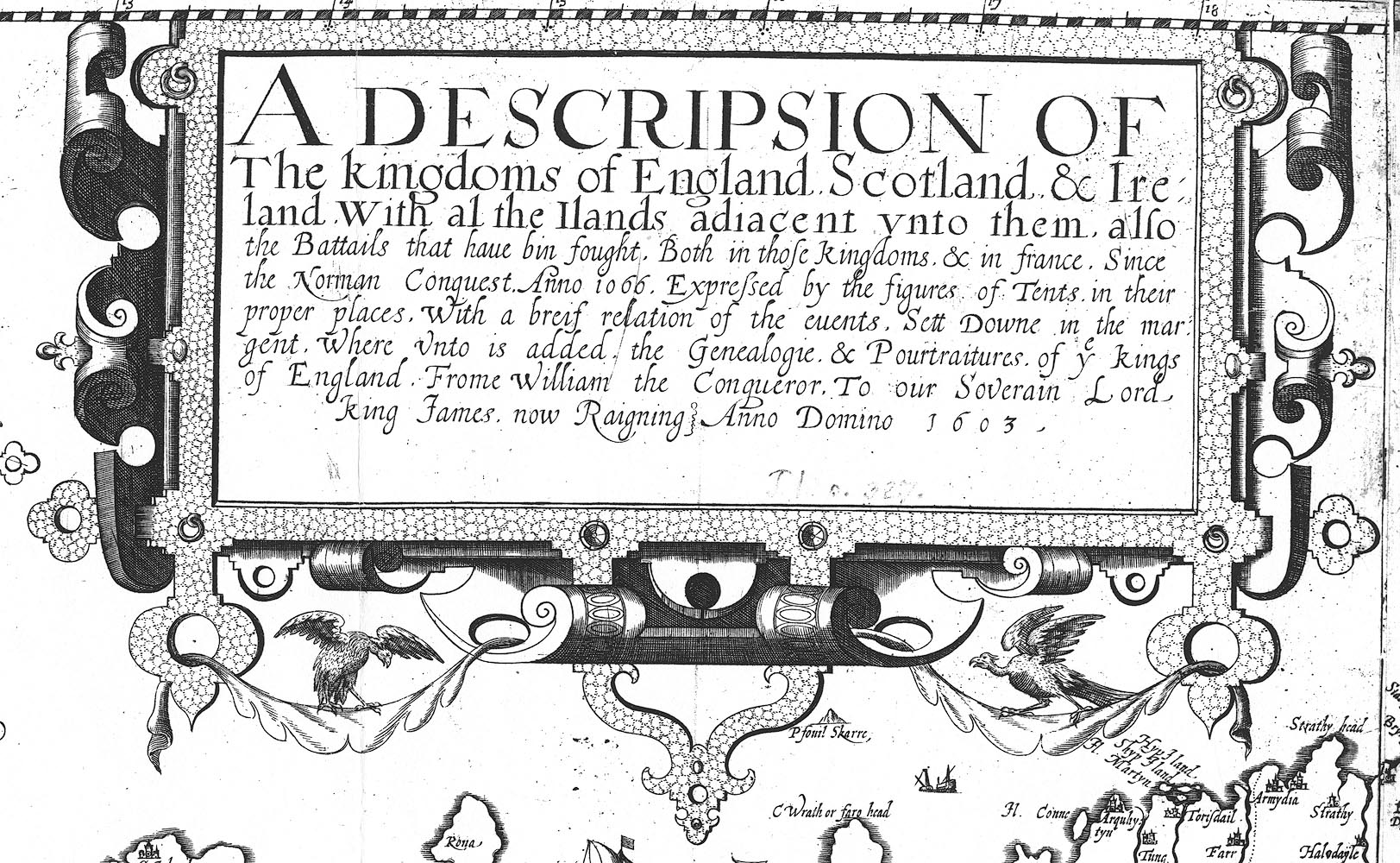
Map, Descripsion of the Kingdoms of England, Scotland and
Ireland, etc, by Hans Woutneel, engraved by William Kip,
London, 1603.
|
||
| inscription:- |
printed scroll cartouche, upper left of centre
A DESCRIPSION OF / The kingdoms of England. Scotland & Ire / land. With al the Ilands adiacent unto them. also / the Battaails that have bin fought ... / ... Expressed by the figure of Tents in their / proper places ... |
|
| references:- |
Barber, Peter (ed): 2006: Map Book, The Lynham, E: 1933 (December): Woutneel's Map of the British Isles: Geographical Journal |
|
| sources:- |
Goettingen University Library |
|
| items seen (illustrated items in bold):- | ||

|
Gottingen University Library : mapp 4570 -- map -- Descripsion of the Kingdoms of England, Scotland and Ireland | |