 English Lake District

|

|
|
|
map type:- Hope 1920s |
|
|
|
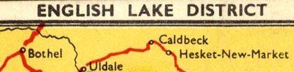
Postcard map, English Lake District, scale about 9 miles
to 1 inch, published by LtCol P M Hope, Keswick, Cumberland,
perhaps 1920s?
Relief is picked out by slightly darker colouring, and by slight embossing, you can feel the hill areas; this is a minimal relief map. |
||
|
(example JandMN (328))
|
||
| map feature:- | up is N & scale line & sea tinted & coast line & rivers & lakes & relief & settlements & roads | |
| inscription:- |
printed top
ENGLISH LAKE DISTRICT |
|
| inscription:- |
printed reverse
POST CARD / Published by Lt-Col. P. M. HOPE, O.B.E., Keswick. |
|
| inscription:- |
printed with scale line
Scale in miles |
|
| scale line:- | 10 miles = 28.1 mm | |
| sources:- |
JandMN Collection |
|
| items seen (illustrated items in bold):- | ||

|
JandMN (328) -- postcard map -- English Lake District | |