 West Cumberland Power and Tramway Company

|

|
|
|
map type:- Garcke 1907 |
|
|
|
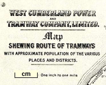
Tramway map, West Cumberland Power and Tramway Company,
reduced from one inch to one mile scale, editor Emile
Garcke, published by the Electrical Press, 37-38 Strand,
London, 1907
On p.933 of the Manual of Electrical Undertakings, 11th edn 1907 (1st edn 1896). The trams ran from near Maryport, through the edge of Workington, then Whitehaven, to Cleator Moor, Cumberland |
||
| map feature:- | north point & up is N & sea plain & coast form lines & county & settlements & railways & tramways & populations | |
| inscription:- |
printed title page of book
... / MANUAL / OF / ELECTRICAL UNDERTAKINGS / AND / DIRECTORY OF OFFICIALS. / 1907. / ... / Compiled under the direction of / EMILE GARCKE, M.I.E.E., F.S.S., / ... // LONDON : / ELECTRICAL PRESS LIMITED, 37 & 38 STRAND, / AND 1 BUCKINGHAM STREET, W.C. / ... |
|
| inscription:- |
printed upper left
WEST CUMBERLAND POWER / AND / TRAMWAY COMPANY, LIMITED. / Map / SHEWING ROUTE OF TRAMWAYS / WITH APPROXIMATE POPULATION OF THE VARIOUS / PLACES AND DISTRICTS. / Sacle : One inch to one mile. |
|
| wxh, page14.5x21.5cm:- | ||
| wxh, map:- | 101x168mm | |
| items seen (illustrated items in bold):- | ||

|
private collection (132) -- tramway map -- West Cumberland Power and Tramway Company | |