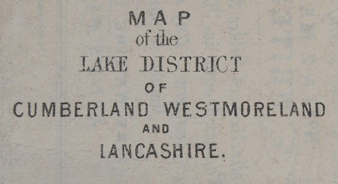
 Map of the Lake District of Cumberland, Westmorland and
Lancashire
Map of the Lake District of Cumberland, Westmorland and
Lancashire

|

|
|
|
map type:- Crosthwaite 1860s |
|
|
|
Railway map, Map of the Lake District of Cumberland,
Westmorland and Lancashire, or Tourists Map of ..., scale
about 10 miles to 1 inch, published by Crosthwaite and Co, 1
and 2 Market Place, Whitehaven, Cumberland, 1860s.
The railways shown are - Newcastle and Carlisle Railway; Maryport and Carlisle Railway; Lancaster and Carlisle Railway; Kendal and Windermere Railway; Whitehaven Junction Railway; Furness Railway; Cockermouth and Workington Railway; Glasgow, Dumfries and Carlisle Railway; Whitehaven and Furness Junction Railway; Port Carlisle Dock and Railway; Alston branch railway; Whitehaven, Cleator and Egremont Railway; Carlisle and Silloth Bay Railway; Ulverstone and Lancaster Railway; Coniston Railway; Border Union Railway; Low Gill and Ingleton branch railway; South Durham and Lancashire Union Railway; Eden Valley Railway; Cockermouth, Keswick and Penrith Railway; which opened up to 1865. The Egremont and Sellafield Railway, Lakeside branch railway and Solway Junction Railway are shown by dotted lines, which opened from 1869 onwards. |
||
|
(example Carlisle Library (173))
|
||
| map feature:- | up is N & scale line & sea plain & coast line & lakes & relief & hill hachuring & settlements & roads (few, to connect railways) & railways | |
| inscription:- |
printed lower left
MAP / of the / LAKE DISTRICT / OF / CUMBERLAND, WESTMORLAND, / AND / LANCASHIRE |
|
| inscription:- |
printed lower left
West Cumberland Railway Guide |
|
| inscription:- |
printed rev, title page?
THE / TOURISTS MAP / OF THE / LAKE DISTRICT / OF / CUMBERLAND, WESTMORLAND, / AND / LANCASHIRE. / Containing the Railways and Stations / accurately laid down. // WHITEHAVEN. / CROSTHWAITE & Co., / 1 & 2 MARKET PLACE, / Crosthwaite & Co. Lith. |
|
| wxh, sheet (badly trimmed):- | 13x21.5cm | |
| wxh, map:- | 127x211mm | |
| scale line:- | 10+10 miles = 50.6 mm | |
| scale:- | 1 to 640000 ? (1 to 636104 from scale line, assuming ) | |
|
||
| sources:- |
Carlisle Library Maps |
|
| items seen (illustrated items in bold):- | ||

|
Carlisle Library : Map 101 -- railway map -- Map of the Lake District of Cumberland, Westmorland and Lancashire -- Tourists Map of the Lake District of Cumberland, Westmorland and Lancashire | |