 Kendal to Cockermouth

|

|
|
|
map type:- Hinton 1765 |
|
|
|
Road strip maps with sections in Westmorland, Cumberland
etc, scales about 2 -2.5 miles to 1 inch, derived from maps
by Ogilby, 1675 onwards, for the Universal Magazine,
published by John Hinton, St Paul's Churchyard, London,
1765-73.
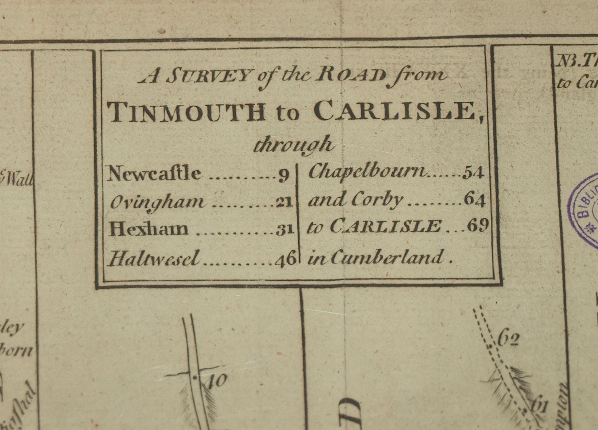
Published in 'The Universal Magazine of Knowledge and Pleasure ... Publish'd ... For John Hinton, at the King's-Arms in St. Paul's Churchyard, London,' 1765-73. 39 plates reduced from 102 plates of Ogilby, plates about 2xsize of Bowen. The plates which concern Westmorland and Cumberland seem to include plates 31 and 36, perhaps 5. Plate 31; A Survey of the Road from Ipswich to Norwich; Kendall to Cockermouth; Egremond to Carlisle; opposite p.281, 1771. Plate 36; A Survey of the Roads from Shrewsbury & Chester to Holywell; Tinmouth to Carlisle; opposite p.169, 1772. Plate 5; The Continuation of the Road from London to Berwick. (which may be the road through Carlisle then across the border country.); opposite p.225, 1769. |
||

|
Ogilby 1675 | |
| scale:- | 1 to 140000 ? (guess) | |
| references:- |
: 1765 & 1773: Universal Magazine of Knowledge and Pleasure:
Hinton, John (London) Klein, Christopher M: 1989: Maps in Eighteenth Century British Magazines: Newberry Library (Chicago, Illinois, United States):: ISBN 0 911028 41 2 |
|
| sources:- |
Chubb 1927 (CCXXVI) Carlisle Library Maps |
|
| items seen (illustrated items in bold):- | ||
|
|
Carlisle Library : Map 27 -- strip map (plate 36) -- Survey of the Road from Tinmouth to Carlisle | |
|
|
Carlisle Library : Map 28 -- strip map (plate 36) -- Survey of the Road from Tinmouth to Carlisle | |
|
|
Carlisle Library : Map 30 -- strip map (plate 31) -- Survey of the Roads from Kendall to Cockermouth and from Egremond to Carlisle | |