 Plan of Windermere and Environs

|

|
|
|
map type:- Garnett 1871 |
|
|
|
Town plans, Plan of Windermere and Environs, Bowness on
Winander Mere, Plan of Ambleside and Environs, and Plan of
Keswick and Environs, scales about 6 inches to 1 mile,
engraved by J Bartholomew, published by John Garnett,
Windermere, Westmorland, 1871.
Included in A Complete Guide to the Lake District of England, by Harriet Martineau, 4th edn 1871. While it is probably based on the OS 6 inch map, the labelling appears to reflect the local interest of John Garnett. |
||
|
(example JandMN (192_1))
|
||
| map feature:- | north point & up is W & scale line & rivers & lakes & relief & hill hachuring & woods & settlements & roads & railways | |
| inscription:- |
printed top
PLAN OF WINDERMERE & ENVIRONS |
|
| wxh, sheet:- | 10x16cm | |
| wxh, map:- | 91x149mm | |
| inscription:- |
printed bottom right, centre
J. Bartholomew, Edinr. / Windermere : J. Garnett. |
|
| scale line:- | 0.25 mile = 38.1 mm | |
| scale:- | 1 to 10560 ? (1 to 10560 from scale line) | |
| sources:- |
JandMN Collection |
|
| items seen (illustrated items in bold):- | ||

|
JandMN (192_1) -- street map -- Plan of Windermere and Environs -- Windermere and Environs | |
|
|
JandMN (192_2) -- street map -- Bowness on Winander Mere | |
|
|
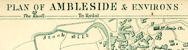
JandMN (192_3) -- map -- Plan of Ambleside and Environs -- Ambleside and Environs | |
|
|
JandMN (192_4) -- map -- Plan of Keswick and Environs -- Keswick and Environs | |