 Morden 1695

|

|
|
|
map type:- Morden 1695 |
|
|
|
Maps, Westmorland, scale about 2.5 miles to 1 inch, and
Cumberland, scale about 4 miles to 1 inch, now Cumbria, by
Robert Morden, 1695; published 1695-1772.
Published in 'Camden's Britannia, Newly Translated into English: with large Additions and Improvements. Publish'd by Edmund Gibson, of Queens-College in Oxford. ... London, Printed by F. Collins, for A. Swalle, at the Unicorn at the West-end of St. Paul's Church-yard; and A. & J. Churchil, at the Black Swan in Pater-noster-Row. 1695' The translation from Latin to English and additional material are by Edmund Gibson; the book size is 8 x 14 ins. The map is plain on the reverse; it is said to be based on John Speed's map, and it is claimed that the maps are uptodate and checked by local gentlemen, the procedure for drawing the 'new' maps is described in a preface. The multiple scale lines is an unexplained feature. Published in 'Britannia: Or A Chorographical Description Of Great Britain and Ireland, Together with the Adjacant Islands. Written in Latin By William Camden, Clarenceux, King at Arms: And Translated into English, with Additions and Improvements. The Second Edition. Revised, Digested, and Published, with large Additions, By Edmund Gibson, D.D. Rector of Lambeth; and now Bishop of Lincoln, and dean of His Majesty's Chapel-Royal. ... London: Printed by Mary Matthews, for Awnsham Churchill, and Sold by William Taylor, in Pater-Noster-Row. MDCCXXII.' ie 1722. The atlas size is 8 x 13 1/4 ins. The edition process included advertisement for information, such as in the Daily Courant, 31 December 1717, '... all Persons who have made any New discoveries of British, Roman, Saxon, or Danish Antiquities, are desired to transmit an Account of them to Mr. Wm. Churchill, at the Black Swan in Pater-Noster-Row, ...' Published in an edition 'Printed for James and John Knapton, John Darby, Arthur Bettesworth, Francis Fayram, John Osborn and Tho. Longman, John Pemberton, Charles Rivington, Francis Clay, Jeremiah Batley, and Aaron Ward.' about 1730. The plates of all the maps are now worn. Published in 'Britannia ... By William Camden ... By Edmund Gibson ... The Third edition ... London: Printed for R. Ware, J. and P. Knapton, T. Longman, C. Hitch, D. Browne, H. Lintot, C. Davis, J. Hodges, A. Millar, W. Bowyer, J. Whiston, J. and J. Rivington, and J. Ward. MDCCLIII.' ie 1753. There may have been retouching and minor corrections of nomenclature, in particular look for towns where the built up area is marked by solid lines rather than shading, and touching up of the title? (note from Skelton and Hodson). Published in 'Britannia ... By William Camden ... By Edmund Gibson, Late Lord Bishop of London ... The Fourth Edition is sprinted from a Copy of 1722, left corrected by the Bishop for the Press ... London. Printed for W. Boyer, W. Whiston, T. Davies, W. Strahan, J. and F. Rivington, L. Davis, B. White, L. Hawes and Co, R. Horsfield, W. Johnston, T. Caslon, S. Crowder, T. Longman, W. and J. Richardson, T. Cadell, T. Lowndes, D. Wilson and G. Nicoll, T. Becket, J. Johnson, J. Robson, J. Almon, J. Knox, T. Evans, W. Flexney, W. Cater, M. Hingeston, and P. Elmsley, MDCCLXXII.' ie 1772. |
||
| see:- | Camden 1695 | |
|
(map example JandMN (24))
|
||
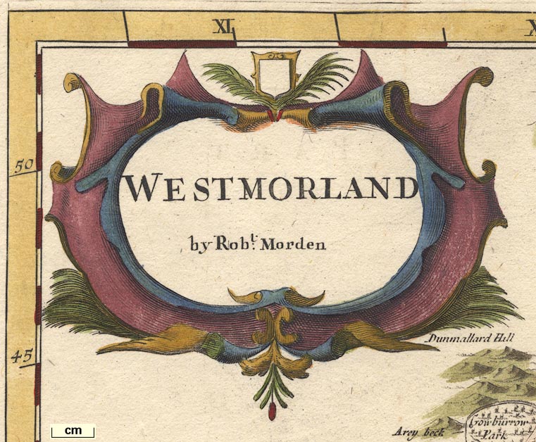
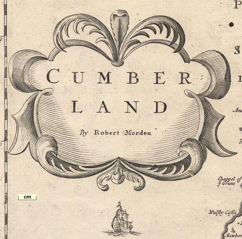
| map feature:- | title cartouche & scroll cartouche & up is N & scale lines & lat and long scales & sea plain & coast shaded & rivers & lakes & relief & hillocks & woods & parks & county & settlements & roads | |
| inscription:- |
printed title cartouche, upper left
WESTMORLAND / by Robt. Morden |
|
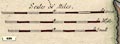
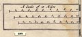
| scale line:- | 8 miles = 79.9 mm | |
| scale line:- | 8 miles = 73.7 mm | |
| scale line:- | 8 miles = 68.2 mm | |
| scale:- | 1 to 170000 ? (average from scale lines, wrongly assuming a statute mile) | |
| wxh, map:- | 418x359mm | |
|
||
|
||
| references:- |
Camden, William & Gibson, Edmund (translator): 1695:
Camden's Britannia, Newly Translated: Swalle, A & Churchill,
A and J (London) Camden, William & Gibson, Edmund (translator): 1715 & 1722: Britannia & Chorographical Description of Great Britain and Ireland: Churchill, Awnsham (London) Camden, William; Gibson, Edmund (trans): 1753: Britannia: Ware, R & Knapton, J and P & Longman, T & Hitch, C & Browne, D & Lintot, H & Davis, C & Hodges, J & Millar, A & Bowyer, W & Whiston, J & Rivington, J and J & Ward, J (London) Camden, William & Gibson, Edmund (trans): 1772: Britannia: Boyer, W & Whiston, W & Davies, T & Strahan, W & Rivington, J and F & Davis, L & White, B & Hawes, L and Co & Horsfield, R & Johnston, W & Caslon, T & Crowder, S & Longman, T & Richardson, W and J & Cadell, T & Lowndes, T & Wilson, D & Nicoll, G & Becket, T & Johnson, J & Robson, J & Almon, J & Knox, J & Evans, T & Flexney, W & Cater, W & Hingeston, M & Elmsley, P (London) Walters, Gwyn & Emery, Frank: 1977: Edward Lhuyd, Edmund Gibson, and the Printing of Camden's Britannia, 1695: Library, The: 32: pp.109-37 : 1971 (facsimile): Camden's Britannia 1695: (Newton Abbot, Devon) |
|
| sources:- |
Chubb 1927 (CXIII) Skelton 1970 JandMN Collection Wordsworth Trust Collection Armitt Library Carlisle Library Maps Kendal Library Maps |
|
| items seen (illustrated items in bold, * have map segments etc):- | ||

|
Armitt Library : ALMC2008.14.12 -- map -- Westmorland | |
|
|
Carlisle Library : Map 15 -- map -- Cumberland | |
|
|
Carlisle Library : Map 65 -- map -- Westmorland | |
|
|
Dove Cottage : 2007.38.17 -- map -- Westmorland | |
|
|
Dove Cottage : 2007.38.20 -- map -- Westmorland | |
|
|
Dove Cottage : 2007.38.21 -- map -- Cumberland | |
|
|
JandMN (24) -- map -- Westmorland * | |
|
|
JandMN (90) -- map -- Cumberland * | |
|
|
JandMN (339) -- map -- England | |
|
|
Kendal Library : Map 81 -- map -- Westmorland | |
|
|
Kendal Library : Map 82 -- map -- Westmorland | |
|
|
Kendal Library : Map 83 -- map -- Westmorland | |
|
|
Kendal Library : Map 84 -- map -- Westmorland | |
|
|
Kendal Library : Map 85 -- map -- Westmorland | |
|
|
Kendal Library : Map 86 -- map -- Westmorland | |
|
|
Kendal Library : Map 87 -- map -- England | |
|
|
private collection (163) -- map -- Episcopatus Dunelmensis -- Bishoprick of Durham | |
|
|
private collection (164) -- map -- West Riding of Yorkshire | |
|
|
private collection (165) -- map -- North Riding of Yorkshire | |
|
|
private collection (166) -- map -- Northumberland | |