 Morden 1695

|

|
|
|
item:- JandMN (339) image:- © see bottom of page |
click to enlarge |
|
|
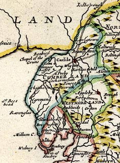
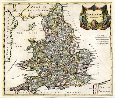
Map, hand coloured engraving, England, including Wales,
scale about 27 miles to 1 inch, by Robert Morden, published
by Abel Swale Awnsham and John Churchil, London, about 1695.
The map includes the road network across England and Wales; the routes are similar to those published by John Ogilby, 1675. |
||

|
Morden 1695 | |
| map feature:- | drape cartouche & labelled borders (NORTH / EAST / SOUTH / WEST) & scale lines & lat and long scales (not rectangular) & coast shaded & rivers & relief & hillocks & county & settlements & roads | |
| inscription:- |
printed title cartouche, upper right
ENGLAND / By Robt. Morden |
|
| inscription:- |
printed centre right, below scales
Sold by Abel Swale Awnsham / & John Churchil |
|
| scale line:- | 50 miles = 53.9 mm | |
| scale line:- | 50 miles = 47.7 mm | |
| scale line:- | 50 miles = 42.6 mm | |
| wxh, sheet:- | 44.5x39.5cm | |
| wxh, map:- | 425x364mm | |
| scale:- | 1 to 1700000 ? (1 to 167407 from average of scale lines wrongly assuming modern mile) | |
|
||