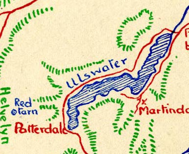
 Tinne 1946 map

|

|
|
|
map type:- Tinne 1946 map |
|
|
|
Map, from a pen and ink drawing, The Lakes, scale about 5
miles to 1 inch, by E D Tinne, published by Frederick Warne
and Co, London, 1946.
Tipped in at the front of The Lure of Lakeland, by E D Tinne. |
||
|
(example JandMN (373_1))
|
||
| map feature:- | up is N & scale line & sea plain & coast shaded & rivers & lakes & relief & hill hachuring & settlements & roads | |
| inscription:- |
printed title page
The Lure of Lakeland / by / E. D. TINNE / ILLUSTRATED BY / THE AUTHOR // FREDERICK WARNE & CO. LTD. / LONDON & NEW YORK |
|
| wxh, sheet:- | 20x16.5cm | |
| wxh, map:- | 190x155mm | |
| inscription:- |
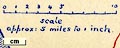
printed with scale line
scale / approx : 5 miles to 1 inch |
|
| scale line:- | 10 miles = 50.8 mm | |
| scale:- | 1 to 320000 ? (1 to 316800 from scale line) | |
|
||
| sources:- |
JandMN Collection |
|
| items seen (illustrated items in bold):- | ||

|
JandMN (373_1) -- map | |