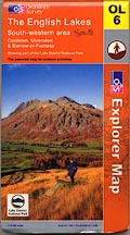

OS 2000s Explorer
The maps were initially produced as the Outdoor Leisure sheets, covering selected areas of the country, the sheets arranged irregularly. They are now replacing the 2.5 inch sheets for the whole country which were arranged logically by 10m square. Sheets are often two sided and exceptionally large, quite impossible to turn inside-out inside a car, or outside in the slightest wind, so that you will have to buy two copies for practical use and buy a larger map cabinet to house them as sheets.
The sheets that concern Westmorland, Cumberland, and the parts of Lancashire north of the sands, and of Yorkshire, that became Cumbria are:-
Explorer OL2, Yorkshire Dales
Explorer OL4, The English Lakes, North-western area
Explorer OL5, The English Lakes, North-eastern area
Explorer OL6, The English Lakes, South-western area
Explorer OL7, The English Lakes, South-eastern area
Explorer OL19, Howgill Fell and Upper Eden Valley
Explorer OL31, North Pennines, Teesdale and Weardale
Explorer OL43, Hadrian's Wall, Haltwhistle and Hexham
Explorer 303, Whitehaven and Workington
Explorer 314, Solway Firth, Wigton and Silloth
Explorer 315, Carlisle, Brampton, Longtown and Gretna Green
Explorer 323, Eskdale and Castle O'er Forest
Explorer 324, Liddesdale and Kershope Forest

 Yorkshire Dales