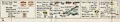
 Dumfries and Gretna

|

|
|
|
map type:- OS 1940s New Popular Edition |
|
|
|
Map series, One Inch 6th edn maps of Great Britain, scale
1 inch to 1 mile, published by the Ordnance Survey,
Southampton, Hampshire, from about 1947.
A hurried postwar edition of the one inch maps, based on revisions made about 1920, with some corrections. The sheets do not make a reliable snapshot of the area after World War II. The sheets that concern Westmorland, Cumberland, and the parts of Lancashire north of the sands, and of Yorkshire, that became Cumbria are:- sheet 75 - Dumfries and Gretna sheet 76 - Carlisle sheet 77 - Hexham (just a tiny of Cumberland) sheet 82 - Keswick sheet 83 - Penrith sheet 84 - Teesdale sheet 88 - Barrow in Furness sheet 89 - Lancaster and Kendal sheet 90 - Wensleydale |
||

|
||
|
||
| references:- |
Oliver, Richard: 2000: Guide to the Ordnance Survey One Inch
New popular Edition: Charles Close Society Higley, Chris: 2011: Old Series to Explorer: Charles Close Society |
|
| sources:- |
JandMN Collection |
|
| sources:- |
|
|
| items seen (illustrated items in bold):- | ||
| see:- | JandMN (413) -- map series -- OS One Inch New popular Edition -- OS One Inch 6th edn | |

|
JandMN (413_76) -- cover location map -- Carlisle | |
|
|
JandMN (413_82) -- cover location map -- Keswick | |
|
|
JandMN (413_83) -- cover location map -- Penrith | |
|
|
JandMN (413_84) -- cover location map -- Teesdale | |
|
|
JandMN (413_88) -- cover location map -- Barrow in Furness | |
|
|
JandMN (413_89) -- cover location map -- Lancaster and Kendal | |
|
|
JandMN (413_90) -- cover location map -- Askrigg and Settle | |