 Civitas Carliolen

|

|
|
|
map type:- Unknown 1560s-90s |
|
|
|
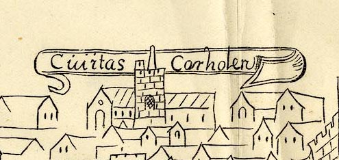
Town plan, Civitas Carliolen, the City of Carlisle,
Cumberland, time of Elizabeth I
Published reproduction by Charles Thurnam and Sons, Carlisle, Cumberland, by Titus Wilson, Kendal, Westmorland, and by Elliot Stock, London, 1894. Tipped in oppposite p.100 of The Royal Charters of the City of Carlisle, edited by R S Ferguson. |
||
|
(example private collection (130_3))
|
||
| map feature:- | folded (3x3) & banner cartouche & labelled borders & up is SW (roughly) & rivers & settlements & roads | |
| inscription:- |
printed cartouche over the city, at the top
Civitas Carliolen |
|
| sources:- |
British Library (Cotton MS Aug. vol.1.12) private collection |
|
| items seen (illustrated items in bold):- | ||

|
private collection (130_3) -- street map -- Civitas Carliolen | |