 Map of the Lake District

|

|
|
|
map type:- LNWR 1910 map |
|
|
|
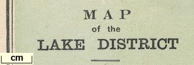
Map of the Lake District, scale about 7 miles to 1 inch,
engraved by McCorquodale and Co, Edinburgh, published by the
London and North Western Railway, LNWR, about 1910.
Published in the LNWR guide book, The English Lakes, about 1910. |
||
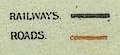
| map feature:- | up is N & scale line & sea tinted & coast line & rivers & lakes & relief & hill hachuring & settlements & roads & railways | |
| inscription:- |
printed lower left
MAP / of the / LAKE DISTRICT |
|
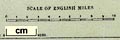
| scale line:- | 10 miles = 36.3 mm | |
| scale:- | 1 to 440000 ? (1 to 443345 from scale line) | |
|
||
|
||
| sources:- |
JandMN Collection |
|
| items seen (illustrated items in bold):- | ||

|
JandMN (49_1) -- map -- Map of the Lake District | |