 Cary 1798 map 2

|

|
|
|
map type:- Cary 1798 map 2 |
|
|
|
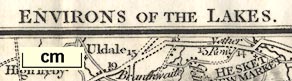
Map, Environs of the Lakes, Westmorland, Cumberland etc,
scale about 5 miles to 1 inch, by John Cary, published by G
and J Cary, 86 St James's Street, London, 1798? 9th edn 1821
and 11th edn 1828.
Included in Cary's New Itinerary, 9th edn 1821, and 11th edn 1828. (I have not found out what map/s exist in the first, 1798, and other editions of the itinerary.) |
||
|
(map example Dove Cottage : 2007.38.115)
|
||
| map feature:- | up is N & scale line & sea plain & coast shaded & rivers & lakes & relief & hill hachuring & woods & trees & forests & parks & county & settlements & roads & canals | |
| inscription:- |
printed top, left, centre and right
NINTH EDITION / ENVIRONS OF THE LAKES / For Cary's New Itinerary |
|
| inscription:- |
printed bottom (trimmed off)
[... G & J Cary ... 1821 ] |
|
| inscription:- |
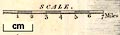
printed above and by scale line
SCALE / Miles |
|
| wxh, sheet:- | 23.5x18cm | |
| wxh, map:- | 214x169mm | |
| scale line:- | 7 miles = 34.8 mm | |
| scale:- | 1 to 320000 ? (1 to 323719 from scale line wrongly assuming a statute mile) | |
|
||
| sources:- |
David Webb Collection Wordsworth Trust Collection |
|
| items seen (illustrated items in bold):- | ||

|
Dove Cottage : 2007.38.115 -- map -- Environs of the Lakes | |
|
|
private collection (20_2) -- road map -- Environs of the Lakes | |