 OS 1840s-60s Old Series

|

|
|
|
map type:- OS 1840s-60s Old Series |
|
|
|
Map series, parts of Westmorland, Cumberland etc, Old
Series 1 inch maps of England, scale 1 inch to 1 mile,
published by the Ordnance Survey, London, 1840s-60s.
Cumbria appears on sheets:- 91, 97, 98, 99, 101, 102, 106, and 107, published in quarter sheets; from the small index diagram available the old county:- Westmorland, quarter sheets:- 97NW, 98NE, 98SE, 98NW, 101SE, 102SW, 102SE, 102NE, 102SE. Cumberland, quarter sheets:- 98NW, 98SW, 99NE, 99SE, 101SW, 101NW, 101NE, 101NE, 102SW, 102NW, 102NE, 106SW, 106NW, 107SE, 107SW. Lancashire North of the Sands, quarter sheets:- 91NE, 98SW, 98NW, 98SE. Yorkshire around Sedbergh, quarter sheets:- 98NE, 98SE, 97SW. Early sheets in the series, starting from the south of England, were not always on a strict projection, and were surveyed for 1 inch mapping. Westmorland and Cumberland, in the north, late in the series, were plotted when a common projection had been established, and were surveyed for 6 inch and then 25 inch mapping. Sheets 91..110 use Cassini's Projection, on the origin of Delamere Forest. Sheet numbering began with the first map, Essex, and followed an odd pattern, up and down working westward over the south of England, then picking up from the north of Wiltshire, boustrophedon northward. Published first for Cumbria towards the end of the 'hachured edition', 1832-69, printed in quarter sheets with piano key borders around the four edges. The quarter sheet numbers have suffix NW, NE, SE, SW on the sheet number. Surveying in Cumbria was begun at Ulverston 1846, Barrow 1847, Kirkby Stephen 1857, Kendal 1858, Whitehaven 1863, Maryport 1864, Carlisle 1866, etc. Dating of the maps is difficult. The Survey date given does not always agree with the content; engraving might be at a different date; revisions were frequent ... Beware. Published in the 'outline edition', 1857-68, printed in quarter sheets with contours, except 91NW. Various states of these sheets exist. Published in a 'hill edition', 1867, printed in quarter sheets with shaded contours. Only ten quarter sheets; 98NW, 98, NE, 98SW, 98SE, 99NE, 99SE, 101NE, 101SW, 101SE, 102SW. Nine of these sheets, not 101NE, were assembled by zincography into two composite sheets for a Report of the Royal Commission on Water Supply, 1868-69. The same nine sheets were published as the Map of the Lake District of Cumberland and Westmorland, about 1870, qv. |
||

|
OS 1881-82 New Series | |
|
|
OS 1870 | |
| map feature (early states):- | scale line & up is N & sea plain & coast form lines & rivers & lakes & relief & hill hachuring & contours & woods & forests & parks & county & settlements & roads & turnpike roads (gates marked) & canals & railways | |
| wxh, map (full size sheets):- | 77.5x62cm (approx) | |
| scale:- | 1 to 63360 ? (nominal) | |

|
||
| references:- |
Hellyer, Roger: 1999: Ordnance Survey Small Scale Maps:
Archer, David (Kerry, Montgomeryshire):: ISBN 0 9517579 5
4 |
|
| sources:- |
|
|
| sources:- |
JandMN Collection Armitt Library |
|
| items seen (illustrated items in bold):- | ||
|
|
Armitt Library : A1819 -- map (OS Old Series 101) | |
| see:- | Armitt Library : A1819 to A1823 -- map series (OS Old Series) | |
|
|
Armitt Library : A1820 -- map (OS Old Series 91) | |
|
|
Armitt Library : A1821 -- map (OS Old Series 98) | |
|
|
Armitt Library : A1822 -- map (OS Old Series 99) | |
|
|
Armitt Library : A1823 -- map (OS Old Series 102) | |
|
|
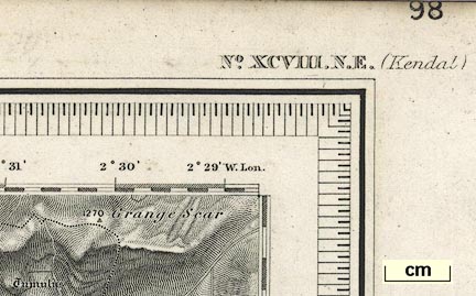
JandMN (60) -- map (OS Old Series 98NE) -- Kendal | |
|
|
private collection (181) -- map (OS Old Series 97) | |