 OS 1840s-60s Old Series

|

|
|
|
item:- Armitt Library : A1823 image:- © see bottom of page |
click to enlarge |
|
|
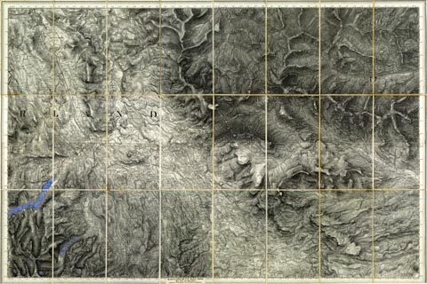
Map, OS 1840s-60s Old Series sheet 102, scale 1 inch to 1
mile, published by the Ordnance Survey, Southampton,
Hampshire, 1840s-60s.
Includes - Alston, Kirkoswald, Penrith, Cumberland now Cumbria; Appleby, Brough, Shap, Westmorland now Cumbria. Includes - Hawes Water, Ullswater, etc. Hachured edition, piano key border, quarter sheets trimmed and mounted to make a full sheet, which is then sectioned for folding 8x3 pieces. The map was probably prepared by, and sold by Letts, Son and Co, 8 Royal Exchange, London. |
||

|
OS 1840s-60s Old Series | |
| map feature:- | up is N & scale line (cut off) & lat and long scales & sea plain & coast form lines & rivers & lakes & relief & hill hachuring & county & settlements & roads & railways & canals | |
| inscription:- |
printed label
Sold by LETTS, SON & CO. 8, Royal Exchange, E.C. / MAP, CHART & GLOBE SELLERS, / Agents by Appointment for the Sale of Ordnance Maps. |
|