 Ramble 1845

|

|
|
|
map type:- Ramble 1845 |

|
|
|
Maps, Westmoreland, scale about 14 miles to 1 inch, and
Cumberland? lithograph copy of the map by R Miller 1810 or
by T Crabb 1819, published by Darton and Clark, 58 Holborn
Hill, London, 1845; published 1845-50.
Published in 'Reuben Ramble's Travels through the Counties of England. With Maps and Historical Vignettes. Darton and Clark, 58 Holborn Hill, Print and Map publishers.' 1845. Published again by Darton and Co, London, 1850. |
||

|
Miller 1810 | |
|
|
Crabb 1819 | |
|
(map example Dove Cottage : 2007.38.44)
|
||
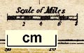
| map feature:- | north point & up is N & scale line & lat and long scales (W of Greenh.) & sea shaded & coast shaded & rivers & lakes & parks & county & wards (? not labelled) & settlements & roads & vignettes | |
| inscription:- |
printed lower right
WESTMORELAND |
|
| wxh, sheet:- | 16x20.5cm | |
| wxh, map:- | 106x69mm | |
| scale line:- | 8 miles = 14.6 mm | |
| scale:- | 1 to 880000 ? (1 to 881832 from scale line assuming a statute mile) | |
|
||
| references:- |
: 1845: Reuben Ramble's Travels through the Counties of
England: Darton and Clark (London) : 1850: Reuben Ramble's Travels through the Counties of England: Darton and Co (London) |
|
| sources:- |
Chubb 1927 (DXVII) Wordsworth Trust Collection Armitt Library Kendal Library Maps |
|
| items seen (illustrated items in bold):- | ||
|
|
Armitt Library : ALMC2008.14.65 -- map -- Westmoreland | |
|
|
Dove Cottage : 2007.38.44 -- map -- Westmoreland | |
|
|
Kendal Library : Map 16 -- map -- Westmoreland | |