 Westmorland, New Divisions of County

|

|
|
|
map type:- Owen-Jones 1885 |
|
|
|
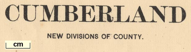
Maps, Westmorland, New Divisions of County, and for
Cumberland, scale about 4 miles to 1 inch, by LtCol Robert
Owen-Jones, printed by the Ordnance Survey, Southampton,
Hampshire, 1885.
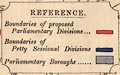
The map shows the proposed new parliamentary divisions, petty session divisions and parliamentary boroughs. It was made to accompany the return for the Redistribution of Seats Act. The maps exist in at least two versions, one with surrounding parts of other counties, the boundary and label colouring differing. |
||
|
(map example JandMN(79))
|
||
| map feature:- | table of symbols & up is N & scale line & sea plain & coast line & rivers & lakes & county & wards (hundreds) & settlements & roads & railways & canals & electoral data | |
| inscription:- |
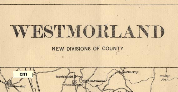
printed top
WESTMORLAND / NEW DIVISIONS OF COUNTY |
|
| inscription:- |
printed cartouche lower left
R. OwenJones / LtColonel R.E ms signature |
|
| inscription:- |
printed bottom
Zincographed at the Ordnance Survey Office, Southampton, 1885. |
|
| wxh, sheet:- | 38x36.5cm | |
| wxh, map:- | 304x327mm | |
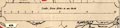
| scale line:- | 12+4 miles = 104.2 mm | |
| scale:- | 1 to 250000 ? (1 to 247116 from scale line) | |
|
||
|
||
|
||
| sources:- |
JandMN Collection |
|
| items seen (illustrated items in bold):- | ||

|
JandMN (79) -- political map -- Westmorland, New Divisions of County | |
|
|
JandMN (80) -- political map -- Cumberland, New Divisions of County | |
|
|
private collection (252) -- political map -- Westmorland, New Divisions of County | |
|
|
private collection (253) -- political map -- Cumberland, New Divisions of County | |
|
|
private collection (254) -- political map -- North Lancashire, New Divisions of County | |