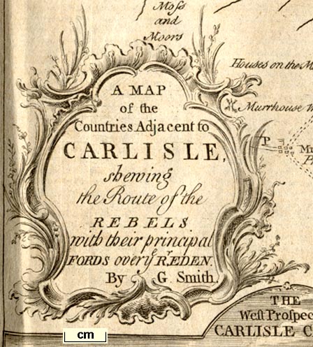
 Map of the Countries Adjacent to Carlisle shewing the Route
of the Rebels
Map of the Countries Adjacent to Carlisle shewing the Route
of the Rebels

|

|
|
|
map type:- Smith 1746 map 1 |
|
|
|
Map of the Countries Adjacent to Carlisle shewing the
Route of the Rebels, scale about 1 inch to 1 mile, by G
Smith, published in the Gentleman's Magazine, London, 1746.
Tipped in opposite p.560, vol.16, 1746, with 'A Letter to a friend, containing an account of the march of the rebels in England, a description of the castle of Carlisle, and a dissertation on the old Roman wall; with respect to the map of it, and the adjacent country, the plan of Carlisle, and the view of its castle, just publish'd in two sheets; the draughts of which were favourably received by the duke of Cumberland on his forming the attack on Carlisle castle, and are now dedicated to his royal highness; by G. Smith.' The rebels are the Scots of the 1745 rebellion; lower left is a vignette view, the West Prospect of Carlisle Castle. |
||
|
(map example HMCMS:B1999.518.1746.map)
|
||
| map feature:- | title cartouche & baroque cartouche & compass rose & up is N & scale line & coast form lines & rivers & relief & hillocks & settlements & roads & vignettes | |
| inscription:- |
printed title cartouche
A MAP / of the / Countries Adjacent to / CARLISLE / shewing / the Route of the / REBELS / with their principal / Ford over ye Rr. EDEN. / By G. Smith. |
|
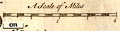
| scale line:- | 2 miles = 56.4 mm | |
| scale:- | 1 to 57000 ? (1 to 57069 from scale line assuming statute mile) | |
| wxh:- | 26.5x20.5cm | |
|
||
| sources:- |
HMCMS Map Collection Armitt Library Carlisle Library Maps |
|
| items seen (illustrated items in bold):- | ||

|
Carlisle Library : Map 20 -- map -- Map of the Countries Adjacent to Carlisle shewing the Route of the Rebels -- West Prospect of Carlisle Castle | |
|
|
Hampshire Museums : B1999.518.1746.map -- map -- Map of the Countries Adjacent to Carlisle shewing the Route of the Rebels -- West Prospect of Carlisle Castle | |