 Whittaker 1821

|

|
|
|
map type:- Whittaker 1821 |
|
|
|
Maps, Westmoreland, scale about 9 miles to 1 inch, and
Cumberland? engraved by Neele and Son, 352 Strand, London,
1821, published by G and W B Whittaker, Ave Maria Lane,
London, 1821-23.
Published in 'The Travellers Pocket Atlas Consisting of A Complete Set of County Maps, For England & Wales, On an original and improved Plan. The Roads leading to the nearest Towns in the adjoining Counties being delineated on each map to which is added an Alphabetical list of the Cities Boroughs & Market towns of England and Wales their distance from London Population &c. London. Published by G. & W. B. Whittaker, 1823.' The atlas size is 3 3/4 x 5 3/4 ins. |
||
|
(map example Dove Cottage : 2007.38.55)
|
||
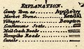
| map feature:- | plain cartouche & table of symbols & compass rose & up is N & scale line & sea plain & coast form lines & rivers & lakes & parks & county & settlements & roads & road distances | |
| inscription:- |
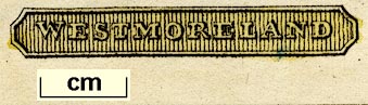
printed title cartouche, lower right
WESTMORELAND |
|
| wxh, sheet:- | 19x14.4cm | |
| wxh, map:- | 159x128mm | |
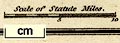
| inscription:- |
printed above scale line
Scale of Statute Miles. |
|
| scale line:- | 10 miles = 29.0 mm | |
| scale:- | 1 to 550000 ? (1 to 554946 from scale line) | |
|
||
|
||
| references:- |
Whittaker, G and W B: 1823: Travellers Pocket Atlas:
(London) |
|
| sources:- |
Chubb 1927 (CCCXC) Wordsworth Trust Collection Armitt Library Kendal Library Maps |
|
| items seen (illustrated items in bold):- | ||

|
Armitt Library : ALMC2008.14.124.1 -- map -- Westmoreland | |
|
|
Dove Cottage : 2007.38.55 -- road map -- Westmoreland | |
|
|
Kendal Library : Map 53 -- map -- Westmoreland | |
|
|
Kendal Library : Map 54 -- map -- Westmoreland | |