 Hall 1833

|

|
|
|
map type:- Hall 1833 |
|
|
|
Maps, Westmoreland, scale about 5 miles to 1 inch, and
Cumberland, scale about 8 miles to 1 inch, by Sidney Hall,
London, published by Chapman and Hall, Strand, London, 1833;
published 1833-80.
Published in vol.2 of 'A Topographical Dictionary of Great Britain and Ireland ... By John Gorton ... with fifty-four quarto Maps, drawn and engraved by Sidney Hall ... London: Chapman and Hall, 186, Strand, 1833.' Published in 'A New British Atlas: comprising A Series of 54 Maps, Constructed from the most Recent Surveys and engraved by Sydney Hall. London. Chapman & Hall, Strand. 1833.' The map in the 1833 new atlas has two pages of text. Published in other editions 1834, 1836. In the 1836 edition the date is removed from the map. Published in 'A Travelling County Atlas: with all the Coach and Rail Roads accurately laid down and coloured, and carefully corrected to the present time. Engraved by Sidney Hall. London: Chapman and Hall, Strand, 1842.' Published in 'A Travelling County Atlas: with all the Coach and Rail Roads accurately laid down and coloured, and carefully corrected to the present time. Engraved by Sidney Hall. London: Chapman and Hall, Strand, 1842.' Published in editions 1843, 1845, 1846, 1848. Published in 'A New County Atlas: with all the Coach and Rail Roads accurately laid down and coloured. Carefully corrected to the end of the Session of 1846. Engraved by S. Hall. London: Chapman and Hall, Strand, 1847.' Published in an edition of 'A Travelling Atlas of the English Counties. By Sidney Hall ... London: Chapman and Hall, 193, Piccadilly.' 1860 Published in an edition 1873. In the 1873 edition the railways are brought up to date; plate numbers are now outside the border. Published in an edition 1880. |
||

|
Hall 1860 | |
|
(map example JandMN (45))
|
||
| map feature:- | title cartouche & plain cartouche & north point & scale line & lat and long scales & coast shaded & rivers & lakes & relief & hill hachuring & parks & county & wards (hundreds) & table of wards (hundreds) & settlements & roads & distances from London & canals | |
| inscription:- |
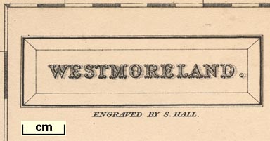
printed title cartouche, upper left
WESTMORELAND. |
|
| inscription:- |
printed under title cartouche, upper left
ENGRAVED BY S. HALL. |
|
| inscription:- |
printed bottom
London, Published by Chapman & Hall 193 Piccadilly. |
|
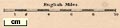
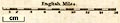
| scale:- | 1 to 330000 ? (1 to 327769 from scale line assuming a statute mile) | |
| scale line:- | 10 miles = 49.1 mm | |
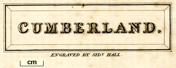
| inscription:- |
[Engraved by S. Hall] |
|
| inscription:- |
[Engraved by Sidy Hall] |
|
| inscription:- |
[London : Published by Chapman and Hall, 186, Strand ...] |
|
| inscription:- |
[London. Published by Chapman & Hall, 186, Strand.] 1842-48 editions |
|
| inscription:- |
[... Chapman & Hall, 193, Piccadilly ...] 1860-73 editions |
|
| inscription:- |
[London : Chapman and Hall Limited.] 1880 edition |
|
|
||
|
||
| references:- |
Gorton, John: 1833: Topographical Dictionary of Great
Britain and Ireland: Chapman and Hall (London) : 1833 & 1834 & 1836: New British Atlas: Chapman and Hall (London) Hall, Sidney: 1842 & 1843 & 1845 & 1846 & 1848: Travelling County Atlas: Chapman and Hall (London) Hall, Sidney: 1860 & 1873 & 1880: Travelling Atlas of English Counties: Chapman and Hall (London) : 1847 : New County Atlas: Chapman and Hall (London) |
|
| sources:- |
Chubb 1927 (CCCCXLVI) Chubb 1927 (CCCCXCVII) JandMN Collection Wordsworth Trust Collection private collection Kendal Library Maps Carlisle Library Maps |
|
| items seen (illustrated items in bold):- | ||
|
|
Carlisle Library : Map 155 -- map -- Cumberland | |
|
|
Carlisle Library : Map 188 -- map -- Westmoreland | |
|
|
Carlisle Library : Map 199 -- map -- Westmoreland | |
|
|
Dove Cottage : 2007.38.42 -- map -- Westmoreland | |
|
|
Dove Cottage : 2009.81.7 -- map -- Cumberland | |
|
|
Dove Cottage : 2009.81.13 -- map -- Cumberland | |
|
|
JandMN (45) -- map -- Westmoreland | |
|
|
JandMN (47_1) -- map -- Westmoreland | |
|
|
JandMN (47_2) -- map -- Cumberland | |
|
|
JandMN (47_3) -- map -- Lancashire | |
|
|
Kendal Library : Map 6 -- map -- Westmoreland | |
|
|
Kendal Library : Map 48 -- map -- Westmoreland | |
|
|
Kendal Library : Map 49 -- map -- Westmoreland | |
|
|
Kendal Library : Map 149 -- map -- Westmoreland | |
|
|
private collection (25) -- map -- Westmoreland | |
|
|
private collection (281) -- map -- Westmoreland -- Westmorland | |