 Map of the Neighbourhood of Sedbergh

|

|
|
|
map type:- Burton 1894 |
|
|
|
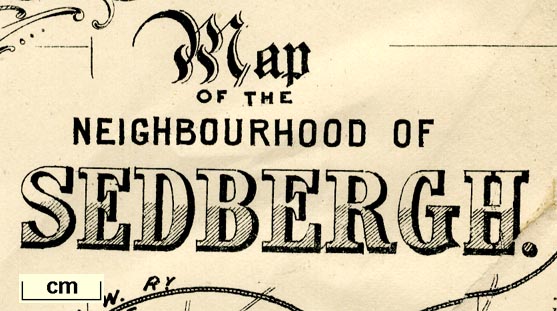
Map of the Neighbourhood of Sedbergh, Yorkshire, scale
about 1 inch to 1 mile, by E Burton, published by Richard
Jackson, Commercial Street, Leeds, Yorkshire, 1894.
A diagram, lower right, refers to 'Survey Sheets One Inch' nos.39, 40, 49, 50, presumably OS sheets from which this map was constructed. Included in An Illustrated Guide to Sedbergh, Garsdale, and Dent, by W Thompson. |
||
|
(example Armitt Library : A1612.B13)
|
||
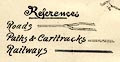
| map feature:- | folded (7x3) & decorative border & table of symbols & compass rose & up is N & magnetic deviation & lat and long data & rivers & lakes & woods & settlements & roads & railways | |
| inscription:- |
printed upper left
Map / OF THE / NEIGHBOURHOOD OF / SEDBERGH. |
|
| inscription:- |
printed lower right
Drawn by E Burton |
|
| inscription:- |
printed bottom
PUBLISHED BY RICHARD JACKSON, COMMERCIAL ST. LEEDS. |
|
| wxh, sheet:- | 48.5x37cm | |
| wxh, map:- | 473x328mm | |
| inscription:- |
printed scale
Scale / One Inch to One Mile |
|
| scale:- | 1 to 63360 ? (nominal) | |
|
||
| sources:- |
Armitt Library |
|
| items seen (illustrated items in bold):- | ||

|
Armitt Library : A1612.B13 -- map -- Map of the Neighbourhood of Sedbergh | |