 Westmorland with Furness

|

|
|
|
map type:- Martindale 1888 |
|
|
|
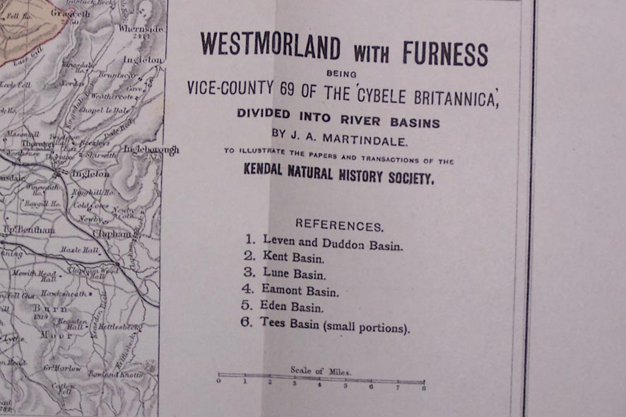
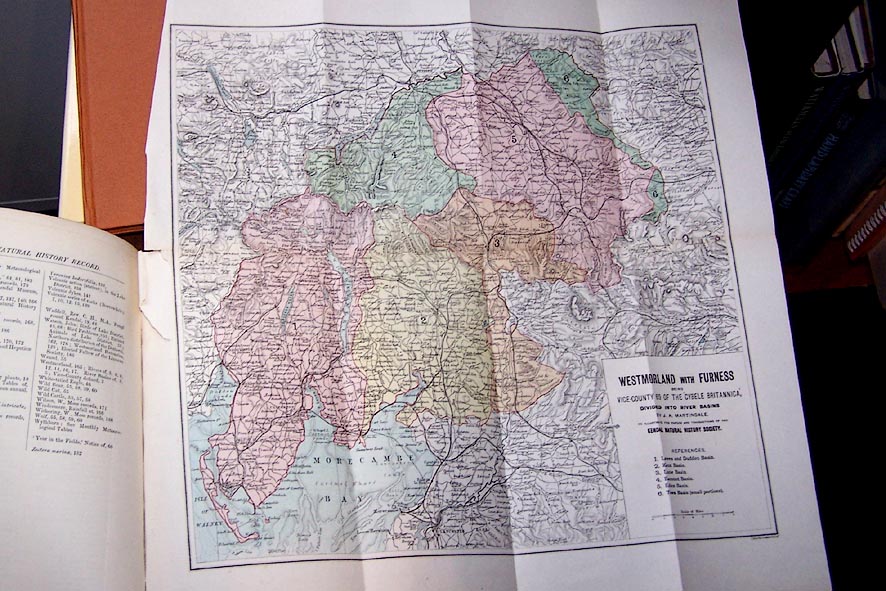
Map, Westmorland with Furness, vice county 69 divided
into river basins, scale about 4 miles to 1 inch, by J A
Martindale, printed? by J Bartholomew, Edinburgh, about
1888.
Tipped into Westmorland Notebook vol.1, 1888-1889, published by Edward Gill, Kendal, Westmorland, about 1889. River basins are used as subdivisions of Watsonian vice counties, referred to as botanical districts. The river basins are: Leven and Duddon, Kent, Lune, Eamont, Eden, and parts of the Tees. |
||
|
(map example private collection)
|
||
| inscription:- |
printed lower right
WESTMORLAND WITH FURNESS / BEING / VICE-COUNTY 69 OF THE 'CYBELE BRITANNICA', / DIVIDED INTO RIVER BASINS / BY J. A. MARTINDALE. / TO ILLUSTRATE THE PAPERS AND TRANSACTIONS OF THE / KENDAL NATURAL HISTORY SOCIETY. |
|
| scale line:- | 8 miles = 49 mm (approx) | |
| scale:- | 1 to 260000 ? (estimate from scale line) | |
| sources:- |
private collection |
|