 Map of Cumberland

|

|
|
|
map type:- Jollie 1794 |
|
|
|
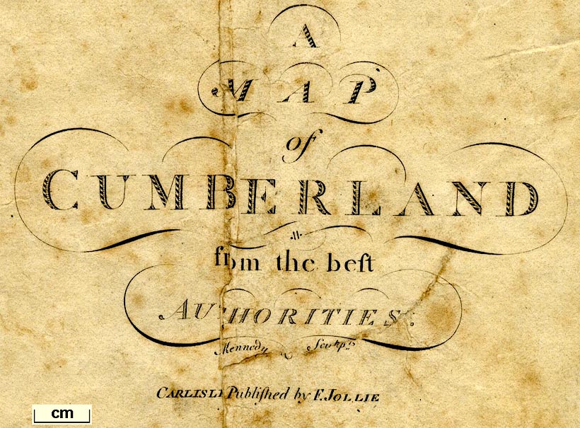
A Map of Cumberland, scale about 3.5 miles to 1 inch,
engraved by James Kennedy, published by F Jollie, Carlisle,
Cumberland, 1794.
Included in the History of the County of Cumberland, by William Hutchinson. |
||
|
(example Carisle Library (16))
|
||
| map feature:- | compass rose & up is NW & scale line & lat and long scales & sea plain & coast form lines & & rivers & lakes & relief & hill hachuring & woods & trees & forests & parks & county & wards & table of wards & settlements & roads | |
| inscription:- |
printed lower centre
A / MAP / of / CUMBERLAND / from the best / AUTHORITIES. / Ja. Kennedy Sculpt. / CARLISLE Published by F. JOLLIE |
|
| wxh, map:- | 494x399mm | |
| inscription:- |
printed with scale line
Scale of Statute Miles 69 1/2 to a Degree of Latitude. |
|
| scale line:- | 12+1 miles= 95.0 mm | |
| scale:- | 1 to 220000 ? (1 to 220226 from scale line) | |
|
||
| sources:- |
Carlisle Library |
|
| items seen (illustrated items in bold):- | ||

|
private collection (170) -- map -- Map of Cumberland | |