 Border, The

|

|
|
|
map type:- OS 1946 Quarter Inch |
|
|
|
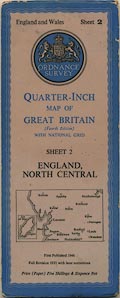
Map series, Quarter Inch Map of Great Britain, 4th edn
with National Grid, Quarter Inch series, scale 4 miles to 1
inch, published by the Ordnance Survey, Southampton,
Hampshire 1946.
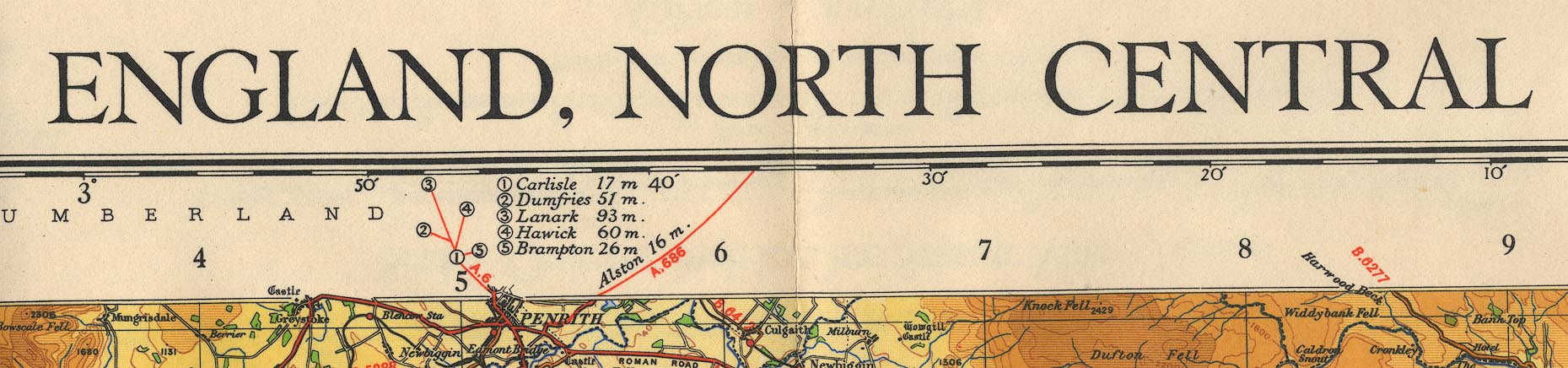
The sheets for Westmorland, Cumberland etc are:- sheet 1 - The Border (which is also sheet 1 of the Scottish series) sheet 2 - England, North Central |
||
|
(map example JandMN (103_2))
|
||
| map feature:- | folded (7x2 sections) & card covers & north point & magnetic deviation & scale line & table of symbols & sea tinted & coast line & rivers & relief & contours & layer colouring & table of heights & woods & county & settlements & roads & canals & railways | |
| inscription:- |
printed top centre
ENGLAND, NORTH CENTRAL |
|
| scale line:- | 25+5 miles = 190.8 mm | |
| scale:- | 1 to 253440 ? (nominal) | |
| wxh, folded in cover:- | 12.5x31.5cm | |
| wxh, sheet:- | 96x62cm | |
| wxh, map:- | 833x515mm | |
|
||
|
||
|
||
| sources:- |
JandMN Collection |
|
| items seen (illustrated items in bold):- | ||

|
JandMN (103) -- map -- Borders, The -- England, North Central | |