 OS 1946 Quarter Inch

|

|
|
|
item:- JandMN (103) image:- © see bottom of page |
click to enlarge |
|
|
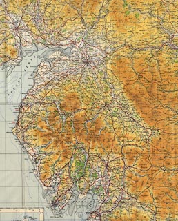
Maps, sheet 1, The Border, and sheet 2, England, North
Central, in the Quarter Inch Map of Great Britain series,
4th edn with National Grid in yards, scale 4 miles to 1
inch, published by the Ordnance Survey, Southampton,
Hampshire, 1946.
Each map has a location map of the map area on the cover, an index map to sheets in the series, town plans tipped in on the rear cover, etc. |
||

|
OS 1946 Quarter Inch | |
| map feature:- | folded (7x2 sections) & card cover & north point & magnetic deviation & scale line & table of symbols & sea tinted & coast line & rivers & relief & contours & layer colouring & table of heights & woods & county & settlements & roads & canals & railways | |
| inscription:- |
sheet 1: printed top centre
THE BORDER |
|
| inscription:- |
sheet 2: printed top centre
ENGLAND, NORTH CENTRAL |
|
| scale line:- | 25+5 miles = 190.1 mm | |
| scale line:- | 25+5 miles = 190.8 mm | |
| wxh, folded in cover:- | 12.5x31.5cm | |
| wxh, sheet:- | 96x62cm | |
| wxh, map:- | 833x515mm | |
| wxh, folded in cover:- | 12.5x31.5cm | |
| wxh, sheet:- | 96x62cm | |
| wxh, map:- | 833x515mm | |
| scale:- | 1 to 253440 (nominal) | |