 Cooper 1808

|

|
|
|
map type:- Cooper 1808 |
|
|
|
Maps, Westmoreland, scale about 9 miles to 1 inch, and
Cumberland, scale about 10.5 miles to 1 inch, by H Cooper,
1808, published by R Phillips, Bridge Street, Blackfriars,
London, 1808; published 1808-29.
Published in 'A Topographical Dictionary of the United Kingdom ... accompanied by forty-six maps, drawn purposely for this work, on an original plan. By Benjamin Pitts Capper, Esq. London: Printed for Richard Phillips, Bridge Street, Blackfriars ... 1808.' The atlas size is 5 1/4 x 8 1/2 ins. Published in another edition 'A Topographical Dictionary ... By B. P. Capper ... London: Printed for Longman, Hurst, Rees, Orme, and Brown, Paternoster Row, 1813.' Published in another edition 'A Topographical Dictionary ... By B. P. Capper ... London: Printed for Geo. B. Whittaker, Ave-Maria-Lane, 1825.' Published in another edition 1826. Published in another edition 'A Topographical Dictionary ... By B. P. Capper ... London: Printed for Sir Richard Phillips and Co., 1829.' |
||
|
(map example JandMN (2))
|
||
| map feature:- | title cartouche & plain cartouche & sea shaded & coast line & north point & up is N (NNW) & scale line & rivers & lakes & relief & hill hachuring & county & wards (hundreds) & settlements & roads & canals | |
| inscription:- |
printed bottom centre
Published by G. & W. B. Whittaker, 13, Ave Maria Lane, 1824. |
|
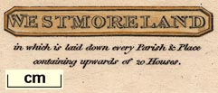
| inscription:- |
printed upper right, plain title cartouche, and underneath
WESTMORELAND / in which is laid down every Parish & Place / containing upwards of 20 Houses. |
|
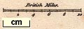
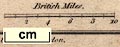
| scale line:- | 10 miles = 29.0 mm | |
| scale:- | 1 to 550000 ? (1 to 554946 from scale line) | |
| wxh, sheet:- | 21.5x13cm | |
| wxh, plate:- | 201x124mm | |
| wxh, map:- | 181x104mm | |
|
(map example BL)
|
||
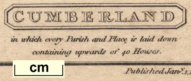
| inscription:- |
... Published Jany 1. 1808; by R Phillips, Bridge Street, Blackfriars, London ... Cooper delt et sculpt. |
|
|
||
|
||
| references:- |
Capper, Benjamin Pitts: 1808: Topographical Dictionary of
the United Kingdom: Phillips, Richard (London) Capper, Benjamin Pitts: 1813: Topographical Dictionary of the United Kingdom: Longman, Hurst, Rees, Orme, and Brown (London) Capper, Benjamin Pitts: 1825 & 1826: Topographical Dictionary of the United Kingdom: Whittaker, G and W B (London) Capper, Benjamin Pitts: 1829: Topographical Dictionary of the United Kingdom: Phillips, Richard, Sir (London) |
|
| sources:- |
Chubb 1927 (CCCXXVII) JandMN Collection Wordsworth Trust Collection Armitt Library Kendal Library Maps Carlisle Library Maps |
|
| items seen (illustrated items in bold):- | ||

|
Armitt Library : A214.8 -- map -- Cumberland | |
|
|
Armitt Library : ALMC2008.14.47 -- map -- Westmoreland | |
|
|
Armitt Library : ALMC2008.14.84 -- map -- Westmoreland | |
|
|
Armitt Library : ALMC2008.14.85 -- map -- Westmoreland | |
|
|
Carlisle Library : Map 142 -- map -- Cumberland | |
|
|
Carlisle Library : Map 146 -- map -- Cumberland | |
|
|
Carlisle Library : Map 178 -- map -- Westmoreland | |
|
|
Carlisle Library : Map 185 -- map -- Westmoreland | |
|
|
Dove Cottage : 2007.38.53 -- map -- Westmoreland | |
|
|
Dove Cottage : 2007.38.54 -- map -- Westmoreland | |
|
|
Dove Cottage : 2009.81.12 -- map -- Cumberland | |
|
|
JandMN (2) -- map -- Westmoreland | |
|
|
JandMN (86) -- map -- Cumberland | |
|
|
Kendal Library : Map 58 -- map -- Westmoreland | |
|
|
Kendal Library : Map 59 -- map -- Westmoreland | |