 Cooper 1808

|

|
|
|
item:- Dove Cottage : 2007.38.53 image:- © see bottom of page |
click to enlarge |
|
|
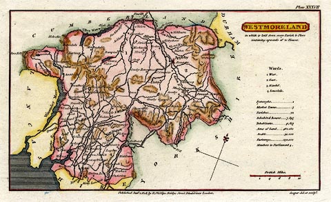
Map, hand coloured engraving, Westmoreland ie
Westmorland, scale about 9 miles to 1 inch, by H Cooper,
1808, published by R Phillips, Bridge Street, Blackfriars,
London, 1808.
Plate 37 from A Topographical Dictionary of the United Kingdom, by Benjamin Pitts Capper. |
||

|
Cooper 1808 | |
| map feature:- | plain cartouche & sea shaded & coast line & north point & up is N (NNW) & scale line & rivers & lakes & relief & hill hachuring & county & wards (hundreds) & settlements & roads & canals | |
| inscription:- |
printed bottom centre and right
Published Jany. 1. 1808, by R. Phillips, Bridge Street Blackfriars London. / Cooper del. et sculpt. |
|
| inscription:- |
printed plain cartouche, upper right, and underneath
WESTMORELAND / in which is laid down every Parish & Place / containing upwards of 20 Houses. |
|
| scale line:- | 10 miles = 28.6 mm | |
| scale:- | 1 to 560000 ? (1 to 562708 from scale line) | |
| wxh, sheet:- | 21x12.5cm | |
| wxh, map:- | 178x102mm | |