Old Cumbria Gazetteer
 |
 |
|
||||||||||||||||
| Carlisle | ||||||||||||||||||
| Luguvalium | ||||||||||||||||||
| Carel | ||||||||||||||||||
| civil parish:- | Carlisle (formerly Cumberland) | |||||||||||||||||
| county:- | Cumbria | |||||||||||||||||
| locality type:- | locality | |||||||||||||||||
| locality type:- | buildings | |||||||||||||||||
| locality type:- | market town | |||||||||||||||||
| locality type:- | selected place | |||||||||||||||||
| locality type:- | twinned town | |||||||||||||||||
| coordinates:- | NY40095591 (etc) | |||||||||||||||||
| 1Km square:- | NY4055 | |||||||||||||||||
| 10Km square:- | NY45 | |||||||||||||||||
| latitude; longitude:- | 2d 56.0m W; 54d 53.7m N | |||||||||||||||||
|
|
||||||||||||||||||
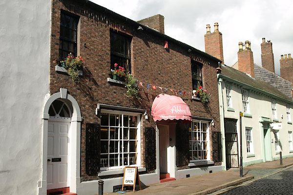
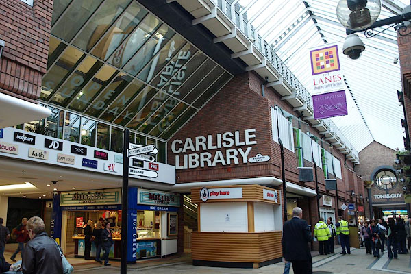
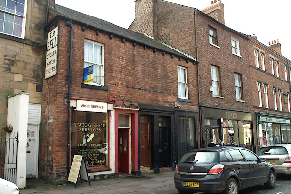
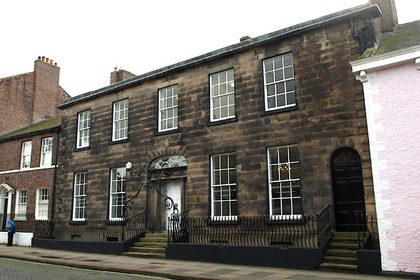
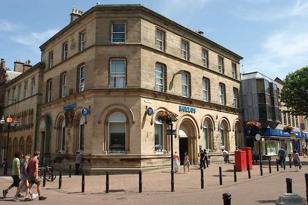
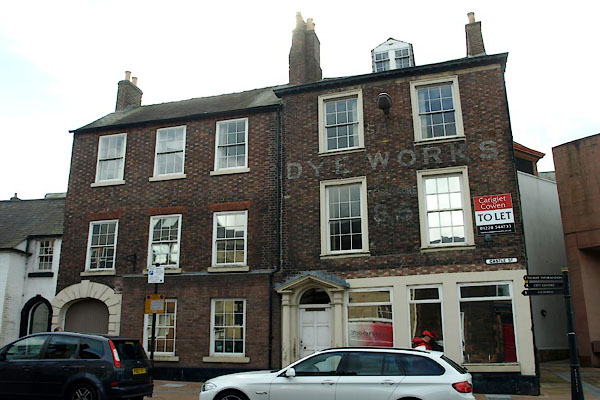
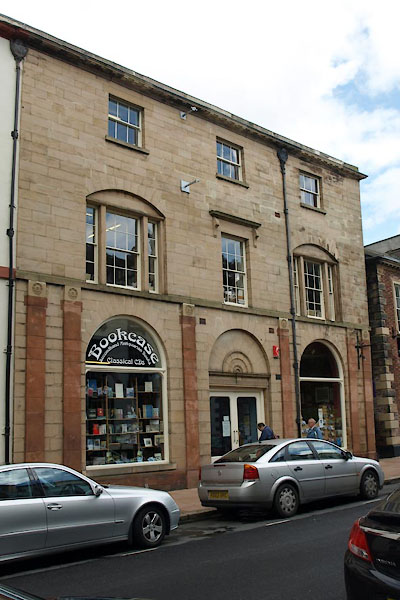
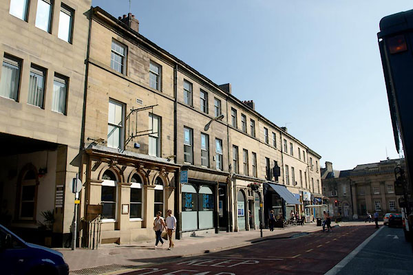
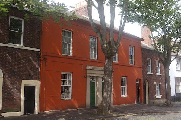
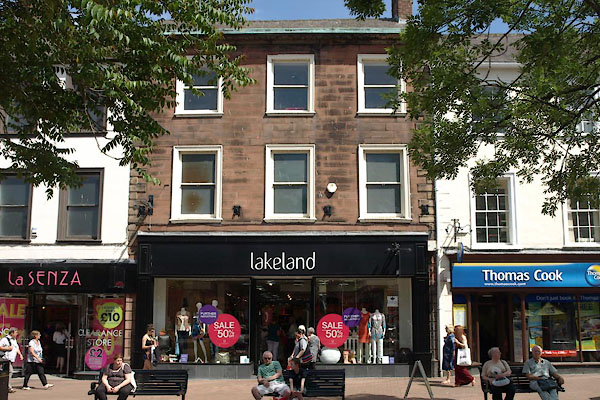
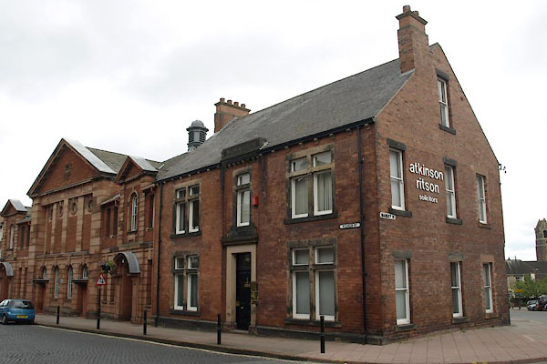
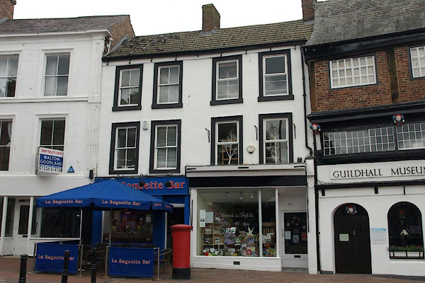
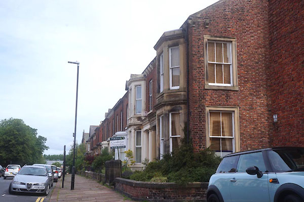
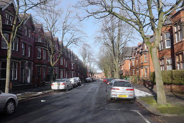
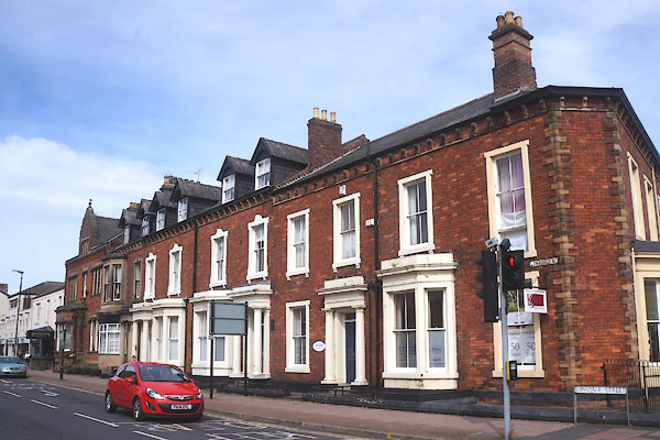
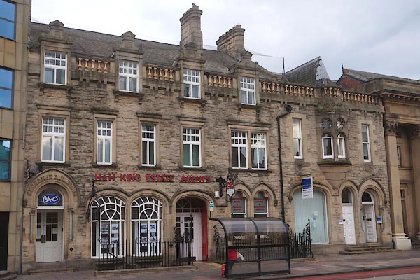
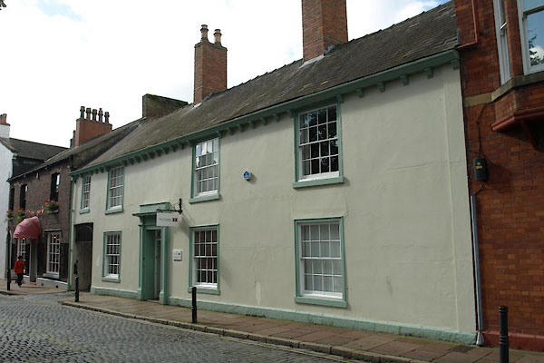
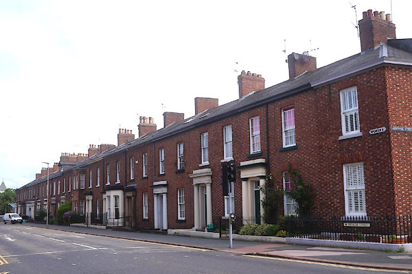
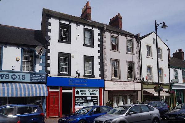
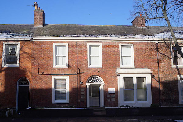
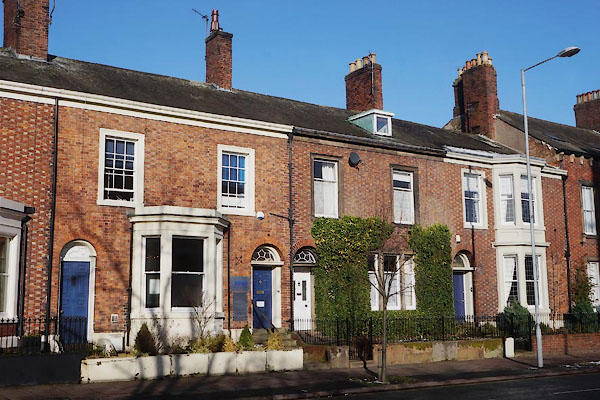
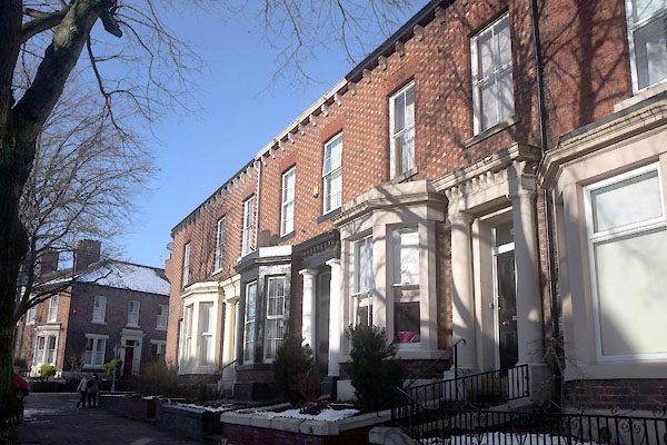
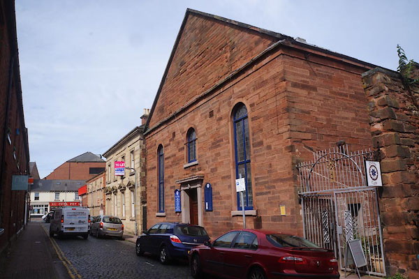
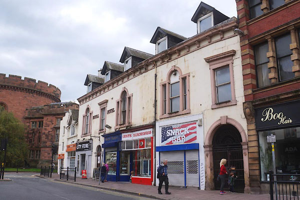
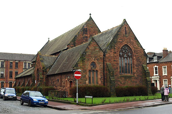
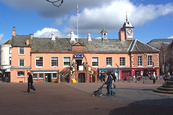
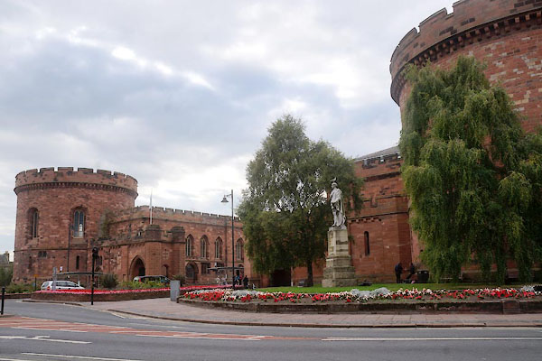
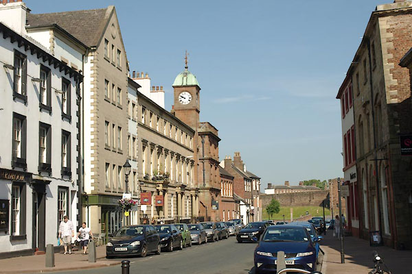
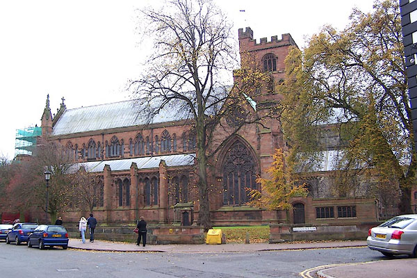
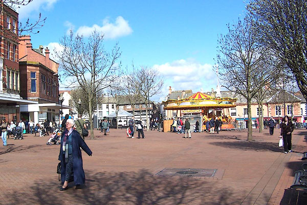 BLW59.jpg Market Place. (taken 19.4.2006) |
||||||||||||||||||
|
|
||||||||||||||||||
| evidence:- | old map:- OS County Series (Cmd 23 3) |
|||||||||||||||||
| source data:- | Maps, County Series maps of Great Britain, scales 6 and 25
inches to 1 mile, published by the Ordnance Survey, Southampton,
Hampshire, from about 1863 to 1948. OS County Series (Cmd 23 4) OS County Series (Cmd 23 7) OS County Series (Cmd 23 8) |
|||||||||||||||||
|
|
||||||||||||||||||
| evidence:- | old map:- OS County Series (Cmd 23 7) placename:- Luguvallium |
|||||||||||||||||
| source data:- | Maps, County Series maps of Great Britain, scales 6 and 25
inches to 1 mile, published by the Ordnance Survey, Southampton,
Hampshire, from about 1863 to 1948. |
|||||||||||||||||
|
|
||||||||||||||||||
| evidence:- | descriptive text:- Monmouth c1136 placename:- Kaerleil |
|||||||||||||||||
| source data:- | Book, The History of the Kings of Britain, by Geoffrey of
Monmouth, about 1136, translated by Lewis Thorpe, published by
Penguin Books, 1966. |
|||||||||||||||||
| source data:- | Courtesy of Penguin Books (licence PM6935) "Leil, the son of Greenshield, a great lover of peace and justice, succeeded him. Leil took advantage of the prosperity of his reign to build a town in the northern part of Britain which he called Kaerleil after himself." |
|||||||||||||||||
|
|
||||||||||||||||||
| evidence:- | old map:- Paris 1240s placename:- Carleolum |
|||||||||||||||||
| source data:- | Map, version B, northern England, Scotland and part of Wales, by Matthew Paris, 1240s.
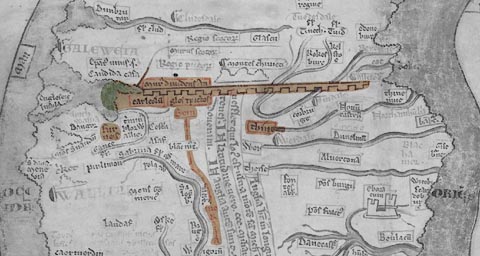 click to enlarge click to enlargePAR2Cm.jpg "carleolu~" derived from copyright image, courtesy of Corpus Christi College item:- Corpus Christi, Cambridge : MS16.f4.5 Image © see bottom of page |
|||||||||||||||||
|
|
||||||||||||||||||
| evidence:- | old map:- Paris 1240s placename:- Karleolum placename:- Carleolum placename:- Karleol |
|||||||||||||||||
| source data:- | Maps, 4 manuscripts, of Great Britain by Matthew Paris, St
Albans, drawn in the mid 13th century. |
|||||||||||||||||
|
|
||||||||||||||||||
| evidence:- | descriptive text:- Froissart 1325-1400 item:- Arthurian legend |
|||||||||||||||||
| source data:- | Book, The Chronicles of Sir John Froissart, 1325-1400,
translated by Lord Berners, "... Northumberland, ... through which there runneth a river full of flint and great stones, called the Water of Tyne. And on this river standeth the town and castle of Carlisle, the which sometime was king Arthur's, and held his court there oftentimes. Also on that river is assised the town of Newcastle-upon-Tyne, in the which town was the marshall of England with a great company of men of arms, to keep the country against the Scots: and at Carlisle was the lord Hereford and the lord Mowbray, who were governours there, to defend the Scots the passage; for the Scots could not enter into England, but they must pass this said river in one place or other. The Englishmen could hear no tidings of the Scots till they were come to the entry of the said country. The Scots were passed this river so privily, that they of Carlisle nor yet of Newcastle knew nothing thereof, for between the said towns it was twenty-four English mile [leagues in the original]." "... but so all that night they [The English] were fain to fast, nor their horses had nothing but leaves of trees and herbs: they cut down boughs of trees with their swords to tie withal their horses and to make themselves lodges. And about noon some poor folks of the country were found, and they said how they were as then fourteen mile from Newcastle-upon-Tyne, and eleven mile from Carlisle, and that there was no town nearer to them wherein they might find anything to do them ease withal. ..." The Scots determined to invade England. An English squire, sent to find out their intent, was discovered and captured. The main army of the Scots went towards Carlisle, while the earl Douglas with a smaller body entered Northumberland. after the Battle of Otterburn, won by the Scots:- "... When tidings came to the other company of the Scots that were beside Carlisle, how their company had distressed the Englishmen beside Otterburn, they were greatly rejoiced, and displeased in their minds that they had not been there. Then they determined to dislodge and to draw into their own countries, seeing their other company were withdrawn. ..." |
|||||||||||||||||
|
|
||||||||||||||||||
| evidence:- | old map:- Gough 1350s-60s placename:- Karlil |
|||||||||||||||||
| source data:- | Map, colour photozincograph copy, reduced size facsimile, Gough
Map of Britain, scale about 28.5 miles to 1 inch, published by
the Ordnance Survey, Southampton, Hampshire, 1875. click to enlarge click to enlargeGgh1Cm.jpg item:- JandMN : 33 Image © see bottom of page |
|||||||||||||||||
|
|
||||||||||||||||||
| evidence:- | old map:- Gough 1350s-60s placename:- Karlil |
|||||||||||||||||
| source data:- | Map, lithograph facsimile, Gough Map of Britain, 20 miles to 1
inch? published by the Ordnance Survey, Southampton, Hampshire,
1935. click to enlarge click to enlargeGgh2Cm.jpg item:- JandMN : 34 Image © see bottom of page |
|||||||||||||||||
|
|
||||||||||||||||||
| evidence:- | old map:- Ptolemy 1540 placename:- Karlil |
|||||||||||||||||
| source data:- | Map, copy, uncoloured lithograph? Anglia II Nova Tabula, New Map
of England, scale about 50 miles to 1 inch, data in the
Geographia by Claudius Ptolemy, engraved by Sebastian Munster,
Basle, Switzerland, 1540.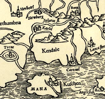 click to enlarge click to enlargePTY4Cm.jpg "Karlil" circle, buildings, towers; town item:- private collection : 131 Image © see bottom of page |
|||||||||||||||||
|
|
||||||||||||||||||
| evidence:- | old map:- Lloyd 1573 placename:- Caerlyle |
|||||||||||||||||
| source data:- | Map, hand coloured copper plate engraving, Angliae Regni,
Kingdom of England, with Wales, scale about 24 miles to 1 inch, authored by Humphrey
Lloyd, Denbigh, Clwyd, drawn and engraved
by Abraham Ortelius, Netherlands, 1573. click to enlarge click to enlargeLld1Cm.jpg "Caerlyle" item:- Hampshire Museums : FA1998.69 Image © see bottom of page |
|||||||||||||||||
|
|
||||||||||||||||||
| evidence:- | old map:- Saxton 1579 placename:- Carlisle |
|||||||||||||||||
| source data:- | Map, hand coloured engraving, Westmorlandiae et Cumberlandiae Comitatus ie Westmorland
and Cumberland, scale about 5 miles to 1 inch, by Christopher Saxton, London, engraved
by Augustinus Ryther, 1576, published 1579-1645.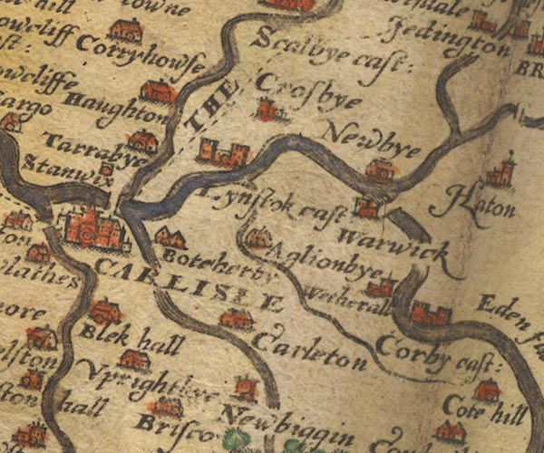 Sax9NY45.jpg Buildings and towers, symbol for a town. "CARLISLE" item:- private collection : 2 Image © see bottom of page |
|||||||||||||||||
|
|
||||||||||||||||||
| evidence:- | old map:- Burghley 1590 (facsimile) placename:- Carlisle |
|||||||||||||||||
| source data:- | Facsimile map, A Platt of the Opposete Border of Scotland to ye West Marches of England,
parts of Cumberland and Scotland including the Debateable Land, from a manuscript
drawn for William Cecil, Lord Burghley, about 1590, published by R B Armstrong, 1897. courtesy of the National Library of Scotland 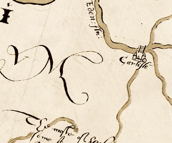 M048NY35.jpg "Carlisle" circle, buildings or walls, two towers item:- National Library of Scotland : MS6113 f.267 Image © National Library of Scotland |
|||||||||||||||||
|
|
||||||||||||||||||
| evidence:- | old map:- Mercator 1595 (edn?) placename:- Carlysle |
|||||||||||||||||
| source data:- | Map, hand coloured engraving, Northumbria, Cumberlandia, et
Dunelmensis Episcopatus, ie Northumberland, Cumberland and
Durham etc, scale about 6.5 miles to 1 inch, by Gerard Mercator,
Duisberg, Germany, about 1595.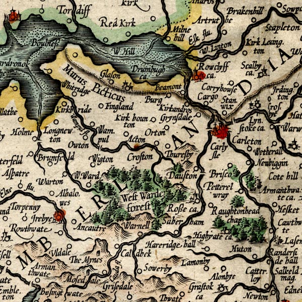 MER8CumC.jpg "Carlysle" circle, buildings, towers, tinted red; city item:- JandMN : 169 Image © see bottom of page |
|||||||||||||||||
|
|
||||||||||||||||||
| evidence:- | old map:- Keer 1605 placename:- Carleslo |
|||||||||||||||||
| source data:- | Map, hand coloured engraving, Westmorland and Cumberland, scale
about 16 miles to 1 inch, probably by Pieter van den Keere, or
Peter Keer, about 1605 edition perhaps 1676. click to enlarge click to enlargeKER8.jpg "Carleslo" dot, two circle, tower, tinted red; town item:- Dove Cottage : 2007.38.110 Image © see bottom of page |
|||||||||||||||||
|
|
||||||||||||||||||
| evidence:- | descriptive text:- Keer 1605 (edn 1620) placename:- Carlile placename:- Luguvallum placename:- Luell placename:- Leucopibia placename:- Caerlualid item:- longitude; latitude; Carlisle, lat and long |
|||||||||||||||||
| source data:- | Map, Westmorlandia et Comberlandia, ie Westmorland and
Cumberland now Cumbria, scale about 16 miles to 1 inch, probably
by Pieter van den Keere, or Peter Keer, about 1605, published
about 1605 to 1676. goto source goto sourcethird page:- "(7) The chiefest Citie in this Shire is Carlile, pleasantly seated betwixt the Rivers Eden, Petterell, and Caud, by the Romans called Luguvallum; by Beda, Luell; by Ptolemy, Leucopibia; by Ninius, Caerlualid; and by us Carlile. This Citie flourishing under the Romans, at their departure, by the furious outrages of the Scots and Picts was dejected, yet in the dayes of Egfrid King of Northumberland was walled about: but againe defaced by the over-running Danes, lay buried in her owne ashes the space of two hundred yeares; upon whose ruines at length Rufus set his compassionate eye, and built there the Castle, planting a Colony of Flemings to secure the Coasts from the Scots, but upon better advisement removed them into Wales. After him, Henry his brother and successor ordained this Citie for an Episcopall See: whose site is placed at the degree of Longitude from the first West part 17. and 2 scruples, and the Pole thence elevated from the degree of Latitude 55. and 56. scruples." |
|||||||||||||||||
|
|
||||||||||||||||||
| evidence:- | old map:- Speed 1611 (Cum/EW) placename:- Carlisle |
|||||||||||||||||
| source data:- | Map, hand coloured engraving, Kingdome of Great Britaine and
Ireland, scale about 36 miles to 1 inch, by John Speed, about
1610-11, published by Thomas Bassett, Fleet Street and Richard
Chiswell, St Paul's Churchyard, London, 1676? click to enlarge click to enlargeSPD6Cm.jpg "Carlisle" dor, circle, building, tower? item:- private collection : 85 Image © see bottom of page |
|||||||||||||||||
|
|
||||||||||||||||||
| evidence:- | old map:- Speed 1611 (Cmd) placename:- Carlile |
|||||||||||||||||
| source data:- | Map, hand coloured engraving, Cumberland and the Ancient Citie
Carlile Described, scale about 4 miles to 1 inch, by John Speed,
1610, published by J Sudbury and George Humble, Popes Head
Alley, London, 1611-12.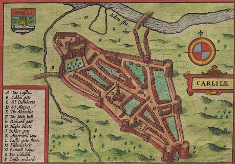 click to enlarge click to enlargeSP11Mk.jpg "CARLILE" item:- private collection : 16 Image © see bottom of page |
|||||||||||||||||
|
|
||||||||||||||||||
| evidence:- | old map:- Speed 1611 (Cmd) placename:- Carlile |
|||||||||||||||||
| source data:- | Map, hand coloured engraving, Cumberland and the Ancient Citie
Carlile Described, scale about 4 miles to 1 inch, by John Speed,
1610, published by J Sudbury and George Humble, Popes Head
Alley, London, 1611-12.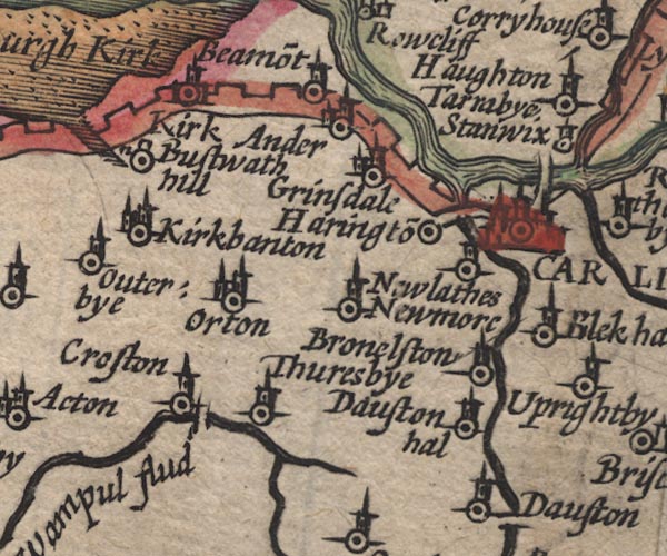 SP11NY35.jpg "CARLILE" circle, buildings, towers item:- private collection : 16 Image © see bottom of page |
|||||||||||||||||
|
|
||||||||||||||||||
| evidence:- | poem:- Drayton 1612/1622 text placename:- Carlill |
|||||||||||||||||
| source data:- | Poem, Poly Olbion, by Michael Drayton, published by published by
John Marriott, John Grismand and Thomas Dewe, and others?
London, part 1 1612, part 2 1622. goto source page 167:- "... ... Eden as to win Her grace in Carlils sight, the Court of all her state, And Cumberlands chiefe towne, loe thus shee doth dilate." "What giveth more delight, (brave Citie) to thy Seat, Then my sweet lovely selfe, a River so compleat, With all that Nature can a dainty Flood endow, That all the Northerne Nymphs me worthily allow, Of all their Nyades kind the neatest, and so farre Transcending, that oft times they in their amorous warre, Have offered by my course, and Beauties to decide The mastery, with her most vaunting in her pride, That mighty Roman Fort, which of the Picts we call But by them neere those times was stil'd Severus wall, Of that great Emperour nam'd, which first that worke began, Betwixt the Irish Sea, and German Ocean, Doth cut me in his course neere Carlill, ..." "... Severus wall, Of that great Emperour nam'd, which first that worke began, ... Doth cut me [Eden] in his course neere Carlill, ..." |
|||||||||||||||||
|
|
||||||||||||||||||
| evidence:- | old map:- Drayton 1612/1622 placename:- Carlell |
|||||||||||||||||
| source data:- | Map, hand coloured engraving, Cumberlande and Westmorlande, by
Michael Drayton, probably engraved by William Hole, scale about
4 or 5 miles to 1 inch, published by John Mariott, John
Grismand, and Thomas Dewe, London, 1622.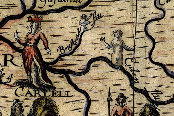 DRY504.jpg "CARLELL" Lady with 'town' headress. item:- JandMN : 168 Image © see bottom of page |
|||||||||||||||||
|
|
||||||||||||||||||
| evidence:- | table of distances:- Simons 1635 |
|||||||||||||||||
| source data:- | Table of distances, uncoloured engraving, Cumberland, with a
thumbnail map, scale about 41 miles to 1 inch, by Mathew Simons,
published in A Direction for the English Traviller, 1635.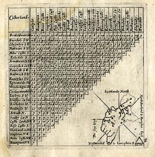 click to enlarge click to enlargeSIM4.jpg C on thumbnail map item:- private collection : 50.11 Image © see bottom of page |
|||||||||||||||||
|
|
||||||||||||||||||
| evidence:- | old map:- Jenner 1643 placename:- Carlile |
|||||||||||||||||
| source data:- | Tables of distances with a maps, Westmerland, scale about 16
miles to 1 inch, and Cumberland, scale about 21 miles to 1 inch,
published by Thomas Jenner, London, 1643; published 1643-80. JEN4Sq.jpg "Carlile" dot, double circle, buildings, red tint |
|||||||||||||||||
|
|
||||||||||||||||||
 Ogilby 1675 road strip maps Ogilby 1675 road strip maps |
||||||||||||||||||
|
|
||||||||||||||||||
| evidence:- | old map:- Berry 1679 placename:- Carlile |
|||||||||||||||||
| source data:- | Road map, diagram, The Grand Roads of England, engraved by John
Rich, made and published by William Berry, at the Sign of the
Globe, London, 1679. "CARLILE" market Saturday |
|||||||||||||||||
|
|
||||||||||||||||||
| evidence:- | old map:- Sanson 1679 placename:- Carlile |
|||||||||||||||||
| source data:- | Map, hand coloured engraving, Ancien Royaume de Northumberland
aujourdhuy Provinces de Nort, ie the Ancient Kingdom of
Northumberland or the Northern Provinces, scale about 9.5 miles
to 1 inch, by Nicholas Sanson, Paris, France, 1679. click to enlarge click to enlargeSAN2Cm.jpg "CARLILE" circle, buildings and towers, italic block caps; city item:- Dove Cottage : 2007.38.15 Image © see bottom of page |
|||||||||||||||||
|
|
||||||||||||||||||
| evidence:- | old map:- Seller 1694 (Cmd) placename:- Carlisle |
|||||||||||||||||
| source data:- | Map, uncoloured engraving, Cumberland, scale about 12 miles to 1
inch, by John Seller, 1694. click to enlarge click to enlargeSEL9.jpg "Carlisle" circle, upright lowercase text; town, large item:- Dove Cottage : 2007.38.89 Image © see bottom of page |
|||||||||||||||||
|
|
||||||||||||||||||
| evidence:- | old map:- Morden 1695 (EW) placename:- Carlile |
|||||||||||||||||
| source data:- | Map, hand coloured engraving, England, including Wales, scale
about 27 miles to 1 inch, by Robert Morden, published by Abel
Swale Awnsham and John Churchil, London, about 1695. click to enlarge click to enlargeMRD3Cm.jpg "Carlile" circle, ?buildings and tower; county town item:- JandMN : 339 Image © see bottom of page |
|||||||||||||||||
|
|
||||||||||||||||||
| evidence:- | old map:- Morden 1695 (Cmd) placename:- Carlisle |
|||||||||||||||||
| source data:- | Map, uncoloured engraving, Cumberland, scale about 4 miles to 1
inch, by Robert Morden, 1695, published by Abel Swale, the
Unicorn, St Paul's Churchyard, Awnsham, and John Churchill, the
Black Swan, Paternoster Row, London, 1695-1715.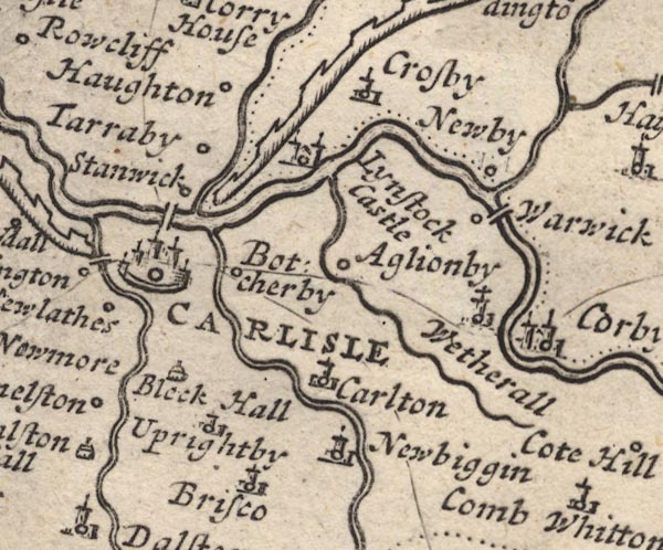 MD12NY45.jpg "CARLISLE" Circle, buildings and towers, with a town wall. item:- JandMN : 90 Image © see bottom of page |
|||||||||||||||||
|
|
||||||||||||||||||
| evidence:- | descriptive text:- Fiennes 1698 placename:- Carlisle item:- market; house |
|||||||||||||||||
| source data:- | Travel book, manuscript record of Journeys through England
including parts of the Lake District, by Celia Fiennes, 1698. "Carlisle stands in view at least 4 mile distant; the town is walled in and all built of stone, the Cathedrall stands high and very eminent to be seen above the town; you enter over the bridge and double gates which are iron-grates and lined with a case of doores of thick timber; there are 3 gates to the town one called the English gate at which I entred, the other the Irish which leads on to White haven and Cokermouth, the other the Scottish gate through which I went into Scotland; the walls of the town and battlements and towers are in very good repaire and looks well; the Cathedrall all built of stone which looked stately but nothing Curious; there was some few houses as the Deans and Treasurer and some of the Doctors houses walled in with little gardens their fronts looked gracefully, else I saw no house except the present Majors [mayor's] house of brick and stone, and one house which was the Chancellors built of stone very lofty 5 good sarshe windows in the front, and this within a stone wall'd garden well kept and iron gates to discover it to view with stone pillars; the streetes are very broad and handsome well pitch'd." "I walked round the walls and saw the river, which twists and turns it self round the grounds, called the Emount which at 3 or 4 miles off is flow'd by the sea; the other river is the Essex which is very broad and ebbs and flows about a mile or two off; there remaines only some of the walls and ruines of the Castle which does shew it to have been a very strong town formerly; the walls are of a prodigious thickness and vast great stones, its moated round and with draw bridges; there is a large Market place with a good Cross and Hall and is well supply'd as I am inform'd with provision at easye rates, but my Landlady notwithstanding ran me up the largest reckoning for allmost nothing; it was the dearest lodging I met with and she pretended she could get me nothing else, so for 2 joynts of mutton and a pinte of wine and bread and beer I had a 12 shilling reckoning; but since, I find tho' I was in the biggest house in town I was in the worst accomodation, and so found it, and a young giddy Landlady that could only dress fine and entertain the soldiers." |
|||||||||||||||||
|
|
||||||||||||||||||
| evidence:- | old map:- Ogilby 1699 map (edn 1712) placename:- Carlisle |
|||||||||||||||||
| source data:- | Road map, uncoloured engraving, a New Mapp of the Roads of England, by John Ogilby,
published by William Bray, Exeter Court, Strand, London, 1712. "Carlisle" 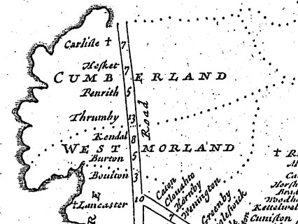 click to enlarge click to enlargeOGY7Cm.jpg item:- private collection : 263.1 Image © see bottom of page |
|||||||||||||||||
|
|
||||||||||||||||||
| evidence:- | old text:- Ogilby 1699 (edn 1712) placename:- Carlile placename:- Luguvallum placename:- Caer Luel placename:- Carleil item:- market |
|||||||||||||||||
| source data:- | Road book, itineraries and map, The Traveller's Guide, by John
Ogilby, published by Abel Swall, Tim Child, White Hart, and R
Knaplock, the Angel and Crown, St Paul's Churchyard, London,
1699. OGY7p072.txt page 72 Distances from London "LONDON to CARLILE in Cumberland. PART II." "Commencing at Garstang in Lancashire, and Extending to CARLISLE." "Containing 78 Miles 3 Furlongs." "..." "At 298'3 appears Carlton-V. of 3F. and at 299'6 Boteherby vulgo Burraby of 2F. at the End of which crossing Petterel flv. at 300'7 at the English-gate enter the City of CARLILE." "A place of great Antiquity, Eminent under the Romans, and call'd in the Itinerary Tables Luguvallum; interperted the Tower by the Vallum, i.e. the Picts Wall; near which it stands; whence contractedly Caer-luel and Carleil or Carlile: 'Twas encompass'd with a Wall, about A.C.680 by Egfred K. of the Northumbers, and Fortify'd with a Castle by K. W. Rufus: Made an Episc. See by Hen. I Anno 1133. and dignify'd with the Title of an Earldom, belonging to the Noble Family of the Howards. 'Tis seated on the S. of Eden flv. and between the Petterel and the Caud on the E. and W. and lies Triangular, the Castle standing in the N.W. corner, the Cathedral is a fine Structure, and the Houses well-built: 'Tis govern'd by a Mayor, 12 Alderm. 2 Bailiffs, &c. sends Burgesses to Parl; Trades chiefly in Fustians, and keeps a considerable Mt. on Saturdays having 3 Gates, viz. the Caldo or Irish-Gate, Bother or English-Gate, and Rickard or Scotch-Gate." |
|||||||||||||||||
|
|
||||||||||||||||||
| evidence:- | old map, descriptive text:- Bowen 1720 (plate 161) |
|||||||||||||||||
| source data:- | Road strip map, uncoloured engraving, pl.161, part of The Road
from Carlisle to Barwick, scale about 2 miles to 1 inch, with
sections in Cumberland, and Scotland, published by Emanuel
Bowen, St Katherines, London, 1720.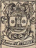 click to enlarge click to enlargeB161Arm2.jpg "Ye Arms of CARLISLE" "CARLISLE - is a City of great Antiquity: said to have been built by [Luel] or Lugubal, a petty king of ye County, long before ye coming of ye Romans: Upon their recess out of this Isle, it was ruined by ye incursions of ye Caledonians or Picts, and other Barbarous Northern Nations; Afterwds. about ye Year 680 it was rebuilt & Walled round with Stone, by Edgfrid K. of Northumberland. Again in ye Yeares 700 & 800 it was sacked & layed in Ashes by ye Danes & Norwegians, & remained in a desolate condition till ye time of Willm. Rufus who haveing made a Peace with ye Scots, visited Carlisle, & considering how good a Barrier it might be against that People, in case of a new eruption, ordered ye Walls & Castle to be repaired. K. Henry 1st. repaired & much augmented its Fortifications. The Castle is at this Day a well Fortifyed building, as is the Cittadel, which rec~ed considerabel additions in its Strength, from K. Henry 8th. The Cathedral (tho it suffered considerably in ye great Rebellion) Still remains a very Magnificent Structure, & there are besides 2 good Parish Churches. The Corporation is very Ancient, by Charter from K: Edwd. 3d. 26o. Rni., Rich. 2d. 5o. & 14o. Rni. Hen. 4th. 12o. Rni., & Hen. 6th. 13o. Rni. &c. & consists of a Mayor, chosen Yearly out of 12 Aldermen, a Recorder, Chamberlain, 2 Sheriffs, chosen Yearly out of 24 Capital Citizens or Comon Council men, a Sword & Mace bearer &c. It trades chiefly in Fustian. Markets, Wednesday & Saturday. Fairs, August 15th., &September 8th." item:- JandMN : 65.161 Image © see bottom of page |
|||||||||||||||||
|
|
||||||||||||||||||
| evidence:- | old map:- Bowen 1720 (plate 94) placename:- Carlisle item:- town wall; town gate |
|||||||||||||||||
| source data:- | Strip maps, uncoloured engravings, road maps, The Road from
London to Carlisle, scale about 2 miles to 1 inch, with sections
in Lancashire and Westmorland, published by Emanuel Bowen, St
Katherines, London, 1720.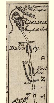 B094m297.jpg Drawn with town walls, castle and cathedral, entering by English Gate. Eden Flu. and Stanwick Chapel item:- Dove Cottage : 2007.38.100 Image © see bottom of page |
|||||||||||||||||
|
|
||||||||||||||||||
| evidence:- | old map:- Bowen 1720 (plate 261) |
|||||||||||||||||
| source data:- | Road strip map, uncoloured engraving, pl.261, the end of the
road from Kendal to Cockermouth and the road from Egremont to
Carlisle, scale about 2 miles to 1 inch, published by Emanuel
Bowen, St Katherines, London, 1720.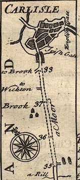 B261m35.jpg The road shown entering Carlisle by Irish Gate; English Gate to right item:- Dove Cottage : Lowther.36 Image © see bottom of page |
|||||||||||||||||
|
|
||||||||||||||||||
| evidence:- | old map:- Bowen 1720 (plate 161) placename:- Carlisle item:- town wall; town gate |
|||||||||||||||||
| source data:- | Road strip map, uncoloured engraving, pl.161, part of The Road
from Carlisle to Barwick, scale about 2 miles to 1 inch, with
sections in Cumberland, and Scotland, published by Emanuel
Bowen, St Katherines, London, 1720. B161m00.jpg "CARLISLE" Showing a street plan, and town walls and gates. item:- JandMN : 65.161 Image © see bottom of page |
|||||||||||||||||
|
|
||||||||||||||||||
| evidence:- | old map:- Bowen 1720 (plate 232) placename:- Carlisle item:- town wall; town gate |
|||||||||||||||||
| source data:- | Road strip map, road map, pl.232, part of The Road from Tinmouth
to Carlisle, scale about 2 miles to 1 inch, with sections in
Northumberland and Cumberland, published by Emanuel Bowen, St
Katherines, London, 1720.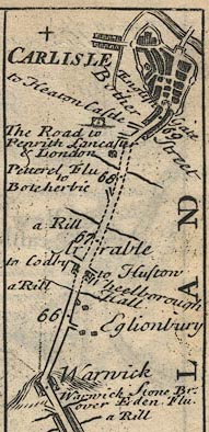 B232m65.jpg "CARLISLE / Bother Street / English Gate" Street plan, town walls and gates, etc; mile 69½. item:- JandMN : 65.232 Image © see bottom of page |
|||||||||||||||||
|
|
||||||||||||||||||
| evidence:- | old map:- Stukeley 1723 placename:- Carlile placename:- Lugubalum |
|||||||||||||||||
| source data:- | Road map, uncoloured engraving, the Antonine Itineraries through
Britain, scale about 55 miles to 1 inch, plotted by William
Stukeley, 1723, published London, 1724.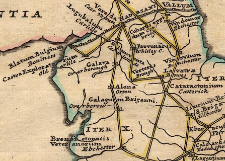 click to enlarge click to enlargeStu1Cm.jpg "Lugubalum / Carlile" item:- Hampshire Museums : FA2001.171 Image © see bottom of page |
|||||||||||||||||
|
|
||||||||||||||||||
| evidence:- | descriptive text:- Defoe 1724-26 placename:- Carlisle |
|||||||||||||||||
| source data:- | Tour through England and Wales, by Daniel Defoe, published in
parts, London, 1724-26. "... we came to Carlisle, a small, but well fortified city, the frontier place and key of England on the west sea, as Berwick upon Tweed is on the east; and in both which there have, for many years, I might say ages, been strong garrisons kept to check the invading Scots;" "..." "But I return to Carlisle: The city is strong, but small, the buildings old, but the streets fair; the great church is a venerable old pile, it seems to have been built twice, or, as it were, rebuilt, the upper part being much more modern than the lower." "King Henry VIII fortify'd the city against the Scots, and built an additional castle to it on the east side, which Mr. Cambden, though I think not justly, calls a cittadel; there is indeed another castle on the west, part of the town rounds the sea, as the wall rounds the whole, is very firm and strong. But Carlisle is strong by situation, being almost surrounded with rivers. On the east it has the River Potterell, on the north Eden, and on the south the Cande, or Canda, or Calda, which all fall into the arms of the sea, which they call the Solway, or Solway Firth." "..." "There is not a great deal of trade here either by sea or land, it being a meer frontier." |
|||||||||||||||||
|
|
||||||||||||||||||
| evidence:- | old map:- Millward and Dickinson 1737 placename:- Carlisle |
|||||||||||||||||
| source data:- | Road map, photocopy, diagram, A New and Correct Map of Roads of
England, probably published by T Millward and B Dickinson, Inigo
Jones's Head, Fleet Street, London, 1737. "CARLISLE / 301" miles from London 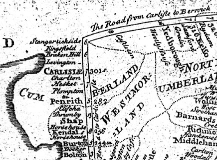 click to enlarge click to enlargeMWD1Cm.jpg item:- private collection : 264 Image © see bottom of page |
|||||||||||||||||
|
|
||||||||||||||||||
| evidence:- | old map:- Badeslade 1742 placename:- Carlisle |
|||||||||||||||||
| source data:- | Map, uncoloured engraving, A Map of Cumberland North from
London, scale about 11 miles to 1 inch, with descriptive text,
by Thomas Badeslade, London, engraved and published by William
Henry Toms, Union Court, Holborn, London, 1742. click to enlarge click to enlargeBD10.jpg "CARLISLE / 235 m" circle and several towers; town; two stars, distance from London; and descriptive text:- "Carlisle is a City &Bishoprick, sends 2 Members [to Parliament], Market Saturday, Fairs August 15. Wednesday before Easter, and 1st. Wednesday in June." item:- JandMN : 115 Image © see bottom of page |
|||||||||||||||||
|
|
||||||||||||||||||
| evidence:- | old text:- Gents Mag placename:- Caer Luel placename:- Lugubal placename:- Luguballum placename:- Luguvallum placename:- Leucopibia placename:- Caer Lualid placename:- Duballus placename:- Carlile placename:- Caerleolum item:- placename, Carlisle; town walls; Carlisle, fire; local authority, Carlisle; Carlisle, siege; siege, Carlisle; rebellion, 1745; 1745 Rebellion |
|||||||||||||||||
| source data:- | Magazine, The Gentleman's Magazine or Monthly Intelligencer or
Historical Chronicle, published by Edward Cave under the
pseudonym Sylvanus Urban, and by other publishers, London,
monthly from 1731 to 1922. goto source Gentleman's Magazine 1745 p.673 "A short description of the ancient City of CARLISLE." "CARLISLE has a most pleasant situation, being between three rivers, having on the North side the Eden, on the East the Petterell, and on the West the Caude. It is secured by a strong stone wall, a castle, and a citadel. 'Tis of an oblong form from N. West to S. East, extending in a point to the *South; ..." "The British chronicle tells us, that it was first built by a petty king of this country, named Luel, or Lugubal, long before the Romans invaded Britain, and upon that account had the name of Caer-Luel or Lugubal. When the Roman legions, in the reign of the emperor Claudius, extending their conquests thus far Northward, they alter'd the name but very little, calling it Luguballum, or Luguvallum. The Saxons kept to the old name Luel. Ptolemy calls it Leucopibia: Nennius, Caer Lualid; the Welch writers, the city of Duballus, we Carlile; and the Latins, Caerleolum. Great pains are taken by some to find out the derivation of the name Luguballum; but none is so probable as this, that being situate just by the Picts wall or Vallum, and Lugus, or Lucus, signifying, in the language of the Celtae and Britains, a tower, it implies a tower or fort upon the wall, or Vallum. And tho' indeed there are little or no remains of the [Stan-]" "*(Or may be said to lie South and North, a part extending to the N. West.)" |
|||||||||||||||||
| source data:- | goto source Gentleman's Magazine 1745 p.674 "wall near this city standing, yet at Stanwicks, a small village just over the bridge, and in the channel of the river itself, there are plain remains of it." "That this city flourished in the time of the Romans, appears evidently from many antiquities frequently dug up here, and the common mention of it in Roman authors." "Upon the departure of the Romans, it was ruin'd by the Scots and Picts, who spoil'd and ravag'd it, and it lay bury'd in its ruins till about the year of Christ 680, when Egfrid rebuilt it, and encompassed it with a fair stone wall; and having repaired the church, restor'd divine worship, placed in it a college of secular priests, and gave it to St Cuthbert, bishop of Landisfern, and his successors, with all the lands 15 miles round." "Again, in the 8th and 9th centuries, the whole country was ruin'd by repeated incursions of the Danes and Norwegians, this city being laid quite desolate, some few ecclesiastics and chief inhabitants only excepted, and in this miserable state it continued 200 years. The Norman conquest, which happen'd in that time, better'd not its condition, for Wm the conqueror took no farther notice of it, than by his writ to subject it, and the rest of the county to the see of Durham. But Wm Rufus, his son, returning from the Scotch wars, after he had settled a peace with that nation, made a visit to Carlile, and being pleased with the situation, proceeded to repair the walls and castle, and rebuild the houses, sending thither first a colony of Flemings, (whom upon second thoughts he removed afterwards into North Wales and Anglesey) and then of English husbandmen out of the South, to teach them to till and improve their land, which before lay uncultivated." "Carlile being thus in some measure restored, K. Henry I. considering how good a barrier it might be made against the Scots, caused it to be well fortified, placed a garrison in it, dignified it with an episcopal see, and bestowed upon it many other privileges and emoluments, which his successors , even down so low as Q. Elizabeth, very much augmented. It was indeed often besieged by the Scots, and twice taken, viz. in K. Stephen's and K. John's days, but recover'd again by their successors K. Henry II. and III. and tho' it was burnt by misfortune 14 Richard II. and near 1500 houses destroyed, with the cathedral and suburbs, yet by the munificence of the succeeding kings it was again restored, and much improv'd in strength and beauty." "It is at present a wealthy and populous place, the houses are well built, and city walled in, having three gates, viz. the Caldo or Irish gate on the S. West, the Bother or English gate on the South, and the Rickard or Scotch gate towards the North. It is govern'd by a mayor, 12 aldermen, two bailiffs, &c. The assizes and sessions for the most part are held in this city." "It has but two parish churches, ..." "This observation is made by the reverend compiler of the Magna Britannia antiqua et nova, from whom the foregoing description is taken, ..." "This city was formerly esteemed the key of England against the Scots on the West side, as Berwick was on the East, and so far is a place of great importance. Notwithstanding it was well provided with cannon, ammunition, &c. it was soon taken by the rebels, for which many causes are assigned [(see]" |
|||||||||||||||||
| source data:- | Armitt Library Collections; books, prints, photographs etc at the Armitt Library and
Museum, Ambleside, Cumbria. goto source Gentleman's Magazine 1745 p.675 "(see p.605 F) in private letters from thence, the writers of them mutually excusing their friends, and charging others with the whole blame, and even with cowardice. A time may come when it will be more easy to discover the truth, or at least more proper to publish these varying accounts." "This city was surrender'd to the rebels Nov. 16, 1745, and taken by his royal highness the D. of Cumberland, after 48 hours battering the West curtain of the castle from Primrose Hill, on Dec. 30, about 400 rebels left there, on the precipitate retreat of the main body to Scotland, surrendering to the king's mercy."  click to enlarge click to enlargeG745M01.jpg The map is a copy of John Speed's map, 1611. item:- Armitt Library Collections Image © see bottom of page |
|||||||||||||||||
|
|
||||||||||||||||||
| Gents Mag 1745 siege |
||||||||||||||||||
|
|
||||||||||||||||||
| evidence:- | old text:- Gents Mag item:- rebellion, 1745; 1745 Rebellion; map; Map of the Countries Adjacent to CARLISLE shewing the Route of the Rebels |
|||||||||||||||||
| source data:- | Map, uncoloured engraving, Map of the Countries Adjacent to
Carlisle shewing the Route of the Rebels, scale about 1 inch to
1 mile, by G Smith, published in the Gentleman's Magazine,
London, 1746. goto source Gentleman's Magazine 1746 opp p.233 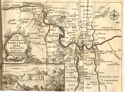 click to enlarge click to enlargeSMT8.jpg Map, uncoloured engraving, Map of the Countries adjacent to Carlisle shewing the Route of the Rebels, published by the Gentleman's Magazine, London, 1746. "A MAP of the Countries Adjacent to CARLISLE shewing the Route of the Rebels with their principal Ford over ye Rr. EDEN. By G. Smith." Size: wxh, sheet = 26.5x20.5cm; scale = 1 to 57000? item:- Hampshire Museums : B1999.518.1746.map Image © see bottom of page |
|||||||||||||||||
|
|
||||||||||||||||||
| Gents Mag 1746 siege |
||||||||||||||||||
|
|
||||||||||||||||||
| evidence:- | descriptive text:- Simpson 1746 placename:- Carlisle placename:- Caer Luel placename:- Caer Lugubal placename:- Luguballum placename:- Lugubalia item:- fortifications; population, Carlisle |
|||||||||||||||||
| source data:- | Atlas, three volumes of maps and descriptive text published as
'The Agreeable Historian, or the Compleat English Traveller
...', by Samuel Simpson, 1746. goto source "Carlisle, the British Chronicle tells us, was first built by a petty King of this County, named Luel, or Lugubal, long before the Romans invaded Britain, and upon that Account had the name of Caer-luel, or Lugubal. In the Time of the Emperor Claudius, when the Roman Legions had extended their Conquest thus far Northward, they altered the Name but very little, calling it Luguballum, or Lugubalia, and fixed their Head Quarters here; whence it is that so many Roman Monuments have been, and still are discover'd in this Neighbourhood, ... This City of Carlisle is 235 Miles computed from London, and 302 measured." "Upon the Departure of the Romans, this City was ruined by the Caledonians, i.e. Scots and Picts, and other barbarous Nations, who spoiling and ravaging it, it lay buried it in its Ruins 'till about the Year of Christ 680, when Egfrid rebuilt it, and encompass'd it with a Stone" goto source"Wall, repair'd the Church, and annexed a College of Canons, or Prebends, to it." "But in the 8th and 9th Centuries, the whole County was again ruined by the repeated Incursions of the Danes and Norwegians, this City being laid quite desolate, and all the Citizens barbarously destroy'd, some few Ecclesiasticks and chief Inhabitants excepted, and in this miserable State it continu'd 200 Years, 'till the Time of the Norman Conquests, which better'd not its Condition, for William, the Conqueror, took no farther Notice of it, than by Writ to subject it, and the rest of the County, to the See of Durham: but William Rufus, his Son, returning Home from the Scotch Wars, after he had settled a Peace with that Nation, made a Visit to Carlisle, and being pleas'd with the Situation, he repair'd it, both as to the Fortifications and Houses, and placed here a Colony first of Flemings, and afterwards of English Husbandmen from the more Southern Provinces, for the Improvement of the Lands, which had then lain so long uncultivated." "Carlisle being thus in some Measure restor'd, King Henry I. considering how good a Barrier it might be made against the Scots, caused it to be well fortify'd, plac'd a Garrison in it, dignify'd it with an Episcopal See, and bestow'd upon it many other Privileges and Emoluments, which might make it strong and populous, which his Successors, even down so low as Queen Elizabeth, very much augmented. It was indeed often besieg'd by the Scots, and twice taken, viz. in King Stephen's and King John's Reigns; but was recover'd gain by their successors King Henry II. and III. and tho' it was burnt by Misfortune in the reign of Richard II. and near 1500 Houses destroy'd, with the Cathedral and Suburbs, yet by the Munificence of the succeeding Kings, it was again restor'd, and much improved in Strength and Beauty." "It is, at present, a wealthy and populous Place, the Houses are well built, the City walled in, having three Gates, viz. the Caldo, or Irish Gate, on the S. the Bother, or English Gate, on the W. and the Richard, or Scotch Gate, towards the N. It trades chiefly in Fustian, has a considerable Market on Saturdays, and three Fairs" goto source"annually, viz. on the Wednesday before Easter, on the first Wednesday in June, and on the 15th of August. It is govern'd by a Mayor, &c. The Assizes and Sessions, for the most Part, are held in this City" "King Edward I. held a Parliament here in the 35th Year of his Reign; and King Henry II. committed the Custody of the City to the Citizens, and granted them the said City, and the Mills thereunto belonging, and the Royalty of Eden Water, in Fee Farm at 80 l. per Annum, with Liberty of the Waste, and to be free from Toll, &c. This City had also Charters granted them by several succeeding Kings, as King Edward III. Richard II. his Grandson, Henry IV. and Henry VI. by some of which, the Citizens are freed from the Fee-Farm Rent payable to the Crown, and enjoy the Fishery in the River Eden, with large Common of Pasture, Right of Fairs and Markets, and many other Immunities which are vested in the Corporation, (in whom also is the Manor) consisting of a Mayor, 12 Aldermen, two Sheriffs, or Bailiffs, 24 Capital Citizens, or Common-Council Men, and a Recorder." "The Representatives in Parliament are chosen by the Freemen of this City, who are commonly reckon'd to be 500; tho' by giving honorary Freedoms, the Number is much increas'd. The Revenues of the City amount to 4 or 500 l. per Annum, and the Number of the Inhabitants taking in those of the Suburbs (tho' the Houses there are but few) is upwards of 2000." goto source"... Materials [were, by the Rebels in the Civil War having demolished churches,] made Use of for the Building of Guard-Houses at every Gate, erecting Batteries in the Castle, and setting themselves up private Dwellings in the Town; tho' it has been observ'd their Posterity never enjoy'd them." "This City has given Title to many noble Persons, and, if we may believe some Historians, to some of the Royal Family." "Ranulph de Meschines, known in our Histories best by the Title of the Earl of Chester, was made Earl of Cumberland, and because he had the Government of that County, and resided chiefly in this City, he was sometime stiled Earl of Carlisle. He began to build this City in 1072. David, the Son of Malcolm III. King of Scotland, made his eldest Son" "Henry, Earl of Huntingdon and Carlisle. King Henry II. regaining Cumberland from the Scots, left it to his Successors, of whom his Grandson made" "William de Vipont, Lord of Carlisle; after whom we read of none 'till" "Andrew de Harcla, near 100 Years after, was by Edward II. created Earl of Carlisle; but he was beheaded, and many Years after" "John Plantagenet, third Son of Henry VI. afterwards Duke of Bedford, and regent of France, is said to have borne the Title of Earl of Carlisle, as also" "Richard the 4th Son of Richard, Duke of York, and Brother to King Edward IV. had the same Title among other Honours. After these, of whom there is no Certainty as to this Title, it lay dormant for several Reigns, 'till it was revived by King James I. who created" "James Hay, Viscount Doncaster, Earl of Carlisle, January 20, 1622, in Consideration of his eminent Services in several Embassies to France and Germany: He dying in 1636, was succeeded by his only Son" "James Hay, next Earl of Carlisle; but he died without Issue; whereupon King Charles II. in 1661, created" goto source"Charles Howard, Son and Heir of Sir William Howard, a younger Branch of the Duke of Norfolk's Family, Earl of Carlisle, in which Family it still remains, in his Great Grandson, the present" "Henry Howard, Earl of Carlisle; who marry'd a Daughter of the Earl of Sunderland, and Sister to his Grace the Duke of Marlborough." |
|||||||||||||||||
|
|
||||||||||||||||||
| evidence:- | old text:- Gents Mag item:- snow |
|||||||||||||||||
| source data:- | Magazine, The Gentleman's Magazine or Monthly Intelligencer or
Historical Chronicle, published by Edward Cave under the
pseudonym Sylvanus Urban, and by other publishers, London,
monthly from 1731 to 1922. goto source Gentleman's Magazine 1749 p.283 "Extract of a letter from the North." "June 3. Snow lay till 7 in the morning, particularly near Carlisle." "June 15. A great snow fell on mount Skiddow, and lay till 3 in the afternoon." "..." |
|||||||||||||||||
|
|
||||||||||||||||||
| evidence:- | old map:- Bickham 1753-54 (Cmd) placename:- Carlisle |
|||||||||||||||||
| source data:- | Map, uncoloured engraving, perspective map, Map of Cumberland
North from London, by George Bickham, James Street, Bunhill
Fields, London, 1753, published by F Jollie and Sons, Carlisle,
Cumberland, 1811.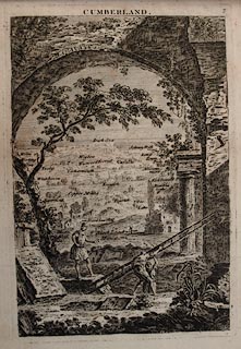 click to enlarge click to enlargeJL05.jpg "Carlisle" view (sort of) item:- Carlisle Library : 4.2 Image © Carlisle Library |
|||||||||||||||||
|
|
||||||||||||||||||
| evidence:- | old map:- Bowen and Kitchin 1760 placename:- Carlile |
|||||||||||||||||
| source data:- | Map, hand coloured engraving, A New Map of the Counties of
Cumberland and Westmoreland Divided into their Respective Wards,
scale about 4 miles to 1 inch, by Emanuel Bowen and Thomas
Kitchin et al, published by T Bowles, Robert Sayer, and John
Bowles, London, 1760.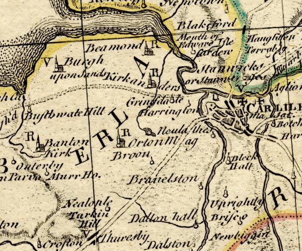 BO18NY35.jpg "CARLILE Ma. Sat." blocks, city, market, town wall and bastions, street map, two crosses potent for charity schools, no symbol for post stage? item:- Armitt Library : 2008.14.10 Image © see bottom of page |
|||||||||||||||||
|
|
||||||||||||||||||
| evidence:- | old map:- Mackenzie 1760s placename:- Carlisle |
|||||||||||||||||
| source data:- | Chart, uncoloured engraving, Solway Firth, Cumberland and
Scotland, scale about 1 inch to 1 mile, by Murdoch Mackenzie
snr, engraved by Thomas Bowen, Fleet Street, published by
Murdoch Mackenzie snr, Kenneth Mackenzie and Murdoch Mackenzie
jnr, London, 1776.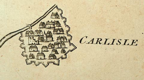 click to enlarge click to enlargeMCK9P1.jpg "CARLISLE" item:- Carlisle Library : Map 327 Image © Carlisle Library |
|||||||||||||||||
|
|
||||||||||||||||||
| evidence:- | old map:- Donald 1774 (Cmd) placename:- Carlisle |
|||||||||||||||||
| source data:- | Map, hand coloured engraving, 3x2 sheets, The County of Cumberland, scale about 1
inch to 1 mile, by Thomas Donald, engraved and published by Joseph Hodskinson, 29
Arundel Street, Strand, London, 1774. D4NY45NW.jpg "CARLISLE" city; blocks, town walls and bastions, street plan, castle cathedral; lettered in upright block caps item:- Carlisle Library : Map 2 Image © Carlisle Library |
|||||||||||||||||
|
|
||||||||||||||||||
| evidence:- | old map:- Donald 1774 (Cmd) placename:- Carlisle |
|||||||||||||||||
| source data:- | Map, hand coloured engraving, 3x2 sheets, The County of Cumberland, scale about 1
inch to 1 mile, by Thomas Donald, engraved and published by Joseph Hodskinson, 29
Arundel Street, Strand, London, 1774.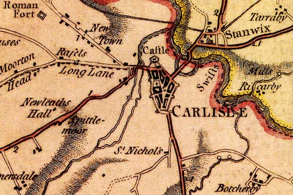 DN04Crls.jpg "CARLISLE" Labelled in block caps for a market town; street map showing the castle, town walls and gates. item:- Carlisle Library : Map 2 Image © Carlisle Library |
|||||||||||||||||
|
|
||||||||||||||||||
| evidence:- | old map:- Donald 1774 (Cmd) placename:- Carlisle |
|||||||||||||||||
| source data:- | Map, hand coloured engraving, 3x2 sheets, The County of Cumberland, scale about 1
inch to 1 mile, by Thomas Donald, engraved and published by Joseph Hodskinson, 29
Arundel Street, Strand, London, 1774.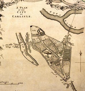 click to enlarge click to enlargeDN04Cr.jpg "A PLAN OF THE CITY OF CARLISLE" item:- Carlisle Library : Map 2 Image © Carlisle Library |
|||||||||||||||||
|
|
||||||||||||||||||
| evidence:- | old map:- Pennant 1777 placename:- Luguvallium placename:- Carlisle |
|||||||||||||||||
| source data:- | Map, hand coloured engraving, A Map of Scotland, Hebrides and
Part of England, drawn for Thomas Pennant, engraved by J Bayly,
published by Benjamin White, London, 1777.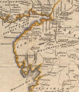 click to enlarge click to enlargePEN1Cm.jpg "LUGUVALLIUM / CARLISLE" circle with side bars and spike; town item:- private collection : 66 Image © see bottom of page |
|||||||||||||||||
|
|
||||||||||||||||||
| evidence:- | old text:- Gents Mag item:- population, Carlisle |
|||||||||||||||||
| source data:- | Magazine, The Gentleman's Magazine or Monthly Intelligencer or
Historical Chronicle, published by Edward Cave under the
pseudonym Sylvanus Urban, and by other publishers, London,
monthly from 1731 to 1922. goto source Gentleman's Magazine 1785 p.68 "At Carlisle there were births, males 103, females 230, in all 133; burials, 153. The births of the Dissenters are not included." |
|||||||||||||||||
|
|
||||||||||||||||||
| evidence:- | old text:- Clarke 1787 placename:- Carleyl item:- gallows |
|||||||||||||||||
| source data:- | Guide book, A Survey of the Lakes of Cumberland, Westmorland,
and Lancashire, written and published by James Clarke, Penrith,
Cumberland, and in London etc, 1787; published 1787-93. goto source Page 109:- In the long ballad about Adam Bell, Clym of the Clough and Wyllyam of Cloudesle, Wyllyam is captured in Carleyl:- "... ..." "... There they hym bound both hand and fote, and in deep dungeon cast; Now Cloudesle, sayd the hye justyce, thou shalt be hanged yn hast." "A payre of new gallowes, sayd the sheryff, now shall I for the make; And the gates of Carleyl shall be shutte, that no man shall come yn thereat. Then shall not helpe, Clym of the Clough, nor yet shall Adam Bell, Though they come wyth a thousand mo, nor all the devels yn hell." "Early in the mornyng the justyce up rose, to the gates first gan he gon, And commandeth to be shut full close, lyghtyly every one. Then went he to the market place, as fast as he could hye, A payre of new gallowes there set he up, besyde the pyllorye." "A lyttle boy among them asked, "What meaneth that gallows-tre?" They sayd to hange a good yeman, called Wyllyam of Cloudesle. ... ..." The ballad is very long |
|||||||||||||||||
| source data:- | goto source Page 156:- "..." ""ELIZABETH, by the grace of God, of England, France, and Ireland, Queen, Defender of the Faith, and so forth:- To all of whom these presents shall come, greeting. Know ye, that we, of our special grace, certain knowledge, and mere motion, fully trusting and having special confidence in the fidelity, valour, discretion, and provident circumspection of our trusty and well-beloved Henry Lord Scroope of Bolton, by the advice of our Council, have constituted and appointed, and by these presents doth constitute and appoint him, the said Lord Scroope, our Keeper, or Warden and Governor-General of the West Marches of our Kingdom of England against the parts of Scotland; and Captain of our city of Carlisle, and head-Steward of all our lordships, manors, lands, and tenements within the West Marches aforesaid; giving and granting to the said Lord Scroope full power and special commandment to do and execute all and every thing which therein doth appear to the office of Warden and Keeper aforesaid, ..." goto sourcePage 157:- "..." ""And for the safety and defence of our town and castle of Berwick, and our city of Carlisle, so often as any assault or siege of the said town and castle or city shall be proposed or made by the Scots or any other our enemies, all fencible men, between the ages of sixteen and sixty, within the said Marches, to cause to be mustered; and all men at arms, armed billmen, and archers, every of them according to their estate, degree, and condition, to be armed and defended with fit and competent armour; and to be marshalled in thousands, hundreds, and twenties; and the same so arrayed and appointed to be holden and kept, so as all men at arms, armed billmen and archers, be ready and prepared to march to the defence and safe keeping of our town and castle of Berwick, or our city of Carlisle aforesaid; so often as any peril, assault, or siege, by the incursions of our enemies, shall happen to be; and to be compelled, upon summons or warning of the said Lord Warden or his deputy, in our name and behalf, to proceed, march, and be led, remain and continue, for the defence of our marches aforesaid, and our realm and faithful subjects; and the rescue, defence, and safe custody of the town, castle, and city aforesaid, by imprisonment of their bodies, and by other ways and means as to the said Lord Warden or his deputy respectively shall seem expedient." |
|||||||||||||||||
|
|
||||||||||||||||||
| evidence:- | old print:- Clarke 1787 placename:- Carlisle |
|||||||||||||||||
| source data:- | Topograph, the view from Penrith Beacon, Cumberland, by James
Clarke, published by James Clarke, London, 1787. click to enlarge click to enlargeCL18.jpg "Carlisle" item:- Armitt Library : A6615.12 Image © see bottom of page |
|||||||||||||||||
|
|
||||||||||||||||||
| Camden 1789 |
||||||||||||||||||
|
|
||||||||||||||||||
| evidence:- | old map:- Aikin 1790 (Cmd) placename:- CARLISLE |
|||||||||||||||||
| source data:- | Map, uncoloured engraving, Cumberland, by John Aikin, London,
1790. click to enlarge click to enlargeAIK3.jpg "CARLISLE" circle and tower; city item:- JandMN : 145 Image © see bottom of page |
|||||||||||||||||
|
|
||||||||||||||||||
| evidence:- | old map:- Howard 1790s (town-Crls) |
|||||||||||||||||
| source data:- | Town plan, uncoloured engraving, Plan of the City of Carlisle
and Places Adjacent, Cumberland, scale about 19 inches to 1
mile, probably by J Howard, 1793 and engraved by James Lowes,
published by Francis Jollie and Sons, Carlisle, Cumberland, 1811.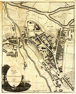 click to enlarge click to enlargeJL08.jpg "PLAN of the CITY of CARLISLE and PLACES ADJACENT" item:- Armitt Library : A214.1 Image © see bottom of page |
|||||||||||||||||
|
|
||||||||||||||||||
| evidence:- | old print:- Green 1790s-1820s placename:- Carlisle |
|||||||||||||||||
| source data:- | Print, coloured aquatint, fishing on the River Eden, Carlisle, Cumberland, by William
Green, Ambleside, Westmorland, 1790s-1800s?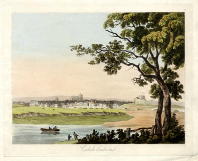 click to enlarge click to enlargePR1731.jpg printed at bottom:- "Carlisle, Cumberland" item:- Armitt Library : 2014.410 Image © see bottom of page |
|||||||||||||||||
|
|
||||||||||||||||||
| evidence:- | old map:- Bailey 1797 placename:- Carlisle |
|||||||||||||||||
| source data:- | Map, soil etc, uncoloured engraving, Cumberland, scale about 21
miles to 1 inch, by J Bailey, engraved by Neele, Strand,
published by Messrs Robinson, Paternoster Row and G Nicol, Pall
Mall, London, 1797. click to enlarge click to enlargeBY04.jpg "Carlisle" group of blocks; town item:- Armitt Library : A680.2 Image © see bottom of page |
|||||||||||||||||
|
|
||||||||||||||||||
| Cary 1798 road book |
||||||||||||||||||
|
|
||||||||||||||||||
| evidence:- | old map:- Baker 1802 placename:- Carlisle |
|||||||||||||||||
| source data:- | Perspective road maps with sections in Lancashire, Westmorland
and Cumberland, by J Baker, London 1802.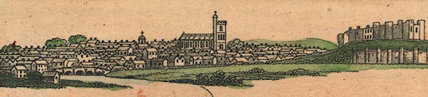 Bk03Vg01.jpg "Carlisle / 304" item:- private collection : 3 Image © see bottom of page |
|||||||||||||||||
|
|
||||||||||||||||||
| evidence:- | descriptive text:- Baker 1802 |
|||||||||||||||||
| source data:- | Perspective road map with sections in Lancashire, Westmorland,
and Cumberland, by J Baker, London 1802. Page 27:- "[approaching from Penrith] ... a wide champaign country opens in great breadth towards the north, in the centre of which the antient city of Carlisle seems lifting its sacred gothic grandeur to the distant view of the traveller. Few places are more commonly noticed in the history of our country than this city, first as a place of celebrity among the Britons, then amongst the Romans, who had a considerable fort here. The famous Picts Wall also crossed the kingdom by this place. It was destroyed by the Romans, but rebuilt by Egfrid, King of Northumberland. It hath been the residence of many feudal princes, and some kings of England and Scotland have alternately possessed themselves thereof. Here Edward King of England held his Parliament, and here David King of Scotland died. It was taken by the rebels in the year [1]745, but retaken by the Duke of Cumberland six weeks after, when one Coppock, whom the pretended had made bishop, was hung on the walls. Some say the first see was established by the Northumbrians, and others by Henry the 1st. The cathedral is a stately structure, ... The walls of the town are of prodigious thickness, and about a mile in circumference. It hath three entrances by gates, strongly fortified; that to the west is called the English gate, one to the south is called the Irish gate, and another nortward is called the Scotch gate. It hath large markets, copiously supplied with provisions, many wealthy inhabitants, large inns, some manfactories in cotton, and numbers of reputable traders." "The sketch of the place from the engraved plan was taken on a green bank, which riseth towards the north, upon a level with the scite of the adjacent town. The several rivers Eden, Candy, and Pentorel, join their liquid embraces in the intervening leaves. The castle from hence on one side, looks like a complete fortress; on another, comely bridges are seen that cross the above rivers, whilst the numerous buildings of the town, its watch towers and walls unite in the view, and form, collectively, materials sufficiently interesting for the largest landscape that ever appeared on canvas; ..." |
|||||||||||||||||
|
|
||||||||||||||||||
| evidence:- | old map:- Cooke 1802 placename:- Carlisle |
|||||||||||||||||
| source data:- | Map, Cumberland, scale about 15.5 miles to 1 inch, by George
Cooke, 1802, bound in Gray's New Book of Roads, 1824, published
by Sherwood, Jones and Co, Paternoster Road, London, 1824. click to enlarge click to enlargeGRA1Cd.jpg "CARLISLE / 299" blocks, upright block caps; city and two stars, distance from London item:- Hampshire Museums : FA2000.62.2 Image © see bottom of page |
|||||||||||||||||
|
|
||||||||||||||||||
| evidence:- | old map:- Cooke 1802 placename:- Carlisle |
|||||||||||||||||
| source data:- | Map, The Lakes, Westmorland and Cumberland, scale about 8.5
miles to 1 inch, engravedby Neele and Son, published by
Sherwood, Jones and Co, Paternoster Road, London, 1824. click to enlarge click to enlargeGRA1Lk.jpg "CARLISLE" blocks, upright block caps; city item:- Hampshire Museums : FA2000.62.5 Image © see bottom of page |
|||||||||||||||||
|
|
||||||||||||||||||
| evidence:- | old text:- Gents Mag item:- roman finds; roman altar; roman inscription; inscription, roman |
|||||||||||||||||
| source data:- | Magazine, The Gentleman's Magazine or Monthly Intelligencer or
Historical Chronicle, published by Edward Cave under the
pseudonym Sylvanus Urban, and by other publishers, London,
monthly from 1731 to 1922. goto source Gentleman's Magazine 1804 p.269 "Description of the Roman Sacrificial Vases lately discovered in Sewell's-lane, Scotch Street, Carlisle." "These antiquities are so valuable, both from their rarity, and from the elegance of the workmanship, that they must be extremely precious in the eyes of the Antiquary. The name that the vase is generally distinguished by is praefericulum, and it is understood to have been appropriated to the holding of incense, &c. used in the sacrifice. Many of these have been brought from Greece and Siciliy, and have been highly estimated by the curious, for the elegance of the workmanship, and the beauty of the relief in the ornaments. But the Grecian vessels are principally of fine clay, or bronze. These vases we are speaking of, we believe, are the first which have been discovered in Britain; and the sculpture of such a vessel but once appears among all the altars found in this country: it is on a beautiful Roman altar, discovered at Ellenborough, which was removed to Flat-hall, at Whitehaven, and is now in the possession of Lord Viscount Lowther. This altar is inscribed "Genio loci, Fortunae reduci, Romae AEternae, et Fato bono," &c. It is said to be the most curious Roman altar that ever was discovered in Britain, and is particularly described both by Camden and Horsley, who go into a long train of conjectures respecting the instruments sculptured on its side, which are the praefericulum, the patera, the axe, and the knife." "- The metal which the vessels in question are formed of seems to be a composition of refined brass, capable of receiving a very high polish, and so flexible that it allowed the artificer to form them extremely thin. At the top and bottom of the vases it is evident that they have been turned and finished in a lathe. From there being no accompanying altar or inscription, we regret we cannot suppose exactly the time of the Empire when these sacred vessels have been used. The only guide is the elegant sculpture of the handles, which consists of four tiers of groups of figures, in excellent workmanship, and all apparently illustrative of sacrifice. The uppermost seems to be two persons holding, or preparing, a cow or bullock for sacrifice; the next, a person taking hold of a hog for the same purpose; the third, a priest cloathed in his robes, standing at an altar, holding something on it; the lower one, which is the most beautiful, is, on the one side, a man cloathed in complete armour, holding a knife, as if going to sacrifice a sheep or a lamb, which another person below holds for that purpose; on the other side the priest stands, with another knife or sword, attending the ceremony. These vases are, from their extreme rarity, and from other cause, unquestionably of much greater value than we were first induced to set upon them." "This piece of antiquity has been preserved, because it fell into the hands of a judicious mechanic; but we have heard it asserted as a fact, that some remains of antiquity, found in this neighbourhood, was a few years ago carries to a founder, who consigned it to the furnace, because no one present understood that such a thing was of the smallest value!" "Carlisle Journal" |
|||||||||||||||||
|
|
||||||||||||||||||
| evidence:- | old map:- Laurie and Whittle 1806 placename:- Carlisle |
|||||||||||||||||
| source data:- | Road map, Completion of the Roads to the Lakes, scale about 10
miles to 1 inch, by Nathaniel Coltman? 1806, published by Robert
H Laurie, 53 Fleet Street, London, 1834. click to enlarge click to enlargeLw18.jpg "CARLISLE 305¾" city; distance from London; travellers supplied with post horses or carriages item:- private collection : 18.18 Image © see bottom of page |
|||||||||||||||||
|
|
||||||||||||||||||
| evidence:- | old map:- Laurie and Whittle 1806 placename:- Carlisle |
|||||||||||||||||
| source data:- | Road map, Continuation of the Roads to Glasgow and Edinburgh,
scale about 10 miles to 1 inch, by Nathaniel Coltman? 1806,
published by Robert H Laurie, 53 Fleet Street, London, 1834. click to enlarge click to enlargeLw21.jpg "CARLISLE 301½" city; distance from London; travellers supplied with post horses or carriages item:- private collection : 18.21 Image © see bottom of page |
|||||||||||||||||
|
|
||||||||||||||||||
| evidence:- | old text:- Capper 1808 placename:- Carlisle, City of placename:- Caer Lyell item:- placename, Carlisle; population; market; fair; town wall |
|||||||||||||||||
| source data:- | Gazetteer, A Topographical Dictionary of the United Kingdom,
compiled by Benjamin Pitts Capper, published by Richard
Phillips, Bridge Street, Blackfriars, London, 1808; published
1808-29. goto source "..." "CARLISLE, CI[T]Y OF, in Cumberland ward, Cumberland, 18 miles from Penrith, and 305 from London. It is situated in a forest, near the confluence of the rivers Eden and Caldew. Its name seems to be derived from the Saxon word Caer Lyell, that is, the city near the wall, from its contiguity to the great Roman wall; and it is said to have been founded by Luil, a petty king of the county, long before the Romans came into the isle; and the site of Old Carlisle is some miles to the south-west of the ground upon which the city now stands. Being a frontier town, it is fortified with a wall, a citadel, and a castle. ... It has two parishes, containing 1420 houses and 10,875 inhabitants, being 4479 males and 5742 females, of whom 2600 were returned as being employed in trade and manufacture. The buildings are good, and the streets are clean and spacious. There are two churches, St. Cuthbert's and St. Mary's, ... The principal streets are English, Scotch, Fisher, Castle, and Abbey streets, which are spacious and well paved. The guildhall, where the trades meet, is a mean and paltry building. The market-place is adorned with a pillar, on the top of which is a lion, and the bridges over the Eden are old-fashioned and very narrow; and although this city has been much improved within the last 50 years, and the population is greatly increased, yet much more still remains to be done, both for appearance and convenience. The Picts, wall (sic), which was built across the country from Newcastle, terminates near this place. It was once strongly fortified, but the castle and walls are now gone to decay, ... It is a bishop's see, and was formerly part of the diocese of Durham; but made a distinct bishopric by Henry I. ... It is governed by a mayor, recorder, 12 aldermen, 24 common council-men, &c. The mayor's court is held every Monday, and the town-sessions every quarter. The session of assize for the county is held here once a year, to which there are two judges, one for criminal, and one for civil causes. They arrive in the city the tenth Sunday after Trinity. The Easter and summer quarter sessions are also held here. The manufactures consist of cotton-yarn, cotton and linen checks, osnaburghs, drills, worsted shags, stamped cottons, hats, shamois, tanned leather, lindsays, nails, hardware, dressed flax, ropes, &c. It sends 2 members to parliament, and gives title of earl to a branch of the Howard family. Market on Wednesday and Saturday; fairs, 26th August, and about 3 weeks after, and 2 statute days for hiring servants, the Saturday before Whitsunday and Martinmas. St. Mary's is a curacy, in the patronage of the dean and chapter of Carlisle; and St. Cuthbert's is also a curacy in the same patronage. Lat. 54° 56′ 0″. Lon. 2° 53′ 0″W. - Hutchinson's Cumberland." "..." |
|||||||||||||||||
|
|
||||||||||||||||||
| evidence:- | old map:- Cooper 1808 placename:- Carlisle |
|||||||||||||||||
| source data:- | Map, uncoloured engraving, Cumberland, scale about 10.5 miles to
1 inch, drawn and engraved by Cooper, published by R Phillips,
Bridge Street, Blackfriars, London, 1808. click to enlarge click to enlargeCOP3.jpg "CARLISLE" blocks, and two spots for MPs; city item:- JandMN : 86 Image © see bottom of page |
|||||||||||||||||
|
|
||||||||||||||||||
| evidence:- | old map:- Wallis 1810 (Cmd) placename:- Carlisle |
|||||||||||||||||
| source data:- | Road map, hand coloured engraving, Cumberland, scale about 16
miles to 1 inch, by James Wallis, 77 Berwick Stree, Soho,
London, 1810. click to enlarge click to enlargeWL13.jpg "CARLISLE / 299" city; distance from London; two asterisks for members of parliament item:- Dove Cottage : 2009.81.10 Image © see bottom of page |
|||||||||||||||||
|
|
||||||||||||||||||
| evidence:- | old text:- Gents Mag item:- storm, 1811; rain; Robson and Co |
|||||||||||||||||
| source data:- | Magazine, The Gentleman's Magazine or Monthly Intelligencer or
Historical Chronicle, published by Edward Cave under the
pseudonym Sylvanus Urban, and by other publishers, London,
monthly from 1731 to 1922. goto source Gentleman's Magazine 1811 part 1 p.178 "... ..." "Feb. 6. In one of the most violent hurricanes of wind, accompanied with rain, ever remembered at Carlisle, the walls of Messrs. Robson and Co's spinning-mill there, which was some time ago consumed by fire, were blown down with a tremendous crash." "... ..." |
|||||||||||||||||
|
|
||||||||||||||||||
| evidence:- | old text:- Gents Mag item:- Border Wars |
|||||||||||||||||
| source data:- | Magazine, The Gentleman's Magazine or Monthly Intelligencer or
Historical Chronicle, published by Edward Cave under the
pseudonym Sylvanus Urban, and by other publishers, London,
monthly from 1731 to 1922. goto source Gentleman's Magazine 1813 part 2 p.51 In a 'Review of New Publications' of the 'Border Antiquities of England and Scotland'. "There are few Cities in England which have been the scenes of more momentous or more interesting events than Carlisle. During those years when the borders of the two countries were the theatre of alternate triumph and defeat of both, it shared with suffering fidelity in the fierce contests of its warlike possessors; and even at a later period, when Rebellion reared her bloody standard in the North, Carlisle was at once the witness of crime, and the scene of its punishment. Recently, also, the Muse of a popular writer has excited an increasing interest concerning all that relates to Border transactions, where will one be found of any importance, that is not more or less connected with Carlisle and its towers of defence? The office of Warden of the Marshes was one commnly bestowed upon Nobles of tried fidelity and known courage; and in their train were to be found the youthful aspirers after military glory, who longed to signalize themselves in feats of arms, where bravery was opposed to bravery, and the wreath of glory was won, not by a single achievment, or by desultory prowess, but by continued watchfulness, labour, and skill. ..." |
|||||||||||||||||
|
|
||||||||||||||||||
| evidence:- | old print:- Farington 1816 placename:- Carlisle placename:- Caerleyl placename:- Caerleol placename:- Luguvallum |
|||||||||||||||||
| source data:- | Print, uncoloured engraving and descriptive text, North East View of Carlisle, Cumberland,
drawn by Joseph Farington, engraved by W Woolnoth, published by T Cadell and W Davies,
Strand, London, 1815.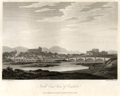 click to enlarge click to enlargeFA0425.jpg printed, bottom left, right, centre "Drawn by J. Farington R.A. / Engraved by W. Woolnoth. / North East View of Carlisle. / London Published Septr. 15, 1815, by T. Cadell &W. Davies, Strand." item:- Armitt Library : A6666.25 Image © see bottom of page |
|||||||||||||||||
|
|
||||||||||||||||||
| evidence:- | old print with text:- Farington 1816 placename:- Carlisle item:- fire, Carlisle; arson; market, Carlisle; fair, Carlisle; charter, Carlisle; population, Carlisle |
|||||||||||||||||
| source data:- | Print, uncoloured engraving and descriptive text, Carlisle from Stanwix, Cumberland,
drawn by Joseph Farington, engraved by J Landseer, published by T Cadell and W Davies,
Strand, London, 1815.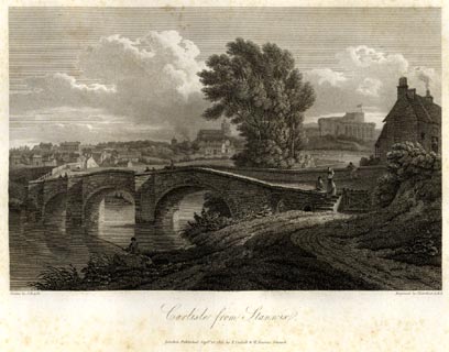 click to enlarge click to enlargeFA0426.jpg printed, bottom left, right, centre "Drawn by J. Farington R.A. / Engraved by J. Landseer A.R.A. / Carlisle from Stanwix. / London Published Septr. 15, 1815, by T. Cadell &W. Davies, Strand." Descriptive text:- "VIEW OF THE ANCIENT CITY OF CARLISLE." "THE ancient city of Carlisle is nearly surrounded by the rivers Eden, Pettrell, and Caldew. It is 305 miles from London, on the great western road to Glasgow, and not more than 13 from the borders of Scotland. There is no doubt that this city, called by the Britons Caerleyl or Caer-leol, was the Luguvallum of the Romans, mentioned in the itinerary of Antoninus. We are told by two of the Scottish historians, that Carlisle, one of the strongest of the British towns, was burnt by the Scots during the absence of the Romans, in the time of the Emperor Nero. It must have been after this event, and probably in the time of Agricola, that Carlisle was fortified with walls by the Romans as a strong frontier town, against the invasions of Picts and Scots. So durable was their structure, that, notwithstanding the recorded desolation of this city by the Danes, and the many subsequent repairs of the walls after its sundry sieges, much Roman masonry remained till of late years in different parts, particularly on the east side. When St. Cuthbert was at Carlisle in 685, we are told by Bede, that the citizens took him to see the walls, and a well of curious workmanship made by the Romans." "..." "The citizens of Carlisle, in the year 1193, gave ten marks for their liberties and privileges. It appears, that they held the city in fee farm, in the year 1201; in 1231 they obtained a confirmation of former grants. In 1292 they gave ten marks for the privilege of having coroners of their own. In the reign of Edward I. the citizens pleaded to a quo warranto, that they were entitled to murage for all goods exposed to sale in the town; a free guild, a market, a fair, &c. They claimed the free guild under Richard the First's charter, and pleaded, that the town had been originally demised to them in farm by King Henry I.; but not being able to make good their claims, in consequence of the records of the town having been destroyed by fire, they were not allowed. The fire here alluded to, was a dreadful conflagration, which had then recently happened, on the 19th of May, 1292. The whole city appears to have been consumed with the priory, the convent of Grey Friers, and their churches; the convent of Black Friers, being near the eastern-wall, alone escaped. This dreadful conflagration is said to have been occasioned by an incendiary, who, from motives of resentment, set fire to his father's house, and was executed for the fact. The King, in consideration of this calamity remitted the citizens a moiety of their fee-farm rent, due the preceding year, and restored to them the city with its ancient privileges." "In the year 1352, King Edward III., in consideration of the importance of Carlisle as a frontier town, and the calamities the citizens had suffered by the plague, and by the assaults of besieging armies, granted them an ample confirmation of all the privileges they had before enjoyed by prescription; markets on Wednesdays and Saturdays; a fair for sixteen days, to commence on the Assumption of the Virgin Mary; the election of a mayor, bailiffs, and coroners; assize of bread, &c., pleas of the Crown; trial of felons; goods of felons and fugitives; the place called Battle-Holme, for holding their markets and fairs; the city mill; the King's fishery in the river Eden, &c. &c. King Charles I., in the year 1637, confirmed all the former charters, and incorporated the citizens. The corporation consists of twelve aldermen, one of whom is annually elected mayor, two bailiffs or sheriffs, two coroners, and twenty-four common-councilmen, with power to elect a recorder and town-clerk." "This city has sent two members to Parliament ever since the reign of Edward I. The members are elected by the free burgesses, about 750 in number." "The markets at Carlisle are still held on Wednesday and Saturday, and abundantly supplied with corn, cattle, and provisions of all sorts. The principal market day is Saturday. There was formerly a horse fair, the first Monday in June, for three days, which has been many year discontinued; there is a considerable cattle fair on the 26th of August; but the principal fair for both horses and cattle, is on the 19th of September. During these fairs, all persons are free from arrest in the city. A series of fairs, or great markets, for horses and cattle, commences on the Saturday after October 10, and continues till Christmas." "In the reign of Henry VI., in consequence, as it appears, of the assizes having been removed to other places, by occasion of the wars with Scotland, an Act of Parliament passed, by which it was ordained, that in time of peace or truce, the assizes for the county should be holden at Carlisle, as had of old been accustomed, and not elsewhere." "..." "Carlisle first began to be of some importance as a manufacturing town about the year 1745, when a large woollen manufactory was set up by some Hamburgh merchants; but after a few years it was discontinued. About 1750 a manufactory of coarse linen, and a new woollen manufactory were set up. Soon after this, the cotton manufactory was introduced, and both that and the linen manufactory rapidly increased. Calico-printing was introduced about 1761." "A great change in the trade of Carlisle has taken place within the last fifteen years; it now consists almost entirely of the manufacture of cotton goods upon a very extensive scale. About one thousand two hundred looms are employed in this manufacture in the town, and a still greater number in the neighbouring towns and villages. The principal articles made are ginghams for the West India market. The spinning of cotton is carried on also to a considerable extent; there being eleven cotton-mills in the town and immediate vicinity. containing about eighty thousand spindles. There are three print-works, where the printing of cotton is carried on very extensively, and various other concerns connected with the cotton-trade, such as dyeing, bleaching, &c. A small mill for weaving calicoes, a manufactory of carpets, and three iron-founderies, have been lately established; and there are four public breweries. According to the returns made to Parliament in 1801 and 1811, the city and suburbs of Carlisle contained, at the former period, 1,338 houses, and 10,221 inhabitants; and at the latter, 1,709 houses, and 12,531 inhabitants." "..." "Carlisle is divided into two parishes, St. Mary's and St. Cuthbert's. The parish of St. Mary comprises the most populous part of the city." "The parish church of St. Mary is, as already stated, within what remains of the nave of the cathedral; the benefice is a perpetual curacy, in the gift of the dean and chapter, to whom the great tithes are appropriated." "In the parish of St. Mary are meeting-houses for the Presbyterians, Independents, Baptists, Quakers, and Methodists, and a Roman Catholic chapel. Robert Milne, many years pastor of one of the Presbyterian congregations, who died at an advanced age in the year 1800, was author of Physico-Theological Lectures, &c. The Quakers have had a congregation here almost from the time of their first establishment: George Fox, their founder, was imprisoned in the dungeon at Carlisle, and suffered great hardship here in 1653." "..." "The parish of St. Cuthbert comprises the district about English Street, the suburb called Botchard-gate, besides several out-townships." "The parish church of St. Cuthbert was rebuilt the beginning of the seventeenth century; it contains no monuments of note." "..." item:- Armitt Library : A6666.26 Image © see bottom of page |
|||||||||||||||||
|
|
||||||||||||||||||
| Gents Mag 1819 |
||||||||||||||||||
|
|
||||||||||||||||||
| evidence:- | old text:- Gents Mag item:- siege, Carlisle; Carlisle, siege; Civil War; rebellion, 1745; 1745 Rebellion |
|||||||||||||||||
| source data:- | Magazine, The Gentleman's Magazine or Monthly Intelligencer or
Historical Chronicle, published by Edward Cave under the
pseudonym Sylvanus Urban, and by other publishers, London,
monthly from 1731 to 1922. goto source Gentleman's Magazine 1816 part 2 p.600 From the Compendium of County History:- "Anno 875, Carlisle destroyed by the Danes." "..." "1153, At Carlisle, David, King of Scotland, died." "1315, Carlisle successfully defended, against Robert Bruce, by Andrew de Hercla, created for this service Earl of Carlisle." "1537, near Carlisle, Nicholas Musgrave, in rebellion against Heny VIII. defeated by the Duke of Norfolk." "..." "1645, June 25, Carlisle, after a noble defence, surrendered to the Scottish army under General Lesley." "1645, October, near Carlisle, Lord Digby and Sir Marmaduke Langdale defeated by the Parliamentarians." "1745, Nov. 15, Carlisle surrendered to Prince Charles Stuart. - Dec. 18, at Clifton, skirmish between the rear of the Prince's army and the van of the Duke of Cumberland's. - Dec. 30, Carlisle retaken by the Duke of Cumberland." |
|||||||||||||||||
|
|
||||||||||||||||||
| evidence:- | old text:- Gents Mag 1819 |
|||||||||||||||||
| source data:- | goto source Gentleman's Magazine 1816 part 2 p.601 Biographical note from the Compendium of County History:- "Gilpin, Sawrey, artist, painter of animals, Carlisle, 1733." "..." "Layburn, Roger, Bp. of Carlisle, near Carlisle (died 1509)." "..." "Robinson, Henry, Bp. of Carlisle, Carlisle, about 1556." |
|||||||||||||||||
|
|
||||||||||||||||||
| evidence:- | old text:- Gents Mag item:- General Election; election |
|||||||||||||||||
| source data:- | Magazine, The Gentleman's Magazine or Monthly Intelligencer or
Historical Chronicle, published by Edward Cave under the
pseudonym Sylvanus Urban, and by other publishers, London,
monthly from 1731 to 1922. goto source Gentleman's Magazine 1820 part 1 p.406 "TOUR THROUGH ENGLAND AND SCOTLAND." "..." "Having entered Carlisle, and walking sedately about to take a view of the City, I was insulted by a drunken Elector, for it was during the agreeable time of the General Election that I found myself in this pleasant situation. - I expostulated; the reply was, 'all was fair at an Election;' now I thought otherwise; for meeting two out of three tipsy, I thought all was foul; and felt comfortable (that is negatively so) that we had not yet improved so far as to have Annual Elections or General Suffrage." "A fresh day brought fresh ideas and fresh circumstances. Happily for us mortals, we do not here 'continue in one stay;' events are but passing, and we ought to make them as agreeable or as pleasant as we can. ..." |
|||||||||||||||||
|
|
||||||||||||||||||
| evidence:- | old text:- Gents Mag item:- poem; Cumberland Ballads; dialect; Rose of Cumberland, The; Heir of Gilsland, The |
|||||||||||||||||
| source data:- | Magazine, The Gentleman's Magazine or Monthly Intelligencer or
Historical Chronicle, published by Edward Cave under the
pseudonym Sylvanus Urban, and by other publishers, London,
monthly from 1731 to 1922. goto source Gentleman's Magazine 1820 part 1 p.228 "..." "Mr. Robert Anderson, another Cumberland poet, is still living in Carlisle. Some time ago he published a volume of peoms, entitled 'Cumberland Ballads.' In these he accurately describes the manners and rustic sports of his native county, in its own dialect. Another edition, with considerable additions of this gentleman's poems, is about shortly to be published by subscription." "Mr. Robert Carlisle, a native of Carlisle, is still living. He has arrived at considerable eminence as a Painter; and is no less celebrated as a votary of the Muses. He has published several detached poems. Mr. Carlisle, if memory does not deceive me, is also author of two Novels, 'The Rose of Cumberland,' and 'The Heir of Gilsland.'" |
|||||||||||||||||
|
|
||||||||||||||||||
| evidence:- | old map:- Hall 1820 (Cmd) placename:- Carlisle |
|||||||||||||||||
| source data:- | Map, hand coloured engraving, Cumberland, scale about 21 miles
to 1 inch, engraved by Sidney Hall, published by S Leigh, 18
Strand, London, 1820-31. click to enlarge click to enlargeHA14.jpg "CARLISLE / 301" circle, upright lowercase text; town; county town; two stars for MPs; distance from London item:- JandMN : 91 Image © see bottom of page |
|||||||||||||||||
|
|
||||||||||||||||||
| evidence:- | descriptive text:- Otley 1823 (5th edn 1834) item:- latitude; longitude; lat and long; geology |
|||||||||||||||||
| source data:- | Guide book, A Concise Description of the English Lakes, the
mountains in their vicinity, and the roads by which they may be
visited, with remarks on the mineralogy and geology of the
district, by Jonathan Otley, published by the author, Keswick,
Cumberland now Cumbria, by J Richardson, London, and by Arthur
Foster, Kirkby Lonsdale, Cumbria, 1823; published 1823-49,
latterly as the Descriptive Guide to the English Lakes. goto source Page 78:- "STATION II.- SKIDDAW." "Latitude 54° 39′ 12″ N. Longitude 3° 8′ 9″W. Height 3022 feet." "..." goto sourcePage 163:- "... From Maryport towards Carlisle, and thence to Penrith, is a large tract of red sandstone of unknown depth. ..."
|
|||||||||||||||||
|
|
||||||||||||||||||
| evidence:- | old map:- Perrot 1823 placename:- Carlisle |
|||||||||||||||||
| source data:- | Map, hand coloured engraving, Cumberland and Westmoreland ie
Westmorland, scale about 38 miles to 1 inch, by Aristide Michel
Perrot, engraved by Migneret, 1823, published by Etienne Ledoux,
9 Rue Guenegaud, Paris, France, 1824-48. click to enlarge click to enlargePER2.jpg "Carlisle" circle; town item:- Dove Cottage : 2007.38.45 Image © see bottom of page |
|||||||||||||||||
|
|
||||||||||||||||||
| evidence:- | old map:- Greenwood 1824 placename:- Carlisle |
|||||||||||||||||
| source data:- | Map, engraving, Map of the County of Cumberland, scale about 1
inch to 1 mile, etc, by Christopher and John Greenwood,
published by George Pringle jnr, 70 Queen Street, Cheapside,
London, 1823.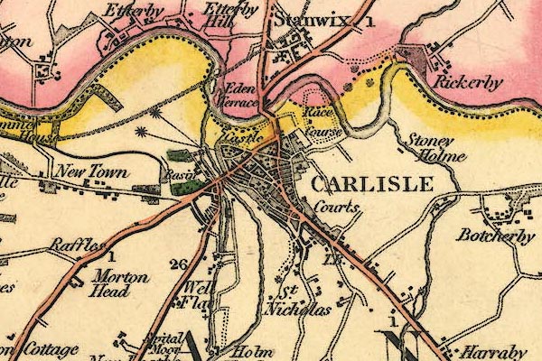 gw12crls.jpg "CARLISLE" street map; labelled in block caps for a market town; two stars for members sent to Parliament; notice the canal Basin, and the line of Hadrian's Wall. item:- National Library of Scotland : EME.b.3.11 Image © National Library of Scotland |
|||||||||||||||||
|
|
||||||||||||||||||
| evidence:- | old map:- Dawson 1830s placename:- Carlisle |
|||||||||||||||||
| source data:- | Map, hand coloured lithograph, Carlisle, proposed new boundary,
scale about 3 inches to 1 mile, by Captain Robert K Dawson,
lithographed by Josiah Nethercliff, 54 Leicester Square, London,
about 1832.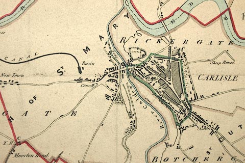 click to enlarge click to enlargeDAW5P1.jpg item:- Carlisle Library : Map 112 Image © Carlisle Library |
|||||||||||||||||
|
|
||||||||||||||||||
| evidence:- | old map:- Cobbett 1832 placename:- Carlisle |
|||||||||||||||||
| source data:- | Map, uncoloured engraving, Cumberland, scale about 20 miles to 1
inch, by William Cobbett, 11 Bolt Court, Fleet Street, London,
1832.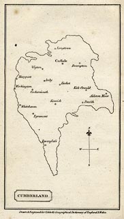 click to enlarge click to enlargeCOB5.jpg "Carlisle" double circle; city item:- JandMN : 117 Image © see bottom of page |
|||||||||||||||||
|
|
||||||||||||||||||
| evidence:- | old map:- Bell 1833 |
|||||||||||||||||
| source data:- | Map, hand coloured steel engraving, Cumberland, scale about 8
miles to 1 inch, by James Bell? engraved by R Scott, published
by Archibald Fullarton and Co, Glasgow, Strathclyde, about 1833.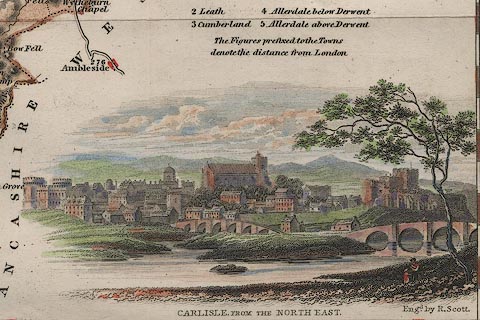 click to enlarge click to enlargeBEL3Vgn2.jpg Vignette on a map of Cumberland "CARLISLE FROM THE NORTH EAST" item:- JandMN : 70 Image © see bottom of page |
|||||||||||||||||
|
|
||||||||||||||||||
| evidence:- | descriptive text:- Ford 1839 (3rd edn 1843) placename:- Carlisle |
|||||||||||||||||
| source data:- | Guide book, A Description of Scenery in the Lake District, by
Rev William Ford, published by Charles Thurnam, Carlisle, by W
Edwards, 12 Ave Maria Lane, Charles Tilt, Fleet Street, William
Smith, 113 Fleet Street, London, by Currie and Bowman,
Newcastle, by Bancks and Co, Manchester, by Oliver and Boyd,
Edinburgh, and by Sinclair, Dumfries, 1839. goto source "..." "THE order in which the Lakes should be visited, if seen in any prescribed order at all, can be pointed out much more easily than satisfactorily. Lancaster and Kendal in the south, Carlisle and Penrith in the north, formerly offered the readiest facilities of access to this Northern Elysium; but since the improvement of steam navigation, Whitehaven and other ports have become equally suitable as starting places. One advantage, however, remains in favour of the old routes, that the direct lines are better, especially for carriages, although to the pedestrian this will not be a matter of any great importance." goto sourcePage 100:- "... Hence [Dalston Hall] the city of Carlisle is in sight the whole way, till you enter it by the suburbs of Shaddongate." "CARLISLE." "The limits of this work will not allow of a large and minute description, but only of such particulars as shall appear to be most interesting to the lake tourist." "The city has lost many objects of antiquity, and wears as neat, clean, and stately an aspect, as any within the Borders. It stands on a gentle eminence in the midst of an extensive plain, watered by the Petteril and Caldew, which here unite with the Eden, and from their banks as foregrounds join in pleasing combinations with the distant city. Approach it as you may, it is seen to great advantage. From the south, after passing through the suburbs of Botchergate, adorned with the new edifice of Christ Church, the entrance is between the Court-houses, impressing the stranger with the not im-" goto sourcePage 101:- "[im]probable idea that he is entering through the bastions of a fortified city. The entrance from the west is graced by Trinity Church of Gothic architecture, while admiration is excited by the Infirmary, a noble Doric building, and in front frown the ramparts and massy keep of the Castle. The road from Glasgow approaches the city from Stanwix Bank, where the east or Newcastle road joining it, they pass into the town over the substantial bridge crossing the Eden. From the Newcastle road is presented the most picturesque view: the meadows and woods of Rickerby, the bridges, and over them the castle and cathedral, are the most striking objects." "The city is well supplied with public walks lying around in various directions: these the tourist should by all means perambulate, particularly those on the northern banks of the river, along which passed the Roman Wall. From Etterby Scar, lying on this side of the river, a mile down the stream, is perhaps the most extensive and lovely. On the brink of the precipice the stranger takes his stand. At his feet roll the rapid waters of the Eden, which he sees forming a large semicircular sweep. Full in front over a beautiful level tract of meadow, intersected by the Caldew and partially divided by hedge-rows, lies the city, the long high roof and square tower of the cathedral crowning its highest ground. The castle, with its towers, and walls, and buttresses, occupies the whole centre. On the right are the suburbs of Caldewgate, the church, the canal basin," goto sourcePage 102:- "and shipping, with the Infirmary: and over all, far away, are seen the range of mountains, amongst which we have been so long roaming, Helvellyn just discernible, Blencathra peeping over the Stack between Carrick Fell and High Pike, beyond which towers the noble Skiddaw. On the left again of the cathedral, lies the densest part of the city, in whose serrated ridge may be distinguished Saint Cuthbert's Church, and the Town Hall, the round towers of the Court Houses, and the slender spire of Christ Church, in Botchergate. Over the lengthened bridge is a tract of rich land, sprinkled with farm-steads and seats; and beyond the woods of Corby, the eastern fells terminating in the distant but aspiring Crossfell. Nearer at hand, the high banks are enlivened with the ancient village of Stanwix and the hamlet of Etterby. By moving into the field behind, and looking in the contrary direction, the panorama is completed, from Criffel rising in azure over the long silvery tide of the Solway, which is visible, Burnswark, and the distant range of Scotch mountains, to the crags, bounding the wastes of Gilsland and Bewcastle." "The Castle is at the north-west corner of the city, on a bold eminence overlooking the river Eden. ..." goto sourcePage 103:- "... There is something very interesting in its appearance, and it is chiefly valuable as a massy feature, giving character to the distant appearance of the city." "The Cathedral is a noble building, deprived, indeed, of the greatest part of its nave. ..." goto sourcePage 105:- "... The north side of the Cathedral forms a fine street-scene, with row of trees around its church-yard wall, which has lately been rebuilt and surmounted by cast-iron rails, the very elegant design for which was handsomely furnished by R. W. Billings, Esq." "The Church of St. Cuthbert is a plain modern building. Trinity Church, in Caldewgate, and Christ Church, are new, having been lately built by the aid of subscriptions from the inhabitants and from the Church Building Commissioners. The former is of the Tudor, the latter of early English architecture, and both have spires, rising from square towers, though in a different manner." "At the head of Castle-street, near the Market-" goto sourcePage 106:- "[Market-]place stands that excellently-conducted inn and posting-house, the Crown and Mitre Hotel and Coffee House, better known by its latter name. Opposite the Bush Inn, which is also well-known on the road as a superior posting-house and hotel, stands the News-room and Library, built by private subscription, from the designs of Mr. Rickman, who was also architect for the churches. The County Gaol and Court-houses were designed by Smirke. One of the circular towers forms the Nisi Prius Court; the other, connected with the prison, the Crown Court. The prison is on the radiated plan, the governor's house being in the centre, and communicating by means of galleries with the different wards. The Infirmary, near the canal, will repay the walk, besides the fresh views of the town gained in this direction. It is built on a very convenient plan, and has a centre portico of four large Doric pillars, supporting a pediment. The merits of its situation have been a subject of much dispute; but what is still worse, owing to litigation between the contractor and the building committee, although finished in 1832, it was not opened for the reception of patients until nine years thereafter." "The city of Carlisle has a police establishment, is lighted with gas, and is under the municipal control of a corporation, composed of mayor, aldermen, and common councilmen. It returns two members to Parliament, and is now the nomination place for the eastern division of the county." "It is a place of great manufacturing bustle," goto sourcePage 107:- "chiefly in cotton, hats, and whips. The cotton trade gives employment to numbers of persons engaged in spinning and hand-loom weaving. The markets are well supplied with almost every thing that can gratify the palate of the gourmand, and rates so low as to render it, in these respects, a very desirable place of residence for persons of limited fortune, but accustomed to luxurious indulgences. The Grammar School, founded by Bishop Smith, affords an opportunity of obtaining an economical English and classical education. With regard to institutions for promoting the education of the poor, supplying their necessities, whether in food, or medicine, or medical attendance, the Infirmary, the Dispensary, and House of Recovery, the National School, the Lancastrian School, and others, fully attest that Carlisle is no whit behind the most favoured towns. It is also an excellent place whence conveyance may be obtained to all parts of the kingdom; mails daily leave the city for Portpatrick and Belfast, Glasgow, Edinburgh, and London by way of Leeds and Manchester; besides several other stage-coaches. The Newcastle and Carlisle Railway offers opportunities four times a-day of travelling between those places; and from the canal basin, a swift fly-boat conveys passengers to Bowness on the Solway, whence they can be comfortably and safely conveyed to Liverpool either by the Royal Victoria or Newcastle steam-packets, in a single tide." |
|||||||||||||||||
|
|
||||||||||||||||||
| evidence:- | old map:- Ford 1839 map placename:- Carlisle |
|||||||||||||||||
| source data:- | Map, uncoloured engraving, Map of the Lake District of
Cumberland, Westmoreland and Lancashire, scale about 3.5 miles
to 1 inch, published by Charles Thurnam, Carlisle, and by R
Groombridge, 5 Paternoster Row, London, 3rd edn 1843.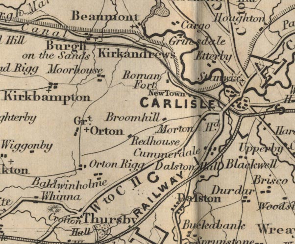 FD02NY35.jpg "CARLISLE" item:- JandMN : 100.1 Image © see bottom of page |
|||||||||||||||||
|
|
||||||||||||||||||
| evidence:- | old text:- Gents Mag item:- rebellion, 1745; 1745 Rebellion; fairs; town walls item:- weaving; spinning; breweries; population, Carlisle; post chaise; military road; roads; population, Carlisle; post |
|||||||||||||||||
| source data:- | Magazine, The Gentleman's Magazine or Monthly Intelligencer or
Historical Chronicle, published by Edward Cave under the
pseudonym Sylvanus Urban, and by other publishers, London,
monthly from 1731 to 1922. goto source Gentleman's Magazine 1839 part 1 p.516 book review "The History and Antiquities of Carlisle: with an account of the Castles, Gentlemen's Seats, and Antiquities in the Vicinity, and Biographical Memoirs of Eminent Men connected with the Locality. 8vo. pp.460." "THIS is, on the whole, a work of considerable merit. The publisher, Mr. Samuel Jefferson, of Carlisle, has been more than usually fortunate in the amount and quality of the literary assistance he has received from a variety of able contributors; and has executed his own editorial task with much judgment and good sense. There was not before any History of Carlisle beyond a few summary guide-books; and the only former accounts of it worthy of mention, are those in the Histories of Cumberland, by Nicolson and Burn, by Hutchinson, and by the Lysons's." "From its peculiar and very important situation as a border fortress, Carlisle mixes more than most places in the general history of the kingdom; and for this part of the subject the foundation was broadly laid in Ridpath's Border History, and in other works. We feel bound, however, to add that our author appears to have availed himself very industriously of all sources within his reach, and to be generally alive to the additional materials which have been afforded by modern works." "..." |
|||||||||||||||||
| source data:- | goto source Gentleman's Magazine 1839 part 1 p.517 "..." "Apart from architecture, Hutchinson had a good talent for observation and description; and his account of Carlisle furnishes a striking example of the value which accrues even in less than half a century to minute and apparently trifling remarks, especially when they are made in a transition period of society - and what period, in this ever-changing world, is not more or less a period of transition? It is true, however, that in the present instance the change has been rapid; for in the course of half a century Carlisle, from being a dull and silent military garrison, quietly sleeping within its girdle of ramparts, has been converted into a strictly manufacturing town, throwing out its various arms of communication, and gathering in its vicinity a teeming and busy population. Mr. Hutchinson's details are somewhat long, and Mr. Jefferson has judiciously compressed them. In the following extracts we shall beat the field still more cursorily, as our only object will be to bring forward the more striking points of this picture:" ""Carlisle after this period (the period of the rebellion in 1745, when it was first occupied by the Pretender's adherents, and afterwards became the scene of the execution of many of them), continued to present the appearance of an important military garrison. Sentries were posted at every gate, besides those at the castle and the house of the governor. The gates were closed and locked every night with the usual military parade; and guns were fired morning and evening, when they were opened or shut. The draw-bridge at the outer gates of the castle was drawn up every night at ten o'clock, and thus all communication with the city was cut off. There were towers or turrets, at intervals, along the whole line of the city walls,and upon these cannon were placed and sentinels posted. The greater part of the soldiers and artillery-men who formed the garrison were quartered on the citizens." ""At this time the trade of Carlisle was very limited, and a large part of it was transacted at two great annual fairs, at which numbers of persons attended from different parts of England and Scotland. Provisions and other necessary articles were very cheap, and the industry of the citizens provided them with wearing apparel of their own spinning. In consequence of the little trade carried on, there were at this time no public carriers from this city. Coals were brought in sacks on ponies, which were allowed to graze in Fisher street, which was then quite green with grass." ""The office of Mayor was considered to be of no great consequence; he seldom appeared in public without some of the insignia of his office, and was generally attended by one of his serjeants. The citizens were industrious and hospitable, and a friendly and neighbourly intercourse pervaded the whole city." "..." ""The houses of the citizens bore no marks of taste, or even what would now be considered requisite for comfort. Most were built of wood and clay, in few instances exceeding one story in height, and generally covered with thatch. The gable-ends of many fronted the street, in the old style of domestic architecture, and presented long rows of porches at each door. The rooms were miserably lighted by the small windows, which were irregularly placed; and the strong outer doors were arched, and fastened together by wooden pins projecting from the surface. Those houses which were two stories high, had the upper rooms floored with oak, but without any ceiling beneath. They were not painted, either within or without. "The lanes and avenues, even the church road, were not paved; and in many places entirely covered with weeds and underwood. The streets, not often trod upon, were in many parts green with grass. The centre part or causeway, rose to considerable height. The fronts from the" |
|||||||||||||||||
| source data:- | goto source Gentleman's Magazine 1839 part 1 p.518 "houses were paved in the same manner; the consequence of which was that the kennels or gutters were deep trenches, and stone bridges were placed in many different parts, for the convenience of passing from one side of the street to the other. These gutters were the reservoirs of all kinds of filth, which, when a sudden heavy rain happened, by stopping the conduit of the bridges, inundated the streets so as to render them impassible (sic) on foot. Manure was of such little value, that the corporation gave a man 40s. per annum, and a new cart occasionally, to remove it every week. Goods were brought into the city on pack-horses, as the roads were so bad as to be almost impassable for other conveyances. The staple trade was in whips and fish-hooks, but there was also a small linen manufactory. As there were no public breweries, the publicans brewed their own ale, and many of them made their own malt. * * *" ""About the year 1747, a company of Hamburgh merchants selected Carlisle as a suitable place in which to carry on an extensive woollen manfactory, although at such a distance from those parts of the kingdom where this branch of business had generally been cultivated. This manufactory was of great consequence to Carlisle and its neighbourhood, but in a few years declined, and the company became insolvent. About the year 1750 Aldermen Richard and William Hodgson established a manufactory of coarse linen cloths, called Osnaburghs, and also a woollen manufactory, which, however, was of short duration." ""At this period the military road from Carlisle to Newcastle was commenced, chiefly on the line which was formerly the Roman road. When this was completed, carts and waggons were more frequently used. Soon after, manufactories of linen and cotton began rapidly to increase, and improvements in the city continually took place. Houses were built in a greatly improved manner, and every year an additional number, which gradually replaced those on the old construction. In 1756 a public brewery was established near the Irish Gate. * * The balls and assemblies were held in a large room in the castle, which occupied the site of the new magazine. At this time there were four private carriages kept in the city, - a coach and four belonging to Dr. Waugh, Dean of Worsester (sic); another coach and four, the property of General Stanwix; and two single horse chaises belonging to Major Farrer and Mr. Dobinson. About this period post chaises were first kept at the Inns. * * *" ""In 1761 a company from Newcastle commenced the calico-printing in this city, under the firm of Scott, Lamb, and Co., and an extensive manufactory was established soon after. In consequence, land increased in value, rents were heightened in proportion, and prices in general rose considerably. Familes who before had been unable to earn more than eight shillings weekly, were now receiving from twenty to thirty shillings. This increase of business brought numbers of Scotch and Irish in search of employment. * * In 1794 there were four print-fields, which employed about one thousand persons. * * There were also two hundred persons employed in spinning cotton. * * Three breweries, at this time, paid upwards of 6000l. annually in duty, and a soap manufactory paid 1500l. * *" ""After the introduction of manufacturing into Carlisle, the population of this city was considerably increased. In 1763 the inhabitants were numbered, on a suggestion of Bishop Lyttelton, and found to be 4158. In 1780 they were again enumerated under the inspection of Dr. Heysham, when they were found to have increased to 6299, and the number of houses was 891. In 1801 the inhabitants were found to be 10,221; in 1811, 12,531; in 1821, 14,....; in 1831, 19,069."" "Such is a sample of the curious particulars and valuable statistical remarks for which we are indebted to the observations of Mr. Hutchinson; and of his correspondent Mr. R. Longrigg, a resident in the city. A few lines, from a subsequent part of the present volume, in which the commercial history of the place is more fully detailed, will complete the picture in its main features:" ""From the introduction of the cotton manufactory, Carlisle commenced a steady course of posperity; since 1761 it has three times doubled its inhabitants, and besides the employment given to the native population, it sends forth work to the inhabitants of the towns and villages at a distance of twenty, thirty, and even forty miles around. The principal fabrics are ginghams and checks (for the West Indian market), calicoes, carpets, table-cloths, &c. There are eleven or twelve cotton-mills in the town and immediate vicinity; three print-fields, several dye-houses, bleacheries, hat-manufactories, three iron-foundries, and four public breweries." |
|||||||||||||||||
| source data:- | goto source Gentleman's Magazine 1839 part 1 p.519 "..." "We must now remark that the judgment shown in the general selection and arrangement of the contents of this volume, is not attended by equal care in its language, or skill in its correction. There is neither the polish of a scholar nor the minute accuracy of the antiquary. The Latin inscriptions, modern as well as ancient, are full of misprints. ..." |
|||||||||||||||||
| source data:- | goto source Gentleman's Magazine 1839 part 1 p.521 "..." "And now we must take leave of Mr. Jefferson and Carlisle, only adding that the history of one of our ancient cities, the scene of many important historical events, and the theatre of many generations once active in the affairs of this busy world, fully merits the expanse of two quarto volumes. The best model for such a history is the Shrewsbury of Blakeway and Owen. We may repeat our general satisfaction with this work, as a popular history; but at the same time we will add out hopes that it is merely a prelude to a larger and more satisfactory work." |
|||||||||||||||||
|
|
||||||||||||||||||
| evidence:- | old map:- Garnett 1850s-60s H placename:- Carlisle |
|||||||||||||||||
| source data:- | Map of the English Lakes, in Cumberland, Westmorland and
Lancashire, scale about 3.5 miles to 1 inch, published by John
Garnett, Windermere, Westmorland, 1850s-60s.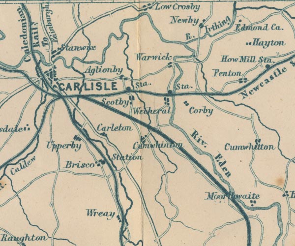 GAR2NY45.jpg "CARLISLE" blocks, minimal street plan, city item:- JandMN : 82.1 Image © see bottom of page |
|||||||||||||||||
|
|
||||||||||||||||||
| evidence:- | old text:- Gents Mag placename:- Karliolensis item:- seal, Carlisle; motto |
|||||||||||||||||
| source data:- | Magazine, The Gentleman's Magazine or Monthly Intelligencer or
Historical Chronicle, published by Edward Cave under the
pseudonym Sylvanus Urban, and by other publishers, London,
monthly from 1731 to 1922. goto source Gentleman's Magazine 1853 part 1 p.414 "Sir Henry Ellis exhibited impressions of the ancient Seal of the city of Carlisle, still in use, of the work of the latter end of the 13th or beginning of the 14th century. The obverse presents the Virgin and Child, and the counterseal a cross flory between four roses. On each side is the same ungrammatical legend: S. COMUNIS CIVIUM KARLIOLENSIS: with an inner legend on the obverse, AVE MARIA GRACIA PLENA." |
|||||||||||||||||
|
|
||||||||||||||||||
| evidence:- | old text:- Dickens 1857 placename:- |
|||||||||||||||||
| source data:- | Book, The Lazy Tour of Two Idle Apprentices, by Charles Dickens,
1857. goto source Page 6:- "..." "Carlisle! Idle and Goodchild had got to Carlisle. It looked congenially and delightfully idle. Something in the way of public amusement had happened last month, and something else was going to happen before Christmas; and, in the meantime there was a lecture on India for those who liked it - which Idle and Goodchild did not. Likewise, by those who" goto sourcePage 7:- "liked them, there were impressions to be bought of all the vapid prints, going and gone, and of nearly all the vapid books. For those who wanted to put anything in missionary boxes, here were the boxes. For those who wanted the Reverend Mr. Podgers (artist's proofs, thirty shillings), here was Mr. Podgers to any amount. Not less gracious and abundant, Mr. Codgers of the vineyard, but opposed to Mr. Podgers, brotherly tooth and nail. Here, were guide-books to the neighbouring antiquities, and eke the Lake country, in several dry and husky sorts; here, many physically and morally impossible heads of both sexes, for young ladies to copy, in the exercise of the art of drawing; here, further, a large impression of Mr. SPURGEON, solid as to the flesh, not to say even something gross. The working young men of Carlisle were drawn up, with their hands in their pockets, across the pavements, four and six abreast, and appeared (much to the satisfaction of Mr. Idle) to have nothing else to do. The working and growing young women of Carlisle, from the age of twelve upwards, promenaded the streets in the cool of the evening, and rallied the said young men. Sometimes the young men rallied the young women, as in the case of a group gathered round an accordion-player, from among whom a young man advanced behind a young woman for whom he appeared to have a tenderness, and hinted to her that he was there and playful, by giving her (he wore clogs) a kick." "On market morning, Carlisle woke up amazingly, and became (to the two Idle Apprentices) disagreeably and reproachfully busy. There were its cattle market, its sheep market, and its pig market down by the river with raw-boned and shock-headed Rob Roys hiding their Lowland dresses beneath heavy plaids, prowling in and out among the animals, and flavouring the air with fumes of whiskey. There was its corn market down the main street, with hum of chaffering over open sacks. There was its general market in the street too, with heather brooms on which the purple flower still flourished, and heather baskets primitive and fresh to behold. With woman trying on clogs and caps at open stalls, and "Bible stalls" adjoining. With "Doctor Mantle's Dispensary for the cure of all Human Maladies and no charge for advice," and with Dr. Mantle's "Laboratory of Medical, Chemical, and Botanical Science" - both healing institutions" goto sourcePage 8:- "established on one pair of trestles, one board, and one sun-blind. With the renowned phrenologist from London, begging to be favoured (at sixpence each) with the company of clients of both sexes, to whom, on examination of their heads, he would make revelations "enabling him or her to know themselves." Through all these bargains and blessings, the recruiting-serjeant watchfully elbowed his way, a thread of War in the peaceful skein. Likewise on the walls were printed hints that the Oxford Blues might not be indisposed to hear of a few fine active young men; and that whereas the standard of that distinguished corps is full six feet, "growing lads of five feet eleven" need not absolutely despair of being accepted." |
|||||||||||||||||
|
|
||||||||||||||||||
| evidence:- | old text:- Gents Mag item:- roman finds |
|||||||||||||||||
| source data:- | Magazine, The Gentleman's Magazine or Monthly Intelligencer or
Historical Chronicle, published by Edward Cave under the
pseudonym Sylvanus Urban, and by other publishers, London,
monthly from 1731 to 1922. goto source Gentleman's Magazine 1862 part 1 pp.578-579 page 578:- "Antiquarian and Literary Intelligence." "... ..." "Mr. Ferguson, of Carlisle, gave an account of the recent discovery there of a sculpture of the Roman period, part of the figure possibly of a soldier in one of the auxiliary cohorts; a torque and crescent appears round the neck, in one hand appears to be a short sword, and in the" page 579:- "other a small casket, with some long-hafted weapon. The figure was about two-thirds life size." |
|||||||||||||||||
|
|
||||||||||||||||||
| evidence:- | old text:- Gents Mag item:- roman inscription; inscription, roman |
|||||||||||||||||
| source data:- | Magazine, The Gentleman's Magazine or Monthly Intelligencer or
Historical Chronicle, published by Edward Cave under the
pseudonym Sylvanus Urban, and by other publishers, London,
monthly from 1731 to 1922. goto source Gentleman's Magazine 1866 part 2 p.470 "... ..." "Inscriptions to the Parcae were heretofore so rarely found in this country, that Horsley does not appear to give a single example. Yet Dr. Bruce,for the third edition of his "Roman Wall," has collected no less than three, including the above [from Skinburness]. The others were discovered a few years since at Carlisle, so that they seem somewhat confined to a particular district. In one these deities are addressed simply as the Parcae (PARCIS):" "PARCIS PROBO DONATALIS PATER . V . S . L.M." "In the third, as in the first, they are style Matres:" "MATRIBVS . PARC . PRO . SALVT(e) SANCTAE . GEMINAE" "and all are dedications for the health, and well-being of children or other relations. It is not strange that the Fates, being three, should, in the north of Britain, be addressed as mothers, considering how very common was the worship of the Deae Matres, and how very pliable the Roman mythology could be made, especially in the provinces. They were styled also Dominae and Victrices. Upon the gold coins of Diocletian and Maximian, the Parcae are represented standing, each holding a torch upon a rudder in their right hands joined together, and they are here inscribed FATIS VICTRICIBVS." "..." |
|||||||||||||||||
|
|
||||||||||||||||||
| evidence:- | old itinerary:- Tinsley 1877 (Roads/Cum) placename:- Carlisle |
|||||||||||||||||
| source data:- | Itinerary, route 3, London to Edinburgh and Glasgow via Boroughbridge and Carlisle,
including from Bowes, Durham; through Brough, Appleby, Westmorland; then Penrith,
Carlisle, Longtown, Cumberland; and into Scotland, published by Tinsley Bros, 8 Catherine
Street, Strand, London, 1877. click to enlarge click to enlargeTLY138.jpg pp.36-49 in British High Roads, North and North Eastern Routes; pp.37-39. printed at p.36:- "... / ROUTE III. - LONDON to EDINBURGH and GLASGOW via / BOROUGHBRIDGE and CARLISLE (See Maps 31 to 42.) / Boroughbridge 206 (as per Route I.), Leeming 221½, Catterick 228, Greta Bridge 242½, Bowes 248½, Brough 261½, Appleby 269¾, / Penrith 283½, Carlisle 301½, Longtown 310¼, Langholm 321¾, / Hawick 349½, Selkirk 356, Middleton 379½, Edinburgh 392½. / ..."  click to enlarge click to enlargeTLY139.jpg item:- private collection : 270.1 Image © see bottom of page |
|||||||||||||||||
|
|
||||||||||||||||||
| evidence:- | old strip map:- Tinsley 1877 (Roads/Cum) placename:- Carlisle |
|||||||||||||||||
| source data:- | Strip map, road map, part of London to Edinburgh via Boroughbridge and Carlisle, including
from Appleby, Westmorland through Penrith to Carlisle, Cumberland, published by Tinsley
Bros, 8 Catherine Street, Strand, London, 1877. click to enlarge click to enlargeTLY1M2.jpg Map pp.35-36 in British High Roads, North and North Eastern Routes. printed at top:- "BRITISH HIGH ROADS. / 35 LONDON TO EDINBURGH, VIA BOROUGHBRIDGE &CARLISLE. 36" item:- private collection : 270.4 Image © see bottom of page |
|||||||||||||||||
|
|
||||||||||||||||||
| evidence:- | old print:- placename:- Carlisle |
|||||||||||||||||
| source data:- | Print, uncoloured engraving, Market Place and Old Town Hall, Carlisle, Cumberland,
published 1900s?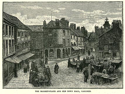 click to enlarge click to enlargePR0251.jpg On p.256 of Our Own Country. printed at bottom:- "MARKET PLACE AND OLD TOWN HALL, CARLISLE." item:- Dove Cottage : 2008.107.251 Image © see bottom of page |
|||||||||||||||||
|
|
||||||||||||||||||
| evidence:- | old print:- Bradley 1901 placename:- Carlisle |
|||||||||||||||||
| source data:- | Print, uncoloured lithograph, The Castle and Eden Bridge, Carlisle, Cumberland, by
Joseph Pennell, published by Macmillan and Co, London, 1901.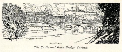 click to enlarge click to enlargeBRL169.jpg On page 262 of Highways and Byways in the Lake District, by A G Bradley. printed at bottom:- "The Castle and Eden Bridge, Carlisle." item:- JandMN : 464.69 Image © see bottom of page |
|||||||||||||||||
|
|
||||||||||||||||||
| evidence:- | old text:- Harper 1907 placename:- Carlisle placename:- Caer Lywelydd placename:- Caer Luel item:- placename, Carlisle; incursions; incursion, 1601; Border Wars; Wars of Scottish Independence; Battle of Flodden Field; land tenure; nag tenements; foot tenements; beacon; 1715 Rebellion; rebellion, 1715; 1745 Rebellion; rebellion, 1745; Civil War; siege, Carlisle; Merry Carlisle |
|||||||||||||||||
| source data:- | HP01p137.txt Page 137:- "..." "Carlisle was the first and stoutest bulwark gainst the northern foe, and maintained that character for close upon sixteen hundred years, from the remote time of the Roman dominion until the union of the kingdoms under James the First. The place, standing as it does upon a rocky bluff, overlooking the levels of the Solway and the Eden, was, it would almost seem, intended by Nature for this office, and here accordingly the Roman wall of Hadrian was traced, running from sea to sea, from Wallsend near Newcastle, to Carlisle, and ending on the Solway Firth at Bowness. Here they found an early Celtic settlement, "Caer Lywelydd;" but it was not the site of Carlisle, but rather Stanwix, its northern suburb, on the opposite bank of the Eden, that formed the Roman military station of Luguvallum, i.e., Lywellydd "on the wall." What is now Carlisle was the civil settlement. When the Romans withdrew, to defend their decaying Empire nearer home, Luguvallum, peopled with half-breed Romano-British, who could not retire with them, made" HP01p138.txt Page 138:- "for years a hopeless fight with the savages out of Scotland on the one hand, and with the Saxons on the other. The Saxons, as almost everywhere else, prevailed in the end, and the town became in their tongue "Caer Luel;" whence the transition to "Carlisle" is one of the easiest." "Carlisle, the great medieval fortress-town, owes its origin to Rufus. The mighty Conqueror, who subdued most other portions of this land, rested short of Westmoreland and Cumberland, which had then one hundred and twenty years been accounted Scottish soil; but it was under his generally despised son that these broad lands were won back for England; and the Scottish King Malcolm, invading England on the east coast, in revenge, was slain in 1093, at Alnwick. Peace, however, was not to reign upon these contested lands for yet many a century; but what could be done was accomplished, and Carlisle Castle arose, a grim Norman keep, upon the highest apex of the town. It was in years after enlarged and strengthened, and the strong walls of the city connected with it; and to-day, although the factory-buildings and the smoky chimneys in the distant view of Carlisle show, readily enough, that the city is now a place of commerce, the Norman castle-keep still darkly crowns the scene, sharing its pre-eminence only with the Cathedral." "But in spite of its castle and the stout town walls, Carlisle has been, many more times than can readily be counted, the scene of warfare, and was often sacked and burnt. It was thus ever a place of arms. In all the country round about, men went armed to the plough, and the great lords held their lands from the King under the strictest obligations to military service, and were captained by the Lord Warden, whose duties included the firing of beacons and the mustering of all men between the ages of sixteen and sixty. Small tenants held their fields and farms under the name of "nag-tenements" and "foot-tenements," and were bound, according to their degree, to fight mounted or on foot." "When the enemy crossed the Border, there was a stir in the city of Carlisle, like that which accompanies the overturning of an ant-heap. The muckle town-bell was rung, the citizens assembled under arms, and the women manned the walls (if" HP01p139.txt Page 137:- "the expression may be allowed) with kettles, boiling-water, and apronsful of stones." "There was no worse time in this long history than the reign of Henry the Eighth. War with Scotland had brought to that country the crushing defeat of Flodden, where, in the words of the Scottish lament, "The flowers of the forest were a' weed awa;" but the result was anarchy in the Borders, where thousands of lawless men lived, whom no man could restrain. The Warden's office was then no light task, and a Scot on the English side, or an Englishman on the Scottish, went in momentary danger of his life. Every man was required to explain his presence, and in the streets of Carlisle none might speak, without leave, to a Scot, and none of that nationality was permitted to live in the city." "..." HP01p141.txt Page 141:- "..." "The last raid took place actually in 1601, when the kingdoms were united by the accession of James the First, and while he was at Berwick, journeying to London. Several hundreds of Scots then came plundering past Carlisle, and many were captured and duly hanged. James, anxious to unite the kingdoms in reality, ordered that the name of "the Border," standing for centuries of warfare, should give place to "the midlands," but the new style does not seem ever to have come into general use; and the coming of the Stuarts meant in after years much more trouble for Carlisle and its surroundings;" HP01p142.txt Page 142:- "for it was in 1644-45 that the city endured the longest and most severe siege in its history. It was held for the King, and beleaguered for eight months by the Scottish General, Leslie. The citizens paid dearly for their loyalty, and were reduced to eating horses, dogs, and rats. Hungry folks chased errant cats hazardously across roof-tops, in view of the besiegers, who took long shots at them; and even hemp-seed became so dear that only the wealthy could afford it. Money current in the city was coined from silver plate; but there was so little food to purchase that, as a diarist of the time wrote, "the citizens were so shrunk from starvation, they could not choose but laugh at one another, to see their clothes hang upon them as upon men on gibbets."" "..." "But Carlisle was not done with trouble, even in the sacrilege of 1645. It escaped in 1715, for the rebels avoided coming to clashes with a fortified city; but it came to know intimately of the much more nearly successful rebellion of 1745. But what use are battlemented walls of stone, if they be manned with faint hearts? After all the brave doings of "merry" Page 143:- "Carlisle," it is sad to think how low the martial spirit had sunk by 1745, when the militia, assembled in the city, declined to fight the rebels under Prince Charlie. A bold front would have compelled the invaders to leave Carlisle alone; but the broadswords of the Highlanders had so much of what military historians term "moral effect" that the militiamen positively refused to run the risk of being cleaved by that terrible cold steel. Poor Colonel Durand, in command - if we may still call that a command which will not obey orders - might rave, and implore, and even weep, but it was useless, and the city was surrendered. Prince Charlie was in camp at Brampton," HP01p144.txt Page 144:- "eight miles away, and it must have been a proud moment for him - if a sorry humiliation for some - when mayor and corporation went out to him and on their knees offered the keys of the gates. The next day the Prince entered in triumph, on a milk-white horse, one hundred pipers piping before him. It must have been a fearful moment - for those who did not love the bagpipes." "George the Second, at St. James's, began to reconsider his position at hearing of this signal failure of his sworn protectors, and many excellent, though time-serving, people in high places began to explain away the disagreeable things they had said of the Stuarts. But in a few weeks, as we know, the Highlanders were retreating; and, trimming their sails anew, politicians and witlings were repeating again their protestations of loyalty to the House of Hanover, and refurbishing that old quotation from Revelation, chapter xvii., verse 11, first current in 1715, by which they affected to believe that James the Second of England and Seventh of Scotland, and his son, the Pretender (de jure James the Third and Eighth) were the subjects of prophecy: "And the beast that was, and is not, even he is the eighth, and is of the seven, and goeth into perdition."" "An ingenious find, it must be allowed, and sufficient, providing no one else could refer to Revelation and find another quotation, a little destructive of the first. But such an one was actually to hand in the preceding verse, which very curiously says, "And there are seven kings: five are fallen, and one is, and the other is not yet come: and when he cometh, he must continue a short space." There were those excellent Whigs who, reading this, were not entirely happy until events demonstrated that the rebellion was absolutely hopeless." "The Duke of Cumberland with ease retook the city, and captured it with Prince Charlie's devoted rear-guard: the brave Colonel Townely and his 120 men of the Manchester Regiment, together with over two hundred Highlanders, and some few Frenchmen. They were lodged in the Cathedral, and thence taken in a long melancholy procession to London, there, according to their degree, to be beheaded as gentlemen," HP01p145.txt Page 145:- "or hanged like common malefactors. They rode, tied hand and foot, or walked, roped together, the whole bitter way." "The Duke was not greatly impressed with the military value of the castle. He called it "an old hen-coop," but it held securely enough the other miserable prisoners who were sent into Carlisle after Culloden. Four hundred of them awaited their doom in the grim dungeons, throughout the hot weather of 1746, and in October the executions began, Ninety six fell to the hangman, and others were transported beyond seas. In batches of half-a-dozen or a dozen at a time, they were called forth from their captivity and drawn on hurdles to that Hanoverian Golgotha, Gallows Hill, south of the city, where they were hanged and afterwards quartered, in the bloody-minded old way; their heads afterwards set upon poles over the Scotch Gate." "... it is in the unexpected modern surroundings of the public library that the most tragical memento of that time brings the hazards of rebellion with great vividness before you. This is a plaster cast of a monument erected to Dr. Archibald Campbell in the Savoy Chapel, London. The Chapel was largely destroyed by fire in 1864, and with it the marble monument. The unfortunate doctor was a non-combatant who acted as surgeon to the rebels at Culloden, and escaped abroad from that disastrous field, He returned after seven years, to his Scottish home, thinking he might then safely do so; but was informed against and executed." "..." HP01p148.txt Page 148:- "..." "If you seek frowning gateways, embattled walls, and the like, sufficient to clothe the stirring story of Carlisle, you will be freezing in the cold shade of disappointment, for the streets of Carlisle are wide, many of the houses are modern, and railways are very much to the fore. The Cathedral is obscurely placed, and almost the only picturesque nook is the alley called St. Alban's Row. Even the old upping-blocks that used to stand so plentifully by the kerbstones for the convenience of horsemen, and were a feature of Carlisle, have disappeared. Only the odd names of the streets and alleys occasionally remain: among them Rickergate, Whippery, and Durham Ox Lane." "Carlisle of to-day has a commercial reputation. It makes hats and whips, and textile fabrics, to say nothing of dye-works, where the citizens of Carlisle are prepared (at a price) to dye for their country. The manufacture of gingham, too, the secret of it stolen long ago from Guingamp, its native place, in Britanny, occupies a good deal of attention, and the production of biscuits and cardboard-boxes makes up the tale of the city's activities. But Carlisle, for all these developments, looks a poor place, and by no means a merry. All the fun ceased when raiding and murdering went out of date," HP01p153.txt Page 153:- 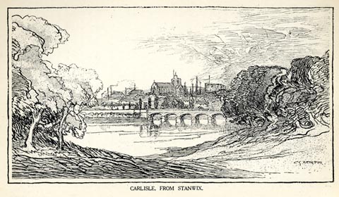 click to enlarge click to enlargeHP0125.jpg "CARLISLE, FROM STANWIX." item:- JandMN : 1055.26 Image © see bottom of page |
|||||||||||||||||
|
|
||||||||||||||||||
| evidence:- | text:- Mason 1907 (edn 1930) placename:- Merrie Carlisle item:- Border Wars |
|||||||||||||||||
| source data:- | Text book, The Ambleside Geography Books bk.III, The Counties of
England, by Charlotte M Mason, published by Kegan Paul, Trench,
Trubner and Co, Broadway House, 68-74 Carter Lane, and the
Parents' Educational Union Office, 26 Victoria Street, London,
edn 1930. MSN1P025.txt Page 25:- "..." "The Eden ... winds round the old castle of "merrie Carlisle" - "merrie" in the days of border warfare, and now a busy town with glass, cotton, and iron works. It has a very large railway station, for the lines of four important companies meet here." |
|||||||||||||||||
|
|
||||||||||||||||||
| evidence:- | old itinerary:- Johnson 1908 (Roads/Cum) placename:- Carlisle |
|||||||||||||||||
| source data:- | Itinerary, Route 37 in Roads Made Easy by Picture and Pen, Preston to Glasgow, by
Claude Johnson, edited by Lord Montagu, published by The Car Illustrated, 168 Piccadilly,
London, 1908.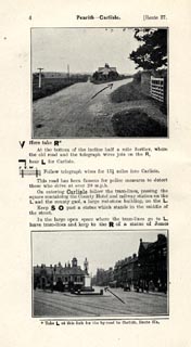 click to enlarge click to enlargeJS5004.jpg pp.1-10 in the road book, Roads Made Easy by Picture and Pen, vol.3. printed at beginning, p.1:- "ROUTE 37. / PRESTON via Lancaster (21½), Kendal (42½), Shap (58½), Penrith (69), Carlisle (87), Lockerbie (111½), Beattock (125¾), Abington (144½), Hamilton (170½) to GLASGOW (182). / (The Land's End to John o' Groats Route.)" 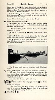 click to enlarge click to enlargeJS5005.jpg item:- private collection : 268.2 Image © see bottom of page |
|||||||||||||||||
|
|
||||||||||||||||||
| evidence:- | old itinerary:- Johnson 1908 (Roads/Cum) placename:- Carlisle |
|||||||||||||||||
| source data:- | Itinerary, Route 37 reverse in Roads Made Easy by Picture and Pen, Glasgow to Preston,
by Claude Johnson, edited by Lord Montagu, published by The Car Illustrated, 168 Piccadilly,
London, 1908. click to enlarge click to enlargeJS5015.jpg pp.11-21 in the road book, Roads Made Easy by Picture and Pen, vol.3. printed at beginning, p.11:- "ROUTE 37. Reverse / GLASGOW via Hamilton (11½), Abington (37½), Beattock (56¼), Lockerbie (70½), Carlisle (95), Penrith (113), Shap (123½), Kendal (139½), Lancaster (160½) to PRESTON (182)."  click to enlarge click to enlargeJS5016.jpg item:- private collection : 268.3 Image © see bottom of page |
|||||||||||||||||
|
|
||||||||||||||||||
| evidence:- | old itinerary:- Johnson 1908 (Roads/Cum) placename:- Carlisle |
|||||||||||||||||
| source data:- | Itinerary, Route 37a in Roads Made Easy by Picture and Pen, Penrith to Carlisle alternative
route, by Claude Johnson, edited by Lord Montagu, published by The Car Illustrated,
168 Piccadilly, London, 1908. click to enlarge click to enlargeJS5022.jpg pp.22-23 in the road book, Roads Made Easy by Picture and Pen, vol.3. printed at beginning, p.22:- "ROUTE 37A. / PENRITH to CARLISLE. / An Alternative Route by By-roads."  click to enlarge click to enlargeJS5023.jpg item:- private collection : 268.4 Image © see bottom of page |
|||||||||||||||||
|
|
||||||||||||||||||
| evidence:- | old itinerary:- Johnson 1908 (Roads/Cum) placename:- Carlisle |
|||||||||||||||||
| source data:- | Itinerary, Route 37a reverse in Roads Made Easy by Picture and Pen, Penrith to Carlisle
alternative route, by Claude Johnson, edited by Lord Montagu, published by The Car
Illustrated, 168 Piccadilly, London, 1908.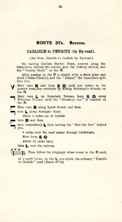 click to enlarge click to enlargeJS5024.jpg p.24 in the road book, Roads Made Easy by Picture and Pen, vol.3. printed at beginning, p.24:- "ROUTE 37A. Reverse / CARLISLE to PENRITH (by By-road)." item:- private collection : 268.5 Image © see bottom of page |
|||||||||||||||||
|
|
||||||||||||||||||
| evidence:- | old itinerary:- Johnson 1908 (Roads/Cum) placename:- Carlisle |
|||||||||||||||||
| source data:- | Itinerary, Route 42 in Roads Made Easy by Picture and Pen, Kendal to Carlisle, through
The Lakes, by Claude Johnson, edited by Lord Montagu, published by The Car Illustrated,
168 Piccadilly, London, 1908.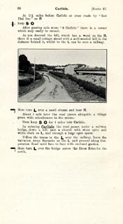 click to enlarge click to enlargeJS5088.jpg pp.85-88 in the road book, Roads Made Easy by Picture and Pen, vol.3. printed at beginning, p.85:- "ROUTE 42. / KENDAL via the Lakes, Windermere (8¼), Grasmere (17), Dunmail Raise (20¼), Thirlmere, Keswick (30), Bothel (42¾), to CARLISLE (61¼)." item:- private collection : 268.12 Image © see bottom of page |
|||||||||||||||||
|
|
||||||||||||||||||
| evidence:- | old itinerary:- Johnson 1908 (Roads/Cum) |
|||||||||||||||||
| source data:- | Itinerary, Route 42 reverse in Roads Made Easy by Picture and Pen, Carlisle to Kendal,
through The Lakes, by Claude Johnson, edited by Lord Montagu, published by The Car
Illustrated, 168 Piccadilly, London, 1908.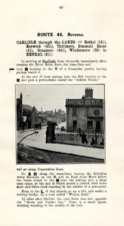 click to enlarge click to enlargeJS5089.jpg pp.89-92 in the road book, Roads Made Easy by Picture and Pen, vol.3. printed at beginning, p.89:- "ROUTE 42. Reverse. / CARLISLE through the Lakes via Bothel (18½), Keswick (31¼), Thirlmere, Dunmail Raise (41), Grasmere (44¼), Windermere (53) to KENDAL (61¼)." item:- private collection : 268.13 Image © see bottom of page |
|||||||||||||||||
|
|
||||||||||||||||||
| evidence:- | old print:- Curwen 1913 item:- charter; trebuchet; springald; town wall; armour |
|||||||||||||||||
| source data:- | Print, lithograph, reproduction of Initial Letter to Edward II's Charter to Carlisle,
Cumberland, published for the Cumberland and Westmorland Antiquarian and Archaeological
Society by Titus Wilson, Kendal, Westmorland, 1913. click to enlarge click to enlargeCW0130.jpg Tipped in opposite p.162 of The Castles and Fortified Towers of Cumberland, Westmorland, and Lancashire North of the Sands, by John F Curwen. printed at bottom:- "INITIAL LETTER TO EDWARD II's CHARTER TO CARLISLE." item:- Armitt Library : A782.30 Image © see bottom of page |
|||||||||||||||||
|
|
||||||||||||||||||
| evidence:- | text:- Curwen 1913 |
|||||||||||||||||
| source data:- | Book, The Castles and Fortified Towers of Cumberland,
Westmorland, and Lancashire North of the Sands, by John F
Curwen, published for the Cumberland and Westmorland Antiquarian
and Archaeological Society by Titus Wilson, Kendal, Westmorland,
1913. p.160:- "... ..." "... the Scots again returned to the attack on the 22nd July, 1315. On this the seventeenth anniversary of Falkirk, King Robert invested the city of Carlisle for eleven days, trampling down all the crops, wasting the suburbs, ..." "The contemporary Chronicle of Lanercost describes how that "on every day of the siege the Scots assaulted one of the three gates of the city, sometimes all three at once; but never without loss, because there were" p.161:- "discharged upon them from the walls such dense volleys of darts and arrows, likewise stones, that they asked of one another whether stones bred and multiplied within the walls. ... ... on the eleventh day, to wit, the feast of S. Peter ad Vinvula the Scots marched off to their own country, leaving behind them all their engines of war." Thus ended, to the honour of Andrew" p.162:- "de Harcla and the townsmen of Carlisle, one of the most famous sieges in the history of Border warfare." "The initial letter to the charter, granted to the citizens of Carlisle shortly afterwards by Edward II., contains a most spirited little vignette representing the siege. Andrew de Harcla, clad in full armour, and easily recognisable by his heraldic insignia, is on the loftiest tower, whilst around him armed citizens hurl stones from the walls and work their springalds against half-naked Scotchmen." "... ..." |
|||||||||||||||||
|
|
||||||||||||||||||
| evidence:- | old map:- Postlethwaite 1877 (3rd edn 1913) placename:- Carlisle |
|||||||||||||||||
| source data:- | Map, uncoloured engraving, Map of the Lake District Mining Field, Westmorland, Cumberland,
Lancashire, scale about 5 miles to 1 inch, by John Postlethwaite, published by W H
Moss and Sons, 13 Lowther Street, Whitehaven, Cumberland, 1877 edn 1913.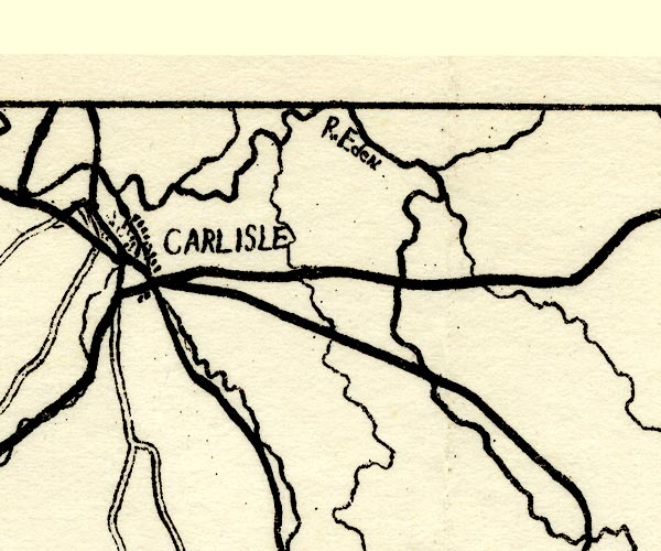 PST2NY45.jpg "CARLISLE" dots, railways, roads, etc item:- JandMN : 162.2 Image © see bottom of page |
|||||||||||||||||
|
|
||||||||||||||||||
| evidence:- | old map:- Nurse 1918 |
|||||||||||||||||
| source data:- | Map, The Diocese of Carlisle, Cumberland, Westmorland, and
Lancashire North of the Sands, scale about 4 miles to 1 inch, by
Rev Euston J Nurse, published by Charles Thurnam and Sons, 11
English Street, Carlisle, Cumberland, 2nd edn 1939.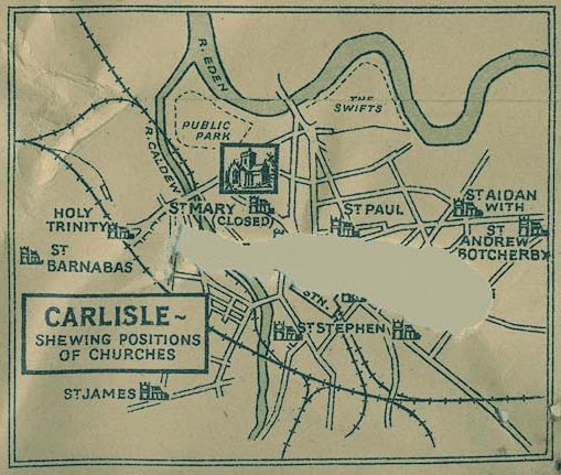 NUR1ins2.jpg item:- JandMN : 27 Image © see bottom of page |
|||||||||||||||||
|
|
||||||||||||||||||
| evidence:- | old text:- Burrow 1920s placename:- Carlisle |
|||||||||||||||||
| source data:- | Road book, strip maps with parts in Westmorland, Cumberland etc,
irregular scales about 1.5 miles to 1 inch, by E J Burrow and
Co, Cheltenham, Gloucestershire, 1920s. "Carlisle, like Lancaster, has that stern, cold look that belongs to northern towns built to resist weather and hard knocks. But that is now only a superficial impression and beneath one finds in Carlisle a great wealth of historical and artistic interest. ..." |
|||||||||||||||||
|
|
||||||||||||||||||
| evidence:- | text:- Rivet and Smith 1979 placename:- Luguvalium placename:- Luguvallo placename:- Lagubaluium |
|||||||||||||||||
| source data:- | The roman town of Carlisle; the capital of the Carvetii. |
|||||||||||||||||
|
|
||||||||||||||||||
| notes about bells |
||||||||||||||||||
|
|
||||||||||||||||||
| evidence:- | market notes:- item:- market |
|||||||||||||||||
| source data:- | www.history.ac.uk/cmh/gaz/gazweb2.htmOwen: 1792: New Book of Fairs: 1889: Market Rights and Tolls: HM GovernmentBowen, Emanuel &Kitchin, Thomas: 1760: New Map of the Counties of Cumberland and Westmoreland | |||||||||||||||||
|
|
||||||||||||||||||
| evidence:- | old map:- Horsley 1732 placename:- Luguvallium placename:- Carlisle |
|||||||||||||||||
| source data:- | Map, uncoloured engraving, Britannia Antiqua, roman Britain,
scale about 50 miles to 1 inch, by John Horsley, perhaps 1732,
edition published about 1869?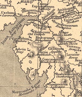 click to enlarge click to enlargeHOR1Cm.jpg "Luguvallium / Carlisle" item:- JandMN : 429 Image © see bottom of page |
|||||||||||||||||
|
|
||||||||||||||||||
| Post Office maps |
||||||||||||||||||
|
|
||||||||||||||||||
| evidence:- | old print:- item:- |
|||||||||||||||||
| source data:- | Print, uncoloured engraving, Royal Agricultural Society at Carlisle, show ground,
published in the Illustrated London News, 10 July 1880.,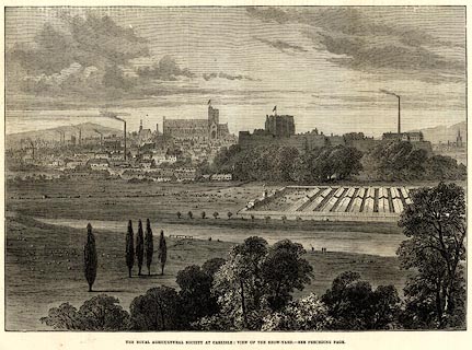 click to enlarge click to enlargePR0569.jpg The showground is set up with tents like a roman fort. printed at bottom:- "THE ROYAL AGRICULTURAL SOCIETY AT CARLISLE: VIEW OF THE SHOW-YARD. ..." item:- Dove Cottage : 2008.107.517 Image © see bottom of page |
|||||||||||||||||
|
|
||||||||||||||||||
| evidence:- | old print:- Harwood 1842 |
|||||||||||||||||
| source data:- | Print, uncoloured engraving, Carlisle, Cumberland, engraved and published by John
and Frederick Harwood, 26 Fenchurch Street, London, about 1842.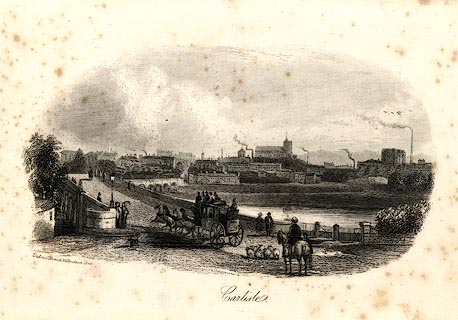 click to enlarge click to enlargeHRW220.jpg printed at bottom left, centre:- "London, J. Harwood, 26, Fenchurch Street. / Carlisle." item:- JandMN : 166.20 Image © see bottom of page |
|||||||||||||||||
|
|
||||||||||||||||||
| evidence:- | old print:- Thurnam 1835 |
|||||||||||||||||
| source data:- | Print, uncoloured lithograph, The Market Cross, and Old Guard House, Carlisle, Cumberland,
drawn by M E Nutter, lithographed by A Picken, published by Charles Thurnam, Carlisle,
Cumberland, by Ackermann and Co, by Hodgson, Boys, and Graves, and by Charles Tilt,
London, 1835.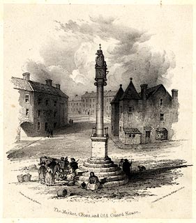 click to enlarge click to enlargeTHM101.jpg Included in Carlisle in the Olden Time. printed at lower left, right, centre:- "Drawn in Zinc by A. Picken. / Printed from Zinc by Day &Haghe, London / The Market Cross, and Old Guard House." item:- Dove Cottage : 2008.123.1 Image © see bottom of page |
|||||||||||||||||
|
|
||||||||||||||||||
| evidence:- | old print:- Thurnam 1835 placename:- Carlisle |
|||||||||||||||||
| source data:- | Print, uncoloured lithograph, Carlisle from Primrose Bank, Cumberland, drawn by M
E Nutter, lithographed by P Gauci, published by Charles Thurnam, Carlisle, Cumberland,
by Ackermann and Co, by Hodgson, Boys, and Graves, and by Charles Tilt, London, 1835.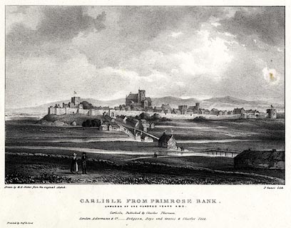 click to enlarge click to enlargeTHM102.jpg Printed by Graf and Soret. Included in Carlisle in the Olden Time. printed at bottom:- "Drawn by M. E. Nutter from the original sketch. / P. Gauci lith. / CARLISLE FROM PRIMROSE BANK. / UPWARDS OF ONE HUNDRED YEARS AGO. / Carlisle, Published by Charles Thurnam. / London. Ackermann & Co. - Hodgson, Boys, and Graves & Charles Tilt. / Printed by Graf &Soret." item:- Dove Cottage : 2008.123.2 Image © see bottom of page |
|||||||||||||||||
|
|
||||||||||||||||||
| evidence:- | old print:- Thurnam 1835 placename:- Carlisle |
|||||||||||||||||
| source data:- | Print, uncoloured lithograph, Carlisle from near Stanwix Bank, Cumberland, drawn by
M E Nutter, lithographed by Giles, published by Charles Thurnam, Carlisle, Cumberland,
by Ackermann and Co, by Hodgson, Boys, and Graves, and by Charles Tilt, London, 1835.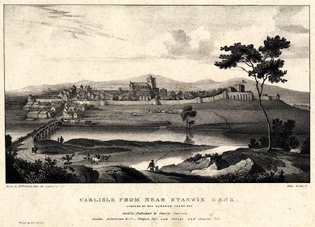 click to enlarge click to enlargeTHM103.jpg Printed by Graf and Soret. Included in Carlisle in the Olden Time. printed at bottom:- "Drawn by M. E. Nutter from the original sketch. / Giles lithog. / CARLISLE FROM NEAR STANWIX BANK. / UPWARDS OF ONE HUNDRED YEARS AGO. / Carlisle, Published by Charles Thurnam. / London. Ackermann & Co. - Hodgson, Boys, and Graves & Charles Tilt. / Printed by Graf &Soret." item:- Dove Cottage : 2008.123.3 Image © see bottom of page |
|||||||||||||||||
|
|
||||||||||||||||||
| evidence:- | old print:- placename:- Carlisle |
|||||||||||||||||
| source data:- | Print, uncoloured engraving, View of the City of Carlisle, Cumberland, published in
the Penny Magazine, by Charles Knight, 22 Ludgate Street and 13 Pall Mall East, London,
3 August 1833.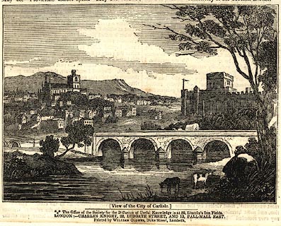 click to enlarge click to enlargePR0590.jpg printed at bottom:- "(View of the City of Carlisle.) / ..." item:- Dove Cottage : 2008.107.538 Image © see bottom of page |
|||||||||||||||||
|
|
||||||||||||||||||
| evidence:- | old print:- Green 1819 placename:- Carlisle |
|||||||||||||||||
| source data:- | Print, soft ground etching, Carlisle from the River Caldew, Cumberland, by William
Green, 1820, published by R Lough and Co, Chronicle Office, Finkle Street, Kendal,
and others, 1820.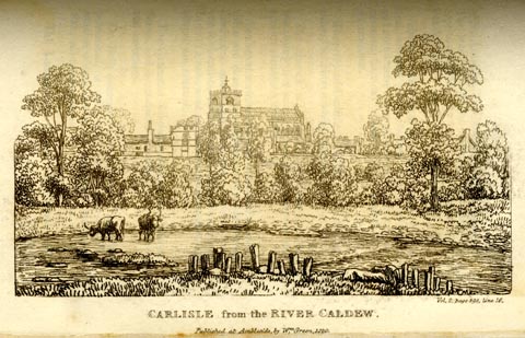 click to enlarge click to enlargeGN0132.jpg Tipped in opposite vol.2 p.398 of The Tourist's New Guide, by William Green. printed at bottom right, centre:- "Vol.2, page 398, line 16. / CARLISLE from the RIVER CALDEW. / Published at Ambleside, by Wm. Green, 1820." item:- Armitt Library : A1141.33 Image © see bottom of page |
|||||||||||||||||
|
|
||||||||||||||||||
| evidence:- | old print:- Cooke 1803-10 placename:- Carlisle |
|||||||||||||||||
| source data:- | Print, engraving, Carlisle, published by Sherwood, Jones and Co, Paternoster Row,
London, 2nd edn 1803-10.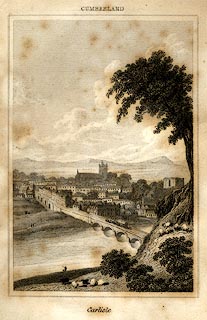 click to enlarge click to enlargeCK10E1.jpg Frontispiece to a Topographical and Statistical Description of the County of Cumberland, and Excursions to the Lakes of Cumberland, by George Alexander Cooke. printed at bottom:- "Carlisle." item:- Armitt Library : A1711.1 Image © see bottom of page |
|||||||||||||||||
|
|
||||||||||||||||||
| evidence:- | old print:- item:- altar; roman altar item:- roman |
|||||||||||||||||
| source data:- | Print, uncoloured engraving, Two Imperfect Roman Altars, discovered in 1755 near Carlisle,
Cumberland, late 18th century?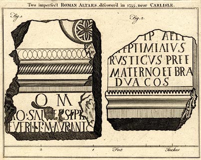 click to enlarge click to enlargePR0543.jpg Fig.1 has inscription:- O M / [ ]O SAL [ ] SIP [ ] / EUER[ ] MAURANI Fig.2. has:- [ ]IP AE[L ] / [ E]PTIMIAIUS / RUSTICUS PREE / MATERNOS ET BRA / DUA COS printed at top:- "Two imperfect ROMAN ALTARS, discoverd in 1755, near CARLISLE." item:- Dove Cottage : 2008.107.492 Image © see bottom of page |
|||||||||||||||||
|
|
||||||||||||||||||
| evidence:- | old map:- Burrow 1920s |
|||||||||||||||||
| source data:- | Road book, On the Road, Dunlop Pictorial Road Plans, volume V,
strip maps with parts in Westmorland, Cumberland etc, irregular
scale about 1.5 miles to 1 inch, by E J Burrow and Co,
Cheltenham, Gloucestershire, 1920s. EJB3Vg59.jpg item:- private collection : 17 Image © see bottom of page |
|||||||||||||||||
|
|
||||||||||||||||||
| evidence:- | old print:- placename:- Carlisle |
|||||||||||||||||
| source data:- | Print, uncoloured engraving, Carlisle from Rickerby Park, Carlisle, Cumberland, published
1900s?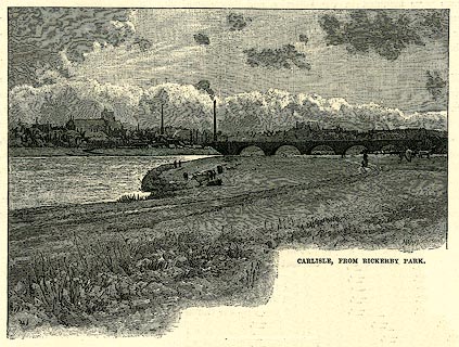 click to enlarge click to enlargePR0254.jpg On p.261 of Our Own Country. printed at lower right:- "HAR[ ]WOR[ ]" printed at bottom:- "CARLISLE, FROM RICKERBY PARK." item:- Dove Cottage : 2008.107.254 Image © see bottom of page |
|||||||||||||||||
|
|
||||||||||||||||||
| evidence:- | old map:- placename:- Carlisle |
|||||||||||||||||
| source data:- | Town plan, uncoloured engraving, Map of Carlisle, Cumberland,
scale about 2 inches to 1 mile, published 1900s?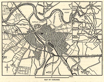 click to enlarge click to enlargePR0257.jpg Map, uncoloured engraving, street map, Map of Carlisle, Cumberland, scale about 2 inches to 1 mile, published 1900s? On p.268 of Our Own Country. An inset map shows Carlisle in the surrounding country. printed at bottom:- "MAP OF CARLISLE." item:- Dove Cottage : 2008.107.257 Image © see bottom of page |
|||||||||||||||||
|
|
||||||||||||||||||
| evidence:- | old print:- |
|||||||||||||||||
| source data:- | Print, uncoloured engraving, Carlisle, Cumberland, published by the Illustrated London
News, 12 August 1882.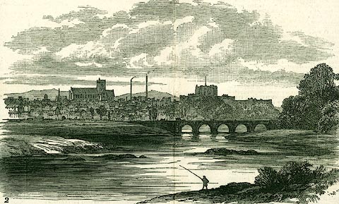 click to enlarge click to enlargePR0309.jpg Illustrations of place visited by the Royal Archaeological Institute. item:- Dove Cottage : 2008.107.309 Image © see bottom of page |
|||||||||||||||||
|
|
||||||||||||||||||
| evidence:- | old print:- |
|||||||||||||||||
| source data:- | Print, uncoloured engraving, English Street, Carlisle, Cumberland, published by the
Illustrated London News, 12 August 1882.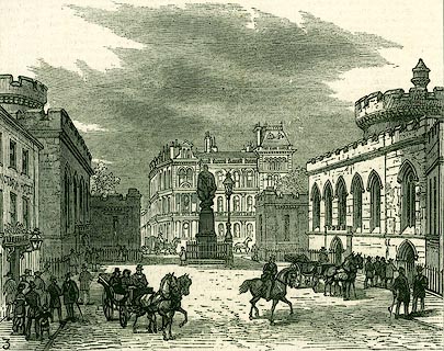 click to enlarge click to enlargePR0310.jpg Illustrations of place visited by the Royal Archaeological Institute. item:- Dove Cottage : 2008.107.310 Image © see bottom of page |
|||||||||||||||||
|
|
||||||||||||||||||
| evidence:- | old print:- placename:- Carlisle |
|||||||||||||||||
| source data:- | Print, uncoloured engraving, Carlisle, Cumberland, published late 19th century? click to enlarge click to enlargePR0244.jpg printed at bottom:- "CARLISLE." item:- Dove Cottage : 2008.107.244 Image © see bottom of page |
|||||||||||||||||
|
|
||||||||||||||||||
| evidence:- | old print:- placename:- Carlisle |
|||||||||||||||||
| source data:- | Print, uncoloured engraving, Carlisle, Cumberland, published late 19th century? click to enlarge click to enlargePR0245.jpg printed at bottom:- "380.- Carlisle" item:- Dove Cottage : 2008.107.245 Image © see bottom of page |
|||||||||||||||||
|
|
||||||||||||||||||
| evidence:- | old print:- placename:- City of Carlisle |
|||||||||||||||||
| source data:- | Print, uncoloured engraving, View of the City of Carlisle, Cumberland, published late
19th century? click to enlarge click to enlargePR0246.jpg printed at bottom:- "2255.- View of the City of Carlisle" item:- Dove Cottage : 2008.107.246 Image © see bottom of page |
|||||||||||||||||
|
|
||||||||||||||||||
| evidence:- | old print:- placename:- Carlisle |
|||||||||||||||||
| source data:- | Print, uncoloured engraving, Meeting of the Royal Agricultural Society of England,
at Carlisle, published by the Illustrated London News, 11 August 1855.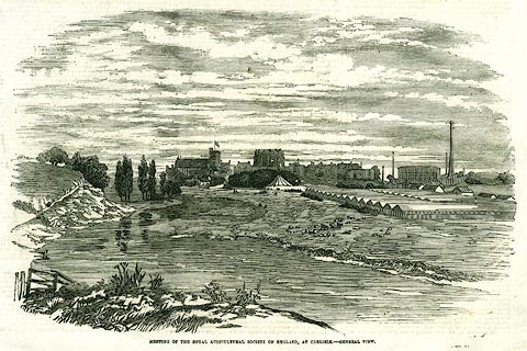 click to enlarge click to enlargePR0359.jpg Page 181; illustrating a report of the meeting. printed at bottom:- "MEETING OF THE ROYAL AGRICULTURAL SOCIETY OF ENGLAND, AT CARLISLE - GENERAL VIEW." item:- Dove Cottage : 2008.107.359 Image © see bottom of page |
|||||||||||||||||
|
|
||||||||||||||||||
| evidence:- | old print:- placename:- Carlisle |
|||||||||||||||||
| source data:- | Print, uncoloured engraving, Carlisle, from the North, Cumberland, drawn by W Westall,
engraved by E Francis, about 1830s?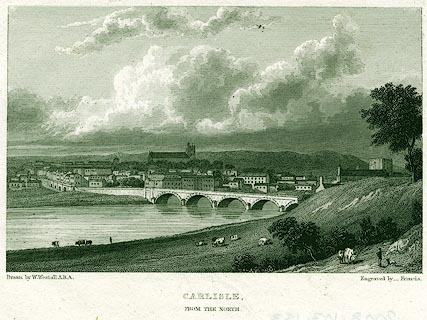 click to enlarge click to enlargePR0153.jpg printed at bottom left, right, centre:- "Drawn by W. Westall, A.R.A. / Engraved by _ Francis. / CARLISLE, / FROM THE NORTH." item:- Dove Cottage : 2008.107.153 Image © see bottom of page |
|||||||||||||||||
|
|
||||||||||||||||||
| evidence:- | old print:- placename:- City of Carlisle |
|||||||||||||||||
| source data:- | Print, uncoloured engraving, City of Carlisle, Cumberland, published by J and J Cundee,
Ivy Lane, Paternoster Row, London, 1819.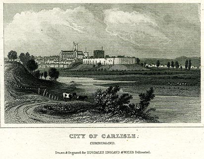 click to enlarge click to enlargePR0191.jpg Included in vol.2 of The New British Traveller, or Modern Panorama of England and Wales, by James Dugdale. printed at bottom:- "CITY OF CARLISLE. / CUMBERLAND. / Drawn & Engraved for DUGDALES ENGLAND &WALES Delineated." item:- Dove Cottage : 2008.107.191 Image © see bottom of page |
|||||||||||||||||
|
|
||||||||||||||||||
| evidence:- | old print:- placename:- Carlisle |
|||||||||||||||||
| source data:- | Print, uncoloured engraving, Carlisle, Cumberland, engraved by Owen, published at
the Albion Press, London, 1818.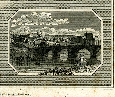 click to enlarge click to enlargePR0243.jpg Eden Bridge with the town in the background. printed at bottom:- "CARLISLE, CUMBERLAND." printed at lower on page:- "[ ]Albion Press, London, 1818. / Owen sculpt." item:- Dove Cottage : 2008.107.243 Image © see bottom of page |
|||||||||||||||||
|
|
||||||||||||||||||
| evidence:- | old print:- placename:- Carlisle |
|||||||||||||||||
| source data:- | Print, uncoloured engraving, Carlisle, Cumberland, drawn by Robert Carlile, engraved
and published by J Walker, 16 Rosomans Street, London, 1797.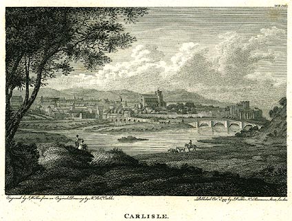 click to enlarge click to enlargePR0248.jpg printed at bottom left, right, centre:- "Engraved by J. Walker from an Original Drawing by Mr. Robt. Carlile. / Published Octr. 2d. 1797, by J. Walker, No.16 Rosomans Street, London. / CARLISLE." item:- Dove Cottage : 2008.107.248 Image © see bottom of page |
|||||||||||||||||
|
|
||||||||||||||||||
| evidence:- | old print:- placename:- City of Carlisle |
|||||||||||||||||
| source data:- | Print, uncoloured engraving, Prospect of the City of Carlisle, Cumberland, published
late 18th century.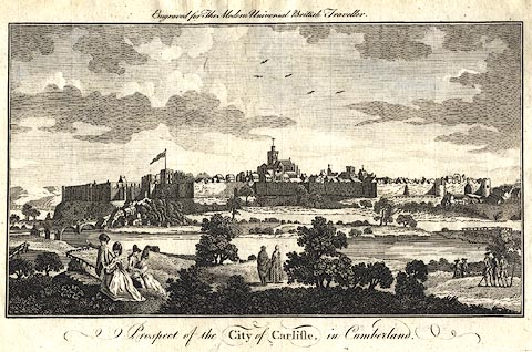 click to enlarge click to enlargePR0385.jpg Included in The Modern Universal British Traveller. The city has town walls and gates. printed at top:- "Engraved for The Modern Universal British Traveller" printed at bottom:- "Prospect of the CITY of CARLISLE, in Cumberland." item:- Dove Cottage : 2008.107.385 Image © see bottom of page |
|||||||||||||||||
|
|
||||||||||||||||||
| evidence:- | old drawing:- item:- cattle |
|||||||||||||||||
| source data:- | Drawing, Carlisle from the North East, Cumberland, by Thomas Bushby, 1917. click to enlarge click to enlargePR1340.jpg In the centre foreground cattle stand in the shallow waters of the River Eden which is spanned by Eden Bridge to far right of composition. Beyond lies a panoramic view of Carlisle partially obscured by trees with the spire of St Mary's church to far left beside the cathedral and the castle in centre of composition. dated at bottom left:- "July 2nd 1917" signed &dated at bottom right:- "Thos. Bushby. 1917" item:- Tullie House Museum : 1996.252.27 Image © Tullie House Museum |
|||||||||||||||||
|
|
||||||||||||||||||
| evidence:- | old map:- Greenwood 1824 (Cmd) placename:- Carlisle |
|||||||||||||||||
| source data:- | Map, engraving, Map of the County of Cumberland, scale about 1
inch to 1 mile, etc, by Christopher and John Greenwood,
published by George Pringle jnr, 70 Queen Street, Cheapside,
London, 1823.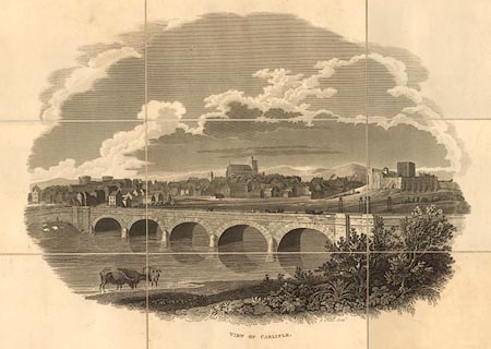 click to enlarge click to enlargeGW12V1.jpg "VIEW OF CARLISLE" item:- National Library of Scotland : EME.b.3.11 Image © National Library of Scotland |
|||||||||||||||||
|
|
||||||||||||||||||
| evidence:- | old print:- placename:- Carlisle item:- sheep |
|||||||||||||||||
| source data:- | Print, lithograph, Carlisle from near Cummersdale, Cumberland, by Matthew Ellis Nutter,
engraved by George Barnard, 1820s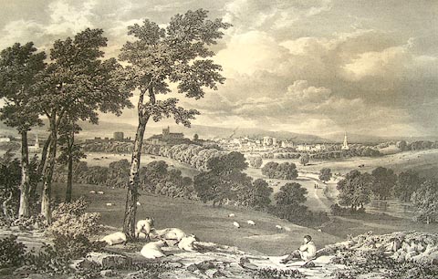 click to enlarge click to enlargePR1304.jpg Printed by C Hallmandel. In the foreground a shepherd sits with his flock, a basket and stick lying on the ground beside him. River Eden flows from right of composition towards the distant city of Carlisle which lies beyond. inscribed at bottom left on print:- "On Stone by GEO. BARNARD from a Drawing after Nature by M NUTTER" printed at bottom centre:- "CARLISLE. from near CUMMERSDALE" inscribed at bottom right on print:- "Printed by C. Hallmandel" item:- Tullie House Museum : 1979.158.2 Image © Tullie House Museum |
|||||||||||||||||
|
|
||||||||||||||||||
| evidence:- | old painting:- |
|||||||||||||||||
| source data:- | Painting, watercolour, North East View of the City of Carlisle, Cumberland, 1778-99.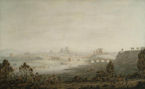 click to enlarge click to enlargePR1370.jpg Panoramic view of the city of Carlisle seen from a slightly elevated perspective across the River Eden from Rickerby Park. In the foreground, a group of men are chopping wood; to the right a man leads his horse and cart along the Newcastle Road. On the far right of the composition stands Stanwix Bank. A mounted horse and carriage can be seen crossing the second bridge across the river Eden. On the far bank a man is fishing in the river. The second tributary of the River Eden is shown slightly silted up beneath the first bridge across the river Eden. The panoramic view of the city shows the citadel, gaol, St Cuthbert's Church, Cathedral, Castle and Walls with distant hills rising beyond. item:- Tullie House Museum : 2006.105 Image © Tullie House Museum |
|||||||||||||||||
|
|
||||||||||||||||||
| evidence:- | old print:- placename:- City of Carlisle |
|||||||||||||||||
| source data:- | Print, South West Prospect of the City of Carlisle, Cumberland, drawn and engraved
by Samuel and Nathaniel Buck, 1745, reprinted and published by Hudson Scott, Carlisle,
1834.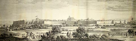 click to enlarge click to enlargePR1320.jpg Panoramic view of Carlisle and its environs. Groups of figures are gathered in the foreground. In the middle distance the River Eden flows horizontally across composition. Beyond it lies the walled city. Distant hills rise beyond. printed at top of paper:- "SOUTH WEST PROSPECT OF THE CITY OF CARLISLE" printed at bottom of paper:- "Walled City 1745 Reprinted from the original plate by Hudson Scott Carlisle August 1834 and sold by Hodgson, Boys and Graves and Ackerman Co London. Saml and Nathl Buck del et sculp publish'd according to act of Parliamt April 15th 1745 Garden Court No 1 Middle Temple London" item:- Tullie House Museum : 1989.61 Image © Tullie House Museum |
|||||||||||||||||
|
|
||||||||||||||||||
| evidence:- | old painting:- placename:- Carlisle |
|||||||||||||||||
| source data:- | Painting, watercolour, Carlisle from Etterby Scaur, One Hundred Years Ago, Carlisle,
Cumberland, by Matthew Ellis Nutter, 1835.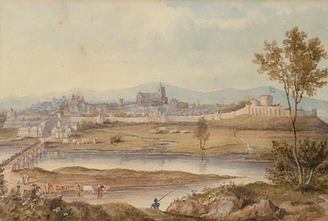 click to enlarge click to enlargePR1314.jpg The walled city of Carlisle viewed from an elevated perspective with the River Eden flowing horizontally across composition. Eden Bridge stands to left of composition; cattle are gathered on the meadows to either side of the river and a lone fisherman stands at the water's edge in centre foreground. Distant hills rise beyond the city. dated at reverse:- "1835" inscribed at reverse:- "Carlisle from Stanwix - as it was nearly one hundred years ago" item:- Tullie House Museum : 1986.100.6 Image © Tullie House Museum |
|||||||||||||||||
|
|
||||||||||||||||||
| evidence:- | old painting:- |
|||||||||||||||||
| source data:- | Painting, oil painting, Richard Ferguson FSA, Chancellor of Carlisle, Cumberland,
by George Harcourt Sephton, 1896. click to enlarge click to enlargePR1292.jpg Three quarter length portrait of Ferguson in late middle age, bearded, seated in an upholstered chair. He holds a gold watch chain in his right hand, his left arm resting on the arm of the chair. signed &dated at bottom right:- "G.H. SEPHTON APRIL 1896" item:- Tullie House Museum : 1978.108.166 Image © Tullie House Museum |
|||||||||||||||||
|
|
||||||||||||||||||
| evidence:- | old painting:- |
|||||||||||||||||
| source data:- | Painting, oil painting, Carlisle from Stanwix, Carlisle, Cumberland, by Frederick
Felix Ferdinand Raffael Fielding, 1811.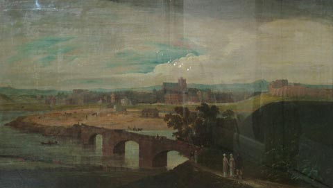 click to enlarge click to enlargePR1281.jpg Panoramic view of Carlisle from an elevated perspective with the city lying on the far side of the River Eden, its stone bridge to right of composition. signed at bottom centre:- "Fred. F. Fielding" item:- Tullie House Museum : 1978.108.113 Image © Tullie House Museum |
|||||||||||||||||
|
|
||||||||||||||||||
| evidence:- | old painting:- |
|||||||||||||||||
| source data:- | Painting, oil painting, Carlisle in 1811, Cumberland, by Frederick Felix Ferdinand
Raffael Fielding, 1811.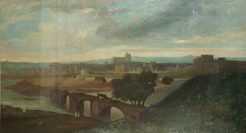 click to enlarge click to enlargePR1282.jpg View of Carlisle from Stanwix with Eden bridge in centre midground, a stagecoach crossing it. The court houses stand to left, the cathedral in centre and the castle to right of composition. Sunset approaches. item:- Tullie House Museum : 1978.108.114 Image © Tullie House Museum |
|||||||||||||||||
|
|
||||||||||||||||||
| evidence:- | old painting:- item:- sheep |
|||||||||||||||||
| source data:- | Painting, watercolour, Distant View of the City from the Northwest, Carlisle, Cumberland,
by Robert Carlyle snr, 1791.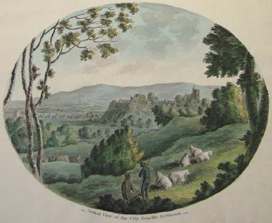 click to enlarge click to enlargePR1231.jpg Frontispiece to watercolour album The Antiquities of the City of Carlisle. The page includes text the oval watercolour of Carlisle from the north west, taken from Etterby Scaur looking south east framed by trees. The foreground includes two men and a group of sheep in farmland. In the middle distance from left to right Carlisle Cathedral, Castle and battlements and Priestbeck Bridge. The Pennines can be seen in the distance. inscribed at front:- "THE Antiquities OF THE City of Carlisle CONTAINING: VIEWS of the CITY_ CASTLE_ CATHEDRAL_CITADEL_GATES_WALLS_&c.with PLANS. DRAWN ON THE SPOT BY ROBERT CARLILE. The first Copy. MDCCXCI." inscribed at below oval watercolour:- "Distant View of the City from the Northwest" item:- Tullie House Museum : 1978.108.77.1 Image © Tullie House Museum |
|||||||||||||||||
|
|
||||||||||||||||||
| evidence:- | old painting:- |
|||||||||||||||||
| source data:- | Painting, oil painting, Carlisle from Stanwix, Cumberland, by Matthias Read, about
1720.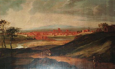 click to enlarge click to enlargePR1290.jpg View of Carlisle from Stanwix; the foreground road winds down to the River Eden in the midground, cattle grazing on the meadow beside it. A poorly clad couple stand conversing to right of foreground whilst a horseman accompanied by a man on foot head towards the city; he turns in his saddle as his greyhound bounds in the opposite direction. The composition is framed to left by slender trees and to right by two grassy slopes and a small hill top church. This painting originally hung in the Grapes Inn, Carlisle. item:- Tullie House Museum : 1978.108.157 Image © Tullie House Museum |
|||||||||||||||||
|
|
||||||||||||||||||
| evidence:- | old painting:- |
|||||||||||||||||
| source data:- | Painting, oil painting, Carlisle from the North East, Cumberland, 1780s-90s?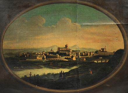 click to enlarge click to enlargePR1303.jpg Panoramic view of Carlisle from across the River Eden with Eden Bridge and Carlisle Castle to right of composition. The cathedral rises above the city in centre of composition. Beyond lie hills with low lying cloud above them in a blue sky. In the foreground an angler stands on the riverbank and small groups of figures saunter along the pathway beside it. The composition is painted within an oval trompe l'oeuil frame against a buff background. Perhaps by James Lowes who was one of the illustrators of Hutchinson's History of Cumberland. item:- Tullie House Museum : 1979.107 Image © Tullie House Museum |
|||||||||||||||||
|
|
||||||||||||||||||
| evidence:- | perhaps old painting:- item:- sunset; cart; harvest |
|||||||||||||||||
| source data:- | Painting, watercolour, Last Load, Harvest near Carlisle, Cumberland, by Thomas Bushby,
1899.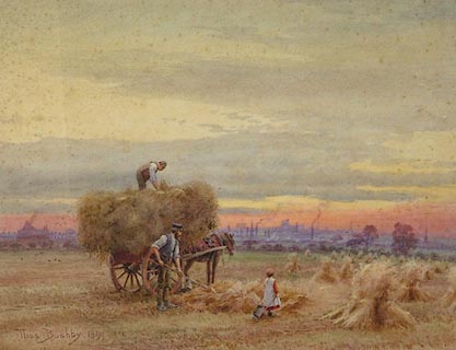 click to enlarge click to enlargePR1118.jpg Sunset scene; at the centre of a wide flat field two men load sheaves of corn onto a cart; a girl wearing a pinafore and holding a toy wheelbarrow stands watching them. Distant view of Carlisle beyond. signed &dated at bottom left:- "Thos. Bushby. 1899" inscribed at bottom centre:- "Near Carlisle" item:- Tullie House Museum : 1971.87.6 Image © Tullie House Museum |
|||||||||||||||||
|
|
||||||||||||||||||
| evidence:- | old painting:- |
|||||||||||||||||
| source data:- | Painting, oil painting, Landscape with Carlisle in the Distance, by Samuel Bough,
1878.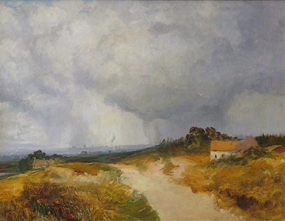 click to enlarge click to enlargePR1166.jpg Autumn; distant view of Carlisle from an elevated perspective on a track crossing a wild hill top with a small farmhouse standing to right and a more substantial house to left, below the brow of the hill. Leaden sky. Samuel Bough's last work annotated at reverse:- "This I Declare to be my husband the late Sam Bough RSA Last Work. Isabella Bough. I certify this as correct. C H Thatcher FRCSE July 18th 1893" item:- Tullie House Museum : 1976.105 Image © Tullie House Museum |
|||||||||||||||||
|
|
||||||||||||||||||
| evidence:- | old print:- |
|||||||||||||||||
| source data:- | Print, coloured, Charles Dickens at Carlisle, Cumberland, by Joseph W Simpson, 1920. click to enlarge click to enlargePR1201.jpg Half length depiction of Dickens in middle age, facing left. In the background stands The Fratry, Carlisle. signed at bottom right on print:- "Simpson" item:- Tullie House Museum : 1978.108.25 Image © Tullie House Museum |
|||||||||||||||||
|
|
||||||||||||||||||
| evidence:- | old drawing:- |
|||||||||||||||||
| source data:- | Drawing, Carlisle Cathedral from below West Walls, Carlisle, Cumberland, by Matthew
Ellis Nutter, 1835? click to enlarge click to enlargePR1219.jpg Summertime; detailed sketch of Carlisle from the north west beside foreground river looking towards the cathedral which rises above the city at centre of composition. The buildings to right of composition are partially obscured by trees standing in midground. item:- Tullie House Museum : 1978.108.75.12 Image © Tullie House Museum |
|||||||||||||||||
|
|
||||||||||||||||||
| evidence:- | old print:- |
|||||||||||||||||
| source data:- | Print, coloured, Robert Anderson, The Cumberland Bard, by Joseph W Simpson, about
1925. click to enlarge click to enlargePR1200.jpg Half length depiction of Anderson in middle age, standing hand on hip, facing right. Behind him stretch Carlisle's streets. signed at bottom right on print:- "Simpson" item:- Tullie House Museum : 1978.108.24 Image © Tullie House Museum |
|||||||||||||||||
|
|
||||||||||||||||||
| evidence:- | old print:- |
|||||||||||||||||
| source data:- | Print, coloured, Bonnie Prince Charlie in Carlisle, Cumberland, by Joseph W Simpson,
1920s. click to enlarge click to enlargePR1208.jpg Bonnie Prince Charlie stands in foreground, half length, facing the viewer; he wears tartan plaid, kilt and bonnet. A group of his followers stand to left of composition, in front of guildhall. Groups of townsfolk are gathered to right. signed at bottom right on print:- "Simpson" item:- Tullie House Museum : 1978.108.64 Image © Tullie House Museum |
|||||||||||||||||
|
|
||||||||||||||||||
| evidence:- | old drawing:- placename:- Carlisle item:- cart; timber drag (?) |
|||||||||||||||||
| source data:- | Drawing, Carlisle From Stanwix Bar, Cumberland, by John Wilson Carmichael, 1838.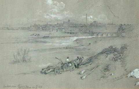 click to enlarge click to enlargePR1017.jpg Distant view of Carlisle from the sloping meadow leading down to the banks of the River Eden. to right of composition stands Eden Bridge. In the foreground two men converse, one of them seated on a cart loaded with logs to which four horses are harnessed. inscribed & signed &dated at bottom left:- "Carlisle from Stanwix bar J W Carmichael Apr 16 1838" item:- Tullie House Museum : 1968.16.18 Image © Tullie House Museum |
|||||||||||||||||
|
|
||||||||||||||||||
| evidence:- | old drawing:- placename:- Carlisle |
|||||||||||||||||
| source data:- | Drawing, Carlisle from near the Dalston Road, Cumberland, by John Wilson Carmichael,
1837. click to enlarge click to enlargePR1018.jpg Panoramic view of Carlisle; a large mill with smoking chimney stands to left of composition; to right lies a railway embankment. In middle distance, to left, stand two figures. inscribed &dated at bottom left:- "Carlisle from near the Dalston Road 1837" item:- Tullie House Museum : 1968.16.19 Image © Tullie House Museum |
|||||||||||||||||
|
|
||||||||||||||||||
| evidence:- | perhaps old drawing:- placename:- Carlisle |
|||||||||||||||||
| source data:- | Drawing, Carlisle from Denton Holme, Cumberland, by John Wilson Carmichael, 1835. click to enlarge click to enlargePR1001.jpg Summertime; distant view of Carlisle seen from a hill top upon which four figures are seated to left of foreground. Distant hills rise beyond. inscribed & initialled &dated at bottom left:- "Carlisle from Denton Holme" at :- "" item:- Tullie House Museum : 1968.16.2 Image © Tullie House Museum |
|||||||||||||||||
|
|
||||||||||||||||||
| evidence:- | old drawing:- placename:- Carlisle |
|||||||||||||||||
| source data:- | Drawing, Carlisle from the East of the River Petril, Cumberland, by John Wilson Carmichael,
1835. click to enlarge click to enlargePR1003.jpg Summertime; distant view of Carlisle seen from an elevated perspective. Carmichael executed 22 pencil drawings of the construction of the Newcastle and Carlisle Railway at the suggestion of the Rail Company. inscribed & initialled &dated at bottom left:- "Carlisle from the East of the River Petril" item:- Tullie House Museum : 1968.16.4 Image © Tullie House Museum |
|||||||||||||||||
|
|
||||||||||||||||||
| evidence:- | old print:- |
|||||||||||||||||
| source data:- | Print, Carlisle, Cumberland, by W Turner, 1797.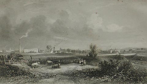 click to enlarge click to enlargePR1072.jpg In a scrapbook album. item:- Tullie House Museum : 1970.80.1.68 Image © Tullie House Museum |
|||||||||||||||||
|
|
||||||||||||||||||
| evidence:- | old print:- placename:- City of Carlisle |
|||||||||||||||||
| source data:- | Print, South West Prospect of the City of Carlisle in 1739, Carlisle, Cumberland,
drawn and engraved by Samuel and Nathaniel Buck, 1739, edition about 1834.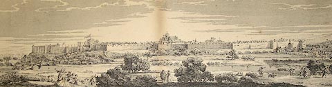 click to enlarge click to enlargePR1107.jpg Panoramic view of Carlisle and its environs. Groups of figures are gathered in the foreground. In the middle distance the River Eden flows horizontally across composition. Beyond it lies the walled city. Distant hills rise beyond. printed at top of paper:- "SOUTH WEST PROSPECT OF THE CITY OF CARLISLE in 1739" item:- Tullie House Museum : 1970.83 Image © Tullie House Museum |
|||||||||||||||||
|
|
||||||||||||||||||
| evidence:- | old painting:- |
|||||||||||||||||
| source data:- | Painting, watercolour, Carlisle from Weaver's Bank, Cumberland, by Thomas Bushby,
1895.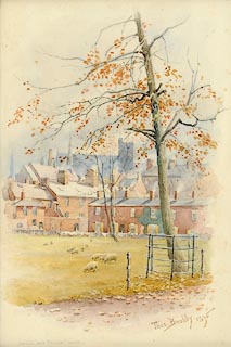 click to enlarge click to enlargePR0995.jpg Late autumn; to the right of foreground stands a tree, a few brown leaves still clinging to its branches. Sheep are grazing on a patch of grass beyond which stand rows of terraced houses, smoke issuing from their chimneys. The cathedral rises above them in the distance. signed &dated at bottom right:- "Thos. Bushby 1895" item:- Tullie House Museum : 1968.11.7.1 Image © Tullie House Museum |
|||||||||||||||||
|
|
||||||||||||||||||
| evidence:- | old painting:- |
|||||||||||||||||
| source data:- | Painting, watercolour, Distant View of the Walled City of Carlisle from the North
East, Cumberland, by Samuel Bough, 1868.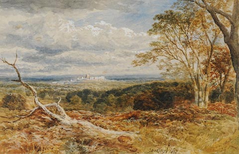 click to enlarge click to enlargePR0984.jpg Autumnal landscape; a distant view of Carlisle seen from the clearing on a wooded hill top, framed to right by tall trees and to left with the raised branch of a felled tree lying amidst bracken. Woodland fills the intervening landscape. Distant hills rise beyond the city. signed &dated at bottom centre:- "Sam Bough 1868" item:- Tullie House Museum : 1961.120 Image © Tullie House Museum |
|||||||||||||||||
|
|
||||||||||||||||||
| evidence:- | old drawing:- |
|||||||||||||||||
| source data:- | Drawing, Panoramic View of Carlisle from the North East, Cumberland, by Robert Carlyle
snr, 24 September 1805.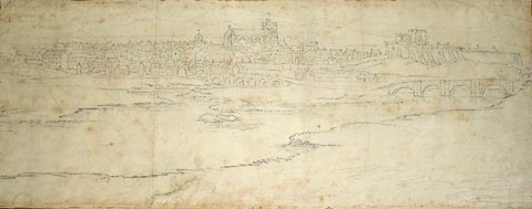 click to enlarge click to enlargePR0796.jpg Panoramic view of the city of Carlisle seen from the meadows beside the River Eden which is spanned by two bridges. The cathedral rises above the rooftops of the city in the centre of composition, with Carlisle castle standing to the right. Distant hills rise beyond the city. inscribed at reverse:- "by R Carlyle Sept 24 1805" item:- Tullie House Museum : 1889.67 Image © Tullie House Museum |
|||||||||||||||||
|
|
||||||||||||||||||
| evidence:- | old painting:- placename:- City of Carlisle |
|||||||||||||||||
| source data:- | Painting, watercolour, North East View of the City of Carlisle, Cumberland, by Robert
Carlyle snr, 1791.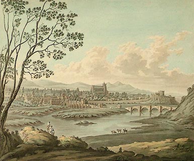 click to enlarge click to enlargePR0906.jpg Summertime; panoramic view of the city of Carlisle seen from an elevated perspective across the River Eden; to left of composition, in the foreground, a family stands looking across the river. At the water's edge a mounted horseman pauses beside three cattle standing on the riverbank. Eden Bridge lies to right of composition and distant hills rise beyond. One of a set of 11 original drawings for proposed aquatints The Antiquities of the City of Carlisle, 1791 inscribed at bottom left:- "Drawn by Rob't Carlyle" inscribed at bottom centre:- "NORTH EAST VIEW of the CITY of CARLISLE." item:- Tullie House Museum : 1935.80.1 Image © Tullie House Museum |
|||||||||||||||||
|
|
||||||||||||||||||
| evidence:- | old print:- placename:- City of Carlisle |
|||||||||||||||||
| source data:- | Print, South West Prospect of the City of Carlisle, drawn and engraved by Samuel and
Nathaniel Buck, 1745, reprinted by Hudson Scott and Sons, Carlisle, Cumberland, 1834.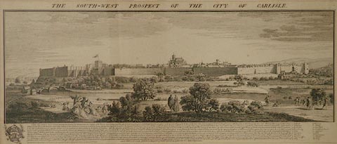 click to enlarge click to enlargePR0963.jpg Panoramic view of Carlisle and its environs. Groups of figures are gathered in the foreground. In the middle distance the River Eden flows horizontally across composition. Beyond it lies the walled city. Distant hills rise beyond. printed at top of paper:- "SOUTH WEST PROSPECT OF THE CITY OF CARLISLE" printed at bottom of paper:- "Walled City 1745 Reprinted from the original plate by Hudson Scott Carlisle August 1834 and sold by Hodgson, Boys and Graves and Ackerman Co London. Saml and Nathl Buck del et sculp publish'd according to act of Parliamt April 15th 1745 Garden Court No 1 Middle Temple London" item:- Tullie House Museum : 1952.16.1 Image © Tullie House Museum |
|||||||||||||||||
|
|
||||||||||||||||||
| evidence:- | old painting:- item:- chest; flag; sceptre; dagger |
|||||||||||||||||
| source data:- | Painting, watercolour, The Corporation Muniment Chest, Carlisle, Cumberland, by William
Henry Nutter, 1864.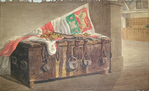 click to enlarge click to enlargePR0869.jpg A wooden chest cross banded in iron and with five padlocks and a lock stands on the floor of a ?municipal interior. On top of it lie a flag, a sceptre and a ceremonial dagger. signed &dated at bottom left:- "W H Nutter 1864" item:- Tullie House Museum : 1917.89.2 Image © Tullie House Museum |
|||||||||||||||||
|
|
||||||||||||||||||
 BVL10.jpg White dial of a longcase clock by:- "Tritschler / Carlisle" H F Tritschler, clockmaker; 19 Lowther Street, Carlisle Courtesy of David Lomax |
||||||||||||||||||
|
|
||||||||||||||||||
| twinned with:- | Slupsk, Poland |
|||||||||||||||||
|
|
||||||||||||||||||
| twinned with:- | Flensburg, Germany |
|||||||||||||||||
|
|
||||||||||||||||||
| places:- |
|
|||||||||||||||||
|
||||||||||||||||||
|
||||||||||||||||||
|
||||||||||||||||||
|
||||||||||||||||||
|
||||||||||||||||||
|
||||||||||||||||||
|
||||||||||||||||||
|
||||||||||||||||||
|
||||||||||||||||||
|
||||||||||||||||||
|
||||||||||||||||||
|
||||||||||||||||||
|
||||||||||||||||||
|
||||||||||||||||||
|
||||||||||||||||||
|
||||||||||||||||||
|
||||||||||||||||||
|
||||||||||||||||||
|
||||||||||||||||||
|
||||||||||||||||||
|
||||||||||||||||||
|
||||||||||||||||||
|
||||||||||||||||||
|
||||||||||||||||||
|
||||||||||||||||||
|
||||||||||||||||||
|
||||||||||||||||||
|
||||||||||||||||||
|
||||||||||||||||||
|
||||||||||||||||||
|
||||||||||||||||||
|
||||||||||||||||||
|
||||||||||||||||||
|
||||||||||||||||||
|
||||||||||||||||||
|
||||||||||||||||||
|
||||||||||||||||||
|
||||||||||||||||||
|
||||||||||||||||||
|
||||||||||||||||||
|
||||||||||||||||||
|
||||||||||||||||||
|
||||||||||||||||||
|
||||||||||||||||||
|
||||||||||||||||||
|
||||||||||||||||||
|
||||||||||||||||||
|
||||||||||||||||||
|
||||||||||||||||||
|
||||||||||||||||||
|
||||||||||||||||||
|
||||||||||||||||||
|
||||||||||||||||||
|
||||||||||||||||||
|
||||||||||||||||||
|
||||||||||||||||||
|
||||||||||||||||||
|
||||||||||||||||||
|
||||||||||||||||||
|
||||||||||||||||||
|
||||||||||||||||||
|
||||||||||||||||||
|
||||||||||||||||||
|
||||||||||||||||||
|
||||||||||||||||||
|
||||||||||||||||||
|
||||||||||||||||||
|
||||||||||||||||||
|
||||||||||||||||||
|
||||||||||||||||||
|
||||||||||||||||||
|
||||||||||||||||||
|
||||||||||||||||||
|
||||||||||||||||||
|
||||||||||||||||||
|
||||||||||||||||||
|
||||||||||||||||||
|
||||||||||||||||||
|
||||||||||||||||||
|
||||||||||||||||||
|
||||||||||||||||||
|
||||||||||||||||||
|
||||||||||||||||||
|
||||||||||||||||||
|
||||||||||||||||||
|
||||||||||||||||||
|
||||||||||||||||||
|
||||||||||||||||||
|
||||||||||||||||||
|
||||||||||||||||||
|
||||||||||||||||||
|
||||||||||||||||||
|
||||||||||||||||||
|
||||||||||||||||||
|
||||||||||||||||||
|
||||||||||||||||||
|
||||||||||||||||||
|
||||||||||||||||||
|
||||||||||||||||||
|
||||||||||||||||||
|
||||||||||||||||||
|
||||||||||||||||||
|
||||||||||||||||||
|
||||||||||||||||||
|
||||||||||||||||||
|
||||||||||||||||||
|
||||||||||||||||||
|
||||||||||||||||||
|
||||||||||||||||||
|
||||||||||||||||||
|
||||||||||||||||||
|
||||||||||||||||||
|
||||||||||||||||||
|
||||||||||||||||||
|
||||||||||||||||||
|
||||||||||||||||||
|
||||||||||||||||||
|
||||||||||||||||||
|
||||||||||||||||||
|
||||||||||||||||||
|
||||||||||||||||||
|
||||||||||||||||||
|
||||||||||||||||||
|
||||||||||||||||||
|
||||||||||||||||||
|
||||||||||||||||||
|
||||||||||||||||||
|
||||||||||||||||||
|
||||||||||||||||||
|
||||||||||||||||||
|
||||||||||||||||||
|
||||||||||||||||||
|
||||||||||||||||||
|
||||||||||||||||||
|
||||||||||||||||||
|
||||||||||||||||||
|
||||||||||||||||||
|
||||||||||||||||||
|
||||||||||||||||||
|
||||||||||||||||||
|
||||||||||||||||||
|
||||||||||||||||||
|
||||||||||||||||||
|
||||||||||||||||||
|
||||||||||||||||||
|
||||||||||||||||||
|
||||||||||||||||||
|
||||||||||||||||||
|
||||||||||||||||||
|
||||||||||||||||||
|
||||||||||||||||||
|
||||||||||||||||||
|
||||||||||||||||||
|
||||||||||||||||||
|
||||||||||||||||||
|
||||||||||||||||||
|
||||||||||||||||||
|
||||||||||||||||||
|
||||||||||||||||||
|
||||||||||||||||||
|
||||||||||||||||||
|
||||||||||||||||||
|
||||||||||||||||||
|
||||||||||||||||||
|
||||||||||||||||||
|
||||||||||||||||||
|
||||||||||||||||||
|
||||||||||||||||||
|
||||||||||||||||||
|
||||||||||||||||||
|
||||||||||||||||||
|
||||||||||||||||||
|
||||||||||||||||||
|
||||||||||||||||||
|
||||||||||||||||||
|
||||||||||||||||||
|
||||||||||||||||||
|
||||||||||||||||||
|
||||||||||||||||||
|
||||||||||||||||||
|
||||||||||||||||||
|
||||||||||||||||||
|
||||||||||||||||||
|
||||||||||||||||||
|
||||||||||||||||||
|
||||||||||||||||||
|
||||||||||||||||||
|
||||||||||||||||||
|
||||||||||||||||||
|
||||||||||||||||||
|
||||||||||||||||||
|
||||||||||||||||||
|
||||||||||||||||||
|
||||||||||||||||||
|
||||||||||||||||||
|
||||||||||||||||||
|
||||||||||||||||||
|
||||||||||||||||||
|
||||||||||||||||||
|
||||||||||||||||||
|
||||||||||||||||||
|
||||||||||||||||||
|
||||||||||||||||||
|
||||||||||||||||||
|
||||||||||||||||||
|
||||||||||||||||||
|
||||||||||||||||||
|
||||||||||||||||||
|
||||||||||||||||||
|
||||||||||||||||||
|
||||||||||||||||||
|
||||||||||||||||||
|
||||||||||||||||||
|
||||||||||||||||||
|
||||||||||||||||||
|
||||||||||||||||||
|
||||||||||||||||||
|
||||||||||||||||||
|
||||||||||||||||||
|
||||||||||||||||||
|
||||||||||||||||||
|
||||||||||||||||||
|
||||||||||||||||||
|
||||||||||||||||||
|
||||||||||||||||||
|
||||||||||||||||||
|
||||||||||||||||||
|
||||||||||||||||||
|
||||||||||||||||||
|
||||||||||||||||||
|
||||||||||||||||||
|
||||||||||||||||||
|
||||||||||||||||||
|
||||||||||||||||||
|
||||||||||||||||||
|
||||||||||||||||||
|
||||||||||||||||||
|
||||||||||||||||||
|
||||||||||||||||||
|
||||||||||||||||||
|
||||||||||||||||||
|
||||||||||||||||||
|
||||||||||||||||||
|
||||||||||||||||||
|
||||||||||||||||||
|
||||||||||||||||||
|
||||||||||||||||||
|
||||||||||||||||||
|
||||||||||||||||||
|
||||||||||||||||||
|
||||||||||||||||||
|
||||||||||||||||||
|
||||||||||||||||||
|
||||||||||||||||||
|
||||||||||||||||||
|
||||||||||||||||||
|
||||||||||||||||||
|
||||||||||||||||||
|
||||||||||||||||||
|
||||||||||||||||||
|
||||||||||||||||||
|
||||||||||||||||||
|
||||||||||||||||||
|
||||||||||||||||||
|
||||||||||||||||||
|
||||||||||||||||||
|
||||||||||||||||||
|
||||||||||||||||||
|
||||||||||||||||||
|
||||||||||||||||||
|
||||||||||||||||||
|
||||||||||||||||||
|
||||||||||||||||||
|
||||||||||||||||||
|
||||||||||||||||||
|
||||||||||||||||||
|
||||||||||||||||||
|
||||||||||||||||||
|
||||||||||||||||||
|
||||||||||||||||||
|
||||||||||||||||||
|
||||||||||||||||||
|
||||||||||||||||||
|
||||||||||||||||||
|
||||||||||||||||||
|
||||||||||||||||||
|
||||||||||||||||||
|
||||||||||||||||||
|
||||||||||||||||||
|
||||||||||||||||||
|
||||||||||||||||||
|
||||||||||||||||||
|
||||||||||||||||||
|
||||||||||||||||||
|
||||||||||||||||||
|
||||||||||||||||||
|
||||||||||||||||||
|
||||||||||||||||||
|
||||||||||||||||||
|
||||||||||||||||||
|
||||||||||||||||||
|
||||||||||||||||||
|
||||||||||||||||||
|
||||||||||||||||||
|
||||||||||||||||||
|
||||||||||||||||||
|
||||||||||||||||||
|
||||||||||||||||||
|
||||||||||||||||||
|
||||||||||||||||||
|
||||||||||||||||||
|
||||||||||||||||||
|
||||||||||||||||||
|
||||||||||||||||||
|
||||||||||||||||||
|
||||||||||||||||||
|
||||||||||||||||||
|
||||||||||||||||||
|
||||||||||||||||||
|
||||||||||||||||||
|
||||||||||||||||||
|
||||||||||||||||||
|
||||||||||||||||||
|
||||||||||||||||||
|
||||||||||||||||||
|
||||||||||||||||||
|
||||||||||||||||||
|
||||||||||||||||||
|
||||||||||||||||||
|
||||||||||||||||||
|
||||||||||||||||||
|
||||||||||||||||||
|
||||||||||||||||||
|
||||||||||||||||||
|
||||||||||||||||||
|
||||||||||||||||||
|
||||||||||||||||||
|
||||||||||||||||||
|
||||||||||||||||||
|
||||||||||||||||||
|
||||||||||||||||||
|
||||||||||||||||||
|
||||||||||||||||||
|
||||||||||||||||||
|
||||||||||||||||||
|
||||||||||||||||||
|
||||||||||||||||||
|
||||||||||||||||||
|
||||||||||||||||||
|
||||||||||||||||||
|
||||||||||||||||||
|
||||||||||||||||||
|
||||||||||||||||||
|
||||||||||||||||||
|
||||||||||||||||||
|
||||||||||||||||||
|
||||||||||||||||||
|
||||||||||||||||||
|
||||||||||||||||||
|
||||||||||||||||||
|
||||||||||||||||||
|
||||||||||||||||||
|
||||||||||||||||||
|
||||||||||||||||||
|
||||||||||||||||||
|
||||||||||||||||||
|
||||||||||||||||||
|
||||||||||||||||||
|
||||||||||||||||||
|
||||||||||||||||||
|
||||||||||||||||||
|
||||||||||||||||||
|
||||||||||||||||||
|
||||||||||||||||||
|
||||||||||||||||||
|
||||||||||||||||||
|
||||||||||||||||||
|
||||||||||||||||||
|
||||||||||||||||||
|
||||||||||||||||||
|
||||||||||||||||||
|
||||||||||||||||||
|
||||||||||||||||||
|
||||||||||||||||||
|
||||||||||||||||||
|
||||||||||||||||||
|
||||||||||||||||||
|
||||||||||||||||||
|
||||||||||||||||||
|
||||||||||||||||||
|
||||||||||||||||||
|
||||||||||||||||||
|
||||||||||||||||||
|
||||||||||||||||||
|
||||||||||||||||||
|
||||||||||||||||||
|
||||||||||||||||||
|
||||||||||||||||||
|
||||||||||||||||||
|
||||||||||||||||||
|
||||||||||||||||||
|
||||||||||||||||||
|
||||||||||||||||||
|
||||||||||||||||||
|
||||||||||||||||||
|
||||||||||||||||||
|
||||||||||||||||||
|
||||||||||||||||||
|
||||||||||||||||||
|
||||||||||||||||||
|
||||||||||||||||||
|
||||||||||||||||||
|
||||||||||||||||||
|
||||||||||||||||||
|
||||||||||||||||||
|
||||||||||||||||||
|
||||||||||||||||||
|
||||||||||||||||||
|
||||||||||||||||||
|
||||||||||||||||||
|
||||||||||||||||||
|
||||||||||||||||||
|
||||||||||||||||||
|
||||||||||||||||||
|
||||||||||||||||||
|
||||||||||||||||||
|
||||||||||||||||||
|
||||||||||||||||||
|
||||||||||||||||||
|
||||||||||||||||||
|
||||||||||||||||||
|
||||||||||||||||||
|
||||||||||||||||||
|
||||||||||||||||||
|
||||||||||||||||||
|
||||||||||||||||||
|
||||||||||||||||||
|
||||||||||||||||||
|
||||||||||||||||||
|
||||||||||||||||||
|
||||||||||||||||||
|
||||||||||||||||||
|
||||||||||||||||||
|
||||||||||||||||||
|
||||||||||||||||||
|
||||||||||||||||||
|
||||||||||||||||||
|
||||||||||||||||||
|
||||||||||||||||||
|
||||||||||||||||||
|
||||||||||||||||||
|
||||||||||||||||||
|
||||||||||||||||||
|
||||||||||||||||||
|
||||||||||||||||||
|
||||||||||||||||||
|
||||||||||||||||||
|
||||||||||||||||||
|
||||||||||||||||||
|
||||||||||||||||||
|
||||||||||||||||||
|
||||||||||||||||||
|
||||||||||||||||||
|
||||||||||||||||||
|
||||||||||||||||||
|
||||||||||||||||||
|
||||||||||||||||||
|
||||||||||||||||||
|
||||||||||||||||||
|
||||||||||||||||||
|
||||||||||||||||||
|
||||||||||||||||||
|
||||||||||||||||||
|
||||||||||||||||||
|
||||||||||||||||||
|
||||||||||||||||||
|
||||||||||||||||||
|
||||||||||||||||||
|
||||||||||||||||||
|
||||||||||||||||||
|
||||||||||||||||||
|
||||||||||||||||||
|
||||||||||||||||||
|
||||||||||||||||||
|
||||||||||||||||||
|
||||||||||||||||||
|
||||||||||||||||||
|
||||||||||||||||||
|
||||||||||||||||||
|
||||||||||||||||||
|
||||||||||||||||||
Lakes Guides menu.