 Old Cumbria Gazetteer
 |
 |
|
| Caldew Bridge, Carlisle | ||
| Caldew Bridge | ||
| site name:- | Caldew, River | |
| Street:- | Bridge Street | |
| locality:- | Carlisle | |
| civil parish:- | Carlisle (formerly Cumberland) | |
| county:- | Cumbria | |
| locality type:- | bridge | |
| coordinates:- | NY39575603 | |
| 1Km square:- | NY3956 | |
| 10Km square:- | NY35 | |
|
|
||
| evidence:- | old map:- OS County Series (Cmd 23 3) placename:- Caldew Bridge |
|
| source data:- | Maps, County Series maps of Great Britain, scales 6 and 25
inches to 1 mile, published by the Ordnance Survey, Southampton,
Hampshire, from about 1863 to 1948. |
|
|
|
||
| evidence:- | old map:- Saxton 1579 |
|
| source data:- | Map, hand coloured engraving, Westmorlandiae et Cumberlandiae Comitatus ie Westmorland
and Cumberland, scale about 5 miles to 1 inch, by Christopher Saxton, London, engraved
by Augustinus Ryther, 1576, published 1579-1645.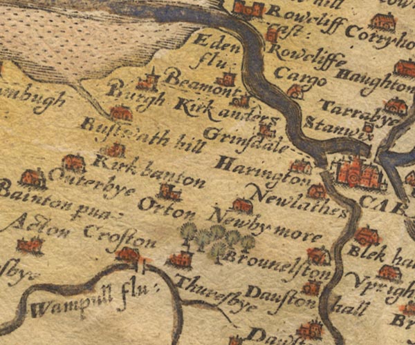 Sax9NY35.jpg Over River Caldew. item:- private collection : 2 Image © see bottom of page |
|
|
|
||
| evidence:- | old map:- Mercator 1595 (edn?) placename:- |
|
| source data:- | Map, hand coloured engraving, Northumbria, Cumberlandia, et
Dunelmensis Episcopatus, ie Northumberland, Cumberland and
Durham etc, scale about 6.5 miles to 1 inch, by Gerard Mercator,
Duisberg, Germany, about 1595.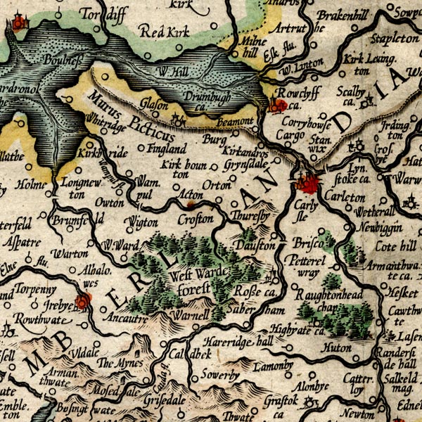 MER8CumC.jpg "" double across a stream; bridge, over the Caldew at Carlisle item:- JandMN : 169 Image © see bottom of page |
|
|
|
||
| evidence:- | old map:- Speed 1611 (Cmd) |
|
| source data:- | Map, hand coloured engraving, Cumberland and the Ancient Citie
Carlile Described, scale about 4 miles to 1 inch, by John Speed,
1610, published by J Sudbury and George Humble, Popes Head
Alley, London, 1611-12.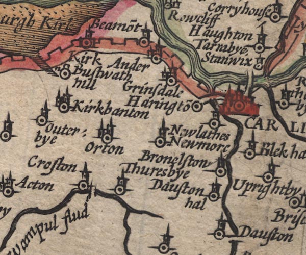 SP11NY35.jpg double line across the Caldew, E side of Carlisle item:- private collection : 16 Image © see bottom of page |
|
|
|
||
| evidence:- | old map:- Jansson 1646 |
|
| source data:- | Map, hand coloured engraving, Cumbria and Westmoria, ie
Cumberland and Westmorland, scale about 3.5 miles to 1 inch, by
John Jansson, Amsterdam, Netherlands, 1646.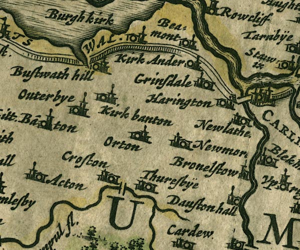 JAN3NY35.jpg Double line crossing the stream. item:- JandMN : 88 Image © see bottom of page |
|
|
|
||
| evidence:- | old map:- Ogilby 1675 (plate 96) |
|
| source data:- | Road strip map, hand coloured engraving, the Road from Kendal to
Cockermouth, and the Road from Egremond to Carlisle, scale about
1 inch to 1 mile, by John Ogilby, London, 1675.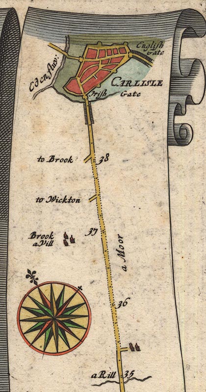 OG96Bm35.jpg In mile 38, Cumberland. Road crosses a river, no bridge drawn. item:- JandMN : 22 Image © see bottom of page |
|
|
|
||
| evidence:- | old map:- Ogilby 1675 (plate 38) |
|
| source data:- | Road strip map, hand coloured engraving, continuation of the
Road from London to Carlisle, scale about 1 inch to 1 mile, by
John Ogilby, London, 1675.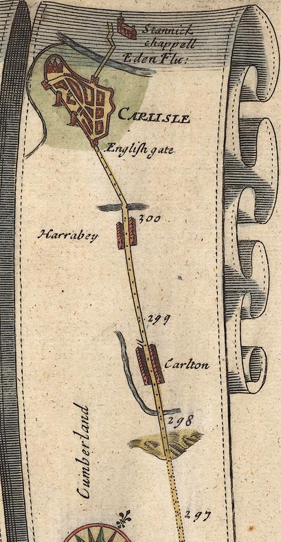 OG38m297.jpg In mile 301, Cumberland. Bridge drawn over the river to the left (west) of the town; no road shown. item:- JandMN : 21 Image © see bottom of page |
|
|
|
||
| evidence:- | old map:- Seller 1694 (Cmd) |
|
| source data:- | Map, uncoloured engraving, Cumberland, scale about 12 miles to 1
inch, by John Seller, 1694. click to enlarge click to enlargeSEL9.jpg two lines cross a stream; bridge item:- Dove Cottage : 2007.38.89 Image © see bottom of page |
|
|
|
||
| evidence:- | old map:- Morden 1695 (Cmd) |
|
| source data:- | Map, uncoloured engraving, Cumberland, scale about 4 miles to 1
inch, by Robert Morden, 1695, published by Abel Swale, the
Unicorn, St Paul's Churchyard, Awnsham, and John Churchill, the
Black Swan, Paternoster Row, London, 1695-1715. MD12NY35.jpg Double line over the Caldew, W of Carlisle. item:- JandMN : 90 Image © see bottom of page |
|
|
|
||
| evidence:- | old map:- Bowen and Kitchin 1760 |
|
| source data:- | Map, hand coloured engraving, A New Map of the Counties of
Cumberland and Westmoreland Divided into their Respective Wards,
scale about 4 miles to 1 inch, by Emanuel Bowen and Thomas
Kitchin et al, published by T Bowles, Robert Sayer, and John
Bowles, London, 1760. BO18NY35.jpg double line across the Caldew item:- Armitt Library : 2008.14.10 Image © see bottom of page |
|
|
|
||
| evidence:- | old map:- Donald 1774 (Cmd) |
|
| source data:- | Map, hand coloured engraving, 3x2 sheets, The County of Cumberland, scale about 1
inch to 1 mile, by Thomas Donald, engraved and published by Joseph Hodskinson, 29
Arundel Street, Strand, London, 1774.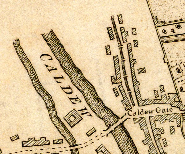 D43956K.jpg bridge over the Caldew; 3 arches, and cutwaters item:- Carlisle Library : Map 2 Image © Carlisle Library |
|
|
|
||
| evidence:- | old map:- Donald 1774 (Cmd) |
|
| source data:- | Map, hand coloured engraving, 3x2 sheets, The County of Cumberland, scale about 1
inch to 1 mile, by Thomas Donald, engraved and published by Joseph Hodskinson, 29
Arundel Street, Strand, London, 1774.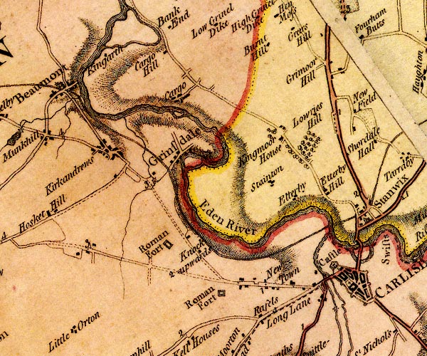 D4NY35NE.jpg double line across a river; a bridge item:- Carlisle Library : Map 2 Image © Carlisle Library |
|
|
|
||
| evidence:- | old map:- Bell 1892 placename:- Caldew Bridge |
|
| source data:- | Map, colour lithograph, Road Map of Cumberland, by George Joseph
Bell, scale about 2.5 miles to 1 inch, printed by Charles
Thurnam and Sons, Carlisle, Cumberland, 1892. BEL9NY35.jpg "CALDEW" bridge symbol Road map of Cumberland showing County Bridges item:- Carlisle Library : Map 38 Image © Carlisle Library |
|
|
|
||
| evidence:- | old print:- Thurnam 1835 |
|
| source data:- | Print, uncoloured lithograph, Carlisle from Primrose Bank, Cumberland, drawn by M
E Nutter, lithographed by P Gauci, published by Charles Thurnam, Carlisle, Cumberland,
by Ackermann and Co, by Hodgson, Boys, and Graves, and by Charles Tilt, London, 1835.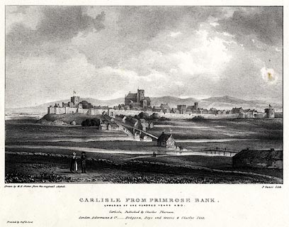 click to enlarge click to enlargeTHM102.jpg Printed by Graf and Soret. Included in Carlisle in the Olden Time. printed at bottom:- "Drawn by M. E. Nutter from the original sketch. / P. Gauci lith. / CARLISLE FROM PRIMROSE BANK. / UPWARDS OF ONE HUNDRED YEARS AGO. / Carlisle, Published by Charles Thurnam. / London. Ackermann & Co. - Hodgson, Boys, and Graves & Charles Tilt. / Printed by Graf &Soret." item:- Dove Cottage : 2008.123.2 Image © see bottom of page |
|
|
|
||
 Lakes Guides menu.