 Old Cumbria Gazetteer
 |
 |
|
| City Walls, Carlisle | ||
| City Walls | ||
| locality:- | Carlisle | |
| civil parish:- | Carlisle (formerly Cumberland) | |
| county:- | Cumbria | |
| locality type:- | town wall | |
| coordinates:- | NY39815620 (etc) | |
| 1Km square:- | NY3956 | |
| 10Km square:- | NY35 | |
| references:- | Listed Buildings 2010 |
|
|
|
||
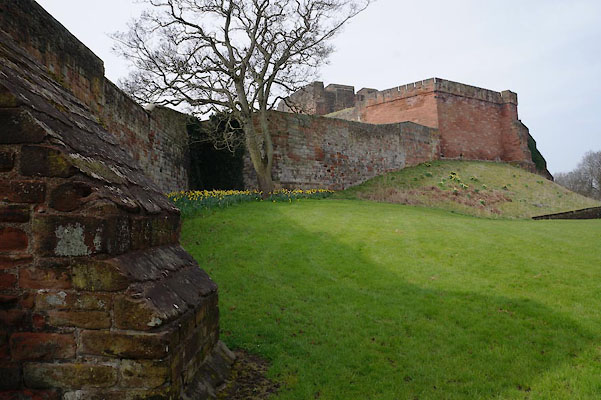 CAF01.jpg East of the castle. (taken 30.3.2014) 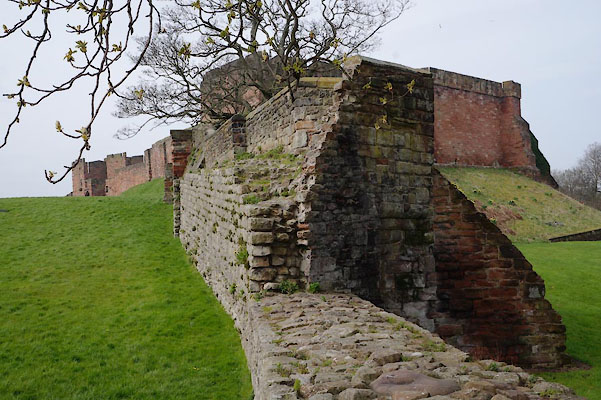 CAF02.jpg East of the castle. (taken 30.3.2014) |
||
|
|
||
| evidence:- | old map:- OS County Series (Cmd 23 3) placename:- City Wall |
|
| source data:- | Maps, County Series maps of Great Britain, scales 6 and 25
inches to 1 mile, published by the Ordnance Survey, Southampton,
Hampshire, from about 1863 to 1948. OS County Series (Cmd 23 7) "City Wall (Site of)" |
|
|
|
||
| evidence:- | old map:- Donald 1774 (Cmd) |
|
| source data:- | Map, hand coloured engraving, 3x2 sheets, The County of Cumberland, scale about 1
inch to 1 mile, by Thomas Donald, engraved and published by Joseph Hodskinson, 29
Arundel Street, Strand, London, 1774.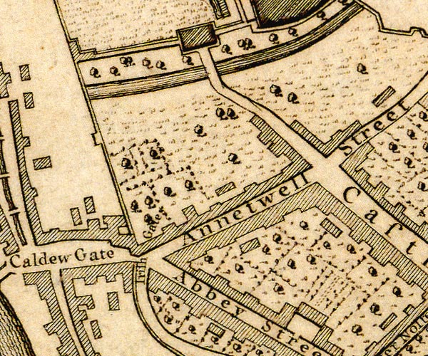 D43956Q.jpg wall west of castle 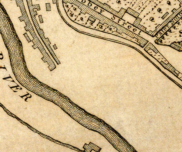 D43955U.jpg 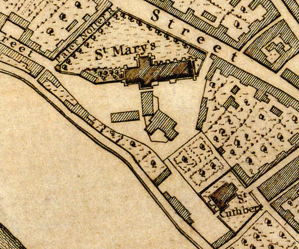 D43955Z.jpg 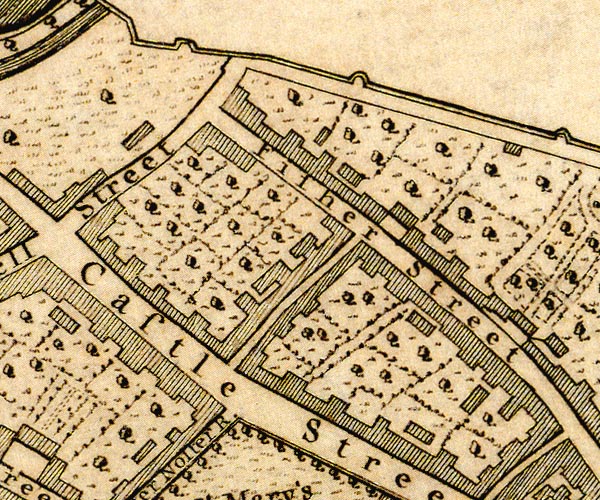 D43956V.jpg 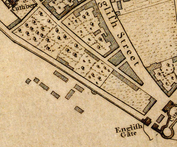 D44055D.jpg wall east of castle 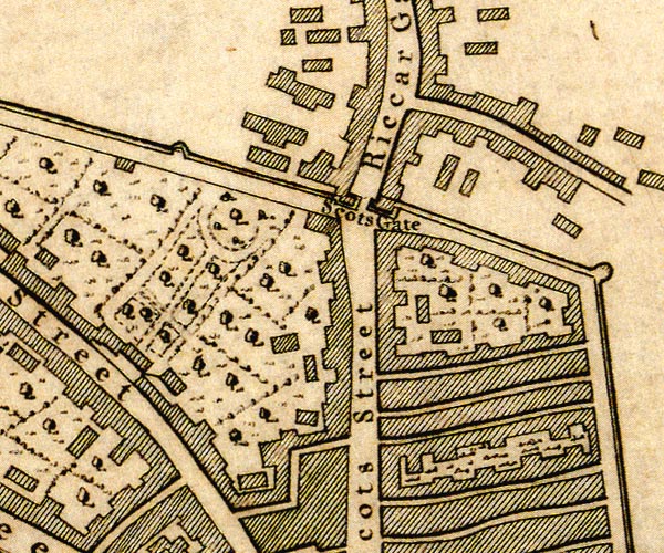 D44056A.jpg 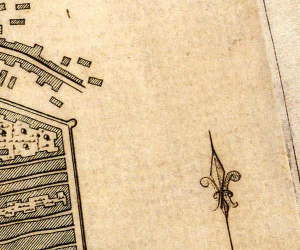 D44056F.jpg 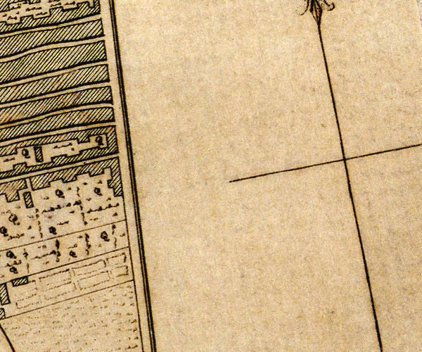 D44055J.jpg town walls and bastions item:- Carlisle Library : Map 2 Images © Carlisle Library |
|
|
|
||
| evidence:- | old text:- Capper 1808 |
|
| source data:- | Gazetteer, A Topographical Dictionary of the United Kingdom,
compiled by Benjamin Pitts Capper, published by Richard
Phillips, Bridge Street, Blackfriars, London, 1808; published
1808-29. goto source goto source"[Carlisle] ... Being a frontier town, it is fortified with a wall, a citadel, and a castle. The wall was first built by Egfrid, king of Northumberland, in the seventh century, and the citadel and castle by William Rufus. The wall has three gates or entrances into the city. The English gate to the south, the Scotch gate to the north, and the Irish gate to the west. ... It was once strongly fortified, but the castle and walls are now gone to decay, ..." |
|
|
|
||
| evidence:- | old text:- Gents Mag item:- rebellion, 1745; 1745 Rebellion |
|
| source data:- | Magazine, The Gentleman's Magazine or Monthly Intelligencer or
Historical Chronicle, published by Edward Cave under the
pseudonym Sylvanus Urban, and by other publishers, London,
monthly from 1731 to 1922. goto source Gentleman's Magazine 1839 part 1 p.517 From a review of The History and Antiquities of Carlisle:- ""Carlisle after this period (the period of the rebellion in 1745, when it was first occupied by the Pretender's adherents, and afterwards became the scene of the execution of many of them), continued to present the appearance of an important military garrison. Sentries were posted at every gate, besides those at the castle and the house of the governor. The gates were closed and locked every night with the usual military parade; and guns were fired morning and evening, when they were opened or shut. The draw-bridge at the outer gates of the castle was drawn up every night at ten o'clock, and thus all communication with the city was cut off. There were towers or turrets, at intervals, along the whole line of the city walls,and upon these cannon were placed and sentinels posted. The greater part of the soldiers and artillery-men who formed the garrison were quartered on the citizens." |
|
|
|
||
| evidence:- | database:- Listed Buildings 2010 placename:- West City Walls placename:- City Walls, West |
|
| source data:- | courtesy of English Heritage "WEST CITY WALLS / / WEST WALLS / CARLISLE / CARLISLE / CUMBRIA / I / 386918 / NY3990255829" |
|
| source data:- | courtesy of English Heritage "City walls. C12 with extensive rebuilding and refacing of 1746, 1876-7, 1985, 1988-9. Squared blocks of red sandstone with some calciferous sandstone (some re-used Roman stone), partly with chamfered plinth and partly battered. Gently curving wall which projects at its northern end, built against a river terrace as a retaining wall; the West Walls street is at the higher level behind and the pavement forms the parapet walk along the wall. The northern projection was rebuilt or refaced in 1876-7, when the nearby railway was re-aligned; set into the end of this part of the wall is the inscription stone WEST WALLS. Off-centre external stone steps to the Town Dyke Orchard were added in 1883; the parapet between the steps and the projection was rebuilt in new red sandstone in 1985. Further south a number of buildings were constructed against the wall and these were demolished in 1988; the wall behind needed partial rebuilding and this was done with red sandstone from the demolished buildings. The foundation stone from each demolished building was incorporated; THE FAWCETT SCHOOLS (dated 1851 in Roman numerals); the mayor and date 1879 for the police station extension, the mayor and date 1840 for the police station; recording the restoration, a stone with the mayor's name and date 1988, the unveiling was on 21 April 1989. At southern end of the exposed wall are the Sallyport steps which were added c1813 and nearby is the medieval sallyport opening, now merely an arched recess. The wall continues beyond the Sallyport steps, but is concealed by buildings; for the listing of the remainder of the wall to the south see Nos 10-22 West Walls (qv) and for the northernmost stretch see under Carlisle Castle (qv). For an engraving of the West Walls when complete in 1745 by the Buck Brothers, see J Cornforth, Country Life, (1978)." |
|
|
|
||
| evidence:- | database:- Listed Buildings 2010 placename:- North City Walls placename:- City Walls, North |
|
| source data:- | courtesy of English Heritage "FRAGMENT OF NORTH CITY WALLS ADJOINING SOUTH EAST ANGLE / / / CARLISLE / CARLISLE / CUMBRIA / I / 386573 / NY3981456210" |
|
| source data:- | courtesy of English Heritage "Fragment of north city walls. C12 with extensive repairs of different periods up to 1973. Squared blocks of red sandstone with some calciferous sandstone and some re-used Roman stone; partly on chamfered plinth with partly flagged parapet walk and rounded coping. High thick wall zig-zagged down slope, partly stepped. Where the wall turns up at a sharp angle there is a C12 sallyport with rounded arch, blocked in similar materials to the wall at an early date. Further down the wall is a projecting oriel C15 or C16 canted turret, now supported by C19 buttress. Towards the demolished end of the wall it has been reduced in height and some stone replaced in 1973 to fill previous gap. At the rear of the wall, part of the parapet walk over the Castle moat has been cut away (probably in 1819); in other places the paving has gone from the walk. Wall was used as a retaining wall for gardens on Finkle Street and build-up of soil caused large crack still evident; soil removed in 1972. Remainder of north walls demolished between 1811 and 1815. Remains standing over 2 metres high survive beneath street level of West Tower Street (excavated 1973). For full details see McCarthy et al (1990)." |
|
|
|
||
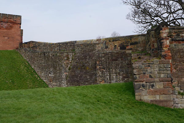 CAF03.jpg East of the castle. (taken 30.3.2014) |
||
|
|
||
| notes:- |
remains of 12th century town walls, some rebuilt |
|
| Perriam, D R &Robinson, J: 1998: Medieval Fortified Buildings of Cumbria: CWAAS::
ISBN 1 873124 23 6; plan and illustrations |
||
|
|
||
Lakes Guides menu.