item:- Hampshire Museums : FA2001.171
image:- © see bottom of page
 Stu1Cm.jpg
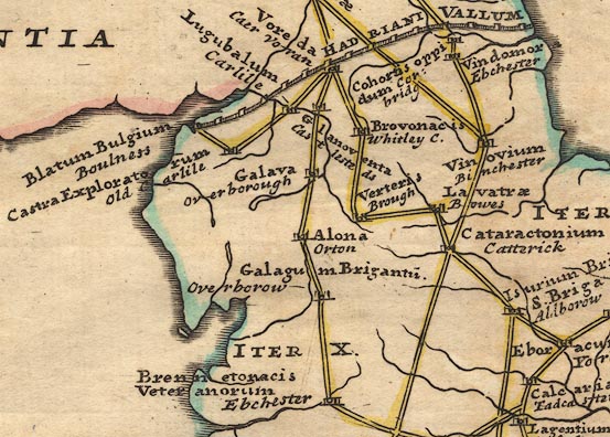
Road map, uncoloured engraving, the Antonine Itineraries through
Britain, scale about 55 miles to 1 inch, plotted by William
Stukeley, 1723, published London, 1724.
 Lakes Guides menu.