 Old Cumbria Gazetteer
 |
 |
|
| boundary stone, Carlisle/St Cuthbert Without | ||
| locality:- | Carlisle | |
| civil parish:- | Carlisle (formerly Cumberland) | |
| civil parish:- | St Cuthbert Without (formerly Cumberland) | |
| county:- | Cumbria | |
| locality type:- | boundary stone | |
| locality type:- | parish boundary mark (?) | |
| coordinates:- | NY42275356 | |
| 1Km square:- | NY4253 | |
| 10Km square:- | NY45 | |
|
|
||
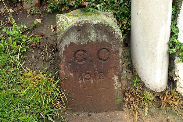 BPL29.jpg Stone:- "C C / 1912" (taken 4.7.2008) |
||
|
|
||
| evidence:- | database:- Listed Buildings 2010 |
|
| source data:- | courtesy of English Heritage "BOUNDARY STONE OUTSIDE NUMBER 431 (431 NOT INCLUDED) / / LONDON ROAD / CARLISLE / CARLISLE / CUMBRIA / II / 386786 / NY4226753576" |
|
| source data:- | courtesy of English Heritage "Parish/township boundary stone. Early C19. Red sandstone. Squared stone with rounded top set at an angle, inscribed on north face H (for Harraby) and C on the south (for Carleton). Thought to be the only such boundary stone surviving in the City." |
|
|
|
||
 Lakes Guides menu.