 |
 |
|
|
|
|
Morton |
| locality:- |
Carlisle |
| civil parish:- |
Carlisle (formerly Cumberland) |
| county:- |
Cumbria |
| locality type:- |
locality |
| locality type:- |
buildings |
| coordinates:- |
NY38285476 (etc) |
| 1Km square:- |
NY3854 |
| 10Km square:- |
NY35 |
|
|
| evidence:- |
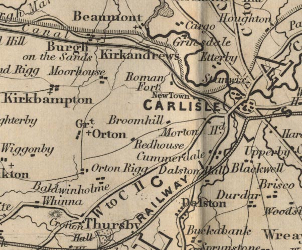
old map:- OS County Series
placename:- Morton
|
| source data:- |
Maps, County Series maps of Great Britain, scales 6 and 25
inches to 1 mile, published by the Ordnance Survey, Southampton,
Hampshire, from about 1863 to 1948.
"Morton"
|
|
|
| evidence:- |
old map:- Ford 1839 map
placename:- Morton Head
|
| source data:- |
Map, uncoloured engraving, Map of the Lake District of
Cumberland, Westmoreland and Lancashire, scale about 3.5 miles
to 1 inch, published by Charles Thurnam, Carlisle, and by R
Groombridge, 5 Paternoster Row, London, 3rd edn 1843.
FD02NY35.jpg
"Morton Hd."
item:- JandMN : 100.1
Image © see bottom of page
|
|
|
| places:- |
 |
NY45103962 boundary stone, Skelton L |
|
|
 |
NY38065487 Morton Bridge (Carlisle) suggested |
|
|
|
NY38265498 Morton Community Centre (Carlisle) L |
|
|
|
NY37905466 Morton Cott (Carlisle) L |
|
|
|
NY44913955 Morton Hills (Skelton) |
|
|
|
NY38695462 Newlaiths Hall (Carlisle) gone? |
|
|
|
NY3854 St Luke's Church (Carlisle) |
|
