 Old Cumbria Gazetteer
 |
 |
|
| Carlisle: Abbey Street | ||
| Abbey Street | ||
| locality:- | Carlisle | |
| civil parish:- | Carlisle (formerly Cumberland) | |
| county:- | Cumbria | |
| locality type:- | street | |
| coordinates:- | NY39745600 (etc) | |
| 1Km square:- | NY3956 | |
| 10Km square:- | NY35 | |
|
|
||
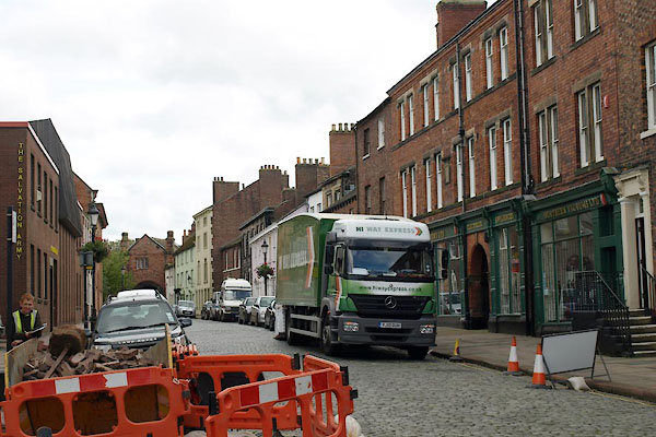
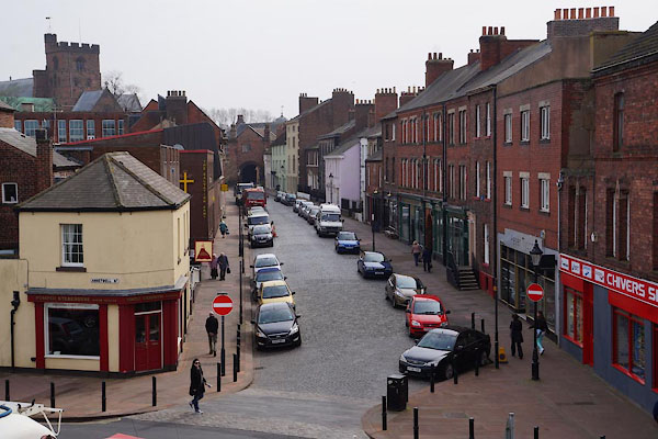 CAF09.jpg (taken 30.3.2014) 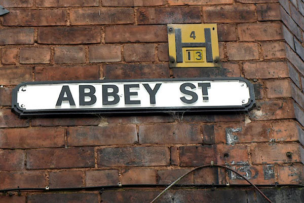 BXH67.jpg Street name, and 2 hydrant markers, (taken 17.9.2012) |
||
|
|
||
| evidence:- | old map:- OS County Series (Cmd 23 3) placename:- Abbey Street |
|
| source data:- | Maps, County Series maps of Great Britain, scales 6 and 25
inches to 1 mile, published by the Ordnance Survey, Southampton,
Hampshire, from about 1863 to 1948. |
|
|
|
||
| evidence:- | old map:- Donald 1774 (Cmd) placename:- Abbey Street |
|
| source data:- | Map, hand coloured engraving, 3x2 sheets, The County of Cumberland, scale about 1
inch to 1 mile, by Thomas Donald, engraved and published by Joseph Hodskinson, 29
Arundel Street, Strand, London, 1774.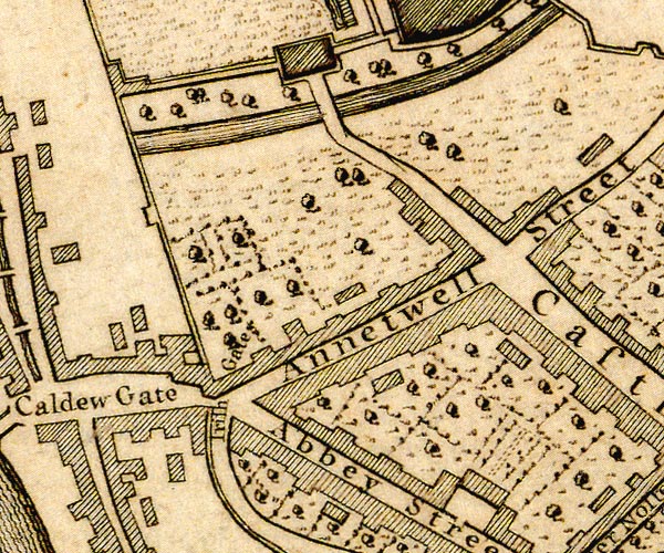 D43956Q.jpg 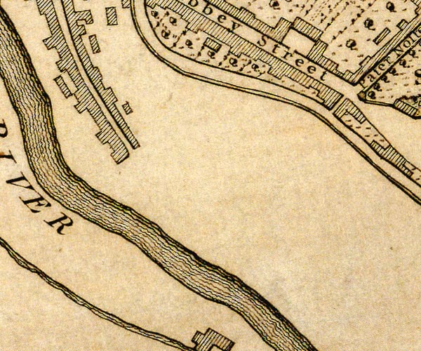 D43955U.jpg "Abbey Street" street item:- Carlisle Library : Map 2 Images © Carlisle Library |
|
|
|
||
| evidence:- | old painting:- item:- flag; White Ensign |
|
| source data:- | Painting, watercolour, The Abbey Gateway from Abbey Street in the Diamond Jubilee
Year of Queen Victoria, Carlisle, Cumberland, by Thomas Bushby, 1897.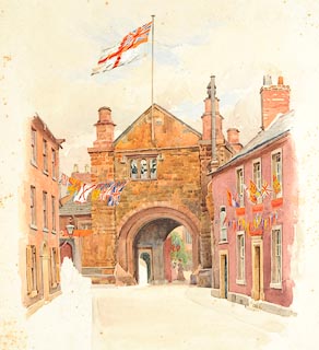 click to enlarge click to enlargePR1117.jpg View of gateway to cathedral, seen from Abbey Street. The street is decked with flags. Work contains several unfinished figures. inscribed at reverse:- "Thos. Bushby Diamond Jubilee 1897" item:- Tullie House Museum : 1971.87.5 Image © Tullie House Museum |
|
|
|
||
 BXH66.jpg (taken 17.9.2012) |
||
|
|
||
 Lakes Guides menu.