 Old Cumbria Gazetteer
 |
 |
|
| Tile Tower, Carlisle | ||
| Tile Tower | ||
| site name:- | City Walls | |
| locality:- | Carlisle | |
| civil parish:- | Carlisle (formerly Cumberland) | |
| county:- | Cumbria | |
| locality type:- | tower | |
| locality type:- | bastion (?) | |
| coordinates:- | NY39635612 | |
| 1Km square:- | NY3956 | |
| 10Km square:- | NY35 | |
|
|
||
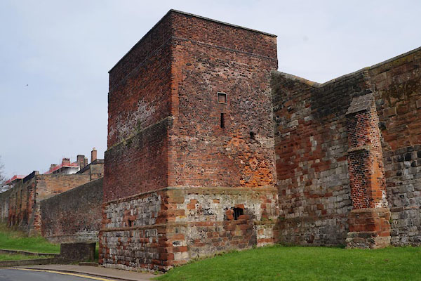 CAF05.jpg (taken 30.3.2014) 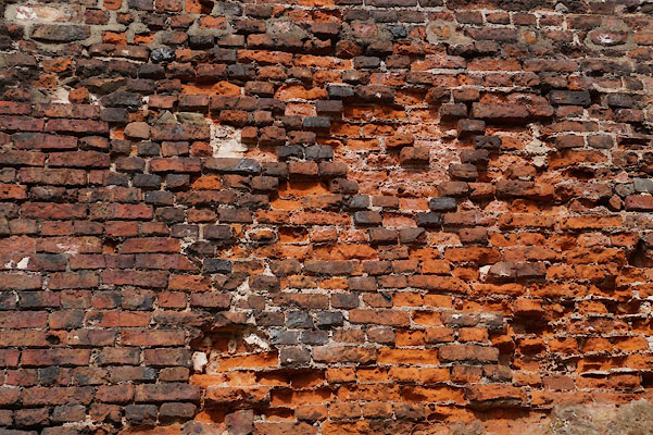 CAF06.jpg Diaper brickwork. (taken 30.3.2014) |
||
|
|
||
| evidence:- | old map:- OS County Series (Cmd 23 3) placename:- King Richard II Tower |
|
| source data:- | Maps, County Series maps of Great Britain, scales 6 and 25
inches to 1 mile, published by the Ordnance Survey, Southampton,
Hampshire, from about 1863 to 1948. |
|
|
|
||
| evidence:- | database:- Listed Buildings 2010 placename:- Tile Tower placename:- West City Walls placename:- City Walls, West |
|
| source data:- | courtesy of English Heritage "WEST CITY WALLS AND TILE TOWER ADJOINING AT SOUTH WEST / / / CARLISLE / CARLISLE / CUMBRIA / I / 386574 / NY3963156120" |
|
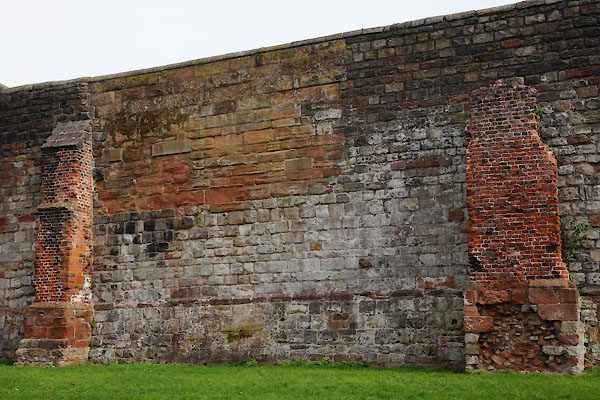
| source data:- | courtesy of English Heritage "City walls and interval tower. C12 walls extensively repaired up to C20; C12 tower rebuilt c1483 for the Duke of Gloucester (Richard III) with C19 and C20 repairs. Walls of mixed red and calciferous sandstone blocks (some stone re-used Roman) on chamfered plinth, with external buttresses repaired in C15 tile bricks. Internal face of C19 brick. Tower has plinth of same materials as walls but rebuilt in C15 tile brick. Flat flagged roof. High wall with projecting 2-storey square tower; parapet walk carried up by steps over tower. The wall is straight and joins the south-west angle of the outer bailey of Carlisle Castle. Upper parts of the wall clearly show the different repairs. The inside of the wall had its facing stones removed in 1745 and this was replaced in brick in the 1830s. The tower has slit vents in each face, the right return has a red sandstone panel, now weathered, originally thought to have had the emblem of a white boar (Richard's coat-of-arms). Rear of tower flush with wall has two C15 elliptical-arched doorways. C19 stone surround openings." "INTERIOR: has steps to tower and upper chambers; brick vaulted ground floor, mural chambers and repaired C15 fireplaces. Along the parapet coping of the wall are inscriptions of various C19 soldiers serving in the garrison of the castle; built into the south end of the wall is a War Department boundary stone." "HISTORY: The tower formerly guarded the Irish Gate; demolition of the gate in 1811 left this isolated part of the West Walls. Houses were built against part of the walls in the early C19 and joist holes for floors can be seen cut into the Tile Tower and wall; the last of these were demolished in 1952. For full details see McCarthy et al (1990). For the remainder of this side of the city walls, see West City Walls, West Walls (qv)." |
|
|
|
||
 CAF07.jpg Town wall west of the castle. (taken 30.3.2014) 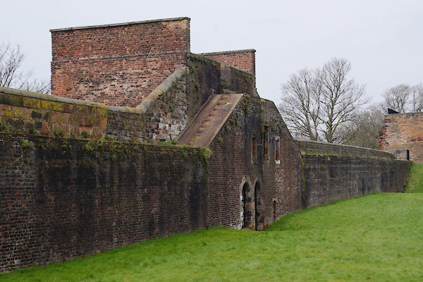 CAF08.jpg (taken 30.3.2014) |
||
|
|
||
 Lakes Guides menu.