 Old Cumbria Gazetteer
 |
 |
|
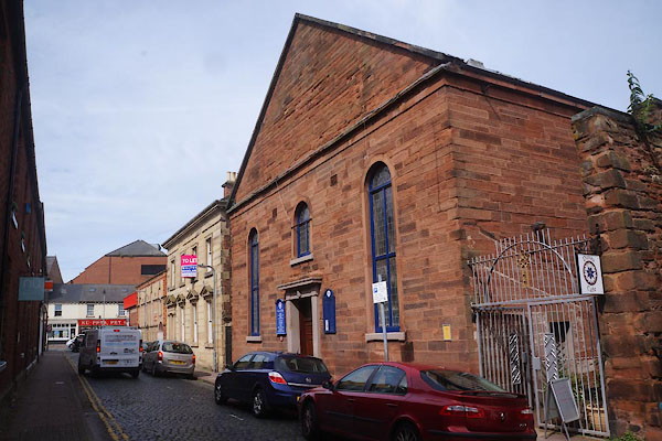
| chapel, Carlisle (3) | ||
| Street:- | Chapel Street | |
| locality:- | Carlisle | |
| civil parish:- | Carlisle (formerly Cumberland) | |
| county:- | Cumbria | |
| locality type:- | chapel | |
| coordinates:- | NY40275606 | |
| 1Km square:- | NY4056 | |
| 10Km square:- | NY45 | |
|
|
||
 CFH49.jpg (taken 5.8.2016) 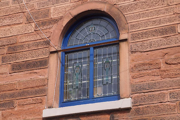 CFH50.jpg Stained glass. (taken 5.8.2016) |
||
| Church of Scotland chapel. |
||
|
|
||
| evidence:- | old map:- OS County Series (Cmd 23 3) placename:- Scotch National Church |
|
| source data:- | Maps, County Series maps of Great Britain, scales 6 and 25
inches to 1 mile, published by the Ordnance Survey, Southampton,
Hampshire, from about 1863 to 1948. "Scotch Natl Church" |
|
|
|
||
| notes:- |
Inside, there is a war memorial plaque to those who died in World War I. |
|
|
|
||
 Lakes Guides menu.