 Old Cumbria Gazetteer
 |
 |
|
| Carlisle: Scotch Street | ||
| Scotch Street | ||
| locality:- | Carlisle | |
| civil parish:- | Carlisle (formerly Cumberland) | |
| county:- | Cumbria | |
| locality type:- | street | |
| coordinates:- | NY40105602 (etc) | |
| 1Km square:- | NY4056 | |
| 10Km square:- | NY45 | |
|
|
||
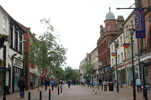 BYR40.jpg (taken 30.6.2013) |
||
|
|
||
| evidence:- | old map:- OS County Series (Cmd 23 3) placename:- Scotch Street |
|
| source data:- | Maps, County Series maps of Great Britain, scales 6 and 25
inches to 1 mile, published by the Ordnance Survey, Southampton,
Hampshire, from about 1863 to 1948. |
|
|
|
||
| evidence:- | old map:- Donald 1774 (Cmd) placename:- Scots Street |
|
| source data:- | Map, hand coloured engraving, 3x2 sheets, The County of Cumberland, scale about 1
inch to 1 mile, by Thomas Donald, engraved and published by Joseph Hodskinson, 29
Arundel Street, Strand, London, 1774.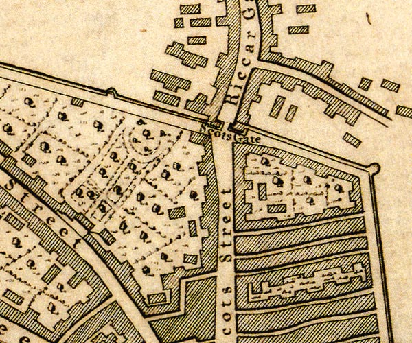 D44056A.jpg 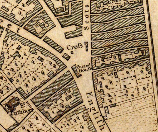 D44055E.jpg "Scots Street" street item:- Carlisle Library : Map 2 Images © Carlisle Library |
|
|
|
||
| evidence:- | old postcard:- placename:- Scotch Street |
|
| source data:- | Postcard, photograph, Town Hall and Scotch Street, Carlisle, Cumberland, published
by Valentine's, Dundee, Angus, about 1918?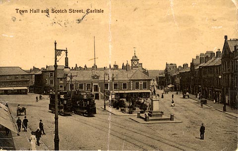 click to enlarge click to enlargePR1071.jpg printed at upper left:- "Town Hall and Scotch Street, Carlisle" printed at reverse:- "Valentine's Series" item:- JandMN : 371 Image © see bottom of page |
|
|
|
||
 Lakes Guides menu.