Old Cumbria Gazetteer
 |
 |
|
||||||||||||||||
| Penrith | ||||||||||||||||||
| Peerith | ||||||||||||||||||
| civil parish:- | Penrith (formerly Cumberland) | |||||||||||||||||
| county:- | Cumbria | |||||||||||||||||
| locality type:- | locality | |||||||||||||||||
| locality type:- | buildings | |||||||||||||||||
| locality type:- | market town | |||||||||||||||||
| locality type:- | selected place | |||||||||||||||||
| coordinates:- | NY51573014 (etc) | |||||||||||||||||
| 1Km square:- | NY5130 | |||||||||||||||||
| 10Km square:- | NY53 | |||||||||||||||||
| 10Km square:- | NY52 | |||||||||||||||||
| latitude; longitude:- | 2d 45.1m W; 54d 39.8m N | |||||||||||||||||
|
|
||||||||||||||||||
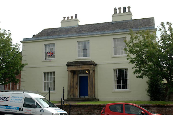
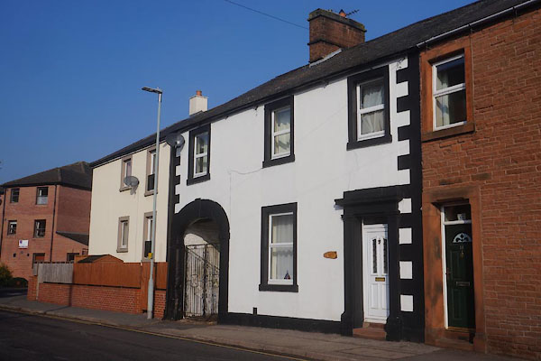
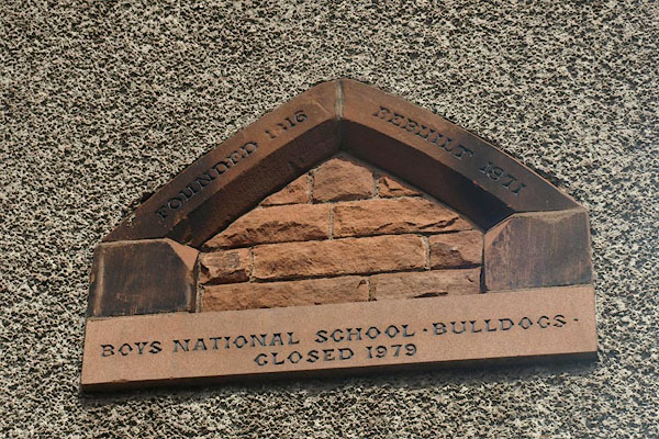
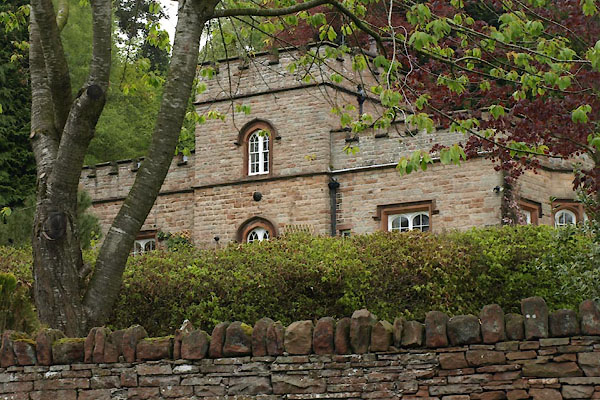
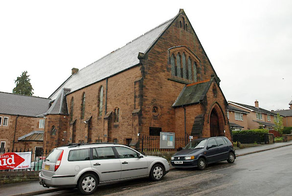
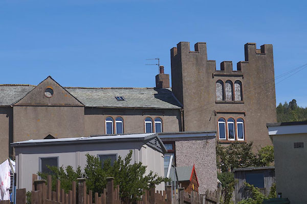
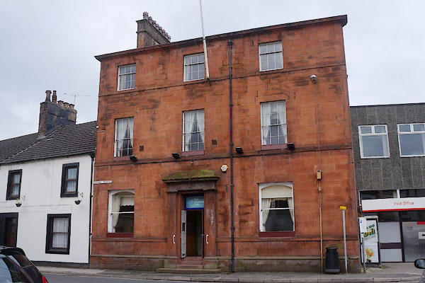
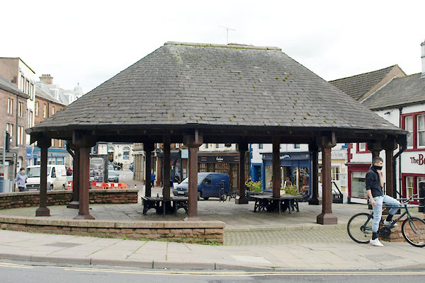
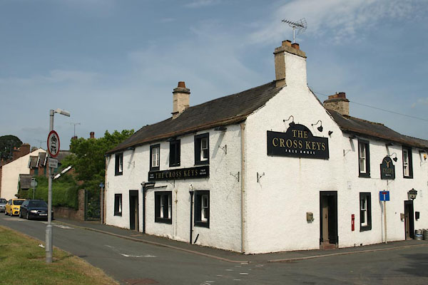
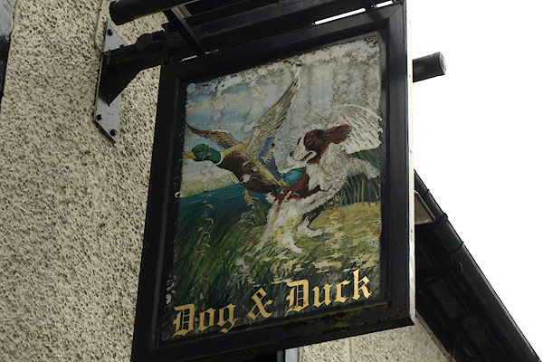
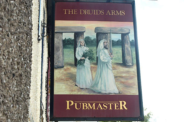
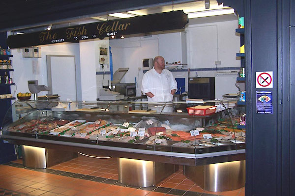
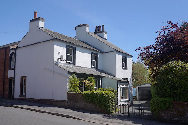
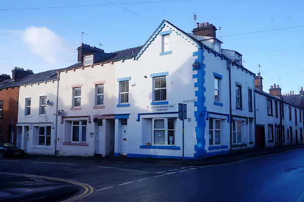
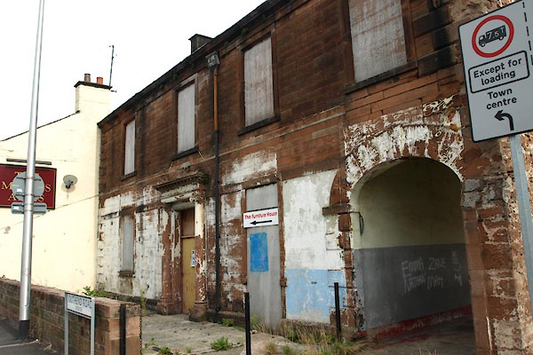
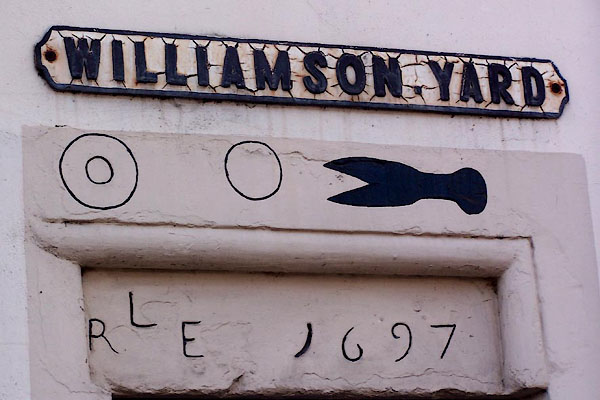
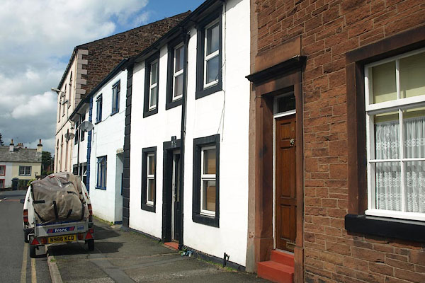
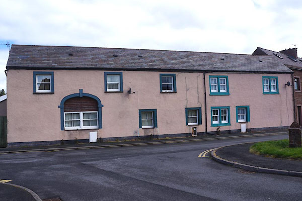
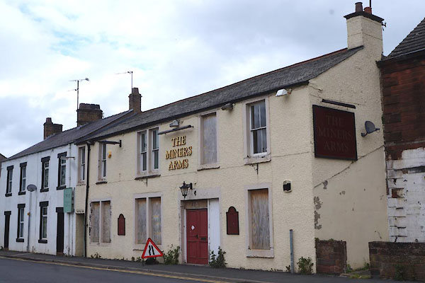
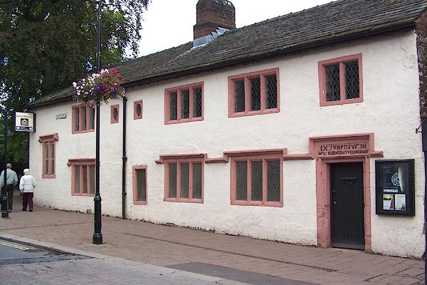
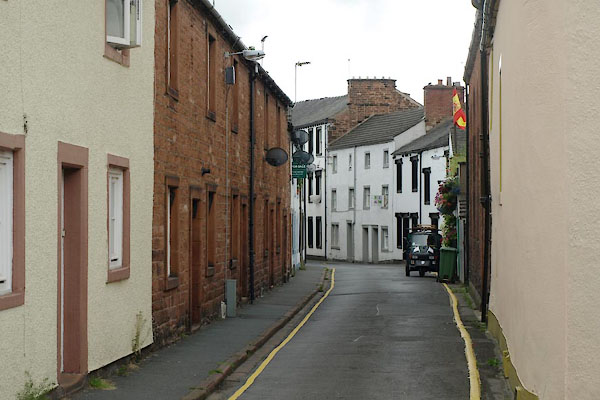
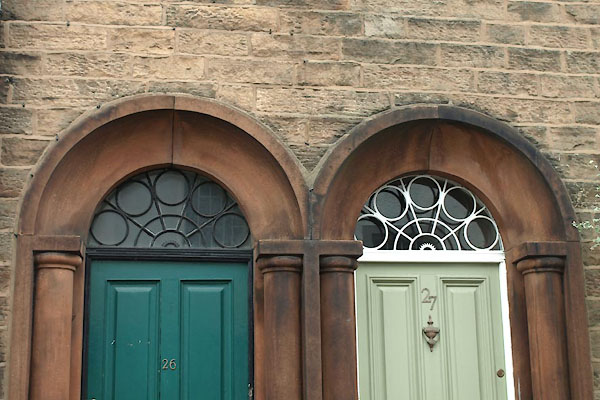
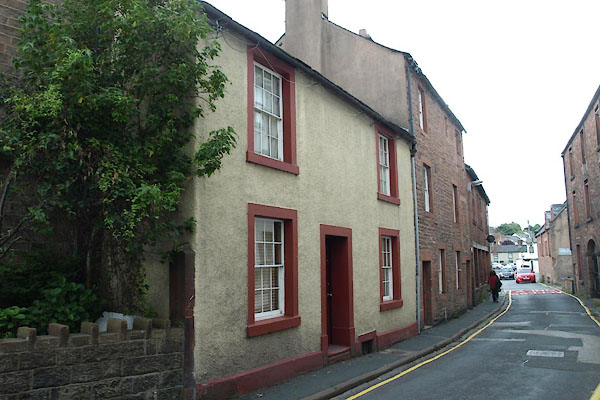
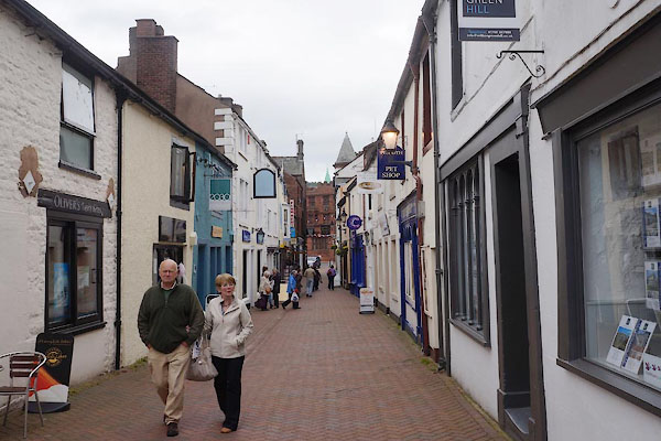
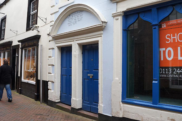
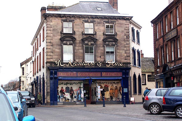
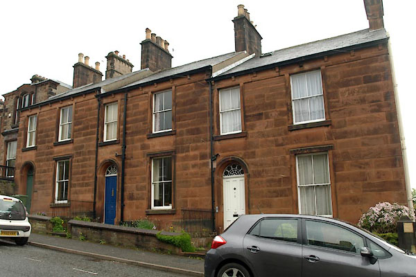
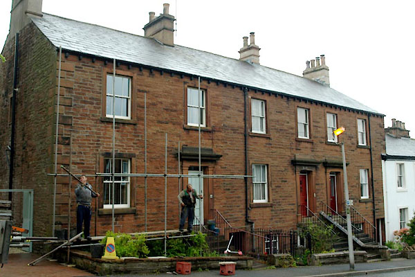
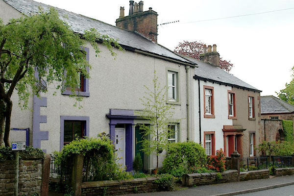
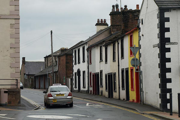
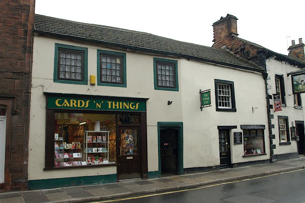
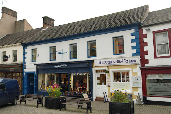
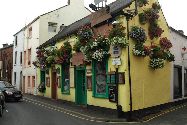
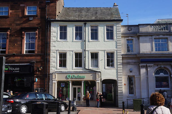
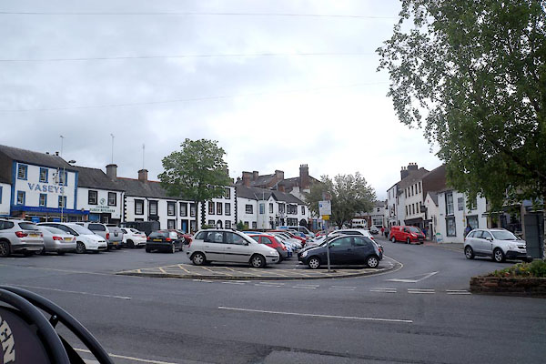
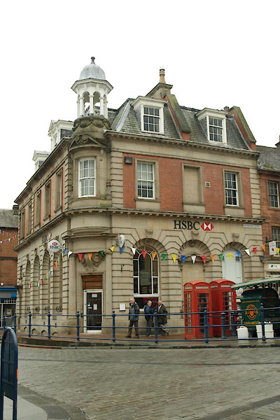
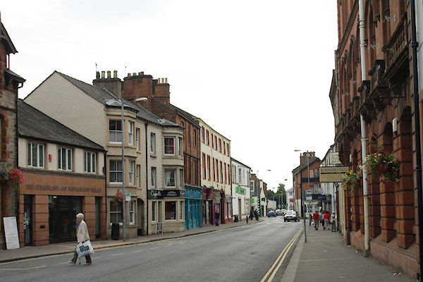
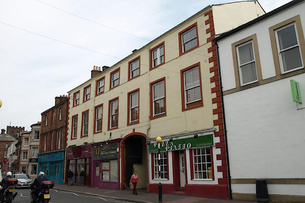
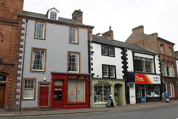
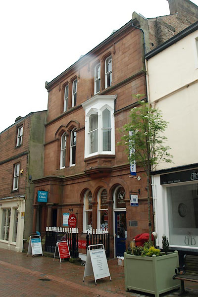
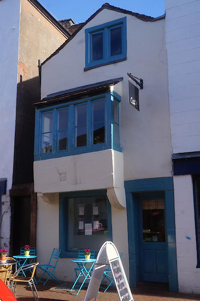
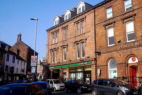
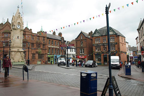
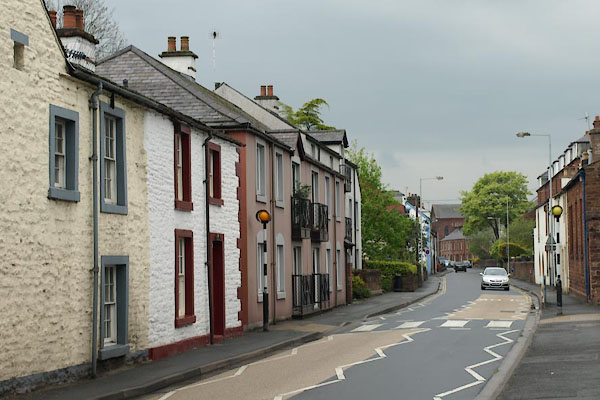
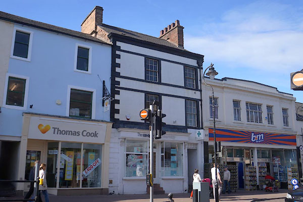
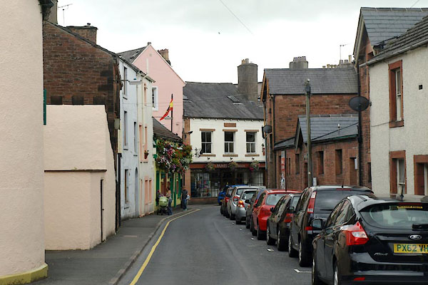
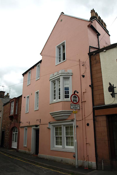
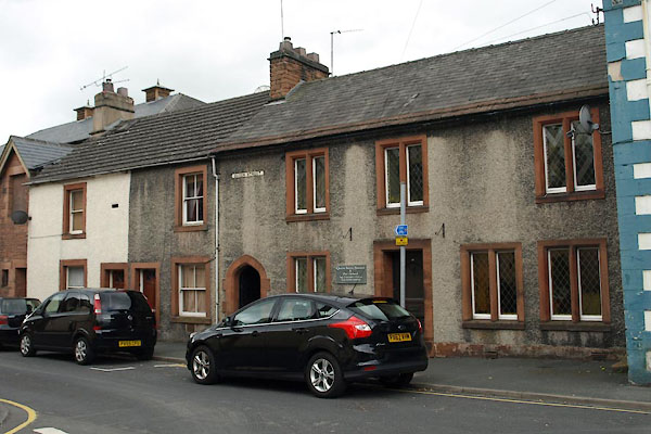
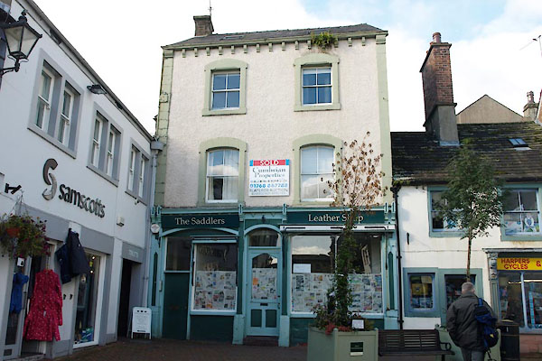
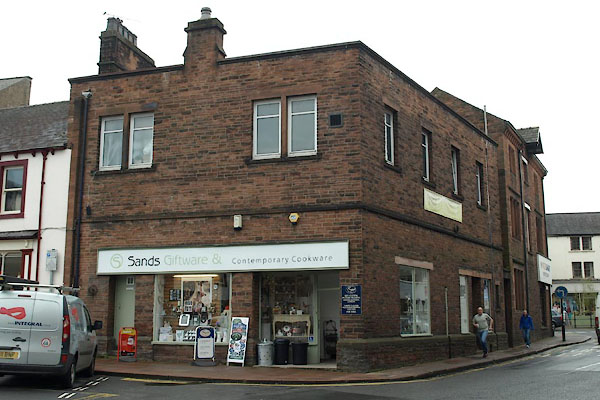
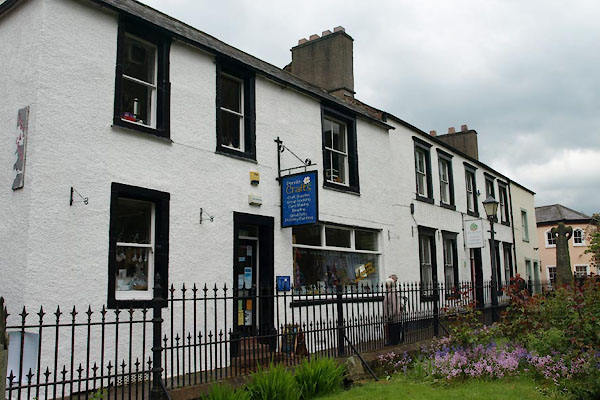
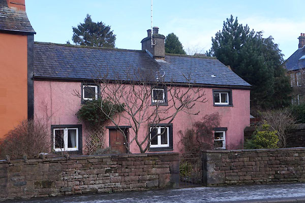
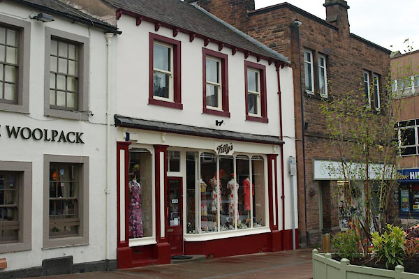
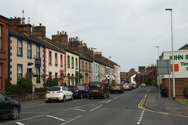
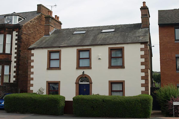
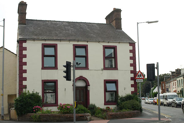
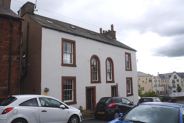
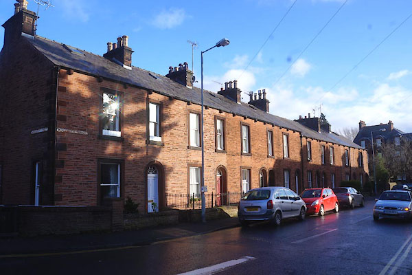
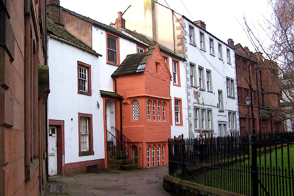
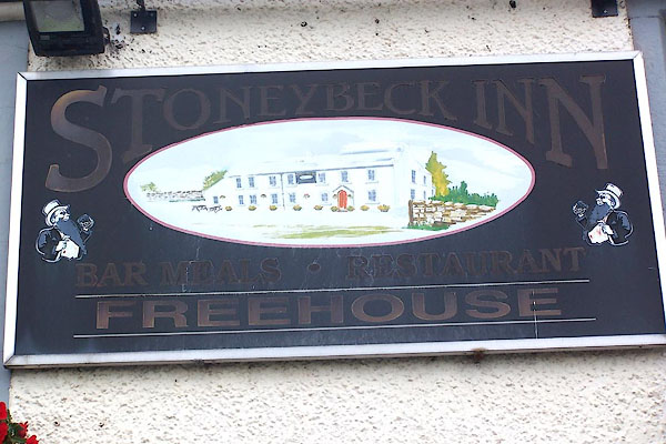
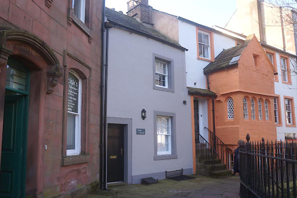
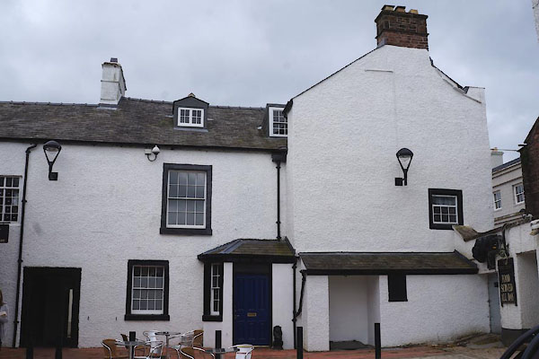
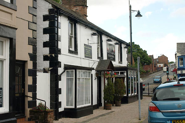
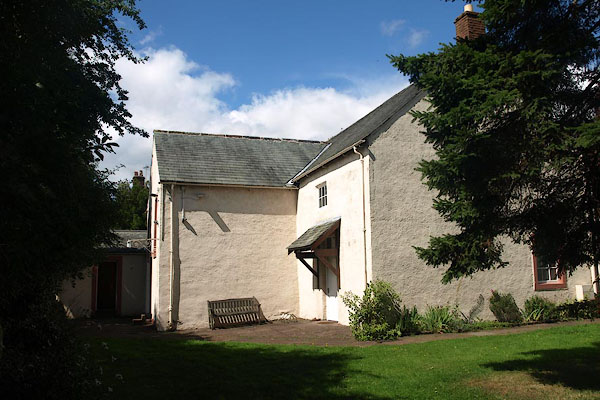
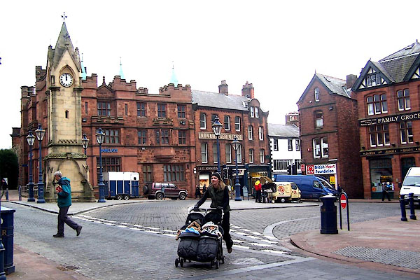 BLO15.jpg Market place? (taken 12.1.2006) 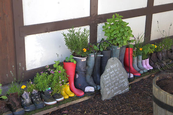 CDG88.jpg Flowers for the visitors. (taken 11.6.2015) |
||||||||||||||||||
|
|
||||||||||||||||||
| evidence:- | old map:- OS County Series (Cmd 58 4) placename:- Penrith |
|||||||||||||||||
| source data:- | Maps, County Series maps of Great Britain, scales 6 and 25
inches to 1 mile, published by the Ordnance Survey, Southampton,
Hampshire, from about 1863 to 1948. OS County Series (Cmd 58 8) |
|||||||||||||||||
|
|
||||||||||||||||||
| evidence:- | old map:- Gough 1350s-60s placename:- Penrith |
|||||||||||||||||
| source data:- | Map, colour photozincograph copy, reduced size facsimile, Gough
Map of Britain, scale about 28.5 miles to 1 inch, published by
the Ordnance Survey, Southampton, Hampshire, 1875. click to enlarge click to enlargeGgh1Cm.jpg item:- JandMN : 33 Image © see bottom of page |
|||||||||||||||||
|
|
||||||||||||||||||
| evidence:- | old map:- Gough 1350s-60s placename:- Penrith |
|||||||||||||||||
| source data:- | Map, lithograph facsimile, Gough Map of Britain, 20 miles to 1
inch? published by the Ordnance Survey, Southampton, Hampshire,
1935. click to enlarge click to enlargeGgh2Cm.jpg item:- JandMN : 34 Image © see bottom of page |
|||||||||||||||||
|
|
||||||||||||||||||
| evidence:- | old map:- Saxton 1579 placename:- Penreth |
|||||||||||||||||
| source data:- | Map, hand coloured engraving, Westmorlandiae et Cumberlandiae Comitatus ie Westmorland
and Cumberland, scale about 5 miles to 1 inch, by Christopher Saxton, London, engraved
by Augustinus Ryther, 1576, published 1579-1645. Sax9NY43.jpg Buildings and towers, symbol for a town. "PENRETH" item:- private collection : 2 Image © see bottom of page |
|||||||||||||||||
|
|
||||||||||||||||||
| evidence:- | old map:- Mercator 1595 (edn?) placename:- Penreathe |
|||||||||||||||||
| source data:- | Map, hand coloured engraving, Northumbria, Cumberlandia, et
Dunelmensis Episcopatus, ie Northumberland, Cumberland and
Durham etc, scale about 6.5 miles to 1 inch, by Gerard Mercator,
Duisberg, Germany, about 1595. MER8CumD.jpg "Penre[a]the" circle, building/s, tower, tinted red item:- JandMN : 169 Image © see bottom of page |
|||||||||||||||||
|
|
||||||||||||||||||
| evidence:- | old map:- Keer 1605 placename:- Penrethe |
|||||||||||||||||
| source data:- | Map, hand coloured engraving, Westmorland and Cumberland, scale
about 16 miles to 1 inch, probably by Pieter van den Keere, or
Peter Keer, about 1605 edition perhaps 1676. click to enlarge click to enlargeKER8.jpg "Penrethe" dot, two circle, tower, tinted red; town item:- Dove Cottage : 2007.38.110 Image © see bottom of page |
|||||||||||||||||
|
|
||||||||||||||||||
| evidence:- | old map:- Speed 1611 (Cum/EW) placename:- Penreth |
|||||||||||||||||
| source data:- | Map, hand coloured engraving, Kingdome of Great Britaine and
Ireland, scale about 36 miles to 1 inch, by John Speed, about
1610-11, published by Thomas Bassett, Fleet Street and Richard
Chiswell, St Paul's Churchyard, London, 1676? click to enlarge click to enlargeSPD6Cm.jpg "Penreth" dot, circle, and tower item:- private collection : 85 Image © see bottom of page |
|||||||||||||||||
|
|
||||||||||||||||||
| evidence:- | old map:- Speed 1611 (Cmd) placename:- Penreth |
|||||||||||||||||
| source data:- | Map, hand coloured engraving, Cumberland and the Ancient Citie
Carlile Described, scale about 4 miles to 1 inch, by John Speed,
1610, published by J Sudbury and George Humble, Popes Head
Alley, London, 1611-12. SP11NY53.jpg "Penreth" circle, buildings, towers item:- private collection : 16 Image © see bottom of page |
|||||||||||||||||
|
|
||||||||||||||||||
| evidence:- | old map:- Speed 1611 (Wmd) placename:- Penreth |
|||||||||||||||||
| source data:- | Map, hand coloured engraving, The Countie Westmorland and
Kendale the Cheif Towne, scale about 2.5 miles to 1 inch, by
John Speed, 1610, published by George Humble, Popes Head Alley,
London, 1611-12.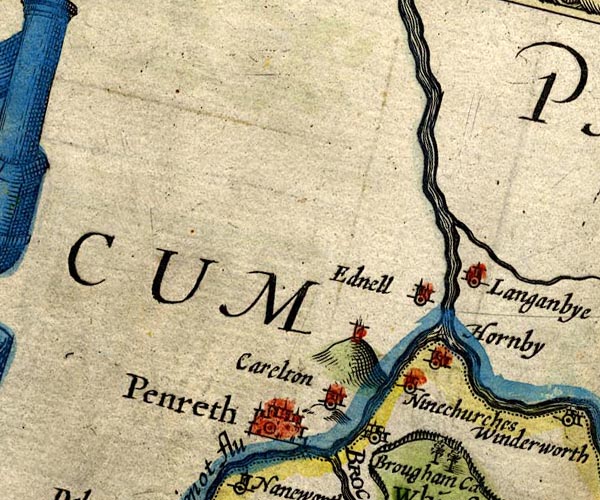 SP14NY53.jpg "Penreth" buildings and towers item:- Armitt Library : 2008.14.5 Image © see bottom of page |
|||||||||||||||||
|
|
||||||||||||||||||
| evidence:- | table of distances:- Simons 1635 placename:- Penreth |
|||||||||||||||||
| source data:- | Table of distances, uncoloured engraving, Cumberland, with a
thumbnail map, scale about 41 miles to 1 inch, by Mathew Simons,
published in A Direction for the English Traviller, 1635.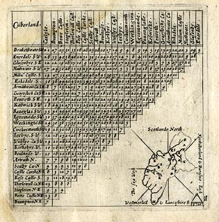 click to enlarge click to enlargeSIM4.jpg "Penreth S.E." upright text, larger place; and tabulated distances; P on thumbnail map item:- private collection : 50.11 Image © see bottom of page |
|||||||||||||||||
|
|
||||||||||||||||||
| evidence:- | old text:- Brathwaite 1638 placename:- Penrith |
|||||||||||||||||
| source data:- | Poem, Drunken Barbaby's Four Journeys to the North of England,
by Richard Brathwaite, 1638, published 1716-1818 at least. goto source goto sourcePage 123:- "... [horse fairs] ..." "Thence to Pearless Penrith went I," "Which of Merchandize hath plenty." |
|||||||||||||||||
|
|
||||||||||||||||||
| evidence:- | old map:- Jenner 1643 placename:- Penreth |
|||||||||||||||||
| source data:- | Tables of distances with a maps, Westmerland, scale about 16
miles to 1 inch, and Cumberland, scale about 21 miles to 1 inch,
published by Thomas Jenner, London, 1643; published 1643-80. JEN4Sq.jpg "Penreth" dot, circle, red tint |
|||||||||||||||||
|
|
||||||||||||||||||
| evidence:- | old map:- Jansson 1646 placename:- Penreth |
|||||||||||||||||
| source data:- | Map, hand coloured engraving, Cumbria and Westmoria, ie
Cumberland and Westmorland, scale about 3.5 miles to 1 inch, by
John Jansson, Amsterdam, Netherlands, 1646. JAN3NY53.jpg "Penreth" Buildings and towers, suggestion of a wall, notice ?fence palings, suggestion of a wall, notice ?fence palings; upright lowercase text; market town. item:- JandMN : 88 Image © see bottom of page |
|||||||||||||||||
|
|
||||||||||||||||||
| evidence:- | old road book:- Ogilby 1675 (edn 1698) placename:- Penrith placename:- Perith |
|||||||||||||||||
| source data:- | OB16p019.txt page 19; plate 38 continued "... to Cumberland, and 5 F. farther, to Penrith vulgo Perith of 6 F. signifying in British the Red-head, a large and well built Town; esteem'd the 2d. of the County, with a fair Church, and in the Church-Yard an old Pyramidal-Monument: It has a good Mt. for Corn, &c. on Tuesdays, and a greater for Cattel, every Tuesday fortnight, from Whitsunday to August 1st." item:- private collection : 367 Image © see bottom of page |
|||||||||||||||||
|
|
||||||||||||||||||
| evidence:- | old map:- Ogilby 1675 (plate 96) placename:- Penrith placename:- Penreth |
|||||||||||||||||
| source data:- | Road strip map, hand coloured engraving, the Road from Kendal to
Cockermouth, and the Road from Egremond to Carlisle, scale about
1 inch to 1 mile, by John Ogilby, London, 1675. OG96m030.jpg In mile 30, Cumberland. Turning right:- "to Penreth" item:- JandMN : 22 Image © see bottom of page |
|||||||||||||||||
| source data:- | Road strip map, hand coloured engraving, the Road from Kendal to
Cockermouth, and the Road from Egremond to Carlisle, scale about
1 inch to 1 mile, by John Ogilby, London, 1675.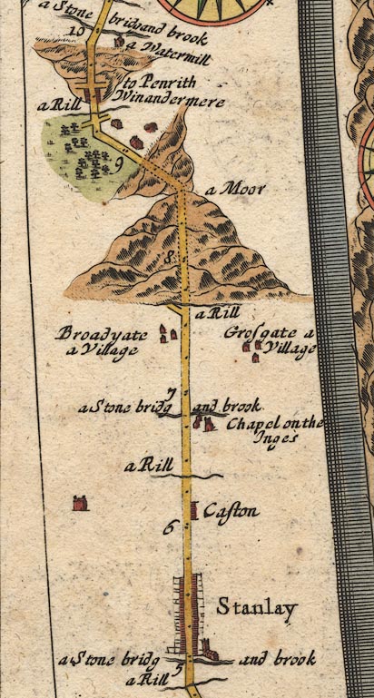 OG96m005.jpg In mile 9, Westmoreland. Crossroads, right:- "to Penrith" item:- JandMN : 22 Image © see bottom of page |
|||||||||||||||||
|
|
||||||||||||||||||
| evidence:- | old map:- Ogilby 1675 (plate 38) placename:- Penrith |
|||||||||||||||||
| source data:- | Road strip map, hand coloured engraving, continuation of the
Road from London to Carlisle, scale about 1 inch to 1 mile, by
John Ogilby, London, 1675.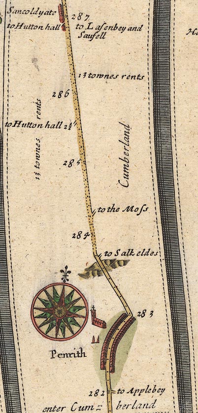 OG38m282.jpg In mile 282, Cumberland. "Penrith" a long row of houses each side of the road on a curve, with a church on the left. item:- JandMN : 21 Image © see bottom of page |
|||||||||||||||||
|
|
||||||||||||||||||
| evidence:- | old map:- Berry 1679 placename:- Penrith |
|||||||||||||||||
| source data:- | Road map, diagram, The Grand Roads of England, engraved by John
Rich, made and published by William Berry, at the Sign of the
Globe, London, 1679. "Penrith" market Tuesday |
|||||||||||||||||
|
|
||||||||||||||||||
| evidence:- | old map:- Sanson 1679 placename:- Penreth |
|||||||||||||||||
| source data:- | Map, hand coloured engraving, Ancien Royaume de Northumberland
aujourdhuy Provinces de Nort, ie the Ancient Kingdom of
Northumberland or the Northern Provinces, scale about 9.5 miles
to 1 inch, by Nicholas Sanson, Paris, France, 1679. click to enlarge click to enlargeSAN2Cm.jpg "Penreth" circle, buildings and towers; town item:- Dove Cottage : 2007.38.15 Image © see bottom of page |
|||||||||||||||||
|
|
||||||||||||||||||
| evidence:- | old map:- Seller 1694 (Cmd) placename:- Penreth |
|||||||||||||||||
| source data:- | Map, uncoloured engraving, Cumberland, scale about 12 miles to 1
inch, by John Seller, 1694. click to enlarge click to enlargeSEL9.jpg "Penreth" circle, upright lowercase text; town item:- Dove Cottage : 2007.38.89 Image © see bottom of page |
|||||||||||||||||
|
|
||||||||||||||||||
| evidence:- | old map:- Morden 1695 (EW) placename:- Penreth |
|||||||||||||||||
| source data:- | Map, hand coloured engraving, England, including Wales, scale
about 27 miles to 1 inch, by Robert Morden, published by Abel
Swale Awnsham and John Churchil, London, about 1695. click to enlarge click to enlargeMRD3Cm.jpg "Penreth" circle, ?buildings and tower; town item:- JandMN : 339 Image © see bottom of page |
|||||||||||||||||
|
|
||||||||||||||||||
| evidence:- | old map:- Morden 1695 (Cmd) placename:- Penrith |
|||||||||||||||||
| source data:- | Map, uncoloured engraving, Cumberland, scale about 4 miles to 1
inch, by Robert Morden, 1695, published by Abel Swale, the
Unicorn, St Paul's Churchyard, Awnsham, and John Churchill, the
Black Swan, Paternoster Row, London, 1695-1715. MD12NY52.jpg "Penrith" Circle, buildings, towers. item:- JandMN : 90 Image © see bottom of page |
|||||||||||||||||
|
|
||||||||||||||||||
| evidence:- | old map:- Morden 1695 (Wmd) placename:- Penrith |
|||||||||||||||||
| source data:- | Map, hand coloured engraving, Westmorland, scale about 2.5 miles to 1 inch, by Robert
Morden, published by Abel Swale, the Unicorn, St Paul's Churchyard, Awnsham, and John
Churchill, the Black Swan, Paternoster Row, London, 1695. MD10NY52.jpg "Penrith" Circle, buildings, towers. item:- JandMN : 24 Image © see bottom of page |
|||||||||||||||||
|
|
||||||||||||||||||
| evidence:- | descriptive text:- Fiennes 1698 placename:- Peroth item:- sandstone; cloth; market |
|||||||||||||||||
| source data:- | Travel book, manuscript record of Journeys through England
including parts of the Lake District, by Celia Fiennes, 1698. "The stones and slatt about Peroth look'd so red that at my entrance into the town thought its buildings were all of brick, but after found it to be the coullour of the stone which I saw in the Quarrys look very red, their slatt is the same which cover their houses; its a pretty large town a good market for cloth that they spinn in the country, hempe and also woollen; its a great market for all sorts of cattle meate corne etc." |
|||||||||||||||||
|
|
||||||||||||||||||
| evidence:- | old map:- Ogilby 1699 map (edn 1712) placename:- Penrith |
|||||||||||||||||
| source data:- | Road map, uncoloured engraving, a New Mapp of the Roads of England, by John Ogilby,
published by William Bray, Exeter Court, Strand, London, 1712. "Penrith" 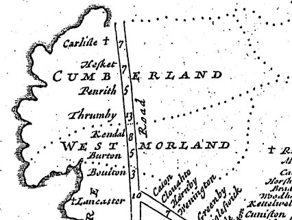 click to enlarge click to enlargeOGY7Cm.jpg item:- private collection : 263.1 Image © see bottom of page |
|||||||||||||||||
|
|
||||||||||||||||||
| evidence:- | old text:- Ogilby 1699 (edn 1712) placename:- Penrith placename:- Perith item:- market; placename, Penrith |
|||||||||||||||||
| source data:- | Road book, itineraries and map, The Traveller's Guide, by John
Ogilby, published by Abel Swall, Tim Child, White Hart, and R
Knaplock, the Angel and Crown, St Paul's Churchyard, London,
1699. OGY7p072.txt page 72 Distances from London "... at 281'5 over Emon-Br. cross Eden flv. to Cumberland, and 5F. farther, to Penrith vulgo Perith of 6F. signifying in British the Red-head, a large and well built T. esteem'd the 2d. of the County, with a fair Church, and in the Church-Yard an old Pyramidal Monument: It has a good Mt. for Corn, &c. on Tuesdays, and a greater for Cattel, every Tuesday fortnight, from Whitsunday to Agust 1st." |
|||||||||||||||||
|
|
||||||||||||||||||
| evidence:- | old map, descriptive text:- Bowen 1720 (plate 94) placename:- Penrith item:- placename, Penrith; sandstone; coat of arms; market; fair; cattle; corn |
|||||||||||||||||
| source data:- | Strip maps, uncoloured engravings, road maps, The Road from
London to Carlisle, scale about 2 miles to 1 inch, with sections
in Lancashire and Westmorland, published by Emanuel Bowen, St
Katherines, London, 1720.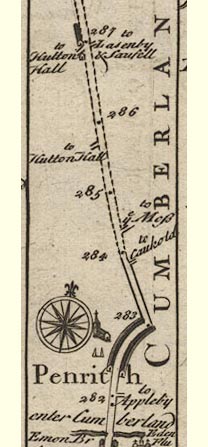 B094m282.jpg "Penrith which in the British Tongue signifies Red head, because ye Soil round about it & ye Stone of which it is built are Reddish. The Town is large & well Built, esteemed the Second in the County for Trade. The Church is a very Spacious & Fine Structure, ... In ye Church Yard on ye North Side of ye Church, are 2 large Pillars, ... The West Side of this Town is fortified wth. a Royal Castle. The Market House is a large & Comodious building, Beautifyed with Bears Climbing up a ragged Staff, the device of the Earls of Warwick. Here are 2 Charity Schools, the one for 20 Boys, & the other for 30 Girls, Maintained by 55 pound per Annum, ye endowment of one Mr. Robinson a Citizen of London & ye Sacrament Money & Parish Stock. Weekly Markets Tuesday for Corn &c. &a very great one for Cattle on ye Sam. Day every fortnight from Whitsunday to August [1st]" item:- Dove Cottage : 2007.38.100 Image © see bottom of page |
|||||||||||||||||
|
|
||||||||||||||||||
| evidence:- | descriptive text:- Defoe 1724-26 placename:- Perith placename:- Penrith |
|||||||||||||||||
| source data:- | Tour through England and Wales, by Daniel Defoe, published in
parts, London, 1724-26. "Perith, or Penrith, is a handsome market town, populous, well built, and, for an inland town, has a very good share of trade. It was unhappily possessed by the late party of Scots Highland rebels, when they made that desperate push into England, and which ended at Preston; in the moor or heath, on the north part of this town, the militia of the county making a brave appearance, and infinitely out-numbering the Highlanders, were drawn up; yet, with all their bravery, they ran away, as soon as the Scots began to advance to charge them, and never fired a gun at them, leaving the town at their mercy. However, to do justice even to the rebels, they offered no injury to the town, only quartered in it one night, took what arms and ammunition they could find, and advanced towards Kendal." |
|||||||||||||||||
|
|
||||||||||||||||||
| evidence:- | old map:- Millward and Dickinson 1737 placename:- Penrith |
|||||||||||||||||
| source data:- | Road map, photocopy, diagram, A New and Correct Map of Roads of
England, probably published by T Millward and B Dickinson, Inigo
Jones's Head, Fleet Street, London, 1737. "Penrith / 282" miles from London 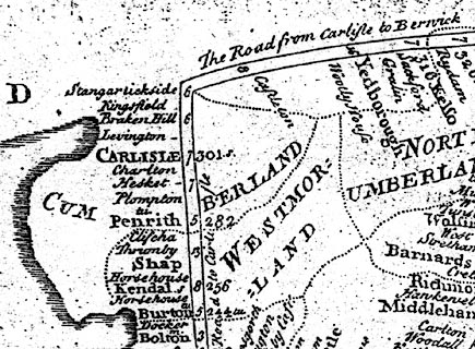 click to enlarge click to enlargeMWD1Cm.jpg item:- private collection : 264 Image © see bottom of page |
|||||||||||||||||
|
|
||||||||||||||||||
| evidence:- | old map:- Badeslade 1742 placename:- Penrith |
|||||||||||||||||
| source data:- | Maps, Westmorland North from London, scale about 10 miles to 1
inch, and Cumberland North from London, scale about 11 miles to
1 inch, with descriptive text, by Thomas Badeslade, London,
engraved and published by William Henry Toms, Union Court,
Holborn, London, 1742; published 1742-49. "Penrith Market Tuesday, Fair Whitsun Tuesday." |
|||||||||||||||||
|
|
||||||||||||||||||
| evidence:- | old map:- Badeslade 1742 placename:- Penrith |
|||||||||||||||||
| source data:- | Map, uncoloured engraving, A Map of Cumberland North from
London, scale about 11 miles to 1 inch, with descriptive text,
by Thomas Badeslade, London, engraved and published by William
Henry Toms, Union Court, Holborn, London, 1742. click to enlarge click to enlargeBD10.jpg "Penrith" circle, tower/s, upright lowercase text; town item:- JandMN : 115 Image © see bottom of page |
|||||||||||||||||
|
|
||||||||||||||||||
| evidence:- | old text:- Gents Mag item:- rebellion, 1745; 1745 Rebellion |
|||||||||||||||||
| source data:- | Magazine, The Gentleman's Magazine or Monthly Intelligencer or
Historical Chronicle, published by Edward Cave under the
pseudonym Sylvanus Urban, and by other publishers, London,
monthly from 1731 to 1922. goto source Gentleman's Magazine 1745 p.605 "..." "Nov. 21 [1745]. By letters of the 19th from Penrith there is an account, that at three o'clock in the afternoon of the day before, a quarter-master belonging to the rebels, came to that town, and demanded billets for two squadrons, making 250 horse, that were to be there that night, and for 8000 men more, who were to be there next day. The horse came in that evening, and were counted by several people, but did not exceed half the number they were said to be." "Nov. 22. Letters from the North of the 20th Inst. mention, that the rebels entered Penrith on the 19th Inst. ..." |
|||||||||||||||||
|
|
||||||||||||||||||
| evidence:- | old text:- Gents Mag 1745 item:- rebeliion, 1745; 1745 Rebellion |
|||||||||||||||||
| source data:- | goto source Gentleman's Magazine 1745 p.612 "... ..." "Whitehall, Nov. 25 [1745]. Advices from Penrith of the 20th at night, mention, that the rebels to the amount of 3000 had been entering that place from four in the afternoon to nine, and that several thousand men were expected there the next day; that according to all appearance their intention was to march southwards, and that a party of them, consisting of 120 men, had gone that afternoon to Lowther-hall, lord Lonsdale's seat." "Letters of the 21st from the same place say, the rebels have been coming in there all that day; that those which had arrived the day before were all gone the Lancashire road; that lord George Murray, lord Elcho, lord Nairn, Glenbucket, and the person styling himself duke of Perth, were arriv'd at Penrith, and the pretender's son was expected every minute." "..." "By advices of the 22d from Penrith, the Highland army which march'd there on the 21st was to halt that day. The pretender's son, with his houshold, came in at the head of a regiment of foot, about three that afternoon, that by the best reckoning that could be made at Emont and Fallowfield-bridge, the whole of their army did not exceed 7000 men, that" |
|||||||||||||||||
|
|
||||||||||||||||||
| evidence:- | old text:- Gents Mag 1745 item:- rebeliion, 1745; 1745 Rebellion |
|||||||||||||||||
| source data:- | goto source Gentleman's Magazine 1745 p.613 "the body of regular horse is very inconsiderable. There are not as yet above 30 Hussars, besides those that march'd with the van guard yesterday to Kendal; that Carlisle was left with only about 100; that they talk'd of great numbers were gone to join them from Scotland, that Old Glenbucket was gone forward with lord Elcho; that their whole train of artillery did not amount to above 16 small field pieces; that their baggage waggons, which were about 20 in number, were very slenderly guarded, some of them being drawn by three, and others by two horses, and that it was expected that the whole body would march from Penrith upon the 24th." |
|||||||||||||||||
|
|
||||||||||||||||||
| evidence:- | descriptive text:- Simpson 1746 placename:- Penrith placename:- Perith |
|||||||||||||||||
| source data:- | Atlas, three volumes of maps and descriptive text published as
'The Agreeable Historian, or the Compleat English Traveller
...', by Samuel Simpson, 1746. goto source "..." "Penrith, or, as it is usually call'd Perith, which, in the British Language, is a Red Hill, or Head, because the Ground hereabouts, and the Stone of which it is built, are both reddish. It is a large well built Town, and esteem'd the second in the County for Trade and Wealth. The Market-House, which is a great Convenience to the People resorting thither to sell their Goods, is a large Building, beautify'd with Bears climbing up a ragged Staff, the Devise of the Earls of Warwick." "..." goto source"..." "In Penrith is a good Market for Corn, and other Commodities, on Tuesdays weekly; but for Cattle a much greater on the same Day once a Fortnight, from Whit-Sunday to August 1. The Fair is on Whit Tuesday; and it is 221 Miles computed, and 283 measured from London." "This Town was possess'd by that Party of Highland Scots Rebels, who made that desperate Push into England, which ended at Preston. In the Moor, or Heath, on the N. Part of the Town, the Militia of the County making a brave Appearance, and infinitely out-numbering the Highlanders, were drawn up; yet with their usual Bravery they run away as soon as the Scots began to advance to charge them, and never fir'd a Gun, leaving the Town at their Mercy: However, to do Justice to the Rebels, they offer'd no Injury to the Town, only quarter'd in it one Night, took what Arms and Ammunition they could find, and advanc'd towards Kendal in Westmoreland." |
|||||||||||||||||
|
|
||||||||||||||||||
| evidence:- | old map:- Simpson 1746 map (Wmd) placename:- Penrith |
|||||||||||||||||
| source data:- | Map, uncoloured engraving, Westmorland, scale about 8 miles to 1
inch, printed by R Walker, Fleet Lane, London, 1746. SMP2NYL.jpg "Penrith" Building. item:- Dove Cottage : 2007.38.59 Image © see bottom of page |
|||||||||||||||||
|
|
||||||||||||||||||
| evidence:- | old map:- Bickham 1753-54 (Cmd) placename:- Penrith |
|||||||||||||||||
| source data:- | Map, uncoloured engraving, perspective map, Map of Cumberland
North from London, by George Bickham, James Street, Bunhill
Fields, London, 1753, published by F Jollie and Sons, Carlisle,
Cumberland, 1811.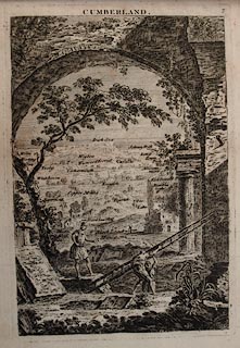 click to enlarge click to enlargeJL05.jpg "Penrith" view (sort of) item:- Carlisle Library : 4.2 Image © Carlisle Library |
|||||||||||||||||
|
|
||||||||||||||||||
| evidence:- | old map:- Bowen and Kitchin 1760 placename:- Penrith |
|||||||||||||||||
| source data:- | Map, hand coloured engraving, A New Map of the Counties of
Cumberland and Westmoreland Divided into their Respective Wards,
scale about 4 miles to 1 inch, by Emanuel Bowen and Thomas
Kitchin et al, published by T Bowles, Robert Sayer, and John
Bowles, London, 1760.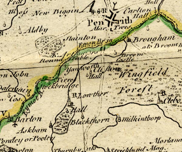 BO18NY42.jpg "Penrith Mar. Twes. / R" blocks, on roads, street plan, town, market, two crosses potent for charity schools, symbol for post stage item:- Armitt Library : 2008.14.10 Image © see bottom of page |
|||||||||||||||||
|
|
||||||||||||||||||
| evidence:- | old map:- Jefferys 1770 (Wmd) placename:- Penrith |
|||||||||||||||||
| source data:- | Map, 4 sheets, The County of Westmoreland, scale 1 inch to 1
mile, surveyed 1768, and engraved and published by Thomas
Jefferys, London, 1770.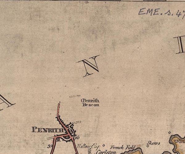 J5NY53SW.jpg "PENRITH" blocks on a street plan, labelled in block caps; settlement, market town?; street plan with many buildings item:- National Library of Scotland : EME.s.47 Image © National Library of Scotland |
|||||||||||||||||
|
|
||||||||||||||||||
| evidence:- | old text:- Pennant 1773 placename:- Penrith item:- ouzel; water ouzel |
|||||||||||||||||
| source data:- | Book, A Tour from Downing to Alston Moor, 1773, by Thomas
Pennant, published by Edward Harding, 98 Pall Mall, London, 1801. goto source Pennant's Tour 1773, page 158 "I soon reached Penrith, and can add very little to the account of this place in my Scotch Tour. I received, in this visit, every civility and information from Mr. Harrison surgeon, who introduced me to Miss Calwin, to whose in-" goto sourcePennant's Tour 1773, page 159 "[in]genuity I have before paid the tribute due. She was so obliging as to present me with a beautiful drawing of a singular or perhaps new species of Water Ouzel, shot somewhere in this neighbourhood. It was rather superior in size to the common: the head, wings, upper part of the body, and tail, were dusky; the chin and throat white - at the bottom of the last was a bar of dusky; the breast, belly and thighs white, marked with short black strokes pointing downwards, most numerous towards the lower belly and thighs; the vent of a rusty yellow, crossed with bars of black; legs rusty yellow." "..." "William III. bestowed the honour of Penrith with all its dependencies, with the appurtenances within the forest of Englewood, on his great favourite William Bentinck duke of Portland. His Majesty at the same time made a grant of" goto sourcePennant's Tour 1773, page 160 "the lordships of Denbigh, Bromfield, and Yala, in the principality of Wales. ..." "I commenced, at this town, an acquaintance with Mr. William Hutchinson, the antiquary of Bernard-castle; an attorney of very fair character, and author of the View of Northumberland, the History of the County of Durham, and of the Excursion to the Lakes; works very justly esteemed." |
|||||||||||||||||
|
|
||||||||||||||||||
| evidence:- | old map:- Donald 1774 (Cmd) placename:- Penrith |
|||||||||||||||||
| source data:- | Map, hand coloured engraving, 3x2 sheets, The County of Cumberland, scale about 1
inch to 1 mile, by Thomas Donald, engraved and published by Joseph Hodskinson, 29
Arundel Street, Strand, London, 1774.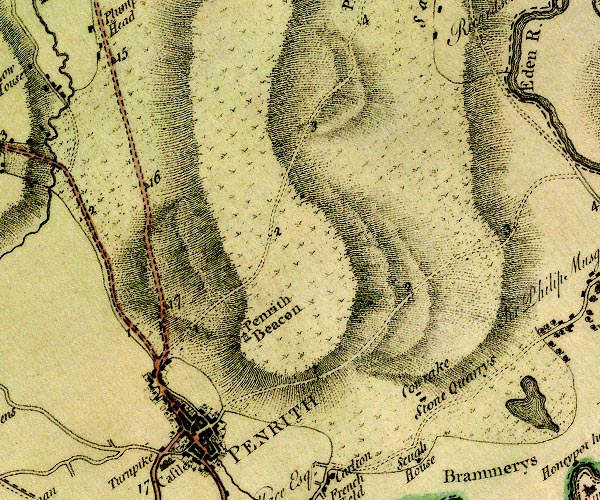 D4NY53SW.jpg "PENRITH" blocks, perhaps a church, labelled in block caps; a town with street plan item:- Carlisle Library : Map 2 Image © Carlisle Library |
|||||||||||||||||
|
|
||||||||||||||||||
| evidence:- | old map:- Donald 1774 (Cmd) placename:- Penrith |
|||||||||||||||||
| source data:- | Map, hand coloured engraving, 3x2 sheets, The County of Cumberland, scale about 1
inch to 1 mile, by Thomas Donald, engraved and published by Joseph Hodskinson, 29
Arundel Street, Strand, London, 1774.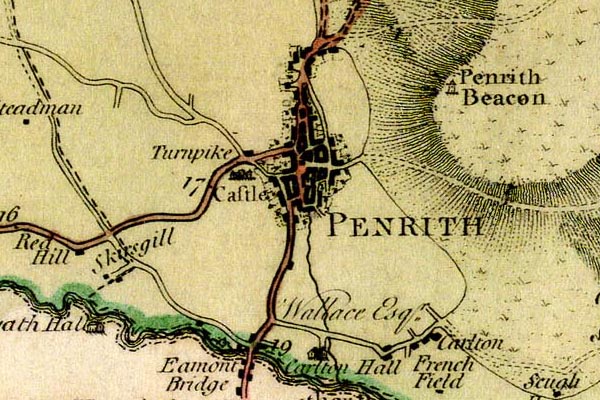 DN04Pnrt.jpg "PENRITH" Labelled in block caps for a market town; street map. item:- Carlisle Library : Map 2 Image © Carlisle Library |
|||||||||||||||||
|
|
||||||||||||||||||
| evidence:- | old map:- Donald 1774 (Cmd) placename:- Penrith |
|||||||||||||||||
| source data:- | Map, hand coloured engraving, 3x2 sheets, The County of Cumberland, scale about 1
inch to 1 mile, by Thomas Donald, engraved and published by Joseph Hodskinson, 29
Arundel Street, Strand, London, 1774. D4NY53SW.jpg "PENRITH" blocks, perhaps a church, labelled in block caps; a town with street plan item:- Carlisle Library : Map 2 Image © Carlisle Library |
|||||||||||||||||
|
|
||||||||||||||||||
| evidence:- | old map:- Donald 1774 (Cmd) placename:- Penrith |
|||||||||||||||||
| source data:- | Map, hand coloured engraving, 3x2 sheets, The County of Cumberland, scale about 1
inch to 1 mile, by Thomas Donald, engraved and published by Joseph Hodskinson, 29
Arundel Street, Strand, London, 1774. DN04Pnrt.jpg "PENRITH" Labelled in block caps for a market town; street map. item:- Carlisle Library : Map 2 Image © Carlisle Library |
|||||||||||||||||
|
|
||||||||||||||||||
| evidence:- | descriptive text:- West 1778 (11th edn 1821) placename:- Penrhydd item:- placename, Penrith; charter (none) |
|||||||||||||||||
| source data:- | Guide book, A Guide to the Lakes, by Thomas West, published by
William Pennington, Kendal, Cumbria once Westmorland, and in
London, 1778 to 1821. goto source Page 167:- "..." "PENRITH. [1]" "So much is already said of this town, that little remains now to be added here. The situation is pleasant, and open to the south. It is tolerably well built, and rather a genteel than a trading town. The town's people are polite and civil, and the inns commodious and well served." "Saving the few resident families, the life of this town is its being a thorough-fare. For, although seated in the midst of a rich and fruitful country, few manufacturers have been induced to fix here. Before the interest of the sister kingdoms became one, Penrith was a place of uncertain tranquillity, and too precarious for the repose of trade and manual industry; being better circumstanced for a place of arms and military exercise. Yet since this happy change of circumstances, no more than one branch of tanning, and a small manufacture of checks have taken place. This must be owing either to want of attention in people of property, or of" "[1] (Bereda, Rav. Chor. Vereda, Anton. Inter.)" goto sourcePage 168:- "industry of the inhabitants. The latter is not to be supposed; for the spirit of agriculture, introduced by the gentlemen of the environs, is in as flourishing a way amongst the farmers of this neighbourhood, as in other parts of the kingdom. The superfluities of the market are bought up for Kendal, where much of that produce is wanting which superabounds here." "The most remarkable objects at Penrith, are the beacon, on the summit of the hill above the town, and the awful remains of the royal fortress on the crest of the rising ground that commands the town. ... now no longer terrible, since the border service ceased, and a mutual inter-" goto sourcePage 169:- "[inter]course of trade and alliance happily took the place of national reprisals and family feuds." "The antiquity of this town is supposed to be found in its name being of British derivation, from Pen and Rhudd, signifying in that langauge, a red head or hill; and such is the colour of the hill above the town, and the ground and stones round it. But with respect to situation, it may well be derived from Pen, the head, and Ryn, a promontory, and so be referred to the beacon hill. It might however be judged a more honourable etymon to derive the name from Pen, and Rhydd, of Rhyddaw, to make free, and that on account of special service or fidelity to the Roman government, the Britons of this town were emancipated from the abject slavery which the nation in general were subjected to, by their tyrannical masters. This, in their own language, might be Penrhydd, and pronounced by the Britons, as by the Welch at this day, Penrith. However this may be, it has been the happiness of this town to remain a royal franchise through all the ages of feudal servitude; at least ever since the reign of Edward I. without the incumbrance of a charter, and it is now peaceably governed by the steward of the honours, and a free jury. The honours of both town and castle belong to the Duke of Portland." goto sourceAddendum; Mr Gray's Journal, 1769 Page 200:- "... crossed the Eden and the Eamont with its green vale, and dined at three o'clock with Mrs. Buchanan, at Penrith, on trout and partridge. In the afternoon walked up beacon-hill, ..." |
|||||||||||||||||
|
|
||||||||||||||||||
| evidence:- | old map:- West 1784 map placename:- Penrith |
|||||||||||||||||
| source data:- | Map, hand coloured engraving, A Map of the Lakes in Cumberland,
Westmorland and Lancashire, scale about 3.5 miles to 1 inch,
engraved by Paas, 53 Holborn, London, about 1784. Ws02NY43.jpg "PENRITH" item:- Armitt Library : A1221.1 Image © see bottom of page |
|||||||||||||||||
|
|
||||||||||||||||||
| evidence:- | old text:- Clarke 1787 placename:- Penrith item:- card playing; bowling green; fish; elopement; market; fair |
|||||||||||||||||
| source data:- | Guide book, A Survey of the Lakes of Cumberland, Westmorland,
and Lancashire, written and published by James Clarke, Penrith,
Cumberland, and in London etc, 1787; published 1787-93. goto source Page 14:- "..." "WE now enter the town of Penrith, remarkable for the neatness of its appearance, if we except the shambles and town-hall; most of the houses being built of red free stone, and covered with those blue slates whose excellence is now well known throughout most towns in the kingdom, though they are generally called, (I know not why) White-slates." goto sourcePage 15:- "Though an inland town, there are some very considerable manufactories of checks, which are daily increasing; two common breweries in good employ; two hair-merchants, who, (limited as their business may seem,) are both men of property; and a tannery, where some business is done. Yet as these employ but a small part of the inhabitants, perhaps the manners of no place are more strongly or generally stamped with the marks of ease and peace. Few are rich, but as few miserably poor. Whoever wishes to enjoy a social glass, is seldom at a loss for a companion. A regular Card-Assembly, during the Winter; and small, though agreeable private parties all the year round, furnish the fair sex with ample amusement; whilst two well frequented bowling-greens, afford, during the fine weather, exercise and amusement to such of the males who have no better employment. During the races and assizes [sessions], a more gay and agreeable place cannot be imagined. The more than usually bustle of those times rousing the inhabitants out of that placid dream of existence they at other times enjoy, and animating them to a degree of real mirth and festivity rarely met with in more pompous scenes." "But why not here, as well as any where else, should I pay the tribute due to the general manners of the country? They deserve it. Every reputable farmer in the neighbourhood prides himself upon the goodness of his ale, and is never so happy as when his friends have taken as much of it as they can carry home. The gentlemen are remarked for affability and hospitality. True it is, that, like trees which grow single, every little irregularity has ample room to expand and shew itself; but at the same time, all is pure nature, undisguised by art. To rise still higher; even a Cynic would acknowledge, were he at Graystock, that there is at least one Nobleman who has the art of joining the polish of France to the hospitality of Britain, and whose chief delight is to shew, that true nobility can reside alone in superior worth." "Penrith has an excellent market on Tuesday, and a small one on Saturday. The Tuesday market is likewise a market for live-cattle, both fat and lean, from Lammas till Whitsuntide; but from Whitsuntide till Lammas the cattle-market is held upon the Nolt-Fair. The markets here are disposed in a manner truly astonishing in so small a town: the wheat-market is in one part of the town; rye and potatoes in another; barley in another; oats and pease in another; live-cattle, horses, and hogs have also their distinct markets. The measures here are different in different articles; as there are two customary bushels in use here, one of 80 quarts and another of 64: by the first are sold barley and oats; by the second, wheat, rye, fruit, pease, and potatoes. The second is called the Penrith Bushel, and is double the Winchester measure, and three of the bushels are called a Load." "The average prices of Fish, in this and the neighbouring inland towns is as follows:" "Penrith is perhaps the greatest thoroughfare in the North of England: all the Irish [most of the Irish] now crossing the sea at Port-Patrick, and consequently take this in their road to the Metropolis. Should they come by Whitehaven this is still their road: besides, since the improvements of the roads, those who are travelling from Scotland to London generally chuse this road. Another set of never-failing travellers are those whom nature, in opposition to an absurd law, prompts to connubial ties; this way they must come on their road to Gretna-Green; more famous, though less dangerous in our days, for the cure of love-sickness, than the promontory of Leucothoc was in days of yore. Those, likewise, whom a taste for natural beauties impells to visit the Lakes, always consider Penrith as a kind of home in these solitary regions: and the consequence is natural, all the inns here seem to vie with each other in attention, and strain every sinew in making the country as agreeable as possible."
goto sourcePage 16:- "The Antiquarians say that this town takes its name from the red-hill out of which it hath been built, and on which the Beacon now stands: this they found on the etymology of the name, Pen-rith, signifying Red-hill, or Red-head. Upon the whole, this seems a more probably conjecture, than that this Penrith was built out of the ruins of the Ala Petriana which Horsley and others call Old Penrith; ..." |
|||||||||||||||||
|
|
||||||||||||||||||
| evidence:- | old text:- Clarke 1787 placename:- Penrith item:- Parliament; Battle of Barnet; fire, Penrith; foray, 1345-46; slavery; Queen's Home Lands; water supply, Penrith; pump; plague; school, Penrith |
|||||||||||||||||
| source data:- | Guide book, A Survey of the Lakes of Cumberland, Westmorland,
and Lancashire, written and published by James Clarke, Penrith,
Cumberland, and in London etc, 1787; published 1787-93. goto source Page 20:- "..." "Having finished the description of this town, it now remains to give a sketch of its history, which is unavoidably entangled with the general history of the country, and likewise with the history of England. The town and signory underwent no changes different from those of the whole county till the year 1251; at that time they were given as the 200 librates of land which King Henry III. gave, together with 5000 merks of silver, as a portion with Margaret his daughter, who was then married to Alexander King of Scots. It was given under the title of the Queen's Haim (or Home) Lands. Though it thus became a property to the Scottish Crown, it was only considered as a part of the King's private estate, (for which he did homage or fealty to the King of England, by paying one soar hawk at the city of Carlisle,) and not as being part of the Scots dominions. This appears from an assize held 6. Edward I.; also from an inquisition taken at Carlisle in 21. Edward I. before Thomas de Normanville, the King's Escheator, beyond Trent, A.D. 1292. The jurors there find, that the said manors are worth 200 pounds, and that John Baliol is next heir, and of the age of thirty years." "Edward, however, in the 26th year of his reign, having quarrelled with Baliol, (then King of the Scots,) seized these lands, and gave them to Beck Bishop of Durham, (known by the name of the Fighting Bishop:) He enjoyed them not long, for being summoned to attend a parliament held at Carlisle in the thirty-third year of the same reign, and not appearing, the lands were adjudged to the Crown. In the year 1306, and the thirty-fourth of his reign, Edward gave these lands to the Duke of Britanny: In his family they continued till 11. of Edward IV.; when Ralph de Nevil, (then Duke,) being slain in battle at Barnet, they again reverted to the Crown for want of heirs. They continued in the Crown till William III. gave them to William Bentick Esq; (afterwards Earl of Portland,) his favourite page: In that family they continued till 1784, when his Grace the present Duke of Portland sold them to his brother-in-law the Duke of Devonshire." "This town of Penrith hath several times severely suffered by the inroads of the Scots, particularly in the 19. of Edward III. when 26,000 entered Cumberland, laying waste all before them. They burnt Penrith, with several other villages; carried away all the inhabitants whom they could any way make useful into Scotland, and there publickly sold them to the highest bidder: they likewise carried off 40,000 head of cattle, and committed such barbarities on the defenceless and weak as humanity must shudder at. In the 6. of Edward the II. they likewise made an incursion, and destroyed this town, at which time it is supposed many of the inhabitants hid their money in the walls of their houses; being afterwards either killed or carried away captives, the money was frequently left there; insomuch that an old house is seldom pulled down but some silver and other coins are found. These calamities, joined to a want of water, and great distance from coal, (the nearest being 26 miles land-carriage,) made this town very thin of inhabitants: but in the year 1748 [1468], Bishop Strickland of Carlisle remedied the former of these wants, by purchasing of the owners of certain Mills, (particularly Vaux of Catterlin,) so much of the water of the river Petterell as would flow through the eye of a mill-stone. This he generously, at his own expence, conveyed to Penrith, and the water still continues to flow in the same quantity, and no more. Since the general use of pumps, no town perhaps is better supplied" goto sourcePage 21:- "with water; scarce any house being so inconsiderable as not to be provided with one of those useful engines." "After the Bishop's patriotic exertion, the town continued to increase till the year 1598, when the plague almost depopulated it; since that time, it has flourished gradually, and seems likely to increase. What probably has added to its prosperity is, that, besides the Queen's School, there are several charity-schools, where indigent children are taught reading, writing, needlework, and every other branch that can make them useful members of society." |
|||||||||||||||||
|
|
||||||||||||||||||
| evidence:- | old text:- Clarke 1787 item:- border service; beacons |
|||||||||||||||||
| source data:- | Guide book, A Survey of the Lakes of Cumberland, Westmorland,
and Lancashire, written and published by James Clarke, Penrith,
Cumberland, and in London etc, 1787; published 1787-93. goto source Page 172:- "..." "A proclamation made at Penrith 14th June 1547, by order of Lord Wharton, for raising the power of the border." "'Forasmuch as the Governour of Scotland, their Queen, and others Noblemen of that realm repaired to Pebles upon a Sunday at night last, and also their ordnance coming from Edinburgh, of intent, with a great army of the whole body of the said realm of Scotland, to do some enterprize against the King's Majesty's possessions and subjects upon the West Marches: Therefore, Thomas Wharton, Knight, Lord Wharton Lord Warden of the West Marches of England for anempst Scotland, Captain of the King's Majesty's city of Carlisle, and one of his Highness's most honourable Council, strictly chargeth and commandeth, in his Majesty's name, That all his Highness's subjects, horsemen, and footmen, within the bounds of the said West Marches, prepare their arrediness, and come forward with ten days victuals, as hath been appointed, so as they may be at Carlisle upon Thursday next at noon; not failing hereof upon pain of death." "'Written at Carlisle this Tuesday the 14th of June 1547. God Save the King.'" "Next day he sent the following Circular Letter, dated 15th June 1547. at Carlisle." "'After my hearty commendations unto you, when yesterday I wrote as well proclamations to be made at Penrith, as otherwise in the parts of Westmorland and Cumberland, for the beacons to burn, and the subjects to come forward, to be at Carlisle to-morrow at noon, for the defence and power of Scotland, and forasmuch as I am credibly informed this Wednesday, by intelligence from out of Scotland, that the governour, their Queen, ordnance, and munition, came to Pebles upon Saturday-night last as I wrote; where, and in those parts they continue; and as yet the governour hath not so great an army as he looked to have at this time, and therefore hath determined with a power to come to the town of Dumfries upon Saturday next, as is appointed; and to levy the garrisons in all parts over-against these West Marches, until they may levy a greater army to do the annoyance they may against the King's Majesty's realm, and possessions upon these marches: Trusting, with the leave of God, to put the borderers in these outward parts of these Marches in such watch and areadiness, as we shall be able to defend their sudden enterprizes; and that I would all his Majesty's subjects under my rule should live in as much quiet and preservation of themselves, and victuals, until the occasion shall come by the enemies, (for intelligence whereof I shall do as well as I can; the weightiness of this, the King's Majesty's service considered,) I require you to repair home to your own houses, with hearty thanks for your areadiness and diligence; and also desire you in his Majesty's name, to continue at your houses in like areadiness, with watch of beacons to come forwards, with ten days victuals, upon warning; and that none of his Majesty's loving subjects fail hereof, upon pain of death. Be the more earnest for your areadiness, for that the governour continueth on their borders, for anempst these Marches. And cause these be read openly to all the King's Majesty's subjects; every gentleman and officer, under his several rule, for their better knowledge of the same. And right heartily fare you well." "'From Carlisle this Wednesday the 15th of June, at four of the clock afternoon," "'To the Gentlemen West Marchers." "'Your loving Friend," "'THOMAS WHARTON.'" |
|||||||||||||||||
|
|
||||||||||||||||||
| evidence:- | old map:- Clarke 1787 placename:- Penrith |
|||||||||||||||||
| source data:- | Town plan, uncoloured engraving, A Map of the Town of Penrith in
the County of Cumberland, by James Clarke, engraved by Samuel
John Neele, 352 Strand, London, published by James Clarke,
London, 1789.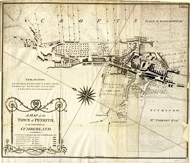 click to enlarge click to enlargeCL17.jpg item:- Armitt Library : A6615.2 Image © see bottom of page |
|||||||||||||||||
|
|
||||||||||||||||||
| evidence:- | old map:- Clarke 1787 placename:- Penrith |
|||||||||||||||||
| source data:- | Map, A Map of the Town of Penrith and Country Adjacent, scale
about 10 ins to 1 mile, by James Clarke, engraved by S J Neele,
352 Strand, published by James Clarke, Penrith, Cumberland and
in London etc, 1787.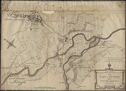 click to enlarge click to enlargeCL01.jpg item:- Dove Cottage : 2014.7.1 Image © see bottom of page |
|||||||||||||||||
|
|
||||||||||||||||||
| evidence:- | old text:- Camden 1789 placename:- Penrith placename:- Perith item:- placename, Penrith; water supply; market; sandstone |
|||||||||||||||||
| source data:- | Book, Britannia, or A Chorographical Description of the Flourishing Kingdoms of England,
Scotland, and Ireland, by William Camden, 1586, translated from the 1607 Latin edition
by Richard Gough, published London, 1789. goto source Page 173:- "..." "... a little way from the confluence of the Eimot and Loder, where is a round fortification called by the inhabitants Arthur's table, stands Penrith, q.d. if derived from the British language, Red Head, or Hill: for the soil and the stones of which it is built are of a red colour; but it is commonly called Perith. It is a small market town of some note, defended on the west by a royal castle, ... has a very handsome church, a spacious market place, with a wooden market house for the use of those who assemble there, adorned with bears and ragged staffs, the arms of the earls of Warwick. It belonged formerly to the bishops of Durham, but bishop Anthony Bec growing insolent through his excessive wealth, Edward I. as we read in the register of Durham "took from him Werk in Tividale, Perith, and the church of Simondburne." For the use, however, of the town, W. Stricland, bishop of Carlisle, of a famous family in these parts, cut, at his own expence, a chanel from Pete-rill, ..." |
|||||||||||||||||
|
|
||||||||||||||||||
| evidence:- | old text:- Camden 1789 (Gough Additions) placename:- Penrith placename:- Pereth item:- market; placename, Penrith; plague |
|||||||||||||||||
| source data:- | Book, Britannia, or A Chorographical Description of the Flourishing Kingdoms of England,
Scotland, and Ireland, by William Camden, 1586, translated from the 1607 Latin edition
by Richard Gough, published London, 1789. goto source Page 188:- "..." ""Pereth, a market town by S. 61 miles from Carluel, where is a strong castle of the king's, and stondeth on a litle water by force cut out of Peterel. But Pereth standith not half a mile from the river of Emot and a mile from the town or castel of Burgham, that longeth to the earls of Cumberland. In Perith is one parish church and a grey friary. A castel of the kinges by the town."" "Penrith lies in a bottom, the beacon standing on a high hill as you enter the road above which is the course. A fine valley opens to the west as you descend from the Carlisle road into a very long suburb neatly paved. The town is considerable and handsome, having a very large market. ..." goto sourcePage 189:- "... On the north wall of the vestry without [St Andrew's Church] is this inscription A.D. 1598, ex gravi peste quae regionibus hisce incubuit obierunt apud Penrith 2260, Kendal 2500, Richmond 2200, Carlisle 1160. Posteri avortite vos &vivite. The parish register says the plague broke out at Carlisle October 3, 1597, and raged here from September 22, 1597, to January 5, 1598, and that only 680 persons were buried here: so that Penrith must have been put for the centre of some district. At the little village of Eden hall the register says 42 person died in this year. The plague raged at Penrith 1380, when the Scots breaking in at the time of a fair, carried it home to their own country, where it made dreadful havoc. The wooden market-house is now gone. ..." "This town was burnt by the Scots 19 Edward III. and 8 Richard II. Richard III. when duke of Gloucester, lodged in the castle, to check the Scots, and enlarged the works with stones as it is said from Mayboro' before-mentioned." "Dr. Todd derives the name of Penrith from Petriana three miles north of it, out of which, he says, it rose." "At the Conquest the manor of Penrith and the forest of Englewood, in which it is situate, were in the possession of the Scots, who were soon after dispossessed, but kept up their claim to the three counties of Cumberland, Westmorland, and Northumberland, ... ... William III. gave the honour of Penrith and all its dependances with the appurtenances within the forest of Englewood, whose boundaries may be seen in Burn, III. 522. to William Bentink, afterwards created earl of Portland, and they are still held by his great grandson William Henry duke of Portland." |
|||||||||||||||||
|
|
||||||||||||||||||
| evidence:- | old map:- Cary 1789 (edn 1805) placename:- Penrith |
|||||||||||||||||
| source data:- | Map, uncoloured engraving, Westmoreland, scale about 2.5 miles
to 1 inch, by John Cary, London, 1789; edition 1805.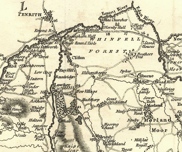 CY24NY52.jpg "PENRITH" group of blocks, labelled in block caps; town item:- JandMN : 129 Image © see bottom of page |
|||||||||||||||||
|
|
||||||||||||||||||
| evidence:- | old map:- Aikin 1790 (Cmd) placename:- Penrith |
|||||||||||||||||
| source data:- | Map, uncoloured engraving, Cumberland, by John Aikin, London,
1790. click to enlarge click to enlargeAIK3.jpg "Penrith" circle; town item:- JandMN : 145 Image © see bottom of page |
|||||||||||||||||
|
|
||||||||||||||||||
| evidence:- | old map:- Bailey 1797 placename:- Penrith |
|||||||||||||||||
| source data:- | Map, soil etc, uncoloured engraving, Cumberland, scale about 21
miles to 1 inch, by J Bailey, engraved by Neele, Strand,
published by Messrs Robinson, Paternoster Row and G Nicol, Pall
Mall, London, 1797. click to enlarge click to enlargeBY04.jpg "Penrith" group of blocks; town item:- Armitt Library : A680.2 Image © see bottom of page |
|||||||||||||||||
|
|
||||||||||||||||||
| evidence:- | old map:- Bailey 1797 placename:- Penrith |
|||||||||||||||||
| source data:- | Map, soil etc, uncoloured engraving, Westmoreland, scale about
12 miles to 1 inch, by J Bailey, engraved by Neele, Strand,
published by Messrs Robinson, Paternoster Row and G Nicol, Pall
Mall, London, 1797. click to enlarge click to enlargeBY05.jpg "Penrith" group of blocks; town item:- Armitt Library : A680.3 Image © see bottom of page |
|||||||||||||||||
|
|
||||||||||||||||||
| evidence:- | road book:- Cary 1798 (2nd edn 1802) placename:- Penrith |
|||||||||||||||||
| source data:- | Road book, itineraries, Cary's New Itinerary, by John Cary, 181
Strand, London, 2nd edn 1802. goto source click to enlarge click to enlargeC38267.jpg page 267-268 "Penrith - Crown, Cumberland / At Penrith, on l. a T.R. to Keswick." market town, post office goto source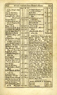 click to enlarge click to enlargeC38269.jpg page 269-270 "INNS. ... Penrith, Crown, George. ..." goto source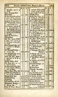 click to enlarge click to enlargeC38281.jpg page 281-282 "Penrith - Crown, Cumberland / On l. a T.R. to Keswick." market town, post office goto source click to enlarge click to enlargeC38285.jpg page 285-286 "INNS. ... Penrith, Crown, George. ..." goto source click to enlarge click to enlargeC38319.jpg page 319-320 "To Penrith, p.282" again:- "To Penrith, p.282" market town, post office item:- JandMN : 228.1 Image © see bottom of page |
|||||||||||||||||
|
|
||||||||||||||||||
| evidence:- | road book:- Cary 1798 (2nd edn 1802) placename:- Penrith |
|||||||||||||||||
| source data:- | Road book, itineraries, Cary's New Itinerary, by John Cary, 181
Strand, London, 2nd edn 1802. goto source click to enlarge click to enlargeC38735.jpg page 735-736 "INNS. Penrith, Crown, George. ..." item:- JandMN : 228.2 Image © see bottom of page |
|||||||||||||||||
|
|
||||||||||||||||||
| evidence:- | descriptive text:- Baker 1802 placename:- Penrith item:- plague |
|||||||||||||||||
| source data:- | Perspective road map with sections in Lancashire, Westmorland,
and Cumberland, by J Baker, London 1802. pp.25-26:- "..." "Penrith is situated beneath some verdurous heights that stretch from it towards the east; one point of which is decorated with a fancy building, commonly called the Beacon. From this spot is a most interesting view if the adjacent country, and hereon are the annual races of the town. The river Emmont on one side winds amicably along the edge of the town, and on another side the ruins of an antient castle occupy the landscape." "... Like other towns on this great military way, it hath often suffered by the rancourous predatory contentions and ravages of the English and the Scotch. It contains neat modern buildings, and many venerable relics of antiquity, such as fragments of its antient walls, Saxon or other monuments. ..." |
|||||||||||||||||
|
|
||||||||||||||||||
| evidence:- | old map:- Baker 1802 placename:- Penrith |
|||||||||||||||||
| source data:- | Perspective road maps with sections in Lancashire, Westmorland
and Cumberland, by J Baker, London 1802.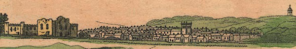 Bk03Vg04.jpg "Penrith / 286" item:- private collection : 3 Image © see bottom of page |
|||||||||||||||||
|
|
||||||||||||||||||
| evidence:- | old map:- Cooke 1802 placename:- Penrith |
|||||||||||||||||
| source data:- | Map, Cumberland, scale about 15.5 miles to 1 inch, by George
Cooke, 1802, bound in Gray's New Book of Roads, 1824, published
by Sherwood, Jones and Co, Paternoster Road, London, 1824. click to enlarge click to enlargeGRA1Cd.jpg "Penrith / 281" blocks, upright lowercase text; town, distance from London item:- Hampshire Museums : FA2000.62.2 Image © see bottom of page |
|||||||||||||||||
|
|
||||||||||||||||||
| evidence:- | old map:- Cooke 1802 placename:- Penrith |
|||||||||||||||||
| source data:- | Map, The Lakes, Westmorland and Cumberland, scale about 8.5
miles to 1 inch, engravedby Neele and Son, published by
Sherwood, Jones and Co, Paternoster Road, London, 1824. click to enlarge click to enlargeGRA1Lk.jpg "Penrith" blocks, upright lowercase text; town item:- Hampshire Museums : FA2000.62.5 Image © see bottom of page |
|||||||||||||||||
|
|
||||||||||||||||||
| evidence:- | old map:- Laurie and Whittle 1806 placename:- Penrith |
|||||||||||||||||
| source data:- | Road map, Completion of the Roads to the Lakes, scale about 10
miles to 1 inch, by Nathaniel Coltman? 1806, published by Robert
H Laurie, 53 Fleet Street, London, 1834. click to enlarge click to enlargeLw18.jpg "Penrith 287¾" market town; distance from London; travellers supplied with post horses or carriages item:- private collection : 18.18 Image © see bottom of page |
|||||||||||||||||
|
|
||||||||||||||||||
| evidence:- | old map:- Laurie and Whittle 1806 placename:- Penrith |
|||||||||||||||||
| source data:- | Road map, Continuation of the Roads to Glasgow and Edinburgh,
scale about 10 miles to 1 inch, by Nathaniel Coltman? 1806,
published by Robert H Laurie, 53 Fleet Street, London, 1834. click to enlarge click to enlargeLw21.jpg "Penrith 283½" market town; distance from London; travellers supplied with post horses or carriages item:- private collection : 18.21 Image © see bottom of page |
|||||||||||||||||
|
|
||||||||||||||||||
| evidence:- | old text:- Capper 1808 placename:- Penrith item:- population; market; fair; fire; plague |
|||||||||||||||||
| source data:- | Gazetteer, A Topographical Dictionary of the United Kingdom,
compiled by Benjamin Pitts Capper, published by Richard
Phillips, Bridge Street, Blackfriars, London, 1808; published
1808-29. goto source "..." "PENRITH, a market town and parish in Leath ward, Cumberland, 17 miles from Carlisle, and 283½from London; containing 670 houses and 3801 inhabitants, viz. 1697 males and 2104 females, of whom 1020 were returned as being employed in trade and manufacture. This town was originally claimed, and continued a long time continued in the possession of the Scots; but it being disputed by the English, it was twice burnt in the reigns of Edward III. and Richard II. when it had a castle erected to check the depredations of the Scots. The church is a large and handsome structure, ... In the church-yard are two ancient rude stone obelisks, set up at each end of what is called the Giant's Grave, ... The town-house in the market-place is built of wood, and embellished with the figures of bears climbing up a ragged staff. It has a good free school, a charity school, and 2 Sunday schools, with several meeting houses for Presbyterians and Quakers. Its principal manufactures are those of check and fancy waistcoat pieces. On the north bank of the river Emont, are two caves ... This town suffered greatly by the plague in 1380, and again in 1598, where it is recorded by an inscription on the vestry wall, that 2260 person died thereof; but the register only accounts for 680 burials. The markets are on Tuesday and Saturday. Fairs, 8th June, and 5th August. It is a vicarage, value 12l. 6s. 3d. in the patronage of the bishop of Carlisle. - Housman's Tour and Hutchinson's Cumberland." "..." |
|||||||||||||||||
|
|
||||||||||||||||||
| evidence:- | old map:- Cooper 1808 placename:- Penrith |
|||||||||||||||||
| source data:- | Map, uncoloured engraving, Cumberland, scale about 10.5 miles to
1 inch, drawn and engraved by Cooper, published by R Phillips,
Bridge Street, Blackfriars, London, 1808. click to enlarge click to enlargeCOP3.jpg "Penrith" circle with two side bars; town item:- JandMN : 86 Image © see bottom of page |
|||||||||||||||||
|
|
||||||||||||||||||
| evidence:- | old text:- Gents Mag item:- storm, 1810; fire; hail |
|||||||||||||||||
| source data:- | Magazine, The Gentleman's Magazine or Monthly Intelligencer or
Historical Chronicle, published by Edward Cave under the
pseudonym Sylvanus Urban, and by other publishers, London,
monthly from 1731 to 1922. goto source Gentleman's Magazine 1810 part 2 p.176 "... ..." "Aug. 4. ..." "In a violent storm of thunder, lightning, and hail, this day, at Penrith, considerable damage was done by the lightning: a barn, containing 10 cart-loads of hay, belonging to Mr. Martindale of Gutter-lane; and a stack, the property of Sir F. T. Vane, of Hutton Hall, were both set on fire, and entirely consumed. A horse and five lambs were killed in a field near Penrith. Several of the hail-stones measured two inches in circumference. ..." |
|||||||||||||||||
|
|
||||||||||||||||||
| evidence:- | old map:- Wallis 1810 (Cmd) placename:- Penrith |
|||||||||||||||||
| source data:- | Road map, hand coloured engraving, Cumberland, scale about 16
miles to 1 inch, by James Wallis, 77 Berwick Stree, Soho,
London, 1810. click to enlarge click to enlargeWL13.jpg "Penrith / 281" town; distance from London item:- Dove Cottage : 2009.81.10 Image © see bottom of page |
|||||||||||||||||
|
|
||||||||||||||||||
| evidence:- | old map:- Otley 1818 placename:- Penrith |
|||||||||||||||||
| source data:- | Map, uncoloured engraving, The District of the Lakes,
Cumberland, Westmorland, and Lancashire, scale about 4 miles to
1 inch, by Jonathan Otley, 1818, engraved by J and G Menzies,
Edinburgh, Scotland, published by Jonathan Otley, Keswick,
Cumberland, et al, 1833. OT02NY53.jpg "PENRITH" item:- JandMN : 48.1 Image © see bottom of page |
|||||||||||||||||
|
|
||||||||||||||||||
| evidence:- | old text:- Gents Mag item:- plague |
|||||||||||||||||
| source data:- | Magazine, The Gentleman's Magazine or Monthly Intelligencer or
Historical Chronicle, published by Edward Cave under the
pseudonym Sylvanus Urban, and by other publishers, London,
monthly from 1731 to 1922. goto source Gentleman's Magazine 1819 part 1 p.508 From the Compendium of County History:- "... In 1598 at Penrith 583 person died of the plague, according to the register, but the number is incorrectly stated on a brass plate in the church as amounting to 2260. ..." |
|||||||||||||||||
|
|
||||||||||||||||||
| evidence:- | old text:- Gents Mag item:- Border Wars; fire, Penrith; fairs; incursion, 1342; incursion, 1345; incursion, 1380 |
|||||||||||||||||
| source data:- | Magazine, The Gentleman's Magazine or Monthly Intelligencer or
Historical Chronicle, published by Edward Cave under the
pseudonym Sylvanus Urban, and by other publishers, London,
monthly from 1731 to 1922. goto source Gentleman's Magazine 1819 part 1 p.505 From the Compendium of County History:- "1342. Penrith and several neighbouring villages burnt by the Scots." "1345. Penrith town burnt by the Scots under Sir William Douglas, who besieged Carlisle, and set fire to the suburbs; ..." "..." "1380. Penrith, during a truce, treacherously surprised by Scots, who slew many of the inhabitants, and carried off numerous prisoners and a great booty as it was a fair day in that town. These marauders also set fire to a street in Carlisle." |
|||||||||||||||||
|
|
||||||||||||||||||
| evidence:- | old text:- Gents Mag 1819 item:- Civil War; rebellion, 1715; 1715 Rebellion; rebellion, 1745; 1745 Rebellion |
|||||||||||||||||
| source data:- | goto source Gentleman's Magazine 1819 part 1 p.506 "1648. ... June 15, Penrith taken by the Parliamentarians under General Lambert, and detachments from his army about the same time took Greystock, Rose, and Scaleby castles, and defeated a body of royalists at Warwick-bridge. ..." "..." "1715. Brampton and Penrith entered in November, and James III. proclaimed by the friends of the Stuarts under General Foster." "..." "1745. Near Longton, Nov. 8, advanced guard of Prince Charles Stuart's army entered Cumberland. ... On the 21st the van of the army marched into Penrith, which Charles with the main body entered on the following day. On their retreat from Derby the army entered Penrith Dec. 17. ..." |
|||||||||||||||||
|
|
||||||||||||||||||
| evidence:- | old text:- Gents Mag 1819 item:- Hymn to Venus |
|||||||||||||||||
| source data:- | goto source Gentleman's Magazine 1816 part 2 p.601 Biographical note from the Compendium of County History:- "Ritson, Isaac, translator of Homer's Hymn to Venus, Penrith." |
|||||||||||||||||
|
|
||||||||||||||||||
| evidence:- | old map:- Hall 1820 (Cmd) placename:- Penrith |
|||||||||||||||||
| source data:- | Map, hand coloured engraving, Cumberland, scale about 21 miles
to 1 inch, engraved by Sidney Hall, published by S Leigh, 18
Strand, London, 1820-31. click to enlarge click to enlargeHA14.jpg "Penrith / 283" circle, upright lowercase text; town; distance from London item:- JandMN : 91 Image © see bottom of page |
|||||||||||||||||
|
|
||||||||||||||||||
| evidence:- | descriptive text:- Otley 1823 (5th edn 1834) item:- population, Penrith; road distances; geology |
|||||||||||||||||
| source data:- | Guide book, A Concise Description of the English Lakes, the
mountains in their vicinity, and the roads by which they may be
visited, with remarks on the mineralogy and geology of the
district, by Jonathan Otley, published by the author, Keswick,
Cumberland now Cumbria, by J Richardson, London, and by Arthur
Foster, Kirkby Lonsdale, Cumbria, 1823; published 1823-49,
latterly as the Descriptive Guide to the English Lakes. goto source Page 112:- "PENRITH" "Is a good market town with 6059 inhabitants. It is a considerable thoroughfare, being situated at the junction of the Yorkshire and Lancashire roads to Carlisle and Glasgow. The principal inns are the Crown and the George. From Penrith to Alston Moor is 20 miles, to Appleby 14, to Carlisle 18, to Kendal by Shap 27, to Keswick 18." "Ullswater may be visited from Penrith, going either by Eamont Bridge and Tirrel, or by Dalemain, to the Inn at Pooley Bridge; with carriages the former road is generally preferred." goto sourcePage 163:- "... From Maryport towards Carlisle, and thence to Penrith, is a large tract of red sandstone of unknown depth. ..." |
|||||||||||||||||
|
|
||||||||||||||||||
| evidence:- | old map:- Perrot 1823 placename:- Penrith |
|||||||||||||||||
| source data:- | Map, hand coloured engraving, Cumberland and Westmoreland ie
Westmorland, scale about 38 miles to 1 inch, by Aristide Michel
Perrot, engraved by Migneret, 1823, published by Etienne Ledoux,
9 Rue Guenegaud, Paris, France, 1824-48. click to enlarge click to enlargePER2.jpg "Penrith" circle; town item:- Dove Cottage : 2007.38.45 Image © see bottom of page |
|||||||||||||||||
|
|
||||||||||||||||||
| evidence:- | old map:- Greenwood 1824 placename:- Penrith |
|||||||||||||||||
| source data:- | Map, engraving, Map of the County of Cumberland, scale about 1
inch to 1 mile, etc, by Christopher and John Greenwood,
published by George Pringle jnr, 70 Queen Street, Cheapside,
London, 1823. gw12pnrt.jpg "PENRITH" street map; labelled in block caps for a market town. item:- National Library of Scotland : EME.b.3.11 Image © National Library of Scotland |
|||||||||||||||||
|
|
||||||||||||||||||
| evidence:- | old map:- Cobbett 1832 placename:- Penrith |
|||||||||||||||||
| source data:- | Map, uncoloured engraving, Cumberland, scale about 20 miles to 1
inch, by William Cobbett, 11 Bolt Court, Fleet Street, London,
1832. click to enlarge click to enlargeCOB5.jpg "Penrith" dot and circle; town item:- JandMN : 117 Image © see bottom of page |
|||||||||||||||||
|
|
||||||||||||||||||
| evidence:- | descriptive text:- Ford 1839 (3rd edn 1843) placename:- Penrith placename:- Perith |
|||||||||||||||||
| source data:- | Guide book, A Description of Scenery in the Lake District, by
Rev William Ford, published by Charles Thurnam, Carlisle, by W
Edwards, 12 Ave Maria Lane, Charles Tilt, Fleet Street, William
Smith, 113 Fleet Street, London, by Currie and Bowman,
Newcastle, by Bancks and Co, Manchester, by Oliver and Boyd,
Edinburgh, and by Sinclair, Dumfries, 1839. goto source "..." "THE order in which the Lakes should be visited, if seen in any prescribed order at all, can be pointed out much more easily than satisfactorily. Lancaster and Kendal in the south, Carlisle and Penrith in the north, formerly offered the readiest facilities of access to this Northern Elysium; but since the improvement of steam navigation, Whitehaven and other ports have become equally suitable as starting places. One advantage, however, remains in favour of the old routes, that the direct lines are better, especially for carriages, although to the pedestrian this will not be a matter of any great importance." goto sourcePage 131:- "... the market-town of" "PENRITH," "Vulgarly called Perith, an ancient, respectable, and well-built town, consisting chiefly of one long street, at the junction of the roads from London and Manchester to Glasgow. The houses, built of stone, are generally plastered and whitewashed. In 1807 the town was much improved by the removal of the market-cross, shambles, and moot-hall; and the south entrance from Appleby has lately been widened and carried by a gentle curve out of the town, instead of by a narrow, crooked, and dangerous road, as it formerly was. The markets and fairs are well attended, and rank high as marts for agricultural produce." "The parish church, dedicated to St. Andrew, ..." goto sourcePage 132:- "[the] ruins of the Castle are on the west side of the town: ... On the north side of the town is the excellent race-course, ... At the George inn is a spacious assembly-room, and at the Crown a news-room, which, with libraries, form a fund of amusement for the inhabitants." "Above the race-course, on the point of a wood-embowered hill, stands the Beacon, ..." goto sourcePage 133:- "Many pleasant and picturesque walks are in this neighbourhood; and, within five miles, are Lowther Castle, Brougham Hall, Eden Hall, Dalemain, Greystoke Castle, Hutton Hall, and Ulles Water." |
|||||||||||||||||
|
|
||||||||||||||||||
| evidence:- | old map:- Ford 1839 map placename:- Penrith |
|||||||||||||||||
| source data:- | Map, uncoloured engraving, Map of the Lake District of
Cumberland, Westmoreland and Lancashire, scale about 3.5 miles
to 1 inch, published by Charles Thurnam, Carlisle, and by R
Groombridge, 5 Paternoster Row, London, 3rd edn 1843. FD02NY53.jpg "PENRITH" item:- JandMN : 100.1 Image © see bottom of page |
|||||||||||||||||
|
|
||||||||||||||||||
| evidence:- | old map:- Garnett 1850s-60s H placename:- Penrith |
|||||||||||||||||
| source data:- | Map of the English Lakes, in Cumberland, Westmorland and
Lancashire, scale about 3.5 miles to 1 inch, published by John
Garnett, Windermere, Westmorland, 1850s-60s. GAR2NY53.jpg "PENRITH" blocks, settlement item:- JandMN : 82.1 Image © see bottom of page |
|||||||||||||||||
|
|
||||||||||||||||||
| evidence:- | old text:- Martineau 1855 |
|||||||||||||||||
| source data:- | Guide book, A Complete Guide to the English Lakes, by Harriet
Martineau, published by John Garnett, Windermere, Westmorland,
and by Whittaker and Co, London, 1855; published 1855-76. goto source Page 170:- "... Penrith is a neat little town, busy, from being the great thoroughfare of the district, but not particularly interesting, except from some Druidical remains in the neighbourhood, a curiosity in the churchyard, and the vicinity of Brougham Castle. ..." |
|||||||||||||||||
|
|
||||||||||||||||||
| evidence:- | old text:- Gents Mag placename:- Penereth item:- licence to crenellate |
|||||||||||||||||
| source data:- | Magazine, The Gentleman's Magazine or Monthly Intelligencer or
Historical Chronicle, published by Edward Cave under the
pseudonym Sylvanus Urban, and by other publishers, London,
monthly from 1731 to 1922. goto source Gentleman's Magazine 1856 part 2 pp.467-475 "..." "LICENCES TO CRENELLATE, FROM THE PATENT ROLLS IN THE TOWER OF LONDON. (Continued from p.330.)" "[Edward III continued]" "..." "20. Homines villae de Penereth villam predictam Penerethz." "..." "z There are some remains of the castle at Penrith, Cumberland, but they appear to be of a later date." "..." |
|||||||||||||||||
|
|
||||||||||||||||||
| evidence:- | old text:- Gents Mag 1856 item:- licence to crenellate |
|||||||||||||||||
| source data:- | goto source Gentleman's Magazine 1856 part 2 pp.467-475 "..." "LICENCES TO CRENELLATE, FROM THE PATENT ROLLS IN THE TOWER OF LONDON. (Continued from p.330.)" "..." "RICHARD II. A.D. 1377. June 22. 1399. Sep. 29." "..." "20. Willielmus Stukeland, clericus quandam cameram suam in villa de Penreth ... March. Scociae." "..." "22. Willielmus de Stirkeland unum mantelettumk Penreth ... March. Scociae." "k The Roll recites the previous grant thus: "nuper," &c. "concessimus," &c. "licentiam," &c., "kernellandi quandam cameram in villa de Penreth super March. Scociae. Nos de uberiori gratia nostra concessimus," &c., "licentiam quod ipse unum mantelletum de petra et calce facere et camerae praedictae conjungere et mantelletum praedictam kernellare," &c. The name is misspelt in both instances: there can be no doubt it ought to be Strickland." "..." |
|||||||||||||||||
|
|
||||||||||||||||||
| evidence:- | old itinerary:- Tinsley 1877 (Roads/Cum) placename:- Penrith |
|||||||||||||||||
| source data:- | Itinerary, route 3, London to Edinburgh and Glasgow via Boroughbridge and Carlisle,
including from Bowes, Durham; through Brough, Appleby, Westmorland; then Penrith,
Carlisle, Longtown, Cumberland; and into Scotland, published by Tinsley Bros, 8 Catherine
Street, Strand, London, 1877.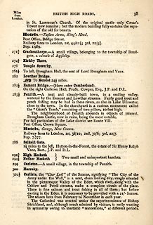 click to enlarge click to enlargeTLY138.jpg pp.36-49 in British High Roads, North and North Eastern Routes; pp.37-39. printed at p.36:- "... / ROUTE III. - LONDON to EDINBURGH and GLASGOW via / BOROUGHBRIDGE and CARLISLE (See Maps 31 to 42.) / Boroughbridge 206 (as per Route I.), Leeming 221½, Catterick 228, Greta Bridge 242½, Bowes 248½, Brough 261½, Appleby 269¾, / Penrith 283½, Carlisle 301½, Longtown 310¼, Langholm 321¾, / Hawick 349½, Selkirk 356, Middleton 379½, Edinburgh 392½. / ..." item:- private collection : 270.1 Image © see bottom of page |
|||||||||||||||||
|
|
||||||||||||||||||
| evidence:- | old strip map:- Tinsley 1877 (Roads/Cum) placename:- Penrith |
|||||||||||||||||
| source data:- | Strip map, road map, part of London to Edinburgh via Boroughbridge and Carlisle, including
from Appleby, Westmorland through Penrith to Carlisle, Cumberland, published by Tinsley
Bros, 8 Catherine Street, Strand, London, 1877.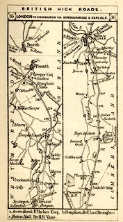 click to enlarge click to enlargeTLY1M2.jpg Map pp.35-36 in British High Roads, North and North Eastern Routes. printed at top:- "BRITISH HIGH ROADS. / 35 LONDON TO EDINBURGH, VIA BOROUGHBRIDGE &CARLISLE. 36" item:- private collection : 270.4 Image © see bottom of page |
|||||||||||||||||
|
|
||||||||||||||||||
| evidence:- | old text:- Harper 1907 placename:- Penrith placename:- Penrhydd item:- placename, Penrith; incursion, 1345; 1745 Rebellion; rebellion, 1745 |
|||||||||||||||||
| source data:- | Guidebook, The Manchester and Glasgow Road, by Charles G Harper,
published by Chapman and Hall Ltd, London, 1907. HP01p130.txt Page 130:- "..." "PENRITH derives its name, originally Pen-rhydd, "the red hill," from Beacon Hill, 937 feet high, under whose shelter this place of narrow and huddled streets lies. The Beacon Hill was in the old days a protection to the surrounding country, for from its crest flared those warning flames that advised many a mile of threatened Westmoreland of the approach of the invading Scots." "But although Penrith is sheltered by its great godfather hill, it was never at any time effectually protected against the invader. Carlisle, eighteen miles away to the north, was its great bulwark, and if that fortified city fell, or were cleverly avoided, then the case of Penrith was sorry indeed, as in the notable instance of 1345, when the Scots, numbering 26,000 men, came pouring across the Border, and burnt the town and many neighbouring villages; taking prisoners with them, on their return, as many hale and hearty men as they could find, to be sold as slaves to the highest bidders. Such was the life on the Borders in the fourteenth century, and reading these things, we are inclined to agree with Taylor the "Water-poet's" conclusion:" "" "Whoso then did in the Borders dwell" "Lived little happier than those in Hell." "The next year, the remaining inhabitants of Penrith, graciously permitted by the King to protect themselves," HP01p131.txt Page 131:- "build a communal castle. and each townsman so far as was possible to him, rebuilt his own dwelling-house in a strong and defensible way. Hence the grim, thick-walled houses that even now line many of the narrow streets. ..." HP01p135.txt Page 135:- "Penrith has suffered much in its time from wars and tumults, but it was afflicted in a dreadful manner by a great plague which almost depopulated the neighbourhood between September, 1597, and January, 1599, as an inscription in the church relates. In Penrith itself 2,260 people died, and in Kendal, 2,500." "..." "The chief streets of the town have been much modernised, but some old landmarks reward the diligent. The "Prince Charles Restaurant," a baker's shop, occupies the mansion where the Young Pretender lodged, and some old Penrith merchants' houses remain: notably one in Angel Lane, on whose front the old local passion for remembrance, that usually finds expression in dates, initials, and improving maxims, develops into family history and epitaph, ..." |
|||||||||||||||||
|
|
||||||||||||||||||
| evidence:- | old itinerary:- Johnson 1908 (Roads/Cum) placename:- Penrith |
|||||||||||||||||
| source data:- | Itinerary, Route 37 in Roads Made Easy by Picture and Pen, Preston to Glasgow, by
Claude Johnson, edited by Lord Montagu, published by The Car Illustrated, 168 Piccadilly,
London, 1908. click to enlarge click to enlargeJS5002.jpg pp.1-10 in the road book, Roads Made Easy by Picture and Pen, vol.3. printed at beginning, p.1:- "ROUTE 37. / PRESTON via Lancaster (21½), Kendal (42½), Shap (58½), Penrith (69), Carlisle (87), Lockerbie (111½), Beattock (125¾), Abington (144½), Hamilton (170½) to GLASGOW (182). / (The Land's End to John o' Groats Route.)"  click to enlarge click to enlargeJS5003.jpg item:- private collection : 268.2 Image © see bottom of page |
|||||||||||||||||
|
|
||||||||||||||||||
| evidence:- | old itinerary:- Johnson 1908 (Roads/Cum) placename:- Penrith |
|||||||||||||||||
| source data:- | Itinerary, Route 37 reverse in Roads Made Easy by Picture and Pen, Glasgow to Preston,
by Claude Johnson, edited by Lord Montagu, published by The Car Illustrated, 168 Piccadilly,
London, 1908. click to enlarge click to enlargeJS5017.jpg pp.11-21 in the road book, Roads Made Easy by Picture and Pen, vol.3. printed at beginning, p.11:- "ROUTE 37. Reverse / GLASGOW via Hamilton (11½), Abington (37½), Beattock (56¼), Lockerbie (70½), Carlisle (95), Penrith (113), Shap (123½), Kendal (139½), Lancaster (160½) to PRESTON (182)." item:- private collection : 268.3 Image © see bottom of page |
|||||||||||||||||
|
|
||||||||||||||||||
| evidence:- | old itinerary:- Johnson 1908 (Roads/Cum) placename:- Penrith |
|||||||||||||||||
| source data:- | Itinerary, Route 41. reverse in Roads Made Easy by Picture and Pen, Glasgow to Doncaster,
through Appleby, by Claude Johnson, edited by Lord Montagu, published by The Car Illustrated,
168 Piccadilly, London, 1908. click to enlarge click to enlargeJS5083.jpg pp.83-84 in the road book, Roads Made Easy by Picture and Pen, vol.3. printed at beginning, p.83:- "ROUTE 41. Reverse. / GLASGOW via Carlisle (95), Penrith (113), Appleby (125½), Bowes (146¾), Scotch Corner (162¾), Boroughbrisge (191¾), to DONCASTER (235¼)." item:- private collection : 268.11 Image © see bottom of page |
|||||||||||||||||
|
|
||||||||||||||||||
| evidence:- | text:- Curwen 1913 placename:- Penereth item:- licence to crenellate |
|||||||||||||||||
| source data:- | Book, The Castles and Fortified Towers of Cumberland,
Westmorland, and Lancashire North of the Sands, by John F
Curwen, published for the Cumberland and Westmorland Antiquarian
and Archaeological Society by Titus Wilson, Kendal, Westmorland,
1913. Licence to crenellate granted by Edward III; 10 April 1346:- "Homines villae de Penereth quod ipsam villam predictam muro de petra et calce firmare et kernellare ... Penereth." |
|||||||||||||||||
|
|
||||||||||||||||||
| evidence:- | old map:- Postlethwaite 1877 (3rd edn 1913) placename:- Penrith |
|||||||||||||||||
| source data:- | Map, uncoloured engraving, Map of the Lake District Mining Field, Westmorland, Cumberland,
Lancashire, scale about 5 miles to 1 inch, by John Postlethwaite, published by W H
Moss and Sons, 13 Lowther Street, Whitehaven, Cumberland, 1877 edn 1913.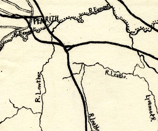 PST2NY52.jpg "PENRITH" roads, railways item:- JandMN : 162.2 Image © see bottom of page |
|||||||||||||||||
|
|
||||||||||||||||||
| evidence:- | old map:- Burrow 1920s placename:- Penrith |
|||||||||||||||||
| source data:- | Road book, On the Road, Dunlop Pictorial Road Plans, volume V,
strip maps with parts in Westmorland, Cumberland etc, irregular
scale about 1.5 miles to 1 inch, by E J Burrow and Co,
Cheltenham, Gloucestershire, 1920s.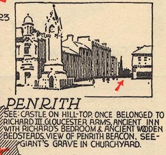 EJB3Vg21.jpg "Penrith is now close ahead, guarded by Beacon Hill and with the merest fragment of its castle lingering near the railway station. The town has some old inns and many old houses built in narrow streets in a way that helps to conjure up pictures of hand-to-hand fighting twixt English and Scots. The churchyard contains two ancient sandstone pillars with traces of Runic decoration, set at either end of what is known as the Giant's Grave. ..." item:- private collection : 17 Image © see bottom of page |
|||||||||||||||||
|
|
||||||||||||||||||
| evidence:- | market notes:- item:- market |
|||||||||||||||||
| source data:- | www.history.ac.uk/cmh/gaz/gazweb2.htmOwen: 1792: New Book of Fairs: 1889: Market Rights and Tolls: HM GovernmentBowen, Emanuel &Kitchin, Thomas: 1760: New Map of the Counties of Cumberland and Westmoreland | |||||||||||||||||
|
|
||||||||||||||||||
 more notes more notes |
||||||||||||||||||
|
|
||||||||||||||||||
 CCS56.jpg Postmark:- "PENRITH / 10-45AM / 6 SEP / 1961 / CUMBERLAND" |
||||||||||||||||||
|
|
||||||||||||||||||
| Post Office maps |
||||||||||||||||||
|
|
||||||||||||||||||
| evidence:- | old print:- Bogg 1898 |
|||||||||||||||||
| source data:- | Print, engraving, Street Scene, Penrith, Cumberland, by A Haselgrave, published by
Edmund Bogg, 3 Woodhouse Lane, and James Miles, Guildford Street, Leeds, Yorkshire,
1898.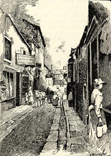 click to enlarge click to enlargeBGG137.jpg Included on p.134 of Lakeland and Ribblesdale, by Edmund Bogg. item:- JandMN : 231.37 Image © see bottom of page |
|||||||||||||||||
|
|
||||||||||||||||||
| evidence:- | old advertisement:- Atkinson 1847 (5th edn 1850) placename:- Penrith item:- coach; Helvellyn, The; Skiddaw, The |
|||||||||||||||||
| source data:- | Advertisement for coaches, Thet Helvellyn and The Skiddaw, running between Ambleside
and Patterdale, Westmorland, and Penrith, Cumberland, 1850.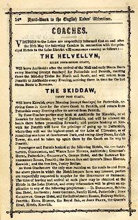 click to enlarge click to enlargeAK2A12.jpg At the end of a Handbook to the English Lakes, 5th edn. item:- Armitt Library : A1144.21 Image © see bottom of page |
|||||||||||||||||
|
|
||||||||||||||||||
| longcase clocks |
||||||||||||||||||
|
|
||||||||||||||||||
|
|
||||||||||||||||||
| hearsay:- |
A market was established here by Henry III, about 1123; Wednesday market and fair
from the Eve of Pentecost to the Monday after the Feast of the Holy Trinity. |
|||||||||||||||||
|
|
||||||||||||||||||
| notes:- |
supposed town walls |
|||||||||||||||||
| licence to crenellate 10 April 1346 |
||||||||||||||||||
| Perriam, D R &Robinson, J: 1998: Medieval Fortified Buildings of Cumbria: CWAAS::
ISBN 1 873124 23 6 |
||||||||||||||||||
|
|
||||||||||||||||||
| personal | ||||||||||||||||||
| person:- | artist : Thompson, Jacob |
|||||||||||||||||
| place:- | birthplace | |||||||||||||||||
| date:- | 1806 |
|||||||||||||||||
| Jacob Thompson, eldest son of Merrick Thompson, was born on Langton Street, 1806.
His father, a Quaker, was a factory owner who had built Factory Yard, Friargate. Jacob
became an artist, exhibiting at Carlisle Academy of Art, and from 1831 at the Royal
Academy and the British Institution, London. After living in the south 1834-41, he
returned to live at The Hermitage, Hackthorpe, on the estate of Lord Lonsdale. He
died there, 1879, and is buried in the churchyard at Lowther. |
||||||||||||||||||
|
|
||||||||||||||||||
| places:- |
|
|||||||||||||||||
|
||||||||||||||||||
|
||||||||||||||||||
|
||||||||||||||||||
|
||||||||||||||||||
|
||||||||||||||||||
|
||||||||||||||||||
|
||||||||||||||||||
|
||||||||||||||||||
|
||||||||||||||||||
|
||||||||||||||||||
|
||||||||||||||||||
|
||||||||||||||||||
|
||||||||||||||||||
|
||||||||||||||||||
|
||||||||||||||||||
|
||||||||||||||||||
|
||||||||||||||||||
|
||||||||||||||||||
|
||||||||||||||||||
|
||||||||||||||||||
|
||||||||||||||||||
|
||||||||||||||||||
|
||||||||||||||||||
|
||||||||||||||||||
|
||||||||||||||||||
|
||||||||||||||||||
|
||||||||||||||||||
|
||||||||||||||||||
|
||||||||||||||||||
|
||||||||||||||||||
|
||||||||||||||||||
|
||||||||||||||||||
|
||||||||||||||||||
|
||||||||||||||||||
|
||||||||||||||||||
|
||||||||||||||||||
|
||||||||||||||||||
|
||||||||||||||||||
|
||||||||||||||||||
|
||||||||||||||||||
|
||||||||||||||||||
|
||||||||||||||||||
|
||||||||||||||||||
|
||||||||||||||||||
|
||||||||||||||||||
|
||||||||||||||||||
|
||||||||||||||||||
|
||||||||||||||||||
|
||||||||||||||||||
|
||||||||||||||||||
|
||||||||||||||||||
|
||||||||||||||||||
|
||||||||||||||||||
|
||||||||||||||||||
|
||||||||||||||||||
|
||||||||||||||||||
|
||||||||||||||||||
|
||||||||||||||||||
|
||||||||||||||||||
|
||||||||||||||||||
|
||||||||||||||||||
|
||||||||||||||||||
|
||||||||||||||||||
|
||||||||||||||||||
|
||||||||||||||||||
|
||||||||||||||||||
|
||||||||||||||||||
|
||||||||||||||||||
|
||||||||||||||||||
|
||||||||||||||||||
|
||||||||||||||||||
|
||||||||||||||||||
|
||||||||||||||||||
|
||||||||||||||||||
|
||||||||||||||||||
|
||||||||||||||||||
|
||||||||||||||||||
|
||||||||||||||||||
|
||||||||||||||||||
|
||||||||||||||||||
|
||||||||||||||||||
|
||||||||||||||||||
|
||||||||||||||||||
|
||||||||||||||||||
|
||||||||||||||||||
|
||||||||||||||||||
|
||||||||||||||||||
|
||||||||||||||||||
|
||||||||||||||||||
|
||||||||||||||||||
|
||||||||||||||||||
|
||||||||||||||||||
|
||||||||||||||||||
|
||||||||||||||||||
|
||||||||||||||||||
|
||||||||||||||||||
|
||||||||||||||||||
|
||||||||||||||||||
|
||||||||||||||||||
|
||||||||||||||||||
|
||||||||||||||||||
|
||||||||||||||||||
|
||||||||||||||||||
|
||||||||||||||||||
|
||||||||||||||||||
|
||||||||||||||||||
|
||||||||||||||||||
|
||||||||||||||||||
|
||||||||||||||||||
|
||||||||||||||||||
|
||||||||||||||||||
|
||||||||||||||||||
|
||||||||||||||||||
|
||||||||||||||||||
|
||||||||||||||||||
|
||||||||||||||||||
|
||||||||||||||||||
|
||||||||||||||||||
|
||||||||||||||||||
|
||||||||||||||||||
|
||||||||||||||||||
|
||||||||||||||||||
|
||||||||||||||||||
|
||||||||||||||||||
|
||||||||||||||||||
|
||||||||||||||||||
|
||||||||||||||||||
|
||||||||||||||||||
|
||||||||||||||||||
|
||||||||||||||||||
|
||||||||||||||||||
|
||||||||||||||||||
|
||||||||||||||||||
|
||||||||||||||||||
|
||||||||||||||||||
|
||||||||||||||||||
|
||||||||||||||||||
|
||||||||||||||||||
|
||||||||||||||||||
|
||||||||||||||||||
|
||||||||||||||||||
|
||||||||||||||||||
|
||||||||||||||||||
|
||||||||||||||||||
|
||||||||||||||||||
|
||||||||||||||||||
|
||||||||||||||||||
|
||||||||||||||||||
|
||||||||||||||||||
|
||||||||||||||||||
|
||||||||||||||||||
|
||||||||||||||||||
|
||||||||||||||||||
|
||||||||||||||||||
|
||||||||||||||||||
|
||||||||||||||||||
|
||||||||||||||||||
|
||||||||||||||||||
|
||||||||||||||||||
|
||||||||||||||||||
|
||||||||||||||||||
|
||||||||||||||||||
|
||||||||||||||||||
|
||||||||||||||||||
|
||||||||||||||||||
|
||||||||||||||||||
|
||||||||||||||||||
|
||||||||||||||||||
|
||||||||||||||||||
|
||||||||||||||||||
|
||||||||||||||||||
|
||||||||||||||||||
|
||||||||||||||||||
|
||||||||||||||||||
|
||||||||||||||||||
|
||||||||||||||||||
|
||||||||||||||||||
|
||||||||||||||||||
|
||||||||||||||||||
|
||||||||||||||||||
|
||||||||||||||||||
|
||||||||||||||||||
|
||||||||||||||||||
|
||||||||||||||||||
|
||||||||||||||||||
|
||||||||||||||||||
|
||||||||||||||||||
|
||||||||||||||||||
|
||||||||||||||||||
|
||||||||||||||||||
|
||||||||||||||||||
|
||||||||||||||||||
|
||||||||||||||||||
|
||||||||||||||||||
|
||||||||||||||||||
|
||||||||||||||||||
|
||||||||||||||||||
|
||||||||||||||||||
|
||||||||||||||||||
|
||||||||||||||||||
|
||||||||||||||||||
|
||||||||||||||||||
|
||||||||||||||||||
|
||||||||||||||||||
|
||||||||||||||||||
|
||||||||||||||||||
|
||||||||||||||||||
|
||||||||||||||||||
|
||||||||||||||||||
|
||||||||||||||||||
|
||||||||||||||||||
|
||||||||||||||||||
|
||||||||||||||||||
|
||||||||||||||||||
|
||||||||||||||||||
|
||||||||||||||||||
|
||||||||||||||||||
|
||||||||||||||||||
|
||||||||||||||||||
|
||||||||||||||||||
|
||||||||||||||||||
|
||||||||||||||||||
|
||||||||||||||||||
|
||||||||||||||||||
|
||||||||||||||||||
|
||||||||||||||||||
|
||||||||||||||||||
|
||||||||||||||||||
|
||||||||||||||||||
|
||||||||||||||||||
|
||||||||||||||||||
|
||||||||||||||||||
|
||||||||||||||||||
|
||||||||||||||||||
|
||||||||||||||||||
|
||||||||||||||||||
|
||||||||||||||||||
|
||||||||||||||||||
|
||||||||||||||||||
|
||||||||||||||||||
|
||||||||||||||||||
|
||||||||||||||||||
|
||||||||||||||||||
|
||||||||||||||||||
|
||||||||||||||||||
|
||||||||||||||||||
|
||||||||||||||||||
|
||||||||||||||||||
|
||||||||||||||||||
|
||||||||||||||||||
|
||||||||||||||||||
|
||||||||||||||||||
|
||||||||||||||||||
|
||||||||||||||||||
|
||||||||||||||||||
|
||||||||||||||||||
|
||||||||||||||||||
|
||||||||||||||||||
|
||||||||||||||||||
|
||||||||||||||||||
|
||||||||||||||||||
|
||||||||||||||||||
|
||||||||||||||||||
|
||||||||||||||||||
|
||||||||||||||||||
|
||||||||||||||||||
|
||||||||||||||||||
|
||||||||||||||||||
|
||||||||||||||||||
|
||||||||||||||||||
|
||||||||||||||||||
|
||||||||||||||||||
|
||||||||||||||||||
|
||||||||||||||||||
|
||||||||||||||||||
|
||||||||||||||||||
|
||||||||||||||||||
|
||||||||||||||||||
|
||||||||||||||||||
|
||||||||||||||||||
|
||||||||||||||||||
|
||||||||||||||||||
|
||||||||||||||||||
|
||||||||||||||||||
|
||||||||||||||||||
|
||||||||||||||||||
|
||||||||||||||||||
|
||||||||||||||||||
|
||||||||||||||||||
|
||||||||||||||||||
|
||||||||||||||||||
|
||||||||||||||||||
|
||||||||||||||||||
|
||||||||||||||||||
|
||||||||||||||||||
|
||||||||||||||||||
|
||||||||||||||||||
|
||||||||||||||||||
|
||||||||||||||||||
|
||||||||||||||||||
|
||||||||||||||||||
|
||||||||||||||||||
|
||||||||||||||||||
|
||||||||||||||||||
|
||||||||||||||||||
|
||||||||||||||||||
|
||||||||||||||||||
|
||||||||||||||||||
|
||||||||||||||||||
|
||||||||||||||||||
|
||||||||||||||||||
|
||||||||||||||||||
|
||||||||||||||||||
|
||||||||||||||||||
|
||||||||||||||||||
|
||||||||||||||||||
|
||||||||||||||||||
|
||||||||||||||||||
|
||||||||||||||||||
|
||||||||||||||||||
|
||||||||||||||||||
|
||||||||||||||||||
|
||||||||||||||||||
|
||||||||||||||||||
|
||||||||||||||||||
|
||||||||||||||||||
|
||||||||||||||||||
|
||||||||||||||||||
|
||||||||||||||||||
|
||||||||||||||||||
|
||||||||||||||||||
|
||||||||||||||||||
|
||||||||||||||||||
|
||||||||||||||||||
|
||||||||||||||||||
|
||||||||||||||||||
|
||||||||||||||||||
|
||||||||||||||||||
|
||||||||||||||||||
|
||||||||||||||||||
|
||||||||||||||||||
|
||||||||||||||||||
|
||||||||||||||||||
|
||||||||||||||||||
|
||||||||||||||||||
|
||||||||||||||||||
|
||||||||||||||||||
|
||||||||||||||||||
|
||||||||||||||||||
|
||||||||||||||||||
|
||||||||||||||||||
|
||||||||||||||||||
|
||||||||||||||||||
|
||||||||||||||||||
|
||||||||||||||||||
|
||||||||||||||||||
|
||||||||||||||||||
|
||||||||||||||||||
|
||||||||||||||||||
|
||||||||||||||||||
|
||||||||||||||||||
|
||||||||||||||||||
|
||||||||||||||||||
|
||||||||||||||||||
|
||||||||||||||||||
|
||||||||||||||||||
|
||||||||||||||||||
|
||||||||||||||||||
|
||||||||||||||||||
|
||||||||||||||||||
|
||||||||||||||||||
|
||||||||||||||||||
|
||||||||||||||||||
|
||||||||||||||||||
|
||||||||||||||||||
|
||||||||||||||||||
|
||||||||||||||||||
|
||||||||||||||||||
|
||||||||||||||||||
|
||||||||||||||||||
|
||||||||||||||||||
|
||||||||||||||||||
|
||||||||||||||||||
|
||||||||||||||||||
|
||||||||||||||||||
|
||||||||||||||||||
|
||||||||||||||||||
|
||||||||||||||||||
|
||||||||||||||||||
|
||||||||||||||||||
|
||||||||||||||||||
|
||||||||||||||||||
|
||||||||||||||||||
|
||||||||||||||||||
|
||||||||||||||||||
|
||||||||||||||||||
|
||||||||||||||||||
|
||||||||||||||||||
|
||||||||||||||||||
|
||||||||||||||||||
|
||||||||||||||||||
|
||||||||||||||||||
|
||||||||||||||||||
|
||||||||||||||||||
|
||||||||||||||||||
|
||||||||||||||||||
|
||||||||||||||||||
|
||||||||||||||||||
|
||||||||||||||||||
|
||||||||||||||||||
|
||||||||||||||||||
|
||||||||||||||||||
|
||||||||||||||||||
|
||||||||||||||||||
|
||||||||||||||||||
|
||||||||||||||||||
|
||||||||||||||||||
|
||||||||||||||||||
|
||||||||||||||||||
|
||||||||||||||||||
|
||||||||||||||||||
|
||||||||||||||||||
|
||||||||||||||||||
|
||||||||||||||||||
|
||||||||||||||||||
|
||||||||||||||||||
|
||||||||||||||||||
|
||||||||||||||||||
|
||||||||||||||||||
|
||||||||||||||||||
|
||||||||||||||||||
|
||||||||||||||||||
|
||||||||||||||||||
|
||||||||||||||||||
|
||||||||||||||||||
|
||||||||||||||||||
Lakes Guides menu.