 Old Cumbria Gazetteer
 |
 |
|
| chapel, Penrith (2) | ||
| Methodist Church | ||
| Street:- | Fell Lane | |
| locality:- | Penrith | |
| civil parish:- | Penrith (formerly Cumberland) | |
| county:- | Cumbria | |
| locality type:- | methodist chapel | |
| locality type:- | chapel | |
| coordinates:- | NY51753032 | |
| 1Km square:- | NY5130 | |
| 10Km square:- | NY53 | |
| references:- | Listed Buildings 2010 |
|
|
|
||
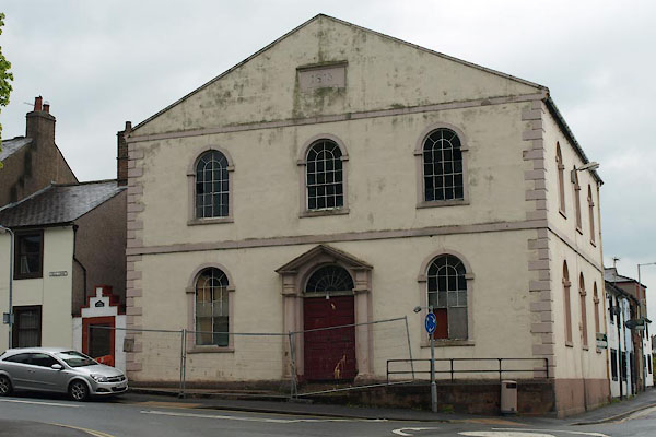 BWL15.jpg (taken 18.5.2012) 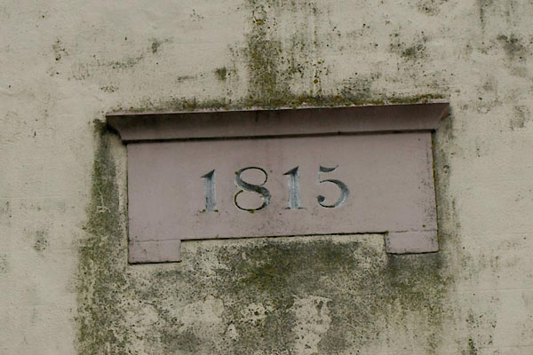 BWL16.jpg Date:- "1815" (taken 18.5.2012) |
||
|
|
||
| evidence:- | old map:- OS County Series (Cmd 58 4) |
|
| source data:- | Maps, County Series maps of Great Britain, scales 6 and 25
inches to 1 mile, published by the Ordnance Survey, Southampton,
Hampshire, from about 1863 to 1948. "W. M. Chapel" |
|
|
|
||
| evidence:- | database:- Listed Buildings 2010 placename:- Methodist Church |
|
| source data:- | courtesy of English Heritage "METHODIST CHURCH / / FELL LANE / PENRITH / EDEN / CUMBRIA / II / 72833 / NY5175330323" |
|
| source data:- | courtesy of English Heritage "Datestone of 1815. Stucco, with quoins, gabled front with 2 bands, and parapet. Entrance has good doorway with 2 stone unfluted Greek Doric 3/4 columns with block entablature and pediment. Semi-circular headed fan-light with radial glazing bars, and 8-panelled door in two halves. Three semi-circular headed sash windows in plain stone dressings. Three similar windows on right hand return side to Benson's Row." |
|
|
|
||
 Lakes Guides menu.