 Old Cumbria Gazetteer
 |
 |
|
| chapel, Penrith | ||
| Street:- | Meeting House Lane | |
| locality:- | Penrith | |
| civil parish:- | Penrith (formerly Cumberland) | |
| county:- | Cumbria | |
| locality type:- | buildings | |
| locality type:- | chapel (ex) | |
| locality type:- | methodist chapel (ex) | |
| coordinates:- | NY51613047 | |
| 1Km square:- | NY5130 | |
| 10Km square:- | NY53 | |
|
|
||
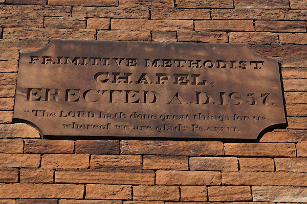 CCF82.jpg Plaque:- "PRIMITIVE METHODIST / CHAPEL, / ERECTED A.D. 1857. / ..." (taken 14.1.2015) 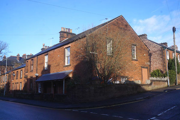 CCF81.jpg (taken 14.1.2015) |
||
|
|
||
| evidence:- | old map:- OS County Series (Cmd 58 4) |
|
| source data:- | Maps, County Series maps of Great Britain, scales 6 and 25
inches to 1 mile, published by the Ordnance Survey, Southampton,
Hampshire, from about 1863 to 1948. "P. Metht. Chapl." |
|
|
|
||
 Lakes Guides menu.