 Old Cumbria Gazetteer
 |
 |
|
| Castlegate Turnpike, Penrith | ||
| Castlegate Turnpike | ||
| Street:- | Norfolk Road | |
| locality:- | Ashbank | |
| locality:- | Penrith | |
| civil parish:- | Penrith (formerly Cumberland) | |
| county:- | Cumbria | |
| locality type:- | toll gate (site) | |
| locality type:- | toll house (ex) | |
| coordinates:- | NY50743004 | |
| 1Km square:- | NY5030 | |
| 10Km square:- | NY53 | |
|
|
||
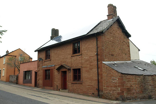 BZD21.jpg 77 Norfolk Road, site of toll house. (taken 23.8.2013) |
||
|
|
||
| evidence:- | old map:- OS County Series (Cmd 58 4) |
|
| source data:- | Maps, County Series maps of Great Britain, scales 6 and 25
inches to 1 mile, published by the Ordnance Survey, Southampton,
Hampshire, from about 1863 to 1948. "Castlegate T.P." line across the road, toll house on N side. |
|
|
|
||
 Act of Parliament Act of Parliament |
||
|
|
||
 Lakes Guides menu.