 Old Cumbria Gazetteer
 |
 |
|
| toll gate, Penrith (3) | ||
| locality:- | Penrith | |
| civil parish:- | Penrith (formerly Cumberland) | |
| county:- | Cumbria | |
| locality type:- | toll gate (site) | |
| coordinates:- | NY51243000 (guess) | |
| 1Km square:- | NY5130 | |
| 10Km square:- | NY53 | |
|
|
||
| evidence:- | old map:- Greenwood 1824 (Cmd) |
|
| source data:- | Map, engraving, Map of the County of Cumberland, scale about 1
inch to 1 mile, etc, by Christopher and John Greenwood,
published by George Pringle jnr, 70 Queen Street, Cheapside,
London, 1823.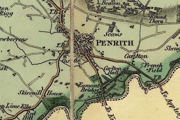 gw12pnrt.jpg "TB" but not located precisely item:- National Library of Scotland : EME.b.3.11 Image © National Library of Scotland |
|
|
|
||
 Act of Parliament Act of Parliament |
||
|
|
||
 Lakes Guides menu.