 Old Cumbria Gazetteer
 |
 |
|
| Rutherford House, Penrith | ||
| Rutherford House | ||
| Street:- | Robinson Street | |
| locality:- | Penrith | |
| civil parish:- | Penrith (formerly Cumberland) | |
| county:- | Cumbria | |
| locality type:- | buildings | |
| coordinates:- | NY51003087 | |
| 1Km square:- | NY5130 | |
| 10Km square:- | NY53 | |
| references:- | Listed Buildings 2010 |
|
|
|
||
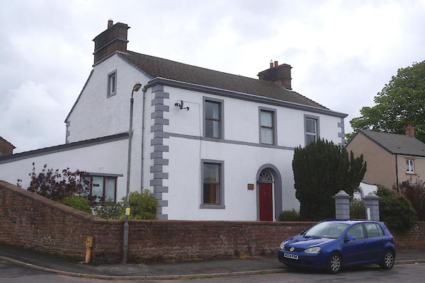 CDD59.jpg (taken 29.5.2015) |
||
|
|
||
| evidence:- | old map:- OS County Series (Cmd 58 4) placename:- Inglewood House |
|
| source data:- | Maps, County Series maps of Great Britain, scales 6 and 25
inches to 1 mile, published by the Ordnance Survey, Southampton,
Hampshire, from about 1863 to 1948. |
|
|
|
||
| evidence:- | database:- Listed Buildings 2010 placename:- Rutherford House |
|
| source data:- | courtesy of English Heritage "RUTHERFORD HOUSE / / ROBINSON STREET / PENRITH / EDEN / CUMBRIA / II / 72920 / NY5100930874" |
|
|
|
||
 Lakes Guides menu.