 Old Cumbria Gazetteer
 |
 |
|
| Fair Hill, Penrith | ||
| Fair Hill | ||
| locality:- | Penrith | |
| civil parish:- | Penrith (formerly Cumberland) | |
| county:- | Cumbria | |
| locality type:- | locality | |
| locality type:- | hill | |
| locality type:- | fair | |
| coordinates:- | NY51233131 (etc) | |
| 1Km square:- | NY5131 | |
| 10Km square:- | NY53 | |
| altitude:- | 516 feet | |
| altitude:- | 157m | |
|
|
||
| evidence:- | old map:- OS County Series (Cmd 58 4) placename:- Fair Hill |
|
| source data:- | Maps, County Series maps of Great Britain, scales 6 and 25
inches to 1 mile, published by the Ordnance Survey, Southampton,
Hampshire, from about 1863 to 1948. "FAIR HILL / (Fairs held here) / 664" |
|
|
|
||
| evidence:- | old map:- Ogilby 1675 (plate 38) |
|
| source data:- | Road strip map, hand coloured engraving, continuation of the
Road from London to Carlisle, scale about 1 inch to 1 mile, by
John Ogilby, London, 1675.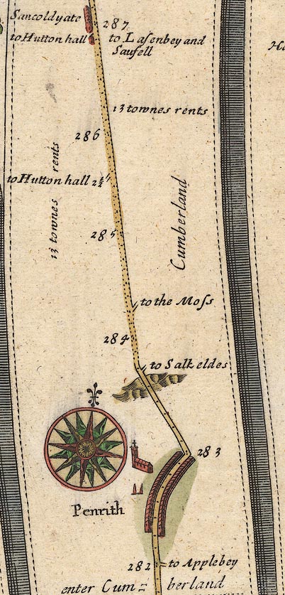 OG38m282.jpg In mile 283, Cumberland. Road ascends a hill. item:- JandMN : 21 Image © see bottom of page |
|
|
|
||
 Lakes Guides menu.