Old Cumbria Gazetteer
 |
 |
|
||
| Eden, River | ||||
| runs into:- |  Eden Estuary Eden Estuary |
|||
|
|
||||
| civil parish:- | Bowness (formerly Cumberland) | |||
| civil parish:- | Rockcliffe (formerly Cumberland) | |||
| civil parish:- | Beaumont (formerly Cumberland) | |||
| civil parish:- | Kingmoor (formerly Cumberland) | |||
| civil parish:- | Carlisle (formerly Cumberland) | |||
| civil parish:- | Wetheral (formerly Cumberland) | |||
| civil parish:- | Cumwhitton (formerly Cumberland) | |||
| civil parish:- | Stanwix Rural (formerly Cumberland) | |||
| civil parish:- | Lazonby (formerly Cumberland) | |||
| civil parish:- | Ainstable (formerly Cumberland) | |||
| civil parish:- | Langwathby (formerly Cumberland) | |||
| civil parish:- | Great Salkeld (formerly Cumberland) | |||
| civil parish:- | Hunsonby (formerly Cumberland) | |||
| civil parish:- | Musgrave (formerly Westmorland) | |||
| civil parish:- | Appleby-in-Westmorland (formerly Westmorland) | |||
| civil parish:- | Murton (formerly Westmorland) | |||
| civil parish:- | Wharton (formerly Westmorland) | |||
| civil parish:- | Kirkby Stephen (formerly Westmorland) | |||
| civil parish:- | Nateby (formerly Westmorland) | |||
| civil parish:- | Mallerstang (formerly Westmorland) | |||
| county:- | Cumbria | |||
| locality type:- | river | |||
| locality type:- | boundary | |||
| locality type:- | parish boundary | |||
| 1Km square:- | NY3658 (etc) | |||
| 10Km square:- | NY35 | |||
| 10Km square:- | NY26 | |||
| 10Km square:- | NY45 | |||
| 10Km square:- | NY54 | |||
| 10Km square:- | NY53 | |||
| 10Km square:- | NY61 | |||
| 10Km square:- | NY70 | |||
| 10Km square:- | SD79 | |||
|
|
||||
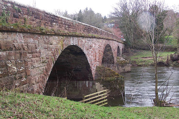
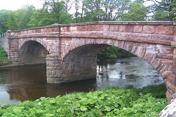
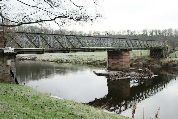
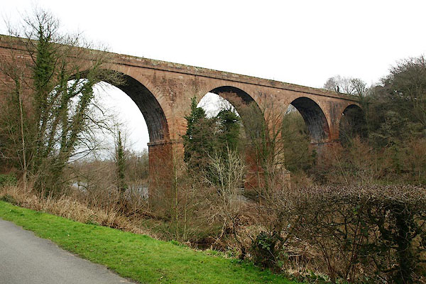
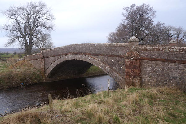
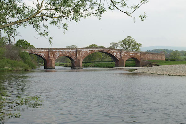
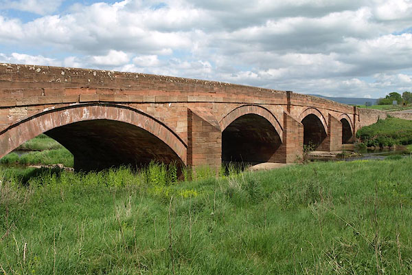
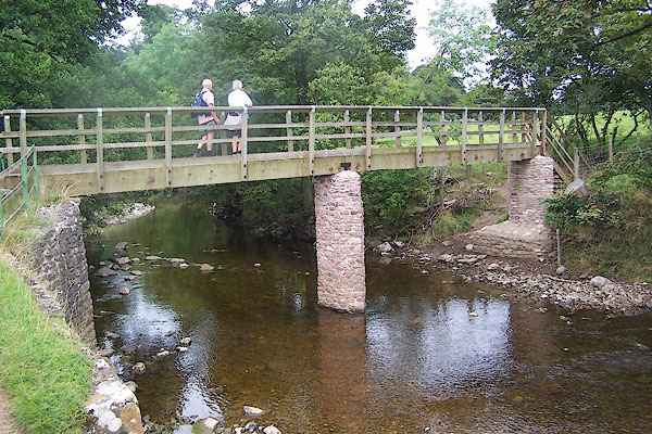
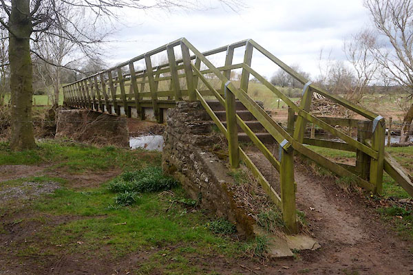
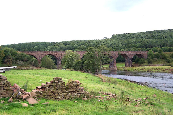
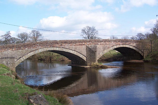
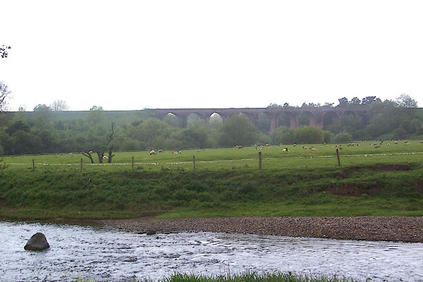
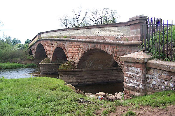
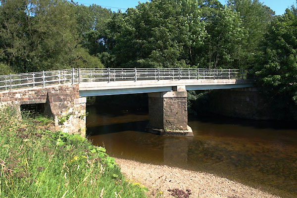
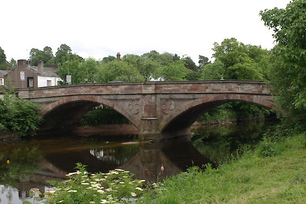
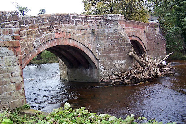
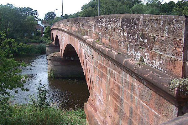
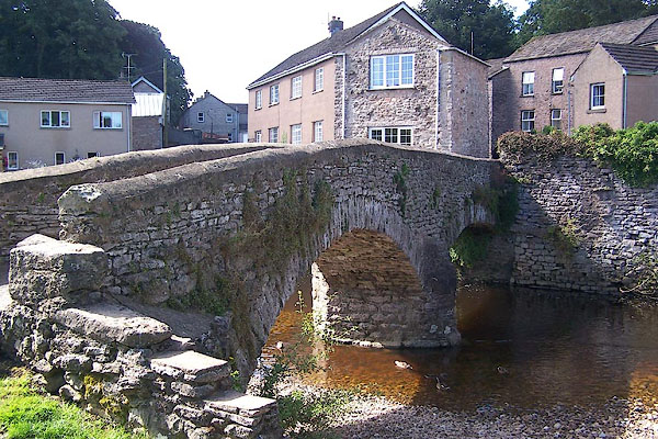
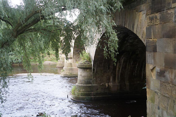
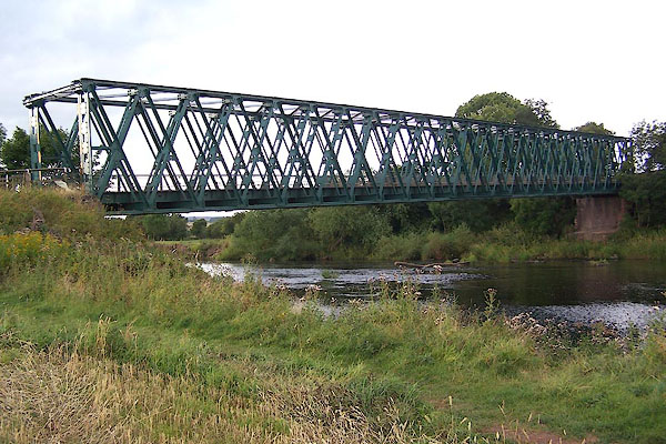
 BME77.jpg At Ousenstand Bridge. (taken 1.6.2006)  BMN32.jpg At Wetheral. (taken 19.8.2006) |
||||
|
|
||||
| evidence:- | old map:- OS County Series (Cmd 16) placename:- Carhead Stream item:- tide |
|||
| source data:- | Maps, County Series maps of Great Britain, scales 6 and 25
inches to 1 mile, published by the Ordnance Survey, Southampton,
Hampshire, from about 1863 to 1948. "Ordinary Spring Tides flow to this point / Carhead Stream" |
|||
|
|
||||
| evidence:- | old map:- OS County Series (Wmd 4 11) placename:- Eden, River |
|||
| source data:- | Maps, County Series maps of Great Britain, scales 6 and 25
inches to 1 mile, published by the Ordnance Survey, Southampton,
Hampshire, from about 1863 to 1948. OS County Series (Wmd 9 9) OS County Series (Wmd 15 7) OS County Series (Wmd 15 12) OS County Series (Wmd 16 9) OS County Series (Wmd 23 2) OS County Series (Wmd 23 11) OS County Series (Wmd 23 15) OS County Series (Wmd 30 2) OS County Series (Wmd 30 7) OS County Series (Wmd 30 11) OS County Series (Wmd 30 15) OS County Series (Wmd 36 3) OS County Series (Cmd 16 5) OS County Series (Cmd 16 14) OS County Series (Cmd 17 13) OS County Series (Cmd 17 14) OS County Series (Cmd 23 3) OS County Series (Cmd 23 4) OS County Series (Cmd 24 6) OS County Series (Cmd 24 15) OS County Series (Cmd 31 12) OS County Series (Cmd 31 16) OS County Series (Cmd 40 6) OS County Series (Cmd 40 14) OS County Series (Cmd 50 2) OS County Series (Cmd 50 6) OS County Series (Cmd 50 10) OS County Series (Cmd 50 15) OS County Series (Cmd 59 4) "River Eden" |
|||
| source data:- | Maps, County Series maps of Great Britain, scales 6 and 25
inches to 1 mile, published by the Ordnance Survey, Southampton,
Hampshire, from about 1863 to 1948. "CHANNEL OF RIVER EDEN" |
|||
| source data:- | Maps, County Series maps of Great Britain, scales 6 and 25
inches to 1 mile, published by the Ordnance Survey, Southampton,
Hampshire, from about 1863 to 1948. Shows an 'Old Course of River Eden'. |
|||
|
|
||||
| evidence:- | old map:- Gough 1350s-60s placename:- Eden Fl. |
|||
| source data:- | Map, colour photozincograph copy, reduced size facsimile, Gough
Map of Britain, scale about 28.5 miles to 1 inch, published by
the Ordnance Survey, Southampton, Hampshire, 1875. click to enlarge click to enlargeGgh1Cm.jpg "fl eden" Running into the Solway Firth. item:- JandMN : 33 Image © see bottom of page |
|||
|
|
||||
| evidence:- | old map:- Gough 1350s-60s placename:- Eden Fl. |
|||
| source data:- | Map, lithograph facsimile, Gough Map of Britain, 20 miles to 1
inch? published by the Ordnance Survey, Southampton, Hampshire,
1935. click to enlarge click to enlargeGgh2Cm.jpg "fl eden" Running into the Solway Firth. item:- JandMN : 34 Image © see bottom of page |
|||
|
|
||||
| evidence:- | old map:- Ptolemy 1540 placename:- Solueus fl. |
|||
| source data:- | Map, copy, uncoloured lithograph? Anglia II Nova Tabula, New Map
of England, scale about 50 miles to 1 inch, data in the
Geographia by Claudius Ptolemy, engraved by Sebastian Munster,
Basle, Switzerland, 1540.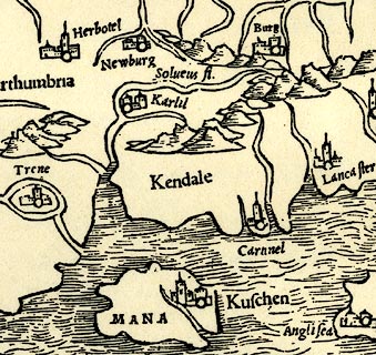 click to enlarge click to enlargePTY4Cm.jpg "Solueus fl." tapering wiggly double line; river item:- private collection : 131 Image © see bottom of page |
|||
|
|
||||
| evidence:- | old map:- Lloyd 1573 placename:- Eden Fl. |
|||
| source data:- | Map, hand coloured copper plate engraving, Angliae Regni,
Kingdom of England, with Wales, scale about 24 miles to 1 inch, authored by Humphrey
Lloyd, Denbigh, Clwyd, drawn and engraved
by Abraham Ortelius, Netherlands, 1573. click to enlarge click to enlargeLld1Cm.jpg "Eden fl." item:- Hampshire Museums : FA1998.69 Image © see bottom of page |
|||
|
|
||||
| evidence:- | old map:- Ptolemy 1578 |
|||
| source data:- | Map, hand coloured engraving, Prima Europe tabula, Europe Map 1,
Ptolemy map of roman Britain, by Gerard Mercator, 1578. click to enlarge click to enlargePty1Cm.jpg item:- private collection : 13 Image © see bottom of page |
|||
|
|
||||
| evidence:- | old map:- Saxton 1579 placename:- Eden Flu. |
|||
| source data:- | Map, hand coloured engraving, Westmorlandiae et Cumberlandiae Comitatus ie Westmorland
and Cumberland, scale about 5 miles to 1 inch, by Christopher Saxton, London, engraved
by Augustinus Ryther, 1576, published 1579-1645. Sax9NY35.jpg "Eden flu:"  Sax9NY45.jpg 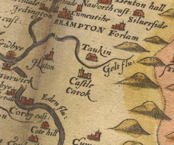 Sax9NY55.jpg "Eden flu:"  Sax9NY54.jpg  Sax9NY53.jpg  Sax9NY62.jpg  Sax9NY71.jpg "Eden flu:" 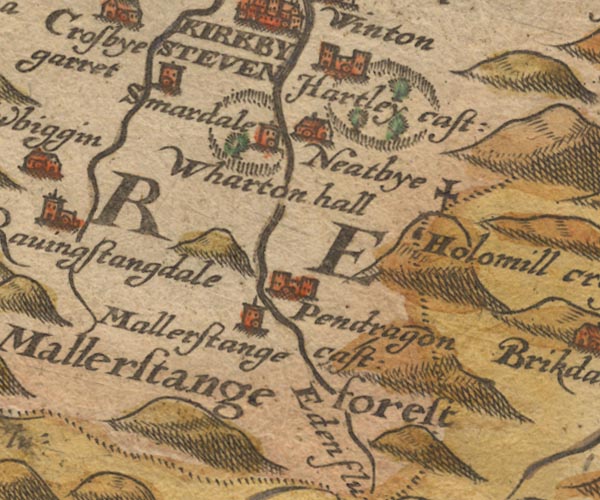 Sax9NY70.jpg "Eden flu:" item:- private collection : 2 Image © see bottom of page |
|||
|
|
||||
| evidence:- | old map:- Burghley 1590 (facsimile) placename:- Eden flu. |
|||
| source data:- | Facsimile map, A Platt of the Opposete Border of Scotland to ye West Marches of England,
parts of Cumberland and Scotland including the Debateable Land, from a manuscript
drawn for William Cecil, Lord Burghley, about 1590, published by R B Armstrong, 1897. courtesy of the National Library of Scotland 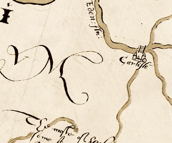 M048NY35.jpg "Eden flu" river item:- National Library of Scotland : MS6113 f.267 Image © National Library of Scotland |
|||
|
|
||||
| evidence:- | old map:- Mercator 1595 (edn?) placename:- Eden flu. |
|||
| source data:- | Map, hand coloured engraving, Northumbria, Cumberlandia, et
Dunelmensis Episcopatus, ie Northumberland, Cumberland and
Durham etc, scale about 6.5 miles to 1 inch, by Gerard Mercator,
Duisberg, Germany, about 1595. MER8CumD.jpg "Eden flu." double line with stream lines; river, county boundary with Westmorland near Langwathby item:- JandMN : 169 Image © see bottom of page |
|||
|
|
||||
| evidence:- | old map:- Mercator 1595 (edn?) placename:- Eden flu. |
|||
| source data:- | Map, hand coloured engraving, Westmorlandia, Lancastria, Cestria
etc, ie Westmorland, Lancashire, Cheshire etc, scale about 10.5
miles to 1 inch, by Gerard Mercator, Duisberg, Germany, 1595,
edition 1613-16. MER5WmdA.jpg "Eden flu." double line with stream lines; river item:- Armitt Library : 2008.14.3 Image © see bottom of page |
|||
|
|
||||
| evidence:- | old map:- Keer 1605 |
|||
| source data:- | Map, hand coloured engraving, Westmorland and Cumberland, scale
about 16 miles to 1 inch, probably by Pieter van den Keere, or
Peter Keer, about 1605 edition perhaps 1676. click to enlarge click to enlargeKER8.jpg "" double wiggly line, tapering to single; river item:- Dove Cottage : 2007.38.110 Image © see bottom of page |
|||
|
|
||||
| evidence:- | old map:- Speed 1611 (Cum/EW) |
|||
| source data:- | Map, hand coloured engraving, Kingdome of Great Britaine and
Ireland, scale about 36 miles to 1 inch, by John Speed, about
1610-11, published by Thomas Bassett, Fleet Street and Richard
Chiswell, St Paul's Churchyard, London, 1676? click to enlarge click to enlargeSPD6Cm.jpg tapering wiggly line, and in Westmorland item:- private collection : 85 Image © see bottom of page |
|||
|
|
||||
| evidence:- | old map:- Speed 1611 (Cmd) placename:- Eden flu. |
|||
| source data:- | Map, hand coloured engraving, Cumberland and the Ancient Citie
Carlile Described, scale about 4 miles to 1 inch, by John Speed,
1610, published by J Sudbury and George Humble, Popes Head
Alley, London, 1611-12. SP11NY36.jpg runs out to its estuary  SP11NY55.jpg "Eden flu" double line with stream lines 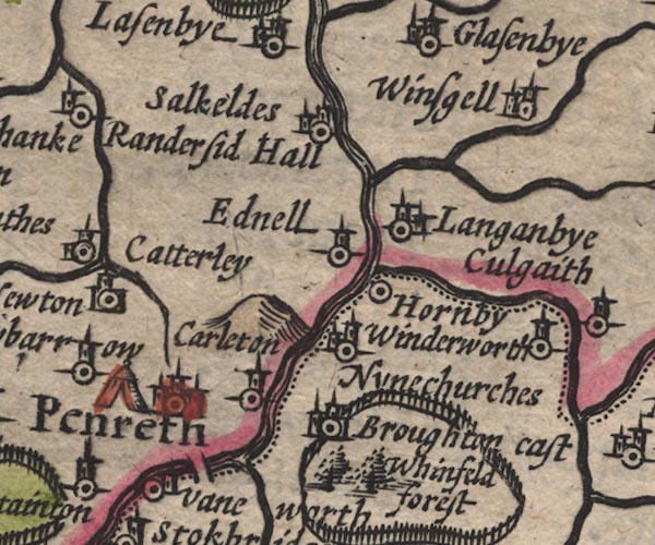 SP11NY53.jpg double line with stream lines, then wiggly line; county boundary item:- private collection : 16 Image © see bottom of page |
|||
|
|
||||
| evidence:- | old map:- Speed 1611 (Wmd) placename:- Ituna flu. |
|||
| source data:- | Map, hand coloured engraving, The Countie Westmorland and
Kendale the Cheif Towne, scale about 2.5 miles to 1 inch, by
John Speed, 1610, published by George Humble, Popes Head Alley,
London, 1611-12.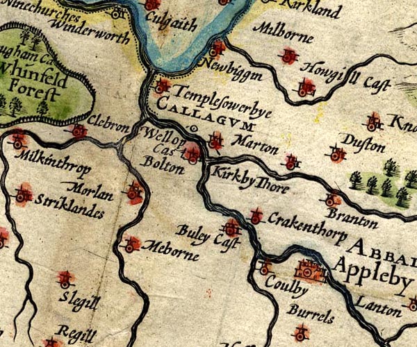 SP14NY62.jpg double line  SP14NY71.jpg "ITUNA flu" double line  SP14NY70.jpg "Eden flud" double line item:- Armitt Library : 2008.14.5 Image © see bottom of page |
|||
|
|
||||
| evidence:- | poem:- Drayton 1612/1622 text placename:- Eden item:- Garden of Eden |
|||
| source data:- | Poem, Poly Olbion, by Michael Drayton, published by published by
John Marriott, John Grismand and Thomas Dewe, and others?
London, part 1 1612, part 2 1622. goto source page 162:- "... ... Eden, issuing out of Husseat-Morvill Hill, And pointing to the North, as then a little Rill, There simply takes her leave of her sweet sister Swale, Borne to the selfe same Sire, but with a stronger gale, Tow'rds the Humber hyes her course, but Eden making on, Through Malerstrang hard by, a Forrest woe begone In love with Edens eyes, of the cleere Naiades kind, Whom thus the Wood-Nymph greets: What passage thou shalt find, My most beloved Brook, in making to thy Bay, That wandring art to wend through many a crooked way, Farre under hanging Hills, through many a cragged strait, And few the watry kind, upon thee to await, Opposed in thy course with many a rugged Cliffe, Besides the Northern winds against thy stream to stiffe, As by maine strength they meant to stop thee in thy course, And send the easly back to Morvill to thy source. O my bright lovely Brooke, whose name doth beare the sound Of Gods first Garden-plot, th'imparadized ground, Wherein he placed Man, from whence by sinne he fell. O little blessed Brooke, how doth my bosome swell, / With" goto sourcepage 163:- "With love I beare to thee, the day cannot suffice For Malerstrang to gaze upon thy beautious eyes." "This say'd, the Forrest rubd her rugged front the while, Cleere Eden looking back, regrets her with a smile, And simply takes her leave, to get into the Maine; When Below a bright Nymph, from Stanmore downe doth straine To Eden, as along to Appleby shee makes, Which passing, to her traine, next Troutbeck in shee takes, And Levenant, then these,a somewhat lesser Rill, When Glenkwin greets her well, and happily to fill, Her more abundant Banks, from Ulls, a mightie Mere On Cumberlands confines, comes Eymot neat and cleere, And Loder doth allure, with whom she haps to meet, ..." "When Eden, though shee seem'd to make unusuall haste, About cleere Loders neck, yet lovingly doth cast Her oft infolding Armes, as Westmerland shee leaves, Where Cumberland againe as kindly her receives. Yet up her watry hands, to Winfield Forrest holds In her rough wooddy armes, which amorously infolds Cleere Eden comming by, with all her watry store, In her dark shades, and seemes her parting to deplore." "... ..." goto sourcepage 166:- "... cleere Eden intertaine, To Cumberland com'n in, from the Westmerian wasts, Whereas the readyest way to Carlill, as shee casts, Shee with two Wood-Nymphs meets, the first is great and wilde, And Westward Forrest hight, the other but a childe, Compared with her Phere, and Inglewood is cald, Both in their pleasant Scites, most happily instald." goto sourcepage 167:- "..." "At Eden now arriv'd, whom we have left too long, Which being com'n at length, the Cumbrian hils among, As shee for Carlill coasts, the Floods from every where, Prepare each in their course, to entertaine her there, From Skidow her tall Sire, first Cauda cleerely brings In Eden all her wealth; so Petterell from her Springs, (Not farre from Skidows foot, whence dainty Cauda creeps) Along to overtake her Soveraigne Eden sweeps, To meet that great concourse, which seriously attend That dainty Cumbrian Queene; whence Gilsland downe doth send Her Riverets to receive Queene Eden in her course; As Irthing comming in from her most plenteous source, Through many a cruell Crag, though she be forc'd to crawle, Yet working forth her way to grace her selfe with all, First Pultrosse is her Page, then Gelt she gets her guide, Which springeth on her South, on her Septentrion side, Shee crooked Cambeck calls, to wait on her along, And Eden overtakes amongst the watry throng. To Carlill being come, cleere Bruscath beareth in, To greet her with the rest, when Eden as to win Her grace in Carlils sight, the Court of all her state, And Cumberlands chiefe towne, loe thus shee doth dilate." "What giveth more delight, (brave Citie) to thy Seat, Then my sweet lovely selfe, a River so compleat, With all that Nature can a dainty Flood endow, That all the Northerne Nymphs me worthily allow, Of all their Nyades kind the neatest, and so farre Transcending, that oft times they in their amorous warre, Have offered by my course, and Beauties to decide The mastery, with her most vaunting in her pride, That mighty Roman Fort, which of the Picts we call But by them neere those times was stil'd Severus wall, Of that great Emperour nam'd, which first that worke began, Betwixt the Irish Sea, and German Ocean, Doth cut me in his course neere Carlill, and doth end At Boulnesse, where my selfe I on the Ocean spend." |
|||
|
|
||||
| evidence:- | old map:- Drayton 1612/1622 placename:- Eden Flu. |
|||
| source data:- | Map, hand coloured engraving, Cumberlande and Westmorlande, by
Michael Drayton, probably engraved by William Hole, scale about
4 or 5 miles to 1 inch, published by John Mariott, John
Grismand, and Thomas Dewe, London, 1622.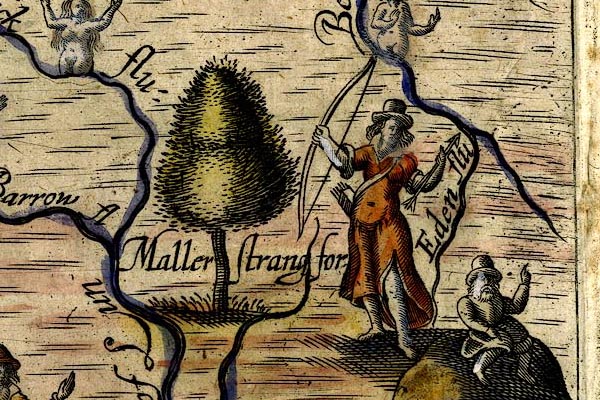 DRY525.jpg "Eden flu" River. item:- JandMN : 168 Image © see bottom of page |
|||
|
|
||||
| evidence:- | table of distances:- Simons 1635 |
|||
| source data:- | Table of distances, uncoloured engraving, Cumberland, with a
thumbnail map, scale about 41 miles to 1 inch, by Mathew Simons,
published in A Direction for the English Traviller, 1635.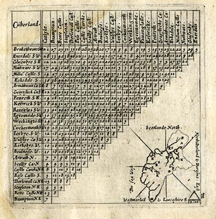 click to enlarge click to enlargeSIM4.jpg on thumbnail map item:- private collection : 50.11 Image © see bottom of page |
|||
|
|
||||
| evidence:- | table of distances:- Simons 1635 |
|||
| source data:- | Table of distances, uncoloured engraving, Westmerland ie
Westmorland, with a thumbnail map, scale about 42 miles to 1
inch, by Mathew Simons, published in A Direction for the English
Traviller, 1635.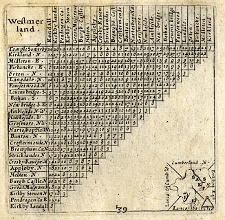 click to enlarge click to enlargeSIM3.jpg on thumbnail map item:- private collection : 50.39 Image © see bottom of page |
|||
|
|
||||
| evidence:- | old map:- Jenner 1643 |
|||
| source data:- | Table of distances, with map, hand coloured engraving,
Cumberland, scale about 21 miles to 1 inch, engraved by Jacob
van Langeren, published by Thomas Jenner, Cornhill, London, 1643. JEN4Sq.jpg wiggly line item:- private collection : 52.Cmd Image © see bottom of page |
|||
|
|
||||
| evidence:- | old map:- Jenner 1643 |
|||
| source data:- | Table of distances, with map, hand coloured engraving,
Westmerland ie Westmorland, scale about 16 miles to 1 inch,
engraved by Jacob van Langeren, published by Thomas Jenner,
Cornhill, London, 1643. JEN3Sq.jpg wiggly line item:- private collection : 52.Wmd Image © see bottom of page |
|||
|
|
||||
| evidence:- | old map:- Jansson 1646 placename:- Eden Flude placename:- Eden Flud |
|||
| source data:- | Map, hand coloured engraving, Cumbria and Westmoria, ie
Cumberland and Westmorland, scale about 3.5 miles to 1 inch, by
John Jansson, Amsterdam, Netherlands, 1646.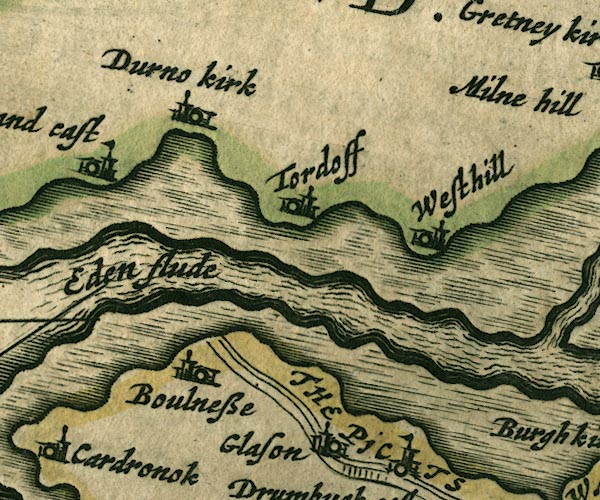 JAN3NY26.jpg "Eden flude"  JAN3NY36.jpg  JAN3NY35.jpg  JAN3NY45.jpg 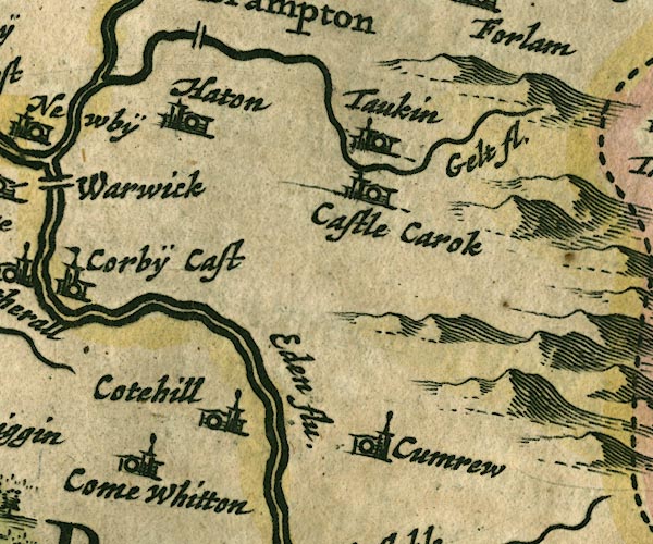 JAN3NY55.jpg "Eden flu."  JAN3NY54.jpg  JAN3NY53.jpg  JAN3NY62.jpg 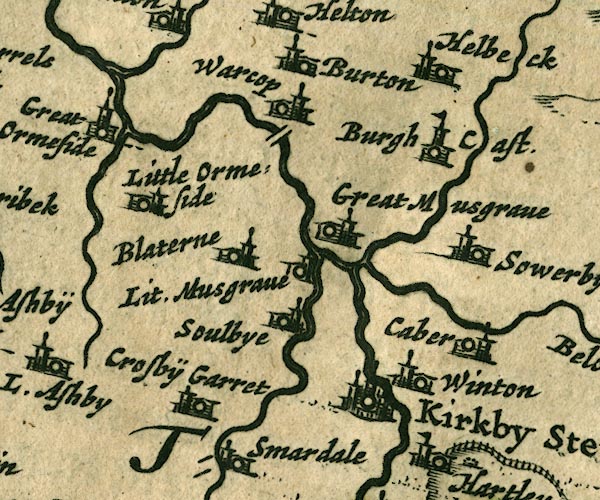 JAN3NY71.jpg 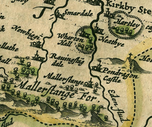 JAN3NY70.jpg "Eden flud" Double line with stream lines, tapering to single line; county boundary for a short stretch. item:- JandMN : 88 Image © see bottom of page |
|||
|
|
||||
| evidence:- | old map:- Ogilby 1675 (plate 62) placename:- Eden Flu. |
|||
| source data:- | Raod strip map, uncoloured engraving, the Road from Carlisle to
Barwick, scale about 1 inch to 1 mile, by John Ogilby, London,
1675. OG62m000.jpg In mile 0, Cumberland. "Eden flu" river further (north) side of Carlisle, crossed by the road, no bridge is drawn. item:- JandMN : 83 Image © see bottom of page |
|||
|
|
||||
| evidence:- | old map:- Ogilby 1675 (plate 86) placename:- Eden Fluvius |
|||
| source data:- | Road strip map, uncoloured engraving, the Road from Tinmouth ...
to Carlisle, scale about 1 inch to 1 mile, by John Ogilby,
London, 1675.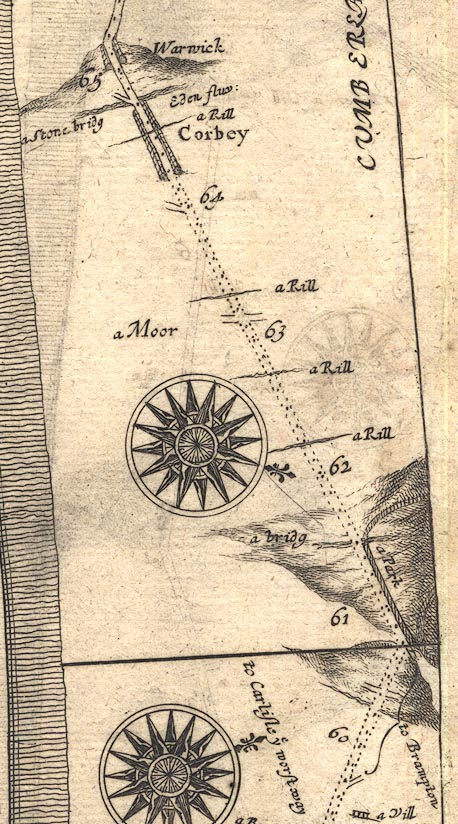 OG86m060.jpg In mile 64, Cumberland. "a Stone bridg Eden fluv:" crossed by the road, no bridge is drawn. 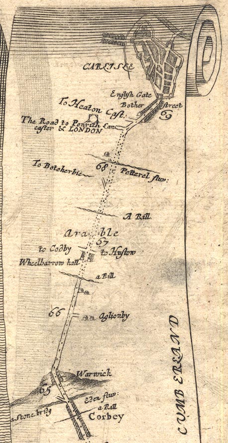 OG86m065.jpg In mile 69, Cumberland. River drawn on the further side (north) of Carlisle, crossed by the road north. item:- JandMN : 73 Image © see bottom of page |
|||
|
|
||||
| evidence:- | old map:- Ogilby 1675 (plate 96) placename:- Eden Fluvius |
|||
| source data:- | Road strip map, hand coloured engraving, the Road from Kendal to
Cockermouth, and the Road from Egremond to Carlisle, scale about
1 inch to 1 mile, by John Ogilby, London, 1675.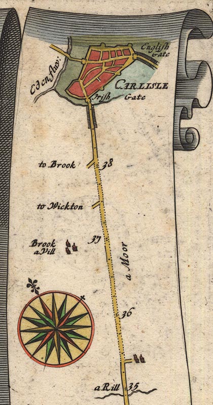 OG96Bm35.jpg In mile 39, Cumberland. "Eden fluv:" river to the left of the road, crossed by a road left (north west) out of Carlisle. item:- JandMN : 22 Image © see bottom of page |
|||
|
|
||||
| evidence:- | old map:- Ogilby 1675 (plate 38) placename:- Eden Flu. |
|||
| source data:- | Road strip map, hand coloured engraving, continuation of the
Road from London to Carlisle, scale about 1 inch to 1 mile, by
John Ogilby, London, 1675.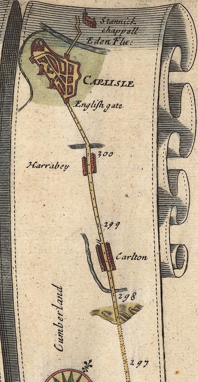 OG38m297.jpg In mile 301, Cumberland. "Eden Flu:" beyond (north) of the town, crossed by the north road, no bridge drawn. item:- JandMN : 21 Image © see bottom of page |
|||
|
|
||||
| evidence:- | old map:- Sanson 1679 placename:- Eden fl. |
|||
| source data:- | Map, hand coloured engraving, Ancien Royaume de Northumberland
aujourdhuy Provinces de Nort, ie the Ancient Kingdom of
Northumberland or the Northern Provinces, scale about 9.5 miles
to 1 inch, by Nicholas Sanson, Paris, France, 1679. click to enlarge click to enlargeSAN2Cm.jpg "Eden fl." tapering wiggly line; river, double line with stream lines for lower reaches, county boundary with Westmorland item:- Dove Cottage : 2007.38.15 Image © see bottom of page |
|||
|
|
||||
| evidence:- | old map:- Seller 1694 (Wmd) |
|||
| source data:- | Map, hand coloured engraving, Westmorland, scale about 8 miles
to 1 inch, by John Seller, 1694. click to enlarge click to enlargeSEL7.jpg tapering wiggly line; river; county boundary, part item:- Dove Cottage : 2007.38.87 Image © see bottom of page |
|||
|
|
||||
| evidence:- | old map:- Seller 1694 (Cmd) |
|||
| source data:- | Map, uncoloured engraving, Cumberland, scale about 12 miles to 1
inch, by John Seller, 1694. click to enlarge click to enlargeSEL9.jpg tapering wiggly line; river item:- Dove Cottage : 2007.38.89 Image © see bottom of page |
|||
|
|
||||
| evidence:- | old map:- Morden 1695 (EW) |
|||
| source data:- | Map, hand coloured engraving, England, including Wales, scale
about 27 miles to 1 inch, by Robert Morden, published by Abel
Swale Awnsham and John Churchil, London, about 1695. click to enlarge click to enlargeMRD3Cm.jpg tapering wiggly line item:- JandMN : 339 Image © see bottom of page |
|||
|
|
||||
| evidence:- | old map:- Morden 1695 (Cmd) placename:- Eden River placename:- Itunae Flu. |
|||
| source data:- | Map, uncoloured engraving, Cumberland, scale about 4 miles to 1
inch, by Robert Morden, 1695, published by Abel Swale, the
Unicorn, St Paul's Churchyard, Awnsham, and John Churchill, the
Black Swan, Paternoster Row, London, 1695-1715.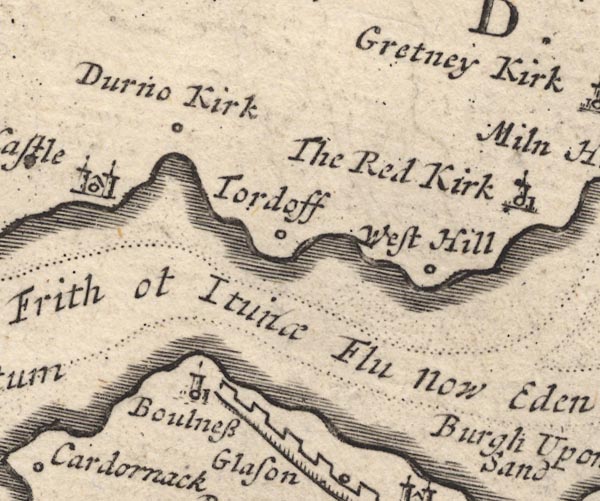 MD12NY26.jpg "Solway Frith ot Itunae Flu now Eden R." 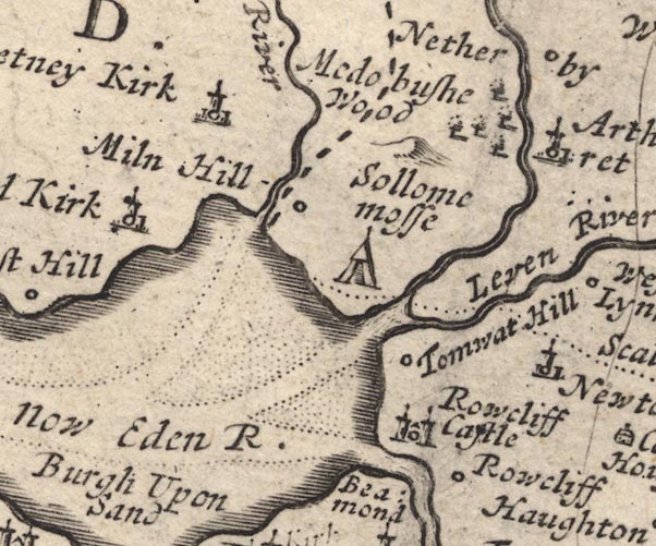 MD12NY36.jpg 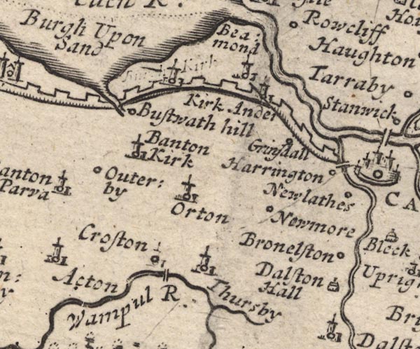 MD12NY35.jpg  MD12NY45.jpg  MD12NY55.jpg "Eden R." 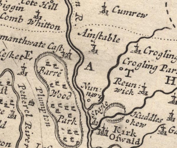 MD12NY54.jpg 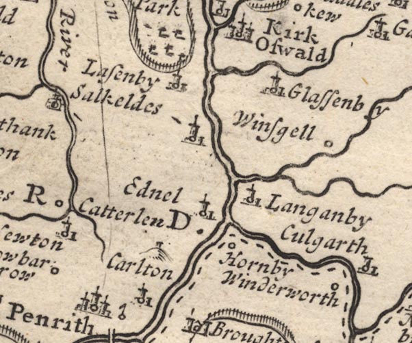 MD12NY53.jpg 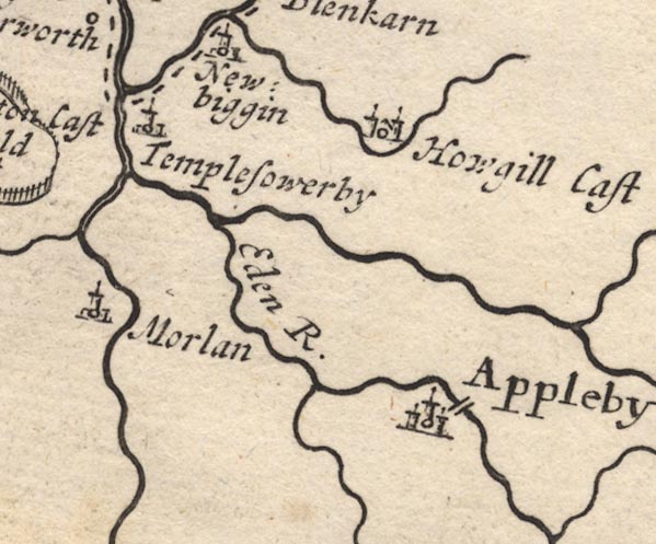 MD12NY62.jpg "Eden R." item:- JandMN : 90 Image © see bottom of page |
|||
|
|
||||
| evidence:- | old map:- Morden 1695 (Wmd) placename:- Eden River placename:- Hunna Flu. |
|||
| source data:- | Map, hand coloured engraving, Westmorland, scale about 2.5 miles to 1 inch, by Robert
Morden, published by Abel Swale, the Unicorn, St Paul's Churchyard, Awnsham, and John
Churchill, the Black Swan, Paternoster Row, London, 1695. MD10NY53.jpg 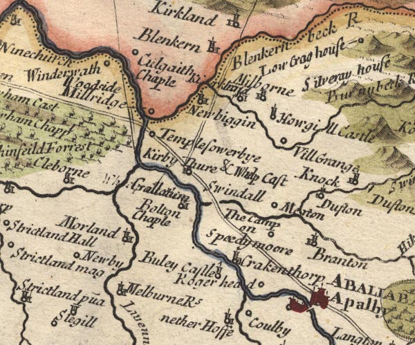 MD10NY62.jpg With the county boundary drawn alongside. 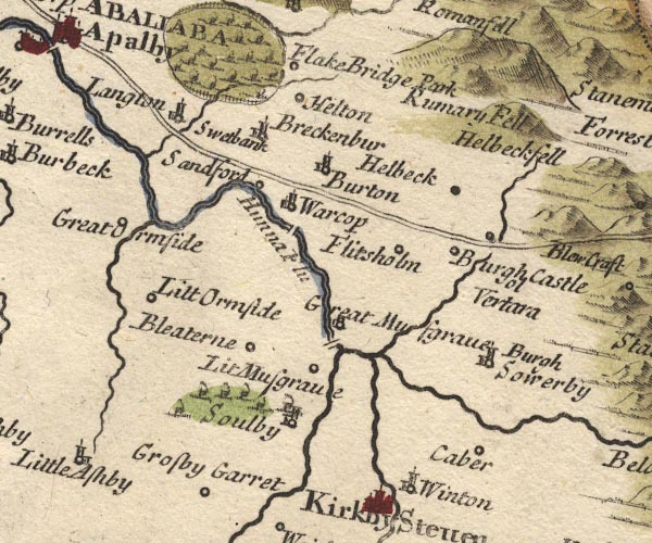 MD10NY71.jpg "Hunna Flu" 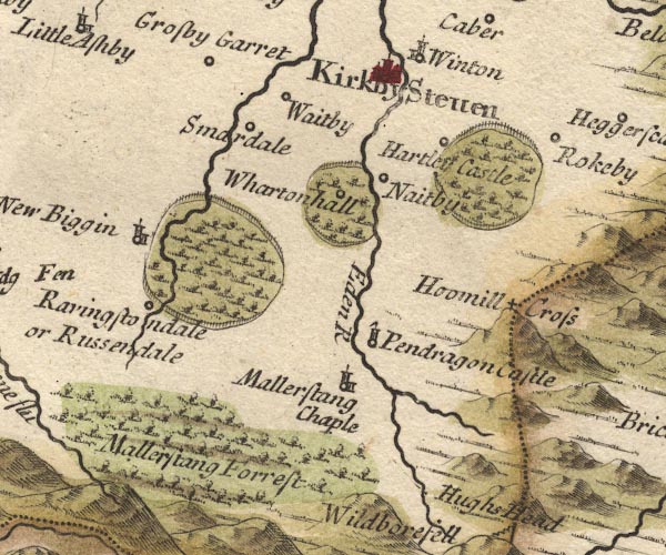 MD10NY70.jpg "Eden R" item:- JandMN : 24 Image © see bottom of page |
|||
|
|
||||
| evidence:- | descriptive text:- Fiennes 1698 item:- eagle; cormorant; fish, Eden river; salmon; trout |
|||
| source data:- | Travel book, manuscript record of Journeys through England
including parts of the Lake District, by Celia Fiennes, 1698. "I walked round the walls [of Carlisle] and saw the river, ... called the Emount ... the other river is the Essex which is very broad and ebbs and flows about a mile or two off; ..." "..." "... leaving this river [Eamont] I came to the Essex which is very broad and hazardous to crosse even when the tyde is out, by which it leaves a broad sand on each side which in some places is unsafe - made me take a good Guide which carry'd me aboute and a crosse some part of it here and some part in another place, it being deep in the channell where I did crosse which was in sight of the mouth of the river that runs into the sea; on the sand before the water was quite gone from it, I saw a great bird which look'd almost black picking up fish and busking in the water, it looked like an Eagle and by its dimentions could scarce be any other bird." |
|||
|
|
||||
| evidence:- | old map:- Bowen 1720 (plate 94) placename:- Eden Flu. |
|||
| source data:- | Strip maps, uncoloured engravings, road maps, The Road from
London to Carlisle, scale about 2 miles to 1 inch, with sections
in Lancashire and Westmorland, published by Emanuel Bowen, St
Katherines, London, 1720.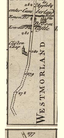 B094m277.jpg item:- Dove Cottage : 2007.38.100 Image © see bottom of page |
|||
|
|
||||
| evidence:- | old map:- Bowen 1720 (plate 161) placename:- Eden Fluvius |
|||
| source data:- | Road strip map, uncoloured engraving, pl.161, part of The Road
from Carlisle to Barwick, scale about 2 miles to 1 inch, with
sections in Cumberland, and Scotland, published by Emanuel
Bowen, St Katherines, London, 1720. B161m00.jpg "Eden Fluvius" item:- JandMN : 65.161 Image © see bottom of page |
|||
|
|
||||
| evidence:- | old map, descriptive text:- Bowen 1720 (plate 162) |
|||
| source data:- | Road book, Britannia Depicta Or Ogilby Improv'd, including road
strip maps with sections in Westmorland and Cumberland, scale
about 2 miles to 1 inch, derived from maps by Ogilby, 1675, also
a county map of Westmorland, scale about 8 miles to 1 inch, and
of Cumberland, scale about 16.5 miles to 1 inch, each with text,
by John Owen, published by Emanuel Bowen, London, 1720;
published 1720-64. "The Eden (at 1 P.161) after having receiv'd several other considerable Rivers, empties it self into ye Ituni: an Bay, ..." |
|||
|
|
||||
| evidence:- | old map:- Bowen 1720 (plate 232) placename:- Eden Fluvius |
|||
| source data:- | Road strip map, road map, pl.232, part of The Road from Tinmouth
to Carlisle, scale about 2 miles to 1 inch, with sections in
Northumberland and Cumberland, published by Emanuel Bowen, St
Katherines, London, 1720.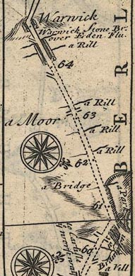 B232m60.jpg "Warwick Stone Br. over Eden Flu; mile 64½." item:- JandMN : 65.232 Image © see bottom of page |
|||
|
|
||||
| evidence:- | old map:- Stukeley 1723 |
|||
| source data:- | Road map, uncoloured engraving, the Antonine Itineraries through
Britain, scale about 55 miles to 1 inch, plotted by William
Stukeley, 1723, published London, 1724. click to enlarge click to enlargeStu1Cm.jpg item:- Hampshire Museums : FA2001.171 Image © see bottom of page |
|||
|
|
||||
| evidence:- | descriptive text:- Defoe 1724-26 placename:- Eden, River |
|||
| source data:- | Tour through England and Wales, by Daniel Defoe, published in
parts, London, 1724-26. "... The River Eden, the last river in England on this side, as the Tyne is on the other, rises in this part out of the side of a monstrous high mountain, called Mowill Hill, or Wildbore Fell, which you please; ..." |
|||
|
|
||||
| evidence:- | old map:- Badeslade 1742 placename:- Eden, River |
|||
| source data:- | Maps, Westmorland North from London, scale about 10 miles to 1
inch, and Cumberland North from London, scale about 11 miles to
1 inch, with descriptive text, by Thomas Badeslade, London,
engraved and published by William Henry Toms, Union Court,
Holborn, London, 1742; published 1742-49. "... the River Eimot, which receives the Loder, and at last unites with the Eden. ... The River Eden rises in the E. part of the County, receives first the little River Belo, afterwards Blenkern, &at the N. point unites with Eimot, and flows into Cumberland." |
|||
|
|
||||
| evidence:- | old map:- Badeslade 1742 placename:- Eden River |
|||
| source data:- | Map, uncoloured engraving, A Map of Cumberland North from
London, scale about 11 miles to 1 inch, with descriptive text,
by Thomas Badeslade, London, engraved and published by William
Henry Toms, Union Court, Holborn, London, 1742. click to enlarge click to enlargeBD10.jpg "Eden R" tapering wiggly line item:- JandMN : 115 Image © see bottom of page |
|||
|
|
||||
| evidence:- | old map:- Badeslade 1742 placename:- Eden River |
|||
| source data:- | Map, uncoloured engraving, A Map of Westmorland North from
London, scale about 10 miles to 1 inch, with descriptive text,
by Thomas Badeslade, London, engraved and published by William
Henry Toms, Union Court, Holborn, London, 1742. click to enlarge click to enlargeBD12.jpg "Eden R." tapering wiggly line; county boundary item:- Dove Cottage : 2007.38.62 Image © see bottom of page |
|||
|
|
||||
| evidence:- | old text:- Gents Mag item:- rebellion, 1745; 1745 Rebellion |
|||
| source data:- | Magazine, The Gentleman's Magazine or Monthly Intelligencer or
Historical Chronicle, published by Edward Cave under the
pseudonym Sylvanus Urban, and by other publishers, London,
monthly from 1731 to 1922. goto source Gentleman's Magazine 1746 p.233 "On Thursday [7.11.1745] the eastermost column had gained Stangarth side on the English border, ... that night we learn'd that they had turn'd to the right for Longtown, which gave us hopes that they would continue their march for Row-cliff and pass the river Eden there, the dryness of the season having reduc'd that stream to a tolerable fording in several places below Carlisle." |
|||
|
|
||||
| evidence:- | descriptive text:- Simpson 1746 placename:- placename:- Ituna |
|||
| source data:- | Atlas, three volumes of maps and descriptive text published as
'The Agreeable Historian, or the Compleat English Traveller
...', by Samuel Simpson, 1746. goto source Page 1020:- "..." "The most noble River in this County [Westmoreland] is the Eden, or Ituna of Ptolomy, which we mentioned in Cumberland. It rises at a Place called Hugh Seat Morville, or Hugh Morvill's Hill, ... In its long Course it receives twelve Rivers and Brooks, some of which are considerable Streams; so that before it joins the Eimot, 'tis a very large River. Tradition says that Uter Pendragon made great Efforts to bring this River from its old Channel, but to no Purpose, which gave Occasion for the Rhyme," "Let Uter Pendragon do what he can, / The River Eden will run as it ran." |
|||
|
|
||||
| evidence:- | old map:- Simpson 1746 map (Wmd) placename:- Eden River placename:- Hunna River |
|||
| source data:- | Map, uncoloured engraving, Westmorland, scale about 8 miles to 1
inch, printed by R Walker, Fleet Lane, London, 1746. SMP2NYL.jpg "Eden R." Wiggly line, double line and stream lines.  SMP2NYR.jpg Wiggly line. 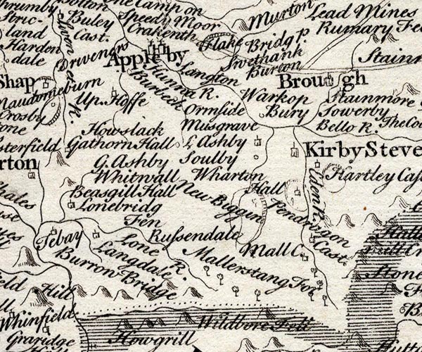 SMP2NYQ.jpg "Hunna R." "Eden R." Wiggly line. item:- Dove Cottage : 2007.38.59 Image © see bottom of page |
|||
|
|
||||
| evidence:- | descriptive text:- Simpson 1746 placename:- Eden, River |
|||
| source data:- | Atlas, three volumes of maps and descriptive text published as
'The Agreeable Historian, or the Compleat English Traveller
...', by Samuel Simpson, 1746. goto source "There are many considerable Rivers in this County, and large Bodies of Water, which the Inhabitants call'd Meres. Of the Rivers, the Chief are the Eden, and the Derwent: the Eden takes its Rise from Ulles Water, and after a Course of about 30 Miles" goto source"to the Northward, turns to the West, and passing by Carlisle, falls into the Solway Frith. ..." |
|||
|
|
||||
| evidence:- | old text:- Gents Mag placename:- Pontem indignatus Araxes item:- limestone |
|||
| source data:- | Magazine, The Gentleman's Magazine or Monthly Intelligencer or
Historical Chronicle, published by Edward Cave under the
pseudonym Sylvanus Urban, and by other publishers, London,
monthly from 1731 to 1922. goto source Gentleman's Magazine 1754 p.230 "... [Kirkby Stephen]" "The village is situated on the west bank of the river Eden, which takes its rise from Hughstat mountain, about six miles higher up, on the skirts of Yorkshire, near the sources of the Swale and the Rother. ..." "..." "The river Eden, which below Carlisle becomes the Pontem indignatus Araxes of Virgil, admits here of all varieties of bridges, even of stepping stones; and as the whole town, or rather whole county, is one bed of limestone, we may observe most amazing varieties in the cradle of the river, wrought by time and the constant force of a rapid current." |
|||
|
|
||||
| evidence:- | old map:- Bowen and Kitchin 1760 |
|||
| source data:- | Map, hand coloured engraving, A New Map of the Counties of
Cumberland and Westmoreland Divided into their Respective Wards,
scale about 4 miles to 1 inch, by Emanuel Bowen and Thomas
Kitchin et al, published by T Bowles, Robert Sayer, and John
Bowles, London, 1760.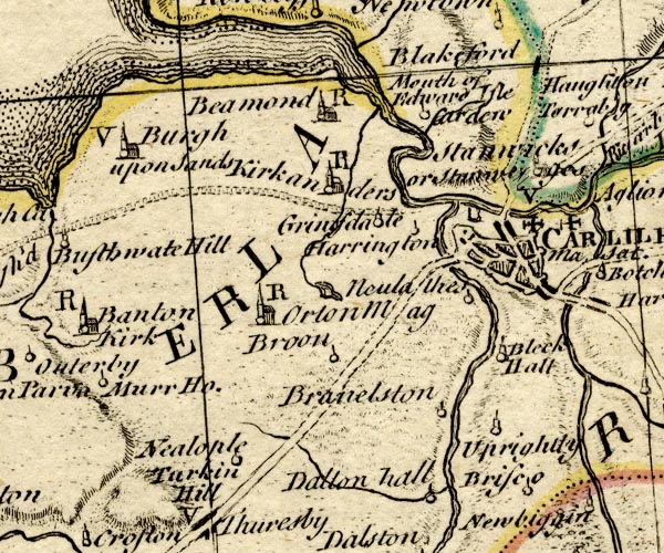 BO18NY35.jpg river mouth into the sea  BO18NY55.jpg "Eden R." double line with stream lines 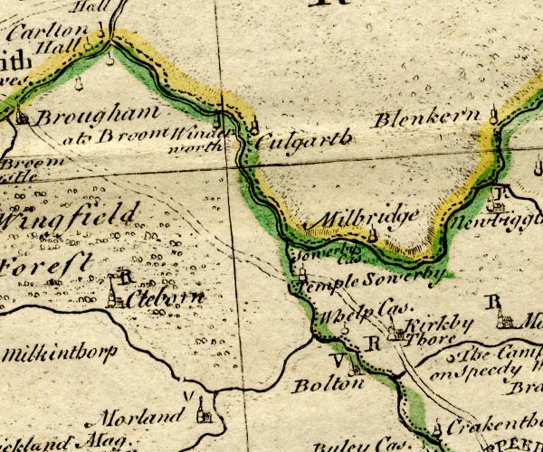 BO18NY52.jpg double line, county boundary Westmorland Cumberland 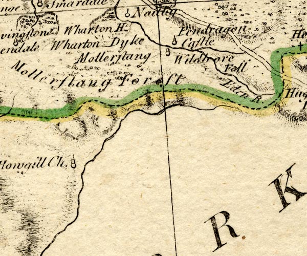 BO18NY70.jpg "Eden R." wiggly line item:- Armitt Library : 2008.14.10 Image © see bottom of page |
|||
|
|
||||
| evidence:- | old map:- Jefferys 1770 (Wmd) placename:- Eden River |
|||
| source data:- | Map, 4 sheets, The County of Westmoreland, scale 1 inch to 1
mile, surveyed 1768, and engraved and published by Thomas
Jefferys, London, 1770.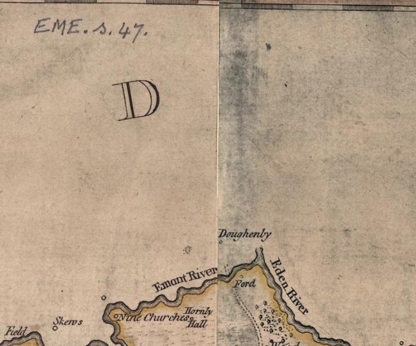 J5NY53SE.jpg "Eden River" 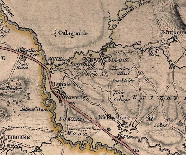 J5NY62NW.jpg 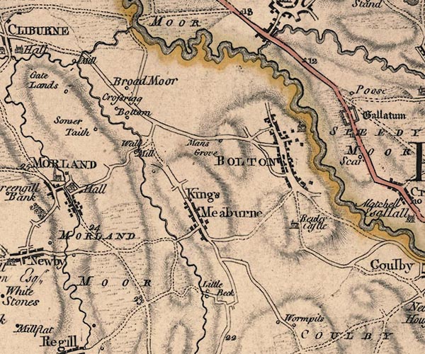 J5NY62SW.jpg  J5NY62SE.jpg  J5NY61NE.jpg  J5NY71NW.jpg  J5NY71SE.jpg "Eden River" 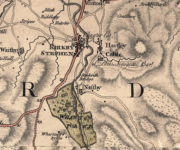 J5NY70NE.jpg 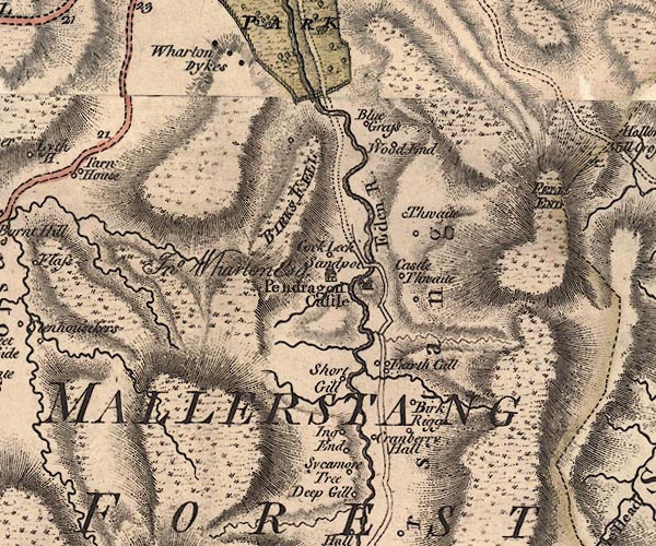 J5NY70SE.jpg "Eden R." 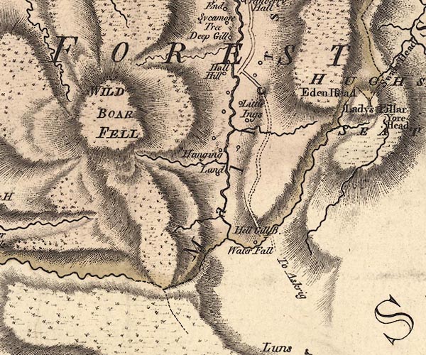 J5SD79NE.jpg single or double wiggly line; river; county boundary item:- National Library of Scotland : EME.s.47 Images © National Library of Scotland |
|||
|
|
||||
| evidence:- | old map:- Donald 1774 (Cmd) placename:- Eden River |
|||
| source data:- | Map, hand coloured engraving, 3x2 sheets, The County of Cumberland, scale about 1
inch to 1 mile, by Thomas Donald, engraved and published by Joseph Hodskinson, 29
Arundel Street, Strand, London, 1774.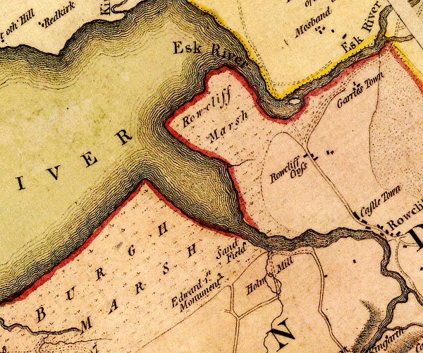 D4NY36SW.jpg estuary 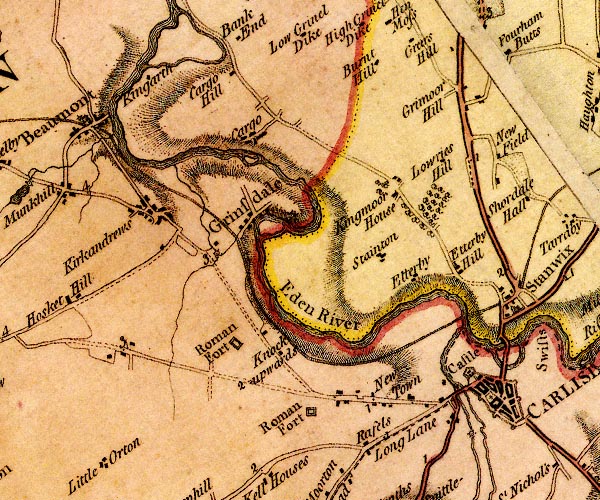 D4NY35NE.jpg "Eden River" 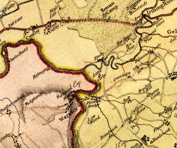 D4NY45NE.jpg 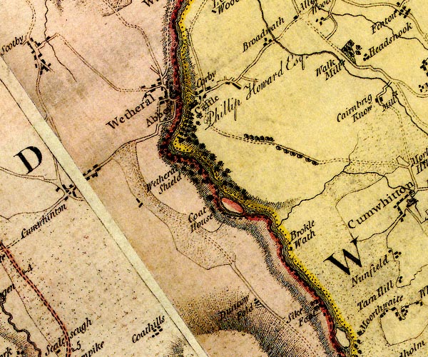 D4NY45SE.jpg 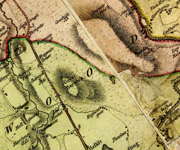 D4NY44NE.jpg  D4NY54NW.jpg  D4NY54SW.jpg  D4NY54SE.jpg  D4NY53NE.jpg 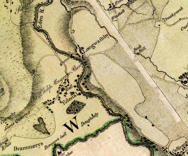 D4NY53SE.jpg "Eden R."  D4NY52NE.jpg  D4NY62NW.jpg single or double wiggly line; a river and county boundary, into the sea item:- Carlisle Library : Map 2 Images © Carlisle Library |
|||
|
|
||||
| evidence:- | old map:- Donald 1774 (Cmd) placename:- Eden, River |
|||
| source data:- | Map, hand coloured engraving, 3x2 sheets, The County of Cumberland, scale about 1
inch to 1 mile, by Thomas Donald, engraved and published by Joseph Hodskinson, 29
Arundel Street, Strand, London, 1774. D43956S.jpg 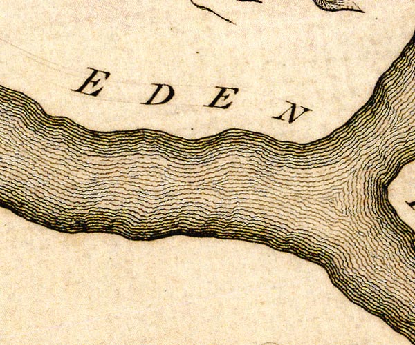 D43956X.jpg  D44056D.jpg river, N branch 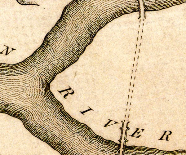 D44056C.jpg "EDEN RIVER" river, two branches 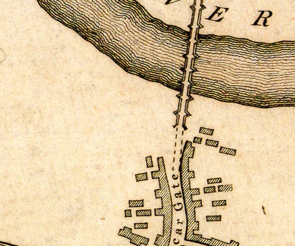 D44056B.jpg  D44056G.jpg river, S branch item:- Carlisle Library : Map 2 Images © Carlisle Library |
|||
|
|
||||
| evidence:- | old map:- Pennant 1777 placename:- Petterell River |
|||
| source data:- | Map, hand coloured engraving, A Map of Scotland, Hebrides and
Part of England, drawn for Thomas Pennant, engraved by J Bayly,
published by Benjamin White, London, 1777.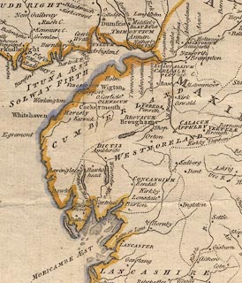 click to enlarge click to enlargePEN1Cm.jpg "Petterell R" river item:- private collection : 66 Image © see bottom of page |
|||
|
|
||||
| evidence:- | descriptive text:- West 1778 (11th edn 1821) |
|||
| source data:- | Guide book, A Guide to the Lakes, by Thomas West, published by
William Pennington, Kendal, Cumbria once Westmorland, and in
London, 1778 to 1821. goto source Addendum; Mr Gray's Journal, 1769 Page 200:- "... On the ascent of the hill above Appleby, the thick hanging woods, and the long reaches of the Eden, clear, rapid and full as ever, winding below, ..." "... crossed the Eden and the Eamont ... [to] Penrith ..." |
|||
|
|
||||
| evidence:- | descriptive text:- Lowther 1780s-90s |
|||
| source data:- | Scrapbook, 4 volumes, of descriptive texts, maps, and prints of
views and coats of arms, for Westmorland and Cumberland,
assembled by a member of the Lowther Family, late 18th early
19th century. Text with a print, engraving, Brough Castle, drawn by Samuel Hooper, engraved by Sparrow, 1775:- "... CAMDEN describing this country [round Brough] says, 'Here Eden seems to stop its course, that it may receive some rivulets; upon one of which, scarce two miles from Eden itself, stood Verterae, an ancient town mentioned by Antoninus and the Notitia; ..." |
|||
|
|
||||
| evidence:- | old map:- West 1784 map placename:- Eden River |
|||
| source data:- | Map, hand coloured engraving, A Map of the Lakes in Cumberland,
Westmorland and Lancashire, scale about 3.5 miles to 1 inch,
engraved by Paas, 53 Holborn, London, about 1784.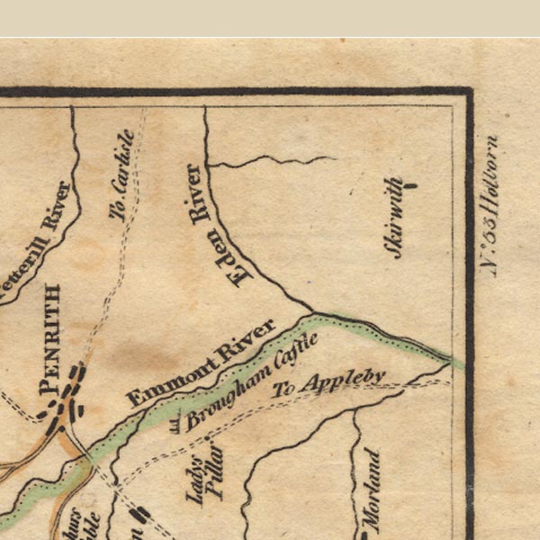 Ws02NY53.jpg item:- Armitt Library : A1221.1 Image © see bottom of page |
|||
|
|
||||
| evidence:- | old text:- Camden 1789 placename:- Eden, River placename:- Ituna |
|||
| source data:- | Book, Britannia, or A Chorographical Description of the Flourishing Kingdoms of England,
Scotland, and Ireland, by William Camden, 1586, translated from the 1607 Latin edition
by Richard Gough, published London, 1789. goto source Page 147:- "... The noble river Eden, called by Ptolemy ITUNA, rising in the county of York, first with a slow stream, but by the influx of rivers gradually increased, seeks it way among these hills to the north-west by Pendragon castle, ... thence by Wharton hall, ... It afterwards runs by St. Stephens, commonly Kirkby Stephen, a noted market town: and two villages of the name Musgrave ... Here [Heartly castle] the Eden seems to stop again to unite with other rivulets, ..." goto sourcePage 148:- "... Apelby. ... almost surrounded by the river Eden, ..." "The river hence pursues its course by Buley, a castle of the bishop of Carlisle, and Kirkby Thore, ..." |
|||
|
|
||||
| evidence:- | old text:- Camden 1789 (Gough Additions) |
|||
| source data:- | Book, Britannia, or A Chorographical Description of the Flourishing Kingdoms of England,
Scotland, and Ireland, by William Camden, 1586, translated from the 1607 Latin edition
by Richard Gough, published London, 1789. goto source Page 150:- "..." "The rivers of this county [Westmorland] are but small, and only three that can properly be called rivers carry their name to the sea: The first river is Eden which springs in Mallerstang, and having in its course received, besides many lesser streams, the conjoined rivers of Lowther and Eamont, enters Cumberland, and running the whole length of that county empties itself into the sea at Rowcliff. ..." "..." Page 156:- "..." "The river Eden rises in this county at Morvill Hugh-seat or Hugh Morvill's hill from one of that name lord of Westmorland. ..." |
|||
|
|
||||
| evidence:- | old text:- Camden 1789 placename:- Eiden, River placename:- Ituna placename:- Lug, River |
|||
| source data:- | Book, Britannia, or A Chorographical Description of the Flourishing Kingdoms of England,
Scotland, and Ireland, by William Camden, 1586, translated from the 1607 Latin edition
by Richard Gough, published London, 1789. goto source Page 173:- "..." "... the noble river Eiden, which waters Westmoreland and the inner parts of this county, pours the largest quantity of water into it [Solway Firth] ..." "The river Ituna, or Eiden, in its way to this county, receives from the west the river Eimot from the lake Ulse ..." goto sourcePage 174:- "..." "The Eden, having now received the Eimot, runs by obscure villages and castles northward through both Salkelds. ..." "From hence the Eden runs by Kirk Oswald, ... thence by Armanthwayte, a castle of the Skeltons: Corby, a castle of the noble and antient family of the Salkelds, ... Thence by Warwic, ... Eden, now ready to discharge itself into its frith, receives two rivers at once, the Peterill and the Caud, which run almost parallel to each other from the south. ..." "... Between the confluence of these rivers in the best and by far the most pleaseant spot, stands the very antient city of Carlisle, ... ... Leland, who at last was forced to believe that the Eden was called Lug, and that Ballum comes from vallis, thus making Lugu-vallum, the valley on the Lug. ... Stanwicks, a little village, a little beyond the river Eden, over which is now a wooden bridge, and crosses the river overagainst the castle, where in the bed of the river are still remains of it, huge stones. ..." |
|||
|
|
||||
| evidence:- | old text:- Camden 1789 (Gough Additions) placename:- Edon, River |
|||
| source data:- | Book, Britannia, or A Chorographical Description of the Flourishing Kingdoms of England,
Scotland, and Ireland, by William Camden, 1586, translated from the 1607 Latin edition
by Richard Gough, published London, 1789. Page 179:- "..." "... a water called Emot ... enter into the river of Edon two miles from Pereth by east, ..." |
|||
|
|
||||
| evidence:- | old map:- Cary 1789 (edn 1805) placename:- Eden River |
|||
| source data:- | Map, uncoloured engraving, Westmoreland, scale about 2.5 miles
to 1 inch, by John Cary, London, 1789; edition 1805.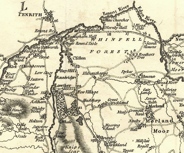 CY24NY52.jpg "Eden River"  CY24NY62.jpg  CY24NY71.jpg  CY24NY70.jpg  CY24SD79.jpg river; county boundary item:- JandMN : 129 Image © see bottom of page |
|||
|
|
||||
| evidence:- | old map:- Aikin 1790 (Wmd) placename:- Eden River |
|||
| source data:- | Map, uncoloured engraving, Westmoreland ie Westmorland, scale
about 8.5 miles to 1 inch, by John Aikin, London, 1790.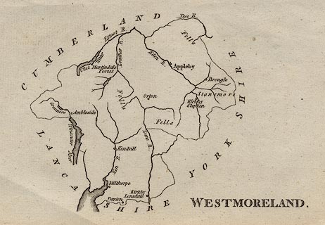 click to enlarge click to enlargeAIK2.jpg "Eden R." river; on county boundary item:- JandMN : 51 Image © see bottom of page |
|||
|
|
||||
| evidence:- | old map:- Aikin 1790 (Cmd) placename:- Eden River |
|||
| source data:- | 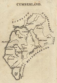 click to enlarge click to enlargeAIK3.jpg "Eden R." river; on county boundary item:- JandMN :145 Image © see bottom of page |
|||
|
|
||||
| evidence:- | old print:- Green 1790s-1820s item:- fishing; fishing net |
|||
| source data:- | Print, coloured aquatint, fishing on the River Eden, Carlisle, Cumberland, by William
Green, Ambleside, Westmorland, 1790s-1800s?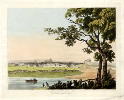 click to enlarge click to enlargePR1731.jpg printed at bottom:- "Carlisle, Cumberland" item:- Armitt Library : 2014.410 Image © see bottom of page |
|||
|
|
||||
| evidence:- | old map:- Bailey 1797 placename:- Eden River |
|||
| source data:- | Map, soil etc, uncoloured engraving, Westmoreland, scale about
12 miles to 1 inch, by J Bailey, engraved by Neele, Strand,
published by Messrs Robinson, Paternoster Row and G Nicol, Pall
Mall, London, 1797.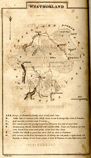 click to enlarge click to enlargeBY05.jpg "Eden R." river item:- Armitt Library : A680.3 Image © see bottom of page |
|||
|
|
||||
| evidence:- | old map:- Bailey 1797 placename:- Eden River |
|||
| source data:- | Map, soil etc, uncoloured engraving, Cumberland, scale about 21
miles to 1 inch, by J Bailey, engraved by Neele, Strand,
published by Messrs Robinson, Paternoster Row and G Nicol, Pall
Mall, London, 1797.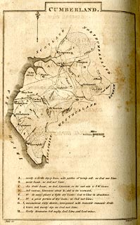 click to enlarge click to enlargeBY04.jpg "Eden R." river item:- Armitt Library : A680.2 Image © see bottom of page |
|||
|
|
||||
| evidence:- | road book:- Cary 1798 (2nd edn 1802) placename:- Eden, River |
|||
| source data:- | Road book, itineraries, Cary's New Itinerary, by John Cary, 181
Strand, London, 2nd edn 1802. goto source click to enlarge click to enlargeC38267.jpg page 267-268 "Cross the River Eden; and on r. a T.R. to Newcastle." goto source click to enlarge click to enlargeC38281.jpg page 281-282 "Cross the Eden River." goto source click to enlarge click to enlargeC38283.jpg page 283-284 "Cross the Eden River; and on r. a T.R. to Newnham." goto source click to enlarge click to enlargeC38319.jpg page 319-320 "Cross the River Eden." twice item:- JandMN : 228.1 Image © see bottom of page |
|||
|
|
||||
| evidence:- | road book:- Cary 1798 (2nd edn 1802) placename:- Eden, River |
|||
| source data:- | Road book, itineraries, Cary's New Itinerary, by John Cary, 181
Strand, London, 2nd edn 1802. goto source click to enlarge click to enlargeC38699.jpg page 699-700 "Cross the Eden River" item:- JandMN : 228.2 Image © see bottom of page |
|||
|
|
||||
| evidence:- | old map:- Skrine 1801 placename:- Eden River |
|||
| source data:- | Map, uncoloured engraving, rivers in Cumberland, Westmorland,
Lancashire and Cheshire, scale about 23 miles to 1 inch, by
Henry Skrine, published by P Elmsly, London, 1801.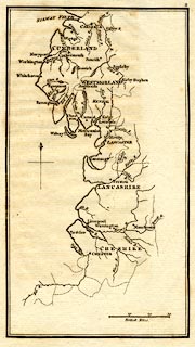 click to enlarge click to enlargeM076.jpg "Eden R." river item:- JandMN : 421 Image © see bottom of page |
|||
|
|
||||
| evidence:- | old map:- Baker 1802 |
|||
| source data:- | Perspective road maps with sections in Lancashire, Westmorland
and Cumberland, by J Baker, London 1802. At Carlisle. 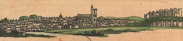 Bk03Vg01.jpg item:- private collection : 3 Image © see bottom of page |
|||
|
|
||||
| evidence:- | old map:- Cooke 1802 placename:- Eden River |
|||
| source data:- | Map, Westmoreland ie Westmorland, scale about 12 miles to 1
inch, by George Cooke, 1802, published by Sherwood, Jones and
Co, Paternoster Road, London, 1824. click to enlarge click to enlargeGRA1Wd.jpg "Eden River" tapering wiggly line; river item:- Hampshire Museums : FA2000.62.4 Image © see bottom of page |
|||
|
|
||||
| evidence:- | old map:- Cooke 1802 placename:- Eden River |
|||
| source data:- | Map, Cumberland, scale about 15.5 miles to 1 inch, by George
Cooke, 1802, bound in Gray's New Book of Roads, 1824, published
by Sherwood, Jones and Co, Paternoster Road, London, 1824. click to enlarge click to enlargeGRA1Cd.jpg "Eden R." tapering wiggly line; river item:- Hampshire Museums : FA2000.62.2 Image © see bottom of page |
|||
|
|
||||
| evidence:- | old map:- Laurie and Whittle 1806 placename:- Eden River |
|||
| source data:- | Road map, Completion of the Roads to the Lakes, scale about 10
miles to 1 inch, by Nathaniel Coltman? 1806, published by Robert
H Laurie, 53 Fleet Street, London, 1834. click to enlarge click to enlargeLw18.jpg "Eden R." river item:- private collection : 18.18 Image © see bottom of page |
|||
|
|
||||
| evidence:- | old map:- Laurie and Whittle 1806 placename:- Eden River |
|||
| source data:- | Road map, Continuation of the Roads to Glasgow and Edinburgh,
scale about 10 miles to 1 inch, by Nathaniel Coltman? 1806,
published by Robert H Laurie, 53 Fleet Street, London, 1834. click to enlarge click to enlargeLw21.jpg "Eden R." river item:- private collection : 18.21 Image © see bottom of page |
|||
|
|
||||
| evidence:- | old map:- Cooper 1808 placename:- Eden River |
|||
| source data:- | Map, uncoloured engraving, Cumberland, scale about 10.5 miles to
1 inch, drawn and engraved by Cooper, published by R Phillips,
Bridge Street, Blackfriars, London, 1808. click to enlarge click to enlargeCOP3.jpg "Eden R." tapering wiggly line; river, ward boundary item:- JandMN : 86 Image © see bottom of page |
|||
|
|
||||
| evidence:- | old map:- Cooper 1808 placename:- Eden River |
|||
| source data:- | Map, hand coloured engraving, Westmoreland ie Westmorland, scale
about 9 miles to 1 inch, by H Cooper, 1808, published by R
Phillips, Bridge Street, Blackfriars, London, 1808. click to enlarge click to enlargeCOP4.jpg "Eden R." tapering wiggly line; river; county boundary and ward boundary item:- Dove Cottage : 2007.38.53 Image © see bottom of page |
|||
|
|
||||
| evidence:- | old map:- Wallis 1810 (Wmd) placename:- Eden River |
|||
| source data:- | Road map, Westmoreland, scale about 19 miles to 1 inch, by James
Wallis, 77 Berwick Street, Soho, 1810, published by W Lewis,
Finch Lane, London, 1835? click to enlarge click to enlargeWAL5.jpg "Eden River" river item:- JandMN : 63 Image © see bottom of page |
|||
|
|
||||
| evidence:- | descriptive text:- Wallis 1810 placename:- Eden |
|||
| source data:- | Map, Westmoreland, scale about 19 miles to 1 inch, and
Cumberland, scale about 16 miles to 1 inch, by James Wallis, 77
Berwick Street, Soho, London, 1810; published 1810-36. "PRINCIPAL RIVERS." "This county is well watered by the rivers, Eden, Loder, Ken, and Lune, or Lon. The Eden, which is one of the most considerable rivers in the North of England, has its source in the very wildest part of this county, not far from the borders of Yorkshire, passes by the town of Appleby, and runs on to the N.W. into Cumberland, being joined in its progress by several streamlets from the N.E. part of the county, called Stanmore. Of this river the common people have a singular tradition that Uter Pendragon endeavoured to change the course of this river, but found all his efforts of no effect; and the tradition is still preserved by the following lines:-" "'Let Uter Pendragon do what he can," "The river Eden will run as it ran.'" |
|||
|
|
||||
| evidence:- | old map:- Otley 1818 placename:- Eden River |
|||
| source data:- | Map, uncoloured engraving, The District of the Lakes,
Cumberland, Westmorland, and Lancashire, scale about 4 miles to
1 inch, by Jonathan Otley, 1818, engraved by J and G Menzies,
Edinburgh, Scotland, published by Jonathan Otley, Keswick,
Cumberland, et al, 1833.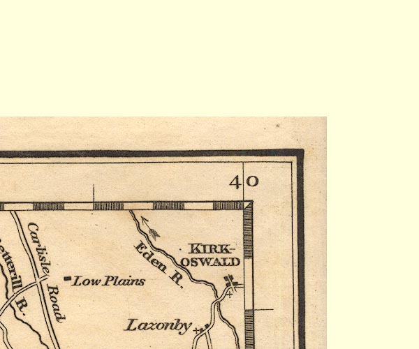 OT02NY54.jpg "Eden R." item:- JandMN : 48.1 Image © see bottom of page |
|||
|
|
||||
| evidence:- | old map:- Hall 1820 (Wmd) placename:- Eden River |
|||
| source data:- | Map, hand coloured engraving, Westmoreland ie Westmorland, scale
about 14.5 miles to 1 inch, by Sidney Hall, London, 1820,
published by Samuel Leigh, 18 Strand, London, 1820-31. click to enlarge click to enlargeHA18.jpg "Eden R." tapering wiggly line; river item:- Armitt Library : 2008.14.58 Image © see bottom of page |
|||
|
|
||||
| evidence:- | old map:- Hall 1820 (Cmd) placename:- Eden, River |
|||
| source data:- | Map, hand coloured engraving, Cumberland, scale about 21 miles
to 1 inch, engraved by Sidney Hall, published by S Leigh, 18
Strand, London, 1820-31. click to enlarge click to enlargeHA14.jpg "R. Eden" tapering wiggly line; river item:- JandMN : 91 Image © see bottom of page |
|||
|
|
||||
| evidence:- | descriptive text:- Otley 1823 (5th edn 1834) |
|||
| source data:- | Guide book, A Concise Description of the English Lakes, the
mountains in their vicinity, and the roads by which they may be
visited, with remarks on the mineralogy and geology of the
district, by Jonathan Otley, published by the author, Keswick,
Cumberland now Cumbria, by J Richardson, London, and by Arthur
Foster, Kirkby Lonsdale, Cumbria, 1823; published 1823-49,
latterly as the Descriptive Guide to the English Lakes. goto source Page 40:- "... the river issuing from thence [Ullswater] is called the Eamont; it receives the Lowther ... near Brougham Castle; and is afterwards absorbed in the Eden, which enters the Solway Frith a little below Carlisle; having first received the Petterill, which rises near Greystoke; and the Caldew, from the east side of Skiddaw." |
|||
|
|
||||
| evidence:- | old map:- Perrot 1823 |
|||
| source data:- | Map, hand coloured engraving, Cumberland and Westmoreland ie
Westmorland, scale about 38 miles to 1 inch, by Aristide Michel
Perrot, engraved by Migneret, 1823, published by Etienne Ledoux,
9 Rue Guenegaud, Paris, France, 1824-48. click to enlarge click to enlargePER2.jpg tapering wiggly line item:- Dove Cottage : 2007.38.45 Image © see bottom of page |
|||
|
|
||||
| evidence:- | descriptive text:- Ford 1839 (3rd edn 1843) item:- salmon leap |
|||
| source data:- | Guide book, A Description of Scenery in the Lake District, by
Rev William Ford, published by Charles Thurnam, Carlisle, by W
Edwards, 12 Ave Maria Lane, Charles Tilt, Fleet Street, William
Smith, 113 Fleet Street, London, by Currie and Bowman,
Newcastle, by Bancks and Co, Manchester, by Oliver and Boyd,
Edinburgh, and by Sinclair, Dumfries, 1839. goto source Page 124:- "..." "... past the village of Cumwhitton, from about five miles. The Eden flows at a short distance through winding vistas, where water, wood, and rock, holms, and sloping banks, combine to produce scenes rarely equalled, never surpassed, but seldom seen by strangers, and therefore comparatively unknown. ..." goto sourcePage 125:- "[Armathwaite] ... An interesting walk through an avenue of flourishing larches, leads for a mile along the margin of a rapid eddying stream to the salmon leaps, where the Eden pours over a rocky wear (sic), and forming part of the great whinstone dyke, which crosses the island, stretching across its whole breadth. Above, the water forms a deep, still, lake-like scene, rocks shoot up perpendicularly out of it, and the immense masses of the Cooms and Baron Wood cast over it a deep gloomy shade:" "'Awful scenes, that calm the troubled breast, And woo the weary to profound repose.'" |
|||
|
|
||||
| evidence:- | old map:- Ford 1839 map placename:- Eden River |
|||
| source data:- | Map, uncoloured engraving, Map of the Lake District of
Cumberland, Westmoreland and Lancashire, scale about 3.5 miles
to 1 inch, published by Charles Thurnam, Carlisle, and by R
Groombridge, 5 Paternoster Row, London, 3rd edn 1843.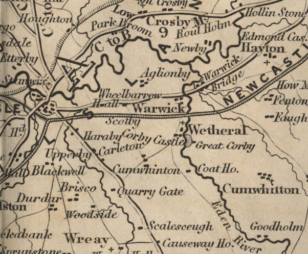 FD02NY45.jpg "Eden R." item:- JandMN : 100.1 Image © see bottom of page |
|||
|
|
||||
| evidence:- | old map:- Garnett 1850s-60s H placename:- Eden, River |
|||
| source data:- | Map of the English Lakes, in Cumberland, Westmorland and
Lancashire, scale about 3.5 miles to 1 inch, published by John
Garnett, Windermere, Westmorland, 1850s-60s. GAR2NY36.jpg "R Eden" river, double line  GAR2NY35.jpg  GAR2NY45.jpg "Riv. Eden"  GAR2NY54.jpg 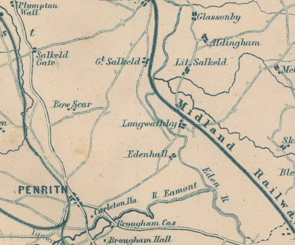 GAR2NY53.jpg "Eden R." part marked as county boundary 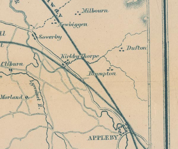 GAR2NY62.jpg item:- JandMN : 82.1 Image © see bottom of page |
|||
|
|
||||
| evidence:- | old photograph:- Bell 1880s-1940s placename:- Eden, River |
|||
| source data:- | Photograph, Appleby Castle and River Eden, Appleby-in-Westmorland, Westmorland, by
Herbert Bell, photographer, Ambleside, Westmorland, 1907.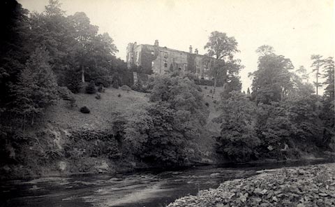 click to enlarge click to enlargeHB0003.jpg Vol.1 no.3 in an album, Examples of Early Domestic and Military Architecture in Westmorland, assembled 1910. ms at bottom:- "3. / Appleby Castle and River Eden. Appleby St. Lawrence. E." item:- Armitt Library : 1958.3165.3 Image © see bottom of page |
|||
|
|
||||
| evidence:- | old photograph:- Bell 1880s-1940s placename:- Eden, River |
|||
| source data:- | Photograph, Lammerside Castle and River Eden, Wharton and Mallerstang, Westmorland,
by Herbert Bell, photographer, Ambleside, Westmorland, 1894.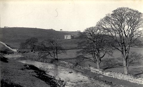 click to enlarge click to enlargeHB0026.jpg Vol.1 no.26 in an album, Examples of Early Domestic and Military Architecture in Westmorland, assembled 1910. ms at bottom:- "26. Lammerside Castle and River Eden. Kirkby Stephen. E." item:- Armitt Library : 1958.3165.26 Image © see bottom of page |
|||
|
|
||||
| evidence:- | text:- Mason 1907 (edn 1930) |
|||
| source data:- | Text book, The Ambleside Geography Books bk.III, The Counties of
England, by Charlotte M Mason, published by Kegan Paul, Trench,
Trubner and Co, Broadway House, 68-74 Carter Lane, and the
Parents' Educational Union Office, 26 Victoria Street, London,
edn 1930. MSN1P025.txt Page 25:- "..." "The Eden, the only considerable river in the two counties [Westmorland and Cumberland], flows north through a flat farming district, and winds round the old castle of "merrie Carlisle" ..." |
|||
|
|
||||
| evidence:- | old map:- Postlethwaite 1877 (3rd edn 1913) placename:- Eden, River |
|||
| source data:- | Map, uncoloured engraving, Map of the Lake District Mining Field, Westmorland, Cumberland,
Lancashire, scale about 5 miles to 1 inch, by John Postlethwaite, published by W H
Moss and Sons, 13 Lowther Street, Whitehaven, Cumberland, 1877 edn 1913. PST2NY45.jpg "R. Eden" wiggly line, and tributaries  PST2NY54.jpg "R. Eden." wiggly line  PST2NY62.jpg "R. Eden." wiggly line item:- JandMN : 162.2 Image © see bottom of page |
|||
|
|
||||
| evidence:- | textbook:- Rivet and Smith 1979 placename:- Ituna |
|||
| source data:- | ||||
|
|
||||
| evidence:- | old print:- placename:- Eden, River |
|||
| source data:- | Print, halftone photograph, River Eden from the Scaur, presumably Etterby Scaur, Carlisle,
by Valentine and Sons, published by Cumberland Motor Services, Tangier Street, Whitehaven,
Cumberland, about 1926.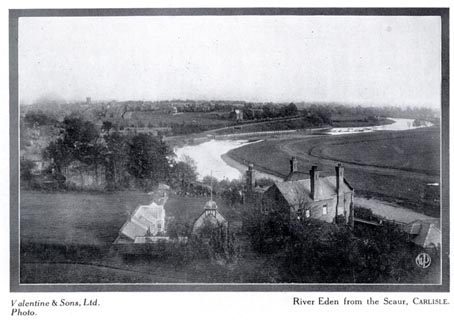 click to enlarge click to enlargeCS103.jpg On p.18 of Cumberland its Lakes and Mountains. lower right "WP" printed, bottom, left right "Valentine &Sons, Ltd. Photo. / River Eden from the Scaur, CARLISLE." item:- JandMN : 1022.3 Image © see bottom of page |
|||
|
|
||||
| evidence:- | old print:- Braithwaite 1922 placename:- Eden, River |
|||
| source data:- | Print, halftone photograph, Eastfield Waterfall, River Eden, Winton, Westmorland,
published by J W Braithwaite and Sons, Kirkby Stephen, Westmorland, 1922.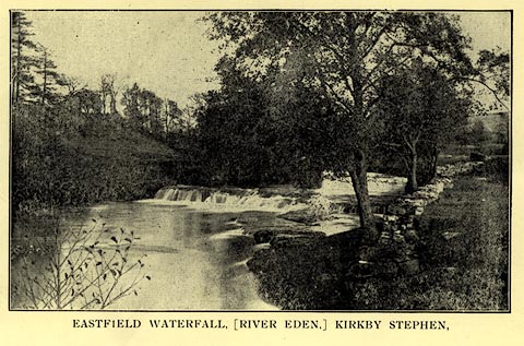 click to enlarge click to enlargeBT0102.jpg Included in a guide book, Kirkby Stephen, 4th edn 1922. printed at bottom:- "EASTFIELD WATERFALL, (RIVER EDEN,) KIRKBY STEPHEN." item:- private collection : 220.2 Image © see bottom of page |
|||
|
|
||||
| evidence:- | old photograph:- Bogg 1898 |
|||
| source data:- | Photograph, halftone print, The Eden at Wetheral, Cumberland, by Edmund Bogg, published
by Edmund Bogg, 3 Woodhouse Lane, and James Miles, Guildford Street, Leeds, Yorkshire,
1898.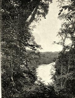 click to enlarge click to enlargeBGG117.jpg Included on p.59 of Lakeland and Ribblesdale, by Edmund Bogg. item:- JandMN : 231.17 Image © see bottom of page |
|||
|
|
||||
| evidence:- | old photograph:- Bogg 1898 |
|||
| source data:- | Photograph, halftone print, The Eden at Corby, Great Corby, Wetheral, Cumberland,
by Edmund Bogg, published by Edmund Bogg, 3 Woodhouse Lane, and James Miles, Guildford
Street, Leeds, Yorkshire, 1898.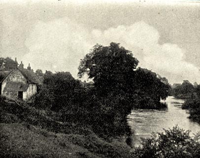 click to enlarge click to enlargeBGG115.jpg Included on p.55 of Lakeland and Ribblesdale, by Edmund Bogg. item:- JandMN : 231.15 Image © see bottom of page |
|||
|
|
||||
| evidence:- | perhaps old print:- Bogg 1898 |
|||
| source data:- | Print, The Rescue of Kinmont Willie, crossing the ?Eden, near Carlisle, Cumberland,
drawn/engraved by Dellagana? published by Edmund Bogg, 3 Woodhouse Lane, and James
Miles, Guildford Street, Leeds, Yorkshire, 1898.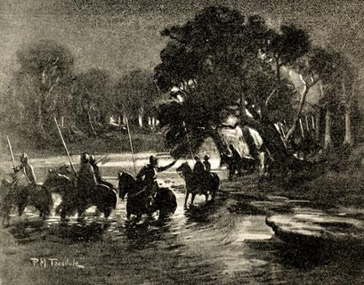 click to enlarge click to enlargeBGG103.jpg Included on p.8 of Lakeland and Ribblesdale, by Edmund Bogg; imaginary scene of Buccleugh and others crossing the river. item:- JandMN : 231.3 Image © see bottom of page |
|||
|
|
||||
| evidence:- | old print:- |
|||
| source data:- | Print, uncoloured engraving, Carlisle, Cumberland, published by the Illustrated London
News, 12 August 1882.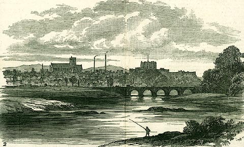 click to enlarge click to enlargePR0309.jpg Illustrations of place visited by the Royal Archaeological Institute. item:- Dove Cottage : 2008.107.309 Image © see bottom of page |
|||
|
|
||||
| evidence:- | old print:- |
|||
| source data:- | Print, uncoloured engraving, Meeting of the Royal Agricultural Society of England,
at Carlisle, published by the Illustrated London News, 11 August 1855.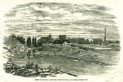 click to enlarge click to enlargePR0359.jpg Page 181; illustrating a report of the meeting. printed at bottom:- "MEETING OF THE ROYAL AGRICULTURAL SOCIETY OF ENGLAND, AT CARLISLE - GENERAL VIEW." item:- Dove Cottage : 2008.107.359 Image © see bottom of page |
|||
|
|
||||
| evidence:- | old print:- Thurnam 1835 |
|||
| source data:- | Print, uncoloured lithograph, Carlisle from near Stanwix Bank, Cumberland, drawn by
M E Nutter, lithographed by Giles, published by Charles Thurnam, Carlisle, Cumberland,
by Ackermann and Co, by Hodgson, Boys, and Graves, and by Charles Tilt, London, 1835.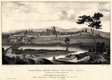 click to enlarge click to enlargeTHM103.jpg Printed by Graf and Soret. Included in Carlisle in the Olden Time. printed at bottom:- "Drawn by M. E. Nutter from the original sketch. / Giles lithog. / CARLISLE FROM NEAR STANWIX BANK. / UPWARDS OF ONE HUNDRED YEARS AGO. / Carlisle, Published by Charles Thurnam. / London. Ackermann & Co. - Hodgson, Boys, and Graves & Charles Tilt. / Printed by Graf &Soret." item:- Dove Cottage : 2008.123.3 Image © see bottom of page |
|||
|
|
||||
| evidence:- | old print:- Rose 1832-35 (vol.1 no.57) |
|||
| source data:- | Print, uncoloured engraving, Appleby, Westmorland, drawn by Thomas Allom, engraved
by M J Starling, published by Peter Jackson, London and Paris, 1830s.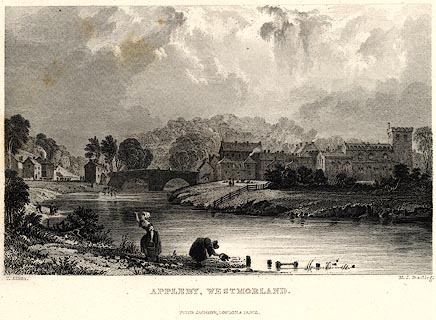 click to enlarge click to enlargePR0021.jpg vol.1 pl.57 in the set of prints, Westmorland, Cumberland, Durham and Northumberland Illustrated, originally. In the foreground water is being fetched from the River Eden. printed at bottom left, right, centre:- "T. Allom. / M. J. Starling. / APPLEBY, WESTMORLAND. / PETER JACKSON, LONDON &PARIS." item:- Dove Cottage : 2008.107.21 Image © see bottom of page |
|||
|
|
||||
| evidence:- | old print:- Rose 1832-35 (vol.1 no.17) |
|||
| source data:- | Print, uncoloured engraving, Corby Castle, Cumberland, drawn by Thomas Allom, engraved
by W Floyd, published by Fisher, Son and Co, London, 1832-35.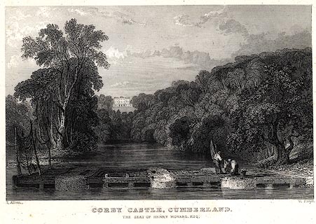 click to enlarge click to enlargePR0007.jpg vol.1 pl.17 in the set of prints, Westmorland, Cumberland, Durham and Northumberland Illustrated. The salmon traps on the River Eden in the foreground. printed at bottom left, right, centre:- "T. Allom. / W. Floyd. / CORBY CASTLE, CUMBERLAND. / SEAT OF HENRY HOWARD, ESQ." item:- Dove Cottage : 2008.107.7 Image © see bottom of page |
|||
|
|
||||
| evidence:- | old print:- |
|||
| source data:- | Print, uncoloured engraving, Corby Castle, Cumberland, drawn by J P Neale, engraved
by W Radclyffe, published by Jones and Co, Temple of the Muses, Finsbury Square, London,
1830.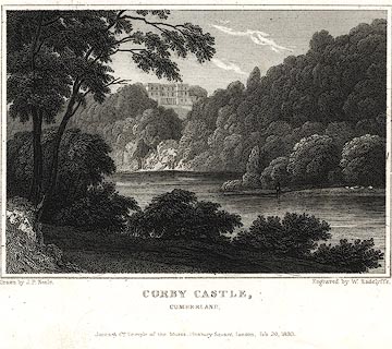 click to enlarge click to enlargePR0368.jpg printed at bottom left, right, centre:- "Drawn by J. P. Neale. / Engraved by W. Radclyffe. / CORBY CASTLE, / CUMBERLAND. / Jones &Co. Temple of the Muses, Finsbury Square, London, Feb 20. 1830." item:- Dove Cottage : 2008.107.368 Image © see bottom of page |
|||
|
|
||||
| evidence:- | old print:- |
|||
| source data:- | Print, uncoloured engraving, Carlisle, from the North, Cumberland, drawn by W Westall,
engraved by E Francis, about 1830s?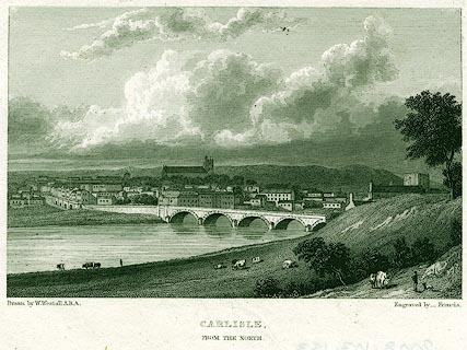 click to enlarge click to enlargePR0153.jpg printed at bottom left, right, centre:- "Drawn by W. Westall, A.R.A. / Engraved by _ Francis. / CARLISLE, / FROM THE NORTH." item:- Dove Cottage : 2008.107.153 Image © see bottom of page |
|||
|
|
||||
| evidence:- | old print:- |
|||
| source data:- | Print, coloured engraving, Carlisle Cathedral, South West View, Cumberland, drawn
by C Warren, engraved by B Winkles, mid 19th century?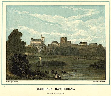 click to enlarge click to enlargePR0087.jpg Included in Winkles' Cathedrals, later edition with ?lithographed colour. View across the river, with Carlisle Castle etc. printed at bottom left, right, centre:- "Drawn by C. Warren. / Engraved by B. Winkles. / for Winkles' Cathedrals. / CARLISLE CATHEDRAL. / SOUTH WEST VIEW." item:- Dove Cottage : 2008.107.87 Image © see bottom of page |
|||
|
|
||||
| evidence:- | old print:- |
|||
| source data:- | Print, uncoloured engraving, Carlisle Cathedral, SW View, Cumberland, drawn by C Warren,
engraved by B Winkles, mid 19th century?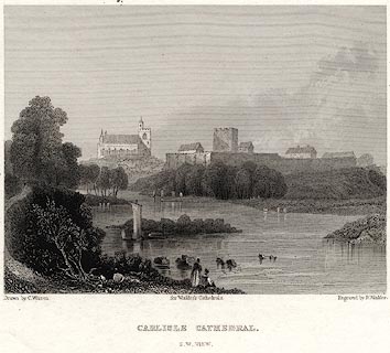 click to enlarge click to enlargePR0081.jpg Included in Winkles' Cathedrals. View across the river, with Carlisle Castle etc. printed at bottom left, right, centre:- "Drawn by C. Warren. / Engraved by B. Winkles. / for Winkles' Cathedrals. / CARLISLE CATHEDRAL. / S.W. VIEW." item:- Dove Cottage : 2008.107.81 Image © see bottom of page |
|||
|
|
||||
| evidence:- | old print:- |
|||
| source data:- | Print, uncoloured engraving, Brougham Castle, Westmorland, drawn by H Gastineau, engraved
by W Tombleson, published by Longman and Co, Paternoster Row, London, 1823.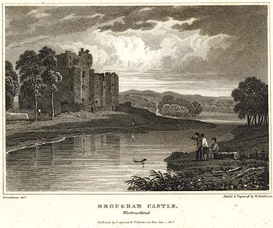 click to enlarge click to enlargePR0364.jpg printed at bottom left, right, centre:- "H. Gastineau delt. / Sketch'd & Engraved by W. Tombleson. / BROUGHAM CASTLE. / Westmorland / Published by Longman &Co. Paternoster Row Jan. 1. 1823." item:- Dove Cottage : 2008.107.364 Image © see bottom of page |
|||
|
|
||||
| evidence:- | old print:- |
|||
| source data:- | Print, uncoloured engraving, Carlisle, Cumberland, engraved by Owen, published at
the Albion Press, London, 1818.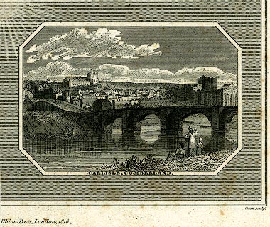 click to enlarge click to enlargePR0243.jpg Eden Bridge with the town in the background. printed at bottom:- "CARLISLE, CUMBERLAND." printed at lower on page:- "[ ]Albion Press, London, 1818. / Owen sculpt." item:- Dove Cottage : 2008.107.243 Image © see bottom of page |
|||
|
|
||||
| evidence:- | old print:- |
|||
| source data:- | Print, uncoloured engraving, Carlisle, Cumberland, drawn by Robert Carlile, engraved
and published by J Walker, 16 Rosomans Street, London, 1797.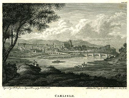 click to enlarge click to enlargePR0248.jpg printed at bottom left, right, centre:- "Engraved by J. Walker from an Original Drawing by Mr. Robt. Carlile. / Published Octr. 2d. 1797, by J. Walker, No.16 Rosomans Street, London. / CARLISLE." item:- Dove Cottage : 2008.107.248 Image © see bottom of page |
|||
|
|
||||
| evidence:- | old print:- |
|||
| source data:- | Print, uncoloured engraving, Prospect of the City of Carlisle, Cumberland, published
late 18th century.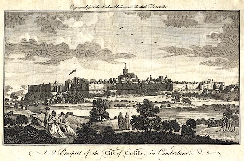 click to enlarge click to enlargePR0385.jpg Included in The Modern Universal British Traveller. The city has town walls and gates. printed at top:- "Engraved for The Modern Universal British Traveller" printed at bottom:- "Prospect of the CITY of CARLISLE, in Cumberland." item:- Dove Cottage : 2008.107.385 Image © see bottom of page |
|||
|
|
||||
| evidence:- | old postcard:- |
|||
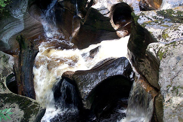
| source data:- | Postcard, National Series, black and white photograph, Stenkrith, Kirkby Stephen,
Westmorland, published by M and L, mid 20th century?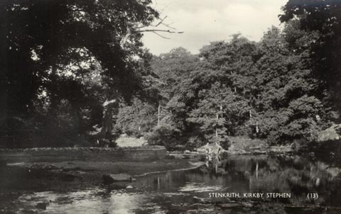 click to enlarge click to enlargePH0083.jpg printed at bottom:- "STENKRITH, KIRKBY STEPHEN" printed at rev:- "M AND L / NATIONAL SERIES" item:- JandMN : 951 Image © see bottom of page |
|||
|
|
||||
| evidence:- | old painting:- |
|||
| source data:- | Painting, oil painting, View of the River Eden, Wetheral, Cumberland, by Samuel Bough,
about 1845.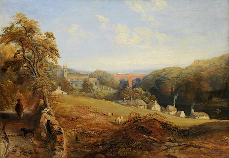 click to enlarge click to enlargePR1150.jpg To left of foreground a woman walks along a country track, her back towards the viewer. A young man, accompanied by his dog, leans against a stone wall beyond which a steeply sloping field culminates in a cluster of cottages beside the river to right of composition. In middle distance stand a church and churchyard beyond which rises a viaduct with a steam train crossing it from right to left. initialled &signed at bottom left:- "SB Sam Bough" item:- Tullie House Museum : 1974.42.1 Image © Tullie House Museum |
|||
|
|
||||
| evidence:- | old print:- |
|||
| source data:- | Print, Corby Castle from the South, Great Corby, Cumberland, by Matthew Ellis Nutter
from a sketch by Mrs Stourton, lithographed by Paul Gauci, London, published by Charles
Thurnam, Carlisle, Cumberland, about 1830.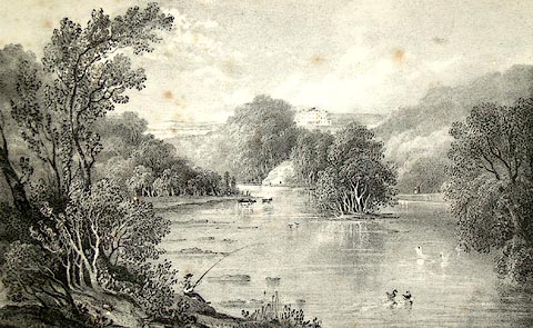 click to enlarge click to enlargePR1211.jpg Summertime; view along the River Eden, looking towards Corby Castle which stands on the top of a wooded hillside. A lone fisherman sits on the left hand bank of the river. Distant hills lie beyond. inscribed at bottom left on print:- "Drawn by M Nutter, from a sketch by the Hon. Mrs Stourton, 1829" printed at bottom centre:- "CORBY CASTLE [FROM THE SOUTH.] Dedicated, by Permission, to Mrs Howard, of Corby Castle, by her most obliged and Obedient humble Servant Charles Thurnam" inscribed at bottom right on print:- "On Stone by P Gauci" item:- Tullie House Museum : 1978.108.71 Image © Tullie House Museum |
|||
|
|
||||
| evidence:- | old print:- item:- fishing |
|||
| source data:- | Print, View of Carlisle, Cumberland, by Paul Sandby, engraved by F Charham, published
by G Kearsly, Fleet Street, London, England, 1780.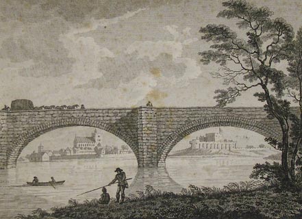 click to enlarge click to enlargePR1360.jpg View of Carlisle Cathedral and Carlisle Castle through two seperate arches of the old Priestbeck Bridge over the River Eden. Two men row a boat to shore and two other men are fishing from the bank. item:- Tullie House Museum : 2004.1.26 Image © Tullie House Museum |
|||
|
|
||||
| evidence:- | old painting:- item:- cattle |
|||
| source data:- | Painting, watercolour, Carlisle from Greeny Bank, Cumberland, by Thomas Bushby, 1917.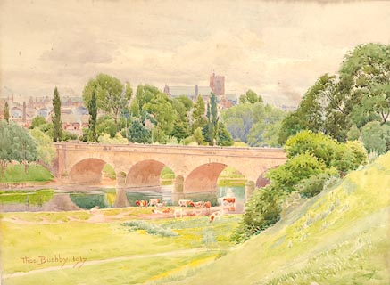 click to enlarge click to enlargePR1142.jpg View of Carlisle across the river Eden with Eden Bridge on right. On nearside, cattle graze beside the water. Two sketched figures walk along a path at the foot of Greeny Bank. signed &dated at bottom left:- "Thos. Bushby. 1917" inscribed at reverse:- "Carlisle from Greeny Bank Thos. Bushby Victoria Lodge Currock Carlisle 1917" item:- Tullie House Museum : 1972.4.14 Image © Tullie House Museum |
|||
|
|
||||
| evidence:- | old painting:- item:- cricket pavillion |
|||
| source data:- | Painting, watercolour, Evening; Carlisle from the Scaur, Cumberland, by Thomas Bushby,
1915.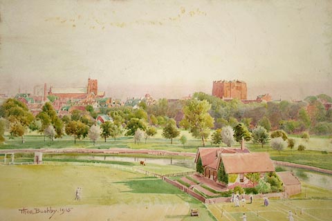 click to enlarge click to enlargePR1140.jpg View of Edenside at evening, from an elevated perspective. Carlisle lies on the far bank of the river Eden; clubhouse with figures playing tennis to right of composition. inscribed at reverse:- "No. 1 'Evening' Carlisle from the Scaur Thos. Bushby. Victoria Lodge, Currock, Carlisle 1915" item:- Tullie House Museum : 1972.4.12 Image © Tullie House Museum |
|||
|
|
||||
| evidence:- | old painting:- |
|||
| source data:- | Painting, watercolour, Carlisle from Rickerby Park, Cumberland, by Thomas Bushby,
1890s.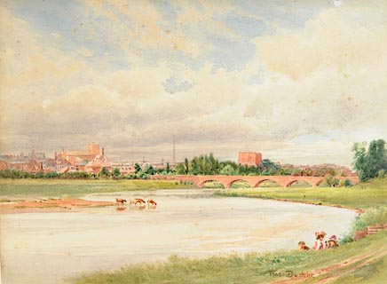 click to enlarge click to enlargePR1141.jpg View of Carlisle across the river Eden with Eden Bridge on right. Cattle stand in the shallows. On nearside, three children sit beside the river. signed at bottom right:- "Thos. Bushby." annotated at reverse:- "Carlisle from Rickerby Pk. Unfinished" item:- Tullie House Museum : 1972.4.13 Image © Tullie House Museum |
|||
|
|
||||
| evidence:- | old painting:- item:- sunset |
|||
| source data:- | Painting, oil painting, Sunset over Carlisle, Cumberland, by Samuel Bough, 1852.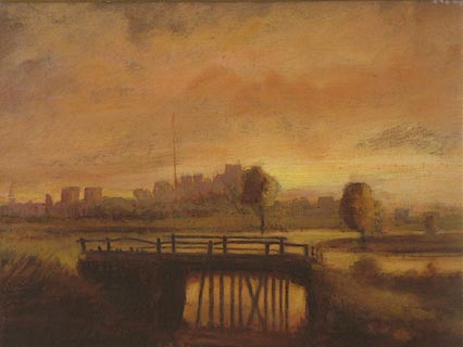 click to enlarge click to enlargePR1045.jpg Hazy view of Carlisle seen from across the River Eden in which the wooden jetty of the foreground is reflected. The city lies in shadow as the evening light fades. item:- Tullie House Museum : 1970.33.29 Image © Tullie House Museum |
|||
|
|
||||
| evidence:- | old painting:- placename:- Eden, River item:- boat; rowing boat; fishing |
|||
| source data:- | Painting, watercolour, View on the River Eden, near Carlisle, Cumberland, by Robert
Carlyle snr, about 1792. click to enlarge click to enlargePR1080.jpg Summertime; view of the River Eden seen from the right hand bank which is heavily wooded. Two fishermen in a rowing boat spread their nets on the calm waters as two gentlemen observe them from the bank to left of foreground. In the distance Carlisle Cathedral and castle may be seen; distant hills rise beyond. Taken from Davidson's Banks looking towards Stainton. inscribed at bottom centre:- "VIEW on the RIVER EDEN, near CARLISLE." item:- Tullie House Museum : 1970.80.6 Image © Tullie House Museum |
|||
|
|
||||
| evidence:- | old painting:- placename:- Eden, River item:- fishing |
|||
| source data:- | Painting, watercolour, View on the River Eden, near Carlisle, at Armathwaite? Cumberland,
by Robert Carlyle snr, about 1792. click to enlarge click to enlargePR1081.jpg Summertime; a family walks on the meadow beside the left bank of River Eden which flows diagonally across composition. To right of composition are two fishermen, one of whom stands whilst the other sits at the water's edge. The far riverbank is formed by a steep hill on the top of which stands a substantial house with outbuildings. At its base cattle stand in the shallows of the river. inscribed at bottom centre:- "VIEW on the RIVER EDEN, near CARLISLE." item:- Tullie House Museum : 1970.80.7 Image © Tullie House Museum |
|||
|
|
||||
| evidence:- | old painting:- item:- cattle |
|||
| source data:- | Painting, watercolour, Carlisle from the Sands, Cumberland, by William Henry Nutter,
1868. click to enlarge click to enlargePR0935.jpg View of Carlisle at sunset from beside the River Eden which flows to right of composition, cattle lingering in the shallows beside the left hand bank. It is spanned by Eden Bridge which crosses composition horizontally. The city lies beyond, reflected by the river. The cathedral stands to left of composition, factory chimneys to its right and the castle in the centre. signed &dated at bottom left:- "W.H. Nutter 1868" item:- Tullie House Museum : 1944.9.2 Image © Tullie House Museum |
|||
|
|
||||
| evidence:- | old painting:- |
|||
| source data:- | Painting, watercolour, Evening near Eden Bridge, Carlisle, Cumberland, by William
Henry Nutter, 1866.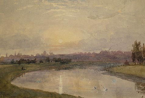 click to enlarge click to enlargePR1035.jpg The river Eden winds from foreground to right of composition, meadows lying to either side. The river, in which linger two swans, reflects the glow of the setting sun; distant hazy view of Carlisle lies beyond. signed &dated at bottom left:- "W H Nutter 1866" labelled at reverse on mount:- "Evening Near Eden Bridge by W H Nutter" item:- Tullie House Museum : 1970.33.16 Image © Tullie House Museum |
|||
|
|
||||
| evidence:- | old painting:- |
|||
| source data:- | Painting, watercolour, Carlisle from Etterby, Cumberland, by William Henry Nutter,
1848.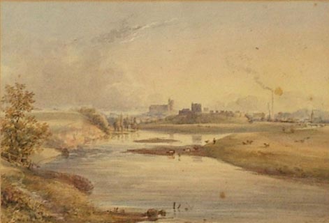 click to enlarge click to enlargePR0969.jpg Distant view of Carlisle at sunset from beside the River Eden, cattle grazing in the meadows beside the right hand bank. The city lies beyond, its cathedral and castle standing in centre of composition with the courthouses and factory chimneys to their right. Distant hills rise beyond. signed &dated at bottom right:- "W H Nutter 1848" item:- Tullie House Museum : 1954.84 Image © Tullie House Museum |
|||
|
|
||||
| evidence:- | old painting:- |
|||
| source data:- | Painting, oil painting, Carlisle from Etterby Scaur, Cumberland, by Samuel Bough,
about 1840.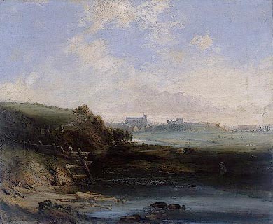 click to enlarge click to enlargePR0934.jpg In foreground a wide river flows beside which stands a solitary fisherman. Beyond, to right, lie meadows with grazing sheep and a distant view of Carlisle. To left rises a steep bank with a path along which saunter families and couples. The date is questionable as St Mary's Tower, depicted here, was demolished in 1835 but image also shows Dixon's Chimney. item:- Tullie House Museum : 1944.9.1 Image © Tullie House Museum |
|||
|
|
||||
| evidence:- | old drawing:- placename:- Eden, River |
|||
| source data:- | Drawing, Wetheral Bridge Across the River Eden, Newcastle and Carlisle Railway, Corby
Bridge, Wetheral, Cumberland, by John Wilson Carmichael, 1835.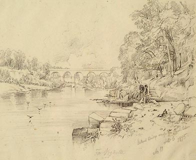 click to enlarge click to enlargePR1009.jpg Summertime; view of viaduct seen from the right hand bank of the River Eden. A whitewashed house nestles amongst the trees on the riverbank; a distant figure approaches along its path. To right of foreground stands a gardener? his lunch laid on the ground nearby, working with an implement beside the water's edge. Swallows skim the surfce of the water. Carmichael executed 22 pencil drawings of the construction of the Newcastle and Carlisle Railway at the suggestion of the Rail Company. inscribed & initialled & dated &numbered at bottom right:- "Wetheral Bridge across the River Eden JWC 1835 No 10" item:- Tullie House Museum : 1968.16.10 Image © Tullie House Museum |
|||
|
|
||||
| evidence:- | old painting:- |
|||
| source data:- | Painting, watercolour, North East View of the City of Carlisle, Cumberland, by Robert
Carlyle snr, 1791.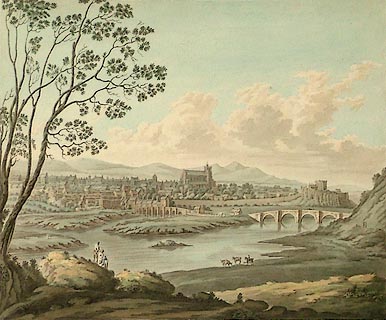 click to enlarge click to enlargePR0906.jpg Summertime; panoramic view of the city of Carlisle seen from an elevated perspective across the River Eden; to left of composition, in the foreground, a family stands looking across the river. At the water's edge a mounted horseman pauses beside three cattle standing on the riverbank. Eden Bridge lies to right of composition and distant hills rise beyond. One of a set of 11 original drawings for proposed aquatints The Antiquities of the City of Carlisle, 1791 inscribed at bottom left:- "Drawn by Rob't Carlyle" inscribed at bottom centre:- "NORTH EAST VIEW of the CITY of CARLISLE." item:- Tullie House Museum : 1935.80.1 Image © Tullie House Museum |
|||
|
|
||||
| evidence:- | old painting:- |
|||
| source data:- | Painting, watercolour, Wetheral Ferry, Cumberland, by Samuel Bough, 1840-43?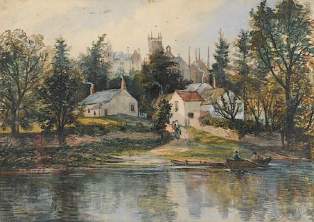 click to enlarge click to enlargePR0865.jpg Late summertime; River Eden flows across horizontal plane of composition; to right, two men in a rowing boat hail a woman carrying a pail who approaches the water's edge along a sandy path. The village lies on the hillside behind her. signed at bottom right:- "S Bough" item:- Tullie House Museum : 1915.16.1 Image © Tullie House Museum |
|||
|
|
||||
| evidence:- | old painting:- |
|||
| source data:- | Painting, watercolour, The Walled City of Carlisle, Viewed from Stanwix, Carlisle,
Cumberland, by Robert Carlyle snr, 1806?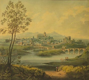 click to enlarge click to enlargePR0870.jpg Summertime; panoramic view of the city of Carlisle seen from an elevated perspective across the River Eden. The composition is framed on the left by a tall tree. To right, a lone man and his dog loiter at the water's edge near to three cattle standing in the shallows. Eden Bridge lies to far right of composition. Distant hills rise beyond the city. The date is problematic; an engraving taken from this work CALMG:1910.15 was published 2.10.1797; in this the number and disposition of figures is altered from those of the original. signed &dated at bottom right:- "R Carlyle 1806" item:- Tullie House Museum : 1917.89.3 Image © Tullie House Museum |
|||
|
|
||||
| evidence:- | old drawing:- |
|||
| source data:- | Drawing, Panoramic View of Carlisle from the North East, Cumberland, by Robert Carlyle
snr, 24 September 1805.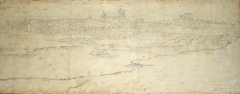 click to enlarge click to enlargePR0796.jpg Panoramic view of the city of Carlisle seen from the meadows beside the River Eden which is spanned by two bridges. The cathedral rises above the rooftops of the city in the centre of composition, with Carlisle castle standing to the right. Distant hills rise beyond the city. inscribed at reverse:- "by R Carlyle Sept 24 1805" item:- Tullie House Museum : 1889.67 Image © Tullie House Museum |
|||
|
|
||||
| evidence:- | old print:- |
|||
| source data:- | Print, Carlisle, Cumberland, from a painting by Robert Carlyle snr, published by J
Walker, 16 Rosoman's Street, London, 1797.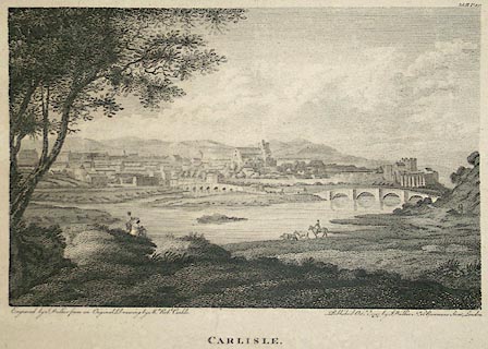 click to enlarge click to enlargePR0859.jpg Summertime; panoramic view of the city of Carlisle seen from an elevated perspective across the River Eden. The composition is framed to left by a tall tree near to which rest a couple and their child. To right, a horseman lingers at the water's edge near to three cattle standing in the shallows. Eden Bridge lies to extreme right of composition. Distant hills rise beyond the city. inscribed at bottom left on print:- "Engraved by J.Walker from an Original Drawing by Mr Robt Carlile." printed at bottom centre:- "CARLISLE" inscribed at bottom right, on print:- "Published Octr 2nd 1797 by J.Walker No 16 Rosomans Street, London." numbered at top right, on print:- "Vol III Pl.37" item:- Tullie House Museum : 1910.15 Image © Tullie House Museum |
|||
|
|
||||
| evidence:- | old drawing:- |
|||
| source data:- | Drawing, Carlisle from the North West, Cumberland, by Joseph Farington, about 1790.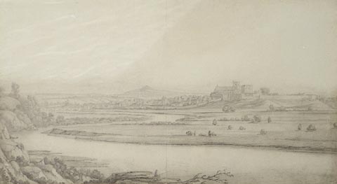 click to enlarge click to enlargePR0861.jpg Distant view of Carlisle seen from an elevated perspective from the far bank of the River Eden. Distant hills rise beyond. item:- Tullie House Museum : 1913.13 Image © Tullie House Museum |
|||
|
|
||||
| evidence:- | old print:- item:- fishing |
|||
| source data:- | Print, hand coloured, View of Carlisle, and the River Eden, Cumberland, painted by
Paul Sandby, drawn by Frederick, Viscount Duncannon, engraved by Francis Chesham,
published by G Kearsley, Fleet Street, London, 1780.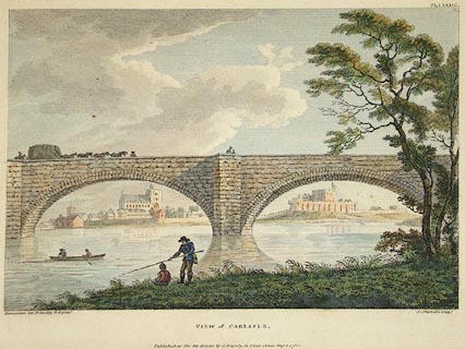 click to enlarge click to enlargePR0889.jpg In centre foreground are two fishermen, one standing whilst the other sits on the riverbank. To left, two other fishermen in a rowing boat haul in their nets. The wide river flows horizontally across composition; it is spanned by a double span stone bridge through which the city of Carlisle is viewed. inscribed at bottom left, on print:- "Duncannon del. P. Sandby R.A. pinxt." printed at bottom centre:- "VIEW of CARLISLE. Published as the Act directs by G. Kearsley, in Fleet Street, May 1, 1780." inscribed at bottom right, on print:- "F. Chesham sculpt." item:- Tullie House Museum : 1925.88.2 Image © Tullie House Museum |
|||
|
|
||||
 CDC20.jpg At Carr Bridge, (taken 26.5.2015) 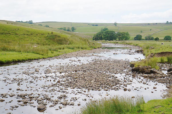 CBB96.jpg At a ford, (taken 11.7.2014) 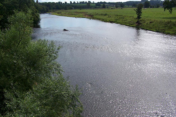 BMN86.jpg At Warwick Bridge. (taken 25.8.2006) 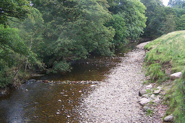 BOC85.jpg (taken 25.8.2006) 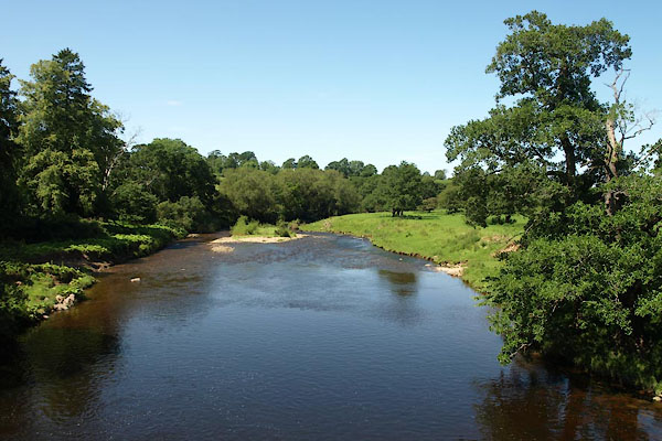 BVA80.jpg At Warcop Old Bridge, (taken 24.7.2011) 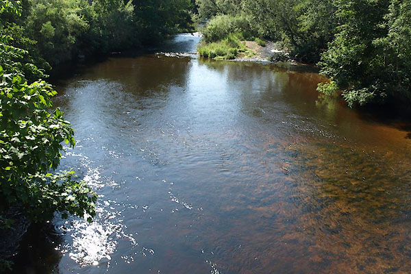 BVB14.jpg At Sandford Bridge, (taken 24.7.2011) 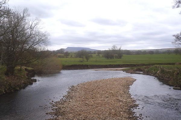 CEU13.jpg meet with Scandal Beck, (taken 1.4.2016) 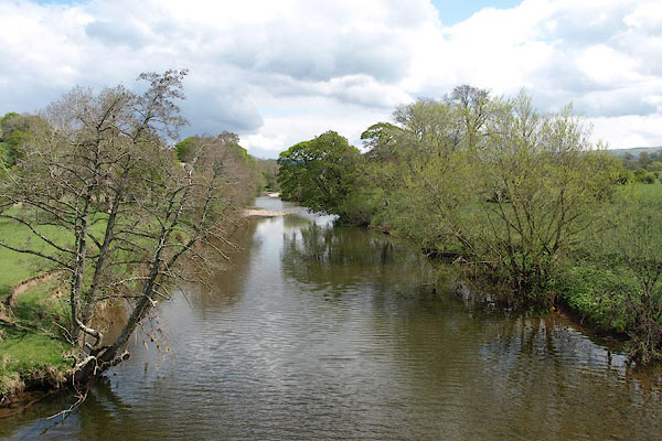 BST07.jpg At Musgrave Bridge, (taken 11.5.2010) 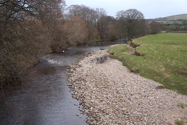 CET87.jpg At Eastfield Bridge, (taken 1.4.2016) 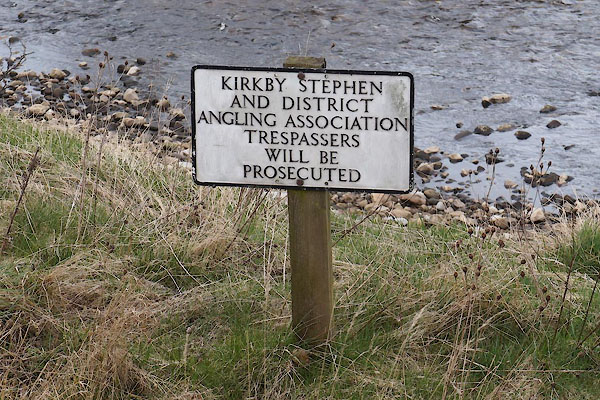 CET88.jpg Fishing notice at Eastfield Bridge, (taken 1.4.2016) 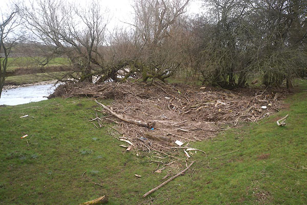 CET89.jpg After floods, December 2015. (taken 1.4.2016) 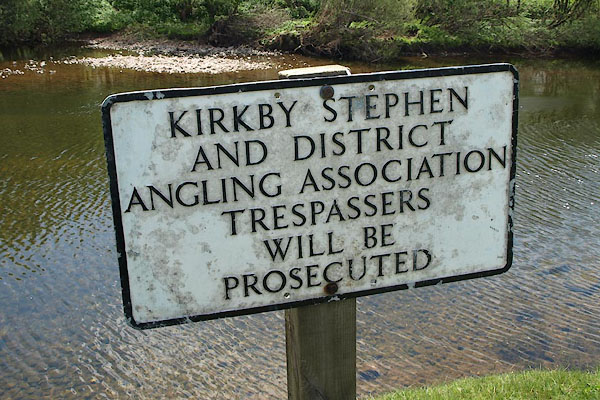 BST08.jpg Fishing notice by Musgrave Bridge, (taken 11.5.2010) 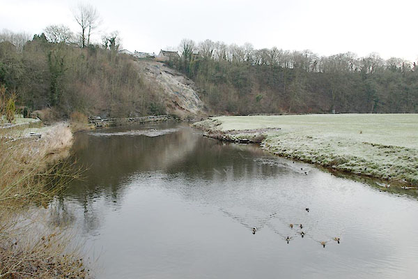 BTX27.jpg At the Holme bridge, Appleby. (taken 7.1.2011) 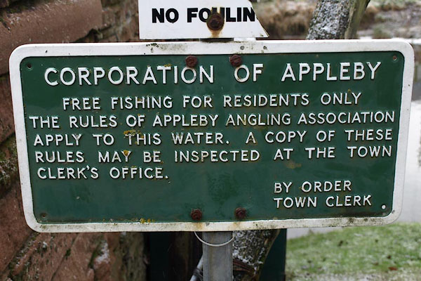 BTX28.jpg Fishing notice, by the Holme bridge, Appleby. (taken 7.1.2011) 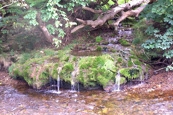 BOC92.jpg The stream entering the Eden. The pools seem to be shaped by deposited limestone? (taken 25.8.2006) 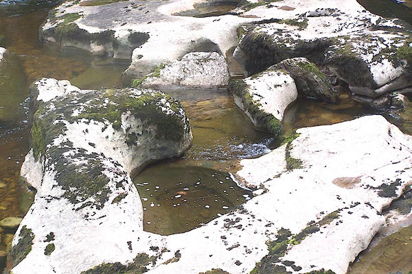 BOC97.jpg (taken 25.8.2006) 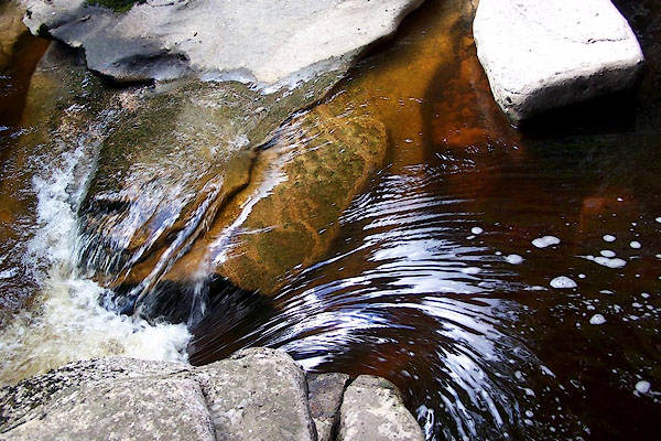 BNX65.jpg At Stenkrith Bridge, Kirkby Stephen. (taken 8.8.2007) 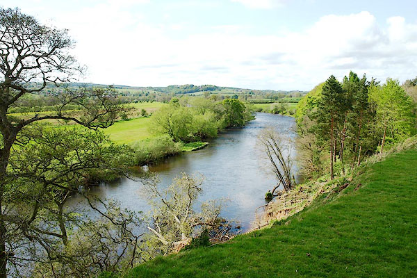 BQN12.jpg Near Daleraven, (taken 8.5.2009) 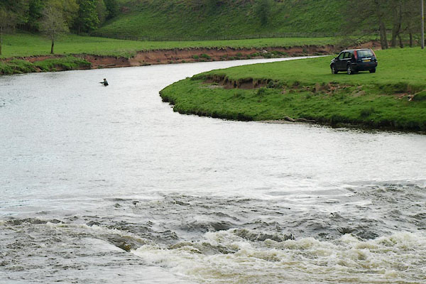 BQN29.jpg Fishing, above Force Mill, (taken 8.5.2009) 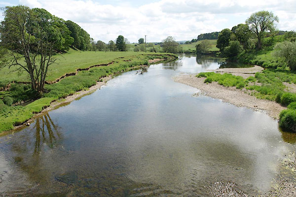 BSV36.jpg At Eden Bridge, Temple Sowerby, (taken 2.6.2010)  BSV37.jpg At Eden Bridge, Temple Sowerby, (taken 2.6.2010) 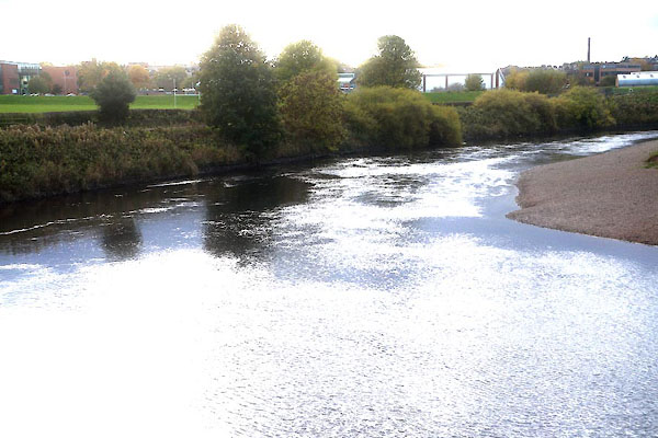 CED52.jpg At Memorial Bridge, Carlisle, (taken 23.10.2015) 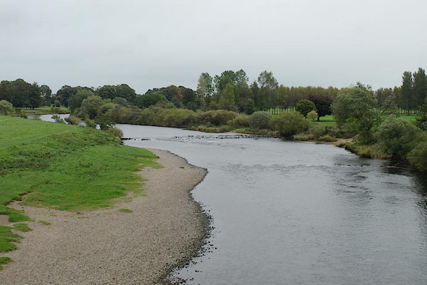 BRR19.jpg At Eden Bridge, Carlisle, (taken 8.8.2007) |
||||
|
|
||||
| mapping:- | Carr Bridge, Mallerstang Thrang Bridge, Mallerstang Castle Bridge, Mallerstang [Mire Close Bridge, Mallerstang] Stenkrith Bridge, Kirkby Stephen footbridge, Kirkby Stephen Bollam Bridge, Kirkby Stephen Frank's Bridge, Kirkby Stephen Lowmill Bridge, Kirkby Stephen New Bridge, Kirkby Stephen Eastfield Bridge, Winton Blandswath Bridge, Musgrave[Musgrave Bridge, Musgrave] Warcop Old Bridge, Warcop[Sandford Bridge, Warcop] Ormside Viaduct, Ormside Bongate Weir, Appleby Bongate Mill, Appleby ford, Appleby[bridge, Appleby] bridge, Appleby (2) Bolton Bridge, Bolton Ousenstand Bridge, Bolton Skygarth Bridge, Temple Sowerby Eden Bridge, Temple Sowerby Langwathby Bridge, Langwathby Long Meg Viaduct, Great Salkeld Armathwaite Bridge, Armathwaite Corby Bridge, Wetheral Memorial Bridge, Carlisle Eden Bridge, Carlisle[Eden Railway Bridge, Carlisle] |
|||
|
|
||||
| places:- |
|
|||
|
||||
|
||||
|
||||
|
||||
|
||||
|
||||
|
||||
|
||||
|
||||
|
||||
|
||||
|
||||
|
||||
|
||||
|
||||
|
||||
|
||||
|
||||
|
||||
|
||||
|
||||
|
||||
|
||||
|
||||
|
||||
|
||||
|
||||
|
||||
|
||||
|
||||
|
||||
|
||||
|
||||
|
||||
|
||||
|
||||
|
||||
|
||||
|
||||
|
||||
|
||||
|
||||
|
||||
|
||||
|
||||
|
||||
|
||||
|
||||
|
||||
|
||||
|
||||
|
||||
|
||||
|
||||
|
||||
|
||||
|
||||
|
||||
|
||||
|
||||
|
||||
|
||||
|
||||
|
||||
|
||||
|
||||
|
||||
|
||||
|
||||
|
||||
|
||||
|
||||
|
||||
|
||||
|
||||
|
||||
|
||||
|
||||
|
||||
|
||||
|
||||
|
||||
|
||||
|
||||
|
||||
|
||||
|
||||
|
||||
|
||||
|
||||
|
||||
|
||||
|
||||
|
||||
|
||||
|
||||
|
||||
|
||||
|
||||
|
||||
|
||||
|
||||
|
||||
|
||||
Lakes Guides menu.