 Old Cumbria Gazetteer
 |
 |
|
| Low Wath, Great Salkeld | ||
| once | ||
| Low Wath | ||
| site name:- | Eden, River | |
| civil parish:- | Great Salkeld (formerly Cumberland) | |
| civil parish:- | Hunsonby (formerly Cumberland) | |
| county:- | Cumbria | |
| locality type:- | ford | |
| coordinates:- | NY56113666 (about) | |
| 1Km square:- | NY5636 | |
| 10Km square:- | NY53 | |
|
|
||
| evidence:- | old map:- OS County Series (Cmd 50 2) placename:- Low Wath |
|
| source data:- | Maps, County Series maps of Great Britain, scales 6 and 25
inches to 1 mile, published by the Ordnance Survey, Southampton,
Hampshire, from about 1863 to 1948. "Low Wath" with tracks joining to road system |
|
|
|
||
| evidence:- | possibly old map:- Bowen and Kitchin 1760 |
|
| source data:- | Map, hand coloured engraving, A New Map of the Counties of
Cumberland and Westmoreland Divided into their Respective Wards,
scale about 4 miles to 1 inch, by Emanuel Bowen and Thomas
Kitchin et al, published by T Bowles, Robert Sayer, and John
Bowles, London, 1760.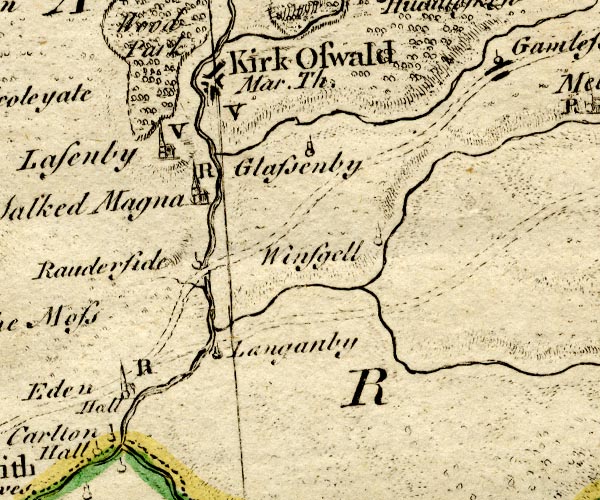 BO18NY53.jpg road across the Eden item:- Armitt Library : 2008.14.10 Image © see bottom of page |
|
|
|
||
| evidence:- | old map:- Donald 1774 (Cmd) |
|
| source data:- | Map, hand coloured engraving, 3x2 sheets, The County of Cumberland, scale about 1
inch to 1 mile, by Thomas Donald, engraved and published by Joseph Hodskinson, 29
Arundel Street, Strand, London, 1774.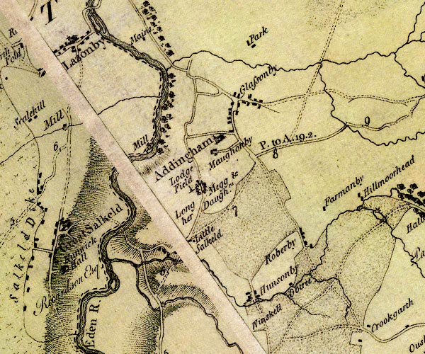 D4NY53NE.jpg ford across the Eden E of Gt Salkeld item:- Carlisle Library : Map 2 Image © Carlisle Library |
|
|
|
||
 Lakes Guides menu.