 Old Cumbria Gazetteer
 |
 |
|
| Armathwaite Bridge, Armathwaite | ||
| Armathwaite Bridge | ||
| site name:- | Eden, River | |
| locality:- | Armathwaite | |
| civil parish:- | Hesket (formerly Cumberland) | |
| civil parish:- | Ainstable (formerly Cumberland) | |
| county:- | Cumbria | |
| locality type:- | bridge | |
| coordinates:- | NY50714603 | |
| 1Km square:- | NY5046 | |
| 10Km square:- | NY54 | |
|
|
||
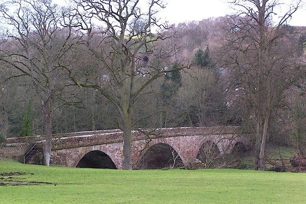
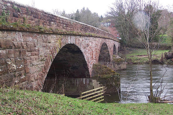 BNI51.jpg (taken 9.3.2007) 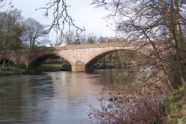 BNI52.jpg (taken 9.3.2007) |
||
|
|
||
| evidence:- | old map:- OS County Series (Cmd 31 12) placename:- Armathwaite Bridge |
|
| source data:- | Maps, County Series maps of Great Britain, scales 6 and 25
inches to 1 mile, published by the Ordnance Survey, Southampton,
Hampshire, from about 1863 to 1948. |
|
|
|
||
| evidence:- | old map:- Donald 1774 (Cmd) |
|
| source data:- | Map, hand coloured engraving, 3x2 sheets, The County of Cumberland, scale about 1
inch to 1 mile, by Thomas Donald, engraved and published by Joseph Hodskinson, 29
Arundel Street, Strand, London, 1774.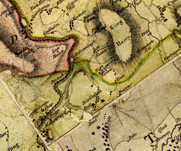 D4NY54NW.jpg double line across a river; a bridge at Armathwaite item:- Carlisle Library : Map 2 Image © Carlisle Library |
|
|
|
||
| evidence:- | descriptive text:- Ford 1839 (3rd edn 1843) |
|
| source data:- | Guide book, A Description of Scenery in the Lake District, by
Rev William Ford, published by Charles Thurnam, Carlisle, by W
Edwards, 12 Ave Maria Lane, Charles Tilt, Fleet Street, William
Smith, 113 Fleet Street, London, by Currie and Bowman,
Newcastle, by Bancks and Co, Manchester, by Oliver and Boyd,
Edinburgh, and by Sinclair, Dumfries, 1839. goto source goto sourcePage 125:- "..." "... [Armathwaite] lies on both sides of the river, which is crossed by a bridge of three bold and graceful arches. ..." |
|
|
|
||
| evidence:- | old map:- Bell 1892 placename:- Armathwaite Bridge |
|
| source data:- | Map, colour lithograph, Road Map of Cumberland, by George Joseph
Bell, scale about 2.5 miles to 1 inch, printed by Charles
Thurnam and Sons, Carlisle, Cumberland, 1892.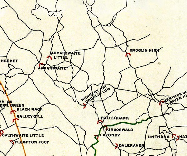 BEL9NY54.jpg "ARMATHWAITE" bridge symbol Road map of Cumberland showing County Bridges item:- Carlisle Library : Map 38 Image © Carlisle Library |
|
|
|
||
| evidence:- | database:- Listed Buildings 2010 placename:- Armathwaite Bridge |
|
| source data:- | courtesy of English Heritage "ARMATHWAITE BRIDGE / / / AINSTABLE / EDEN / CUMBRIA / II / 73431 / NY5073046027" |
|
| source data:- | courtesy of English Heritage "ARMATHWAITE BRIDGE / / / HESKET / EDEN / CUMBRIA / II / 73865 / NY5070546042" |
|
| source data:- | courtesy of English Heritage "Road bridge. Originally C18, inscribed on central parapet stone CUMBERLAND COUNTY COUNCIL/ARMATHWAITE BRIDGE/WIDENED & REBUILT 1907 & 1908/FREDERICK PONSONBY JOHNSON ESQ C.C. HIGH SHERRIFF, D.L./CHAIRMAN OF THE HIGHWAYS &BRIDGE COMMITTEE. Hammer dressed red sandstone. 3 round arches on 2 splayed cut-waters, double width. Joint under arches indicate bridge was built in two sections. This bridge lies partly in Hesket C.P." |
|
|
|
||
 BNI57.jpg (taken 9.3.2007) 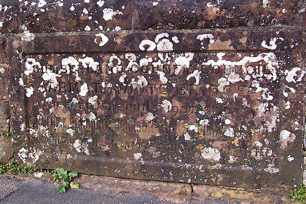 BNI53.jpg Plaque on downstream parapet:- "CUMBERLAND COUNTY COUNCIL / ARMATHWAITE BRIDGE / WIDENED & REBUILT 1907 & 1908 / FREDERICK PONSONBY JOHNSON [ESQ] C.C HIGH SHERIFF D.L / CHAIRMAN OF THE HIGHWAYS &BRIDGES COMITTEE" (taken 9.3.2007) 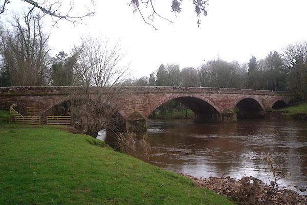 CEU61.jpg (taken 8.4.2016) 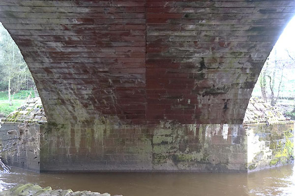 CEU62.jpg Under the E arch, widening on downstream side. (taken 8.4.2016) |
||
| Originally single track width, widened in 1907. |
||
|
|
||
Lakes Guides menu.