 Old Cumbria Gazetteer
 |
 |
|
| ferry, Wetheral | ||
| Wetheral Ferry | ||
| site name:- | Eden, River | |
| locality:- | Wetheral | |
| civil parish:- | Wetheral (formerly Cumberland) | |
| county:- | Cumbria | |
| locality type:- | ferry | |
| coordinates:- | NY46975437 | |
| 1Km square:- | NY4654 | |
| 10Km square:- | NY45 | |
|
|
||
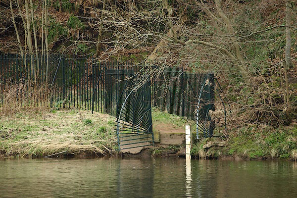 BQF62.jpg The ferry landing on the east bank, opposite Wetheral. (taken 11.3.2009) |
||
|
|
||
| evidence:- | old map:- OS County Series (Cmd 24 6) |
|
| source data:- | Maps, County Series maps of Great Britain, scales 6 and 25
inches to 1 mile, published by the Ordnance Survey, Southampton,
Hampshire, from about 1863 to 1948. "Ferry / Boat House" |
|
|
|
||
| evidence:- | old map:- Donald 1774 (Cmd) |
|
| source data:- | Map, hand coloured engraving, 3x2 sheets, The County of Cumberland, scale about 1
inch to 1 mile, by Thomas Donald, engraved and published by Joseph Hodskinson, 29
Arundel Street, Strand, London, 1774.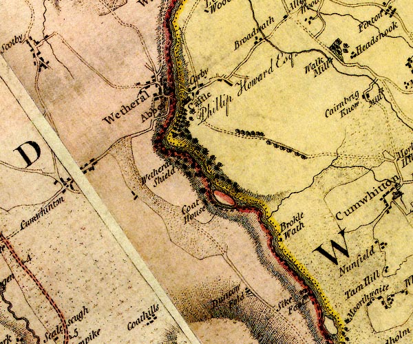 D4NY45SE.jpg river crossing at Wetheral item:- Carlisle Library : Map 2 Image © Carlisle Library |
|
|
|
||
| evidence:- | old painting:- |
|
| source data:- | Painting, watercolour, Wetheral Ferry, Cumberland, by Samuel Bough, 1840-43?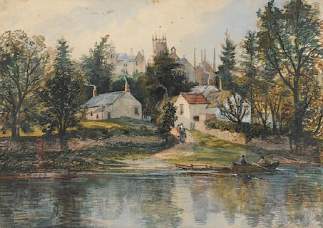 click to enlarge click to enlargePR0865.jpg Late summertime; River Eden flows across horizontal plane of composition; to right, two men in a rowing boat hail a woman carrying a pail who approaches the water's edge along a sandy path. The village lies on the hillside behind her. signed at bottom right:- "S Bough" item:- Tullie House Museum : 1915.16.1 Image © Tullie House Museum |
|
|
|
||
| notes:- |
Before there was a foot crossing on the railway bridge the ferry charged 1d for an
adult, 1/2d for a child. |
|
|
|
||
 Lakes Guides menu.